
Paris
Beschrijving
Capital of France.
Links
Feiten
Verslagen
Gidsen en kaarten
Overnachting
Organisaties
Reisorganisaties
GPS
Anders
Boeken

De Zwerver
Netherlands
2023
Netherlands
2023

De Zwerver
Netherlands
2010
Netherlands
2010
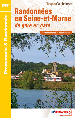
- Wandelgids P773 Randonnées en Seine-et-Marne de gare en gare | FFRP
- Franstalige wandelgids met een beschrijving van een aantal dagtochten. Uitstekende beschrijvingen met duidelijk kaartmateriaal. Mislopen is nauwelijks mogelijk, maar ja .. de franse taal! Ook praktische informatie staat in deze gids. Alle gidsen bevatten een door ons toegevoegde uitgebreide frans - nederlandse wandelwoordenlijst. Dans la... Read more
De Zwerver
Netherlands
2018
Netherlands
2018
- Wandelgids Quartiers et histoires de Paris... à pied | FFRP
- Quartiers et histoires de Paris à pied, FFRP topo-guide Ref. No. VI14, with 12 walks across Paris highlighting various aspects of the city’s history and architecture. The routes, each around 7.5km / 4.7 miles long, are part of the Panamées scheme of free guided walks held every third Thursday of the month and organized by the Comité... Read more
- Also available from:
- Stanfords, United Kingdom

Stanfords
United Kingdom
2018
United Kingdom
2018
- Quartiers & histoires de Paris à pied - 12 itinnéraires
- Quartiers et histoires de Paris à pied, FFRP topo-guide Ref. No. VI14, with 12 walks across Paris highlighting various aspects of the city’s history and architecture. The routes, each around 7.5km / 4.7 miles long, are part of the Panamées scheme of free guided walks held every third Thursday of the month and organized by the Comité... Read more

Meer boeken…
Kaarten
De Zwerver
Netherlands
2020
Netherlands
2020
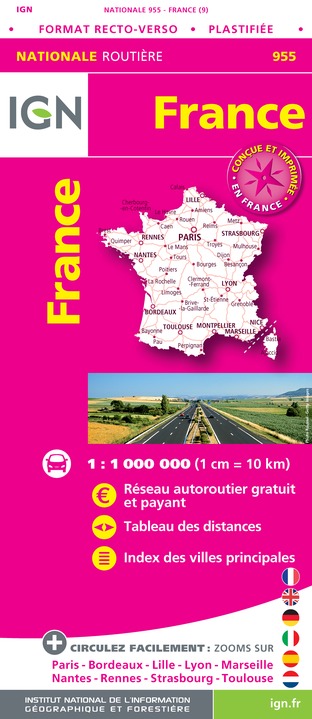
- Wegenkaart - landkaart 955 Frankrijk maxi Recto Verso (geplastificeerd) | IGN - Institut Géographique National
- An laminated IGN route map of France enables you to plan your journeys across France. Includes table of distances and index of principal towns as well as map enlargements for Paris, Bordeaux, Lille, Lyon, Marseille, Nantes, Rennes, Strasbourg and Toulouse. Read more
- Also available from:
- Stanfords, United Kingdom

Stanfords
United Kingdom
2020
United Kingdom
2020
- France IGN Road Map WATERPROOF
- An laminated IGN route map of France enables you to plan your journeys across France. Includes table of distances and index of principal towns as well as map enlargements for Paris, Bordeaux, Lille, Lyon, Marseille, Nantes, Rennes, Strasbourg and Toulouse. Read more
De Zwerver
Netherlands
Netherlands
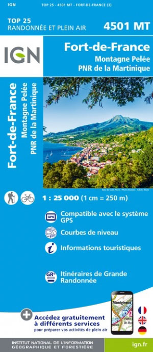
- Wandelkaart - Topografische kaart 4501MT Fort-de-France - Montagne Pelée - PNR Martinique | IGN - Institut Géographique National
- One of the three topographic maps from the Institut Géographique National in Paris covering Martinique. Cartography is similar to that used for IGN’s coverage of France at this scale, with contours at 10m intervals, relief shading, and plenty of information on the type of vegetation: woods and forests, brushwood, plantations and orchards,... Read more
- Also available from:
- Stanfords, United Kingdom

Stanfords
United Kingdom
United Kingdom
- Martinique - Fort-de-France - Montagne Pelee - PNR de la Martinique IGN 4501MT
- One of the three topographic maps from the Institut Géographique National in Paris covering Martinique. Cartography is similar to that used for IGN’s coverage of France at this scale, with contours at 10m intervals, relief shading, and plenty of information on the type of vegetation: woods and forests, brushwood, plantations and orchards,... Read more
De Zwerver
Netherlands
Netherlands
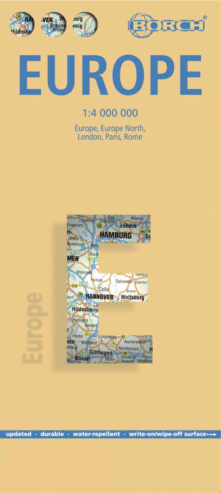
- Wegenkaart - landkaart Europa - Europe | Borch
- Europa / Europe 1 : 4 000 000 ab 9.9 EURO Europe 1 : 4 000 000, Europe North, London, Paris, Rome/Roma / updated / durable / water-repellent / write-on/wipe-off surface Borch Maps. 15. Auflage Read more
De Zwerver
Netherlands
Netherlands
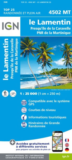
- Wandelkaart - Topografische kaart 4502MT Le Lamentin - Presqu''île Caravelle - PNR Martinique | IGN - Institut Géographique National
- One of the three topographic maps from the Institut Géographique National in Paris covering Martinique. Cartography is similar to that used for IGN’s coverage of France at this scale, with contours at 10m intervals, relief shading, and plenty of information on the type of vegetation: woods and forests, brushwood, plantations and orchards,... Read more
- Also available from:
- Stanfords, United Kingdom

Stanfords
United Kingdom
United Kingdom
- Martinique - Le Lamentin - Presqu`ile de la Caravalle IGN 4502MT
- One of the three topographic maps from the Institut Géographique National in Paris covering Martinique. Cartography is similar to that used for IGN’s coverage of France at this scale, with contours at 10m intervals, relief shading, and plenty of information on the type of vegetation: woods and forests, brushwood, plantations and orchards,... Read more
De Zwerver
Netherlands
Netherlands
- Also available from:
- Stanfords, United Kingdom

Stanfords
United Kingdom
United Kingdom
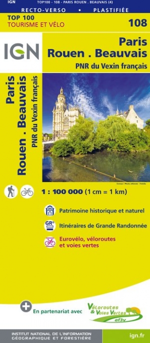
- Paris - Rouen - Beauvais - PNR du Vexin français IGN TOP100 108
- Discover the new double-sided laminated edition of TOP100 road maps of France from the Institut Géographique National (IGN); exceptionally detailed, contoured road maps which include the cycle paths and greenways of the AF3V (French Association for the Development of Cycle Paths and Greenways), ideal for exploring the French countryside by car,... Read more
De Zwerver
Netherlands
Netherlands
De Zwerver
Netherlands
Netherlands
De Zwerver
Netherlands
Netherlands
- Also available from:
- Stanfords, United Kingdom

Stanfords
United Kingdom
United Kingdom
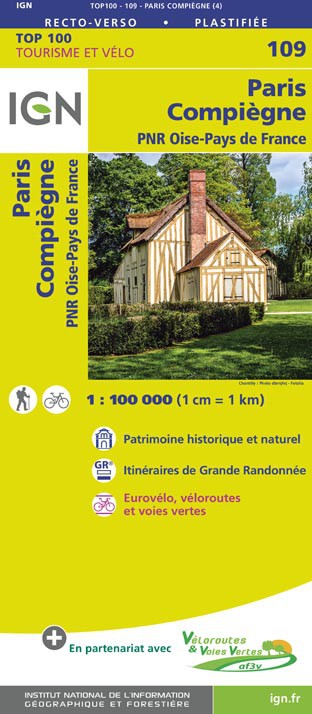
- Paris - Compiegne - PNR Oise-Pays de France IGN TOP100 109
- Discover the new double-sided laminated edition of TOP100 road maps of France from the Institut Géographique National (IGN); exceptionally detailed, contoured road maps which include the cycle paths and greenways of the AF3V (French Association for the Development of Cycle Paths and Greenways), ideal for exploring the French countryside by car,... Read more

Stanfords
United Kingdom
United Kingdom
- Parcs et jardins de Paris à pied FFRP Topo-guide No. VI12
- Parcs et jardins de Paris à pied, FFRP topo-guide Ref. No.VI12, with 27 routes to enjoy the green areas of the capital: in the city’s famous parks including the Parc Montsouris, Parc Monceau, Buttes-Chaumont or the Luxembourg Gardens, in the smaller green spaces such as Jardins-Martin-Lutter-King, in the Père Lachaise Cemetery, in the Bois de... Read more

Stanfords
United Kingdom
United Kingdom
- Djibouti IGN 85004
- Djibouti at 1:200,000 on an indexed map from the Institut Géographique National in Paris showing both the country’s road and rail networks and its physical geography, plus an enlargement of Djibouti City with its international airport.Road classification indicates unsurfaced routes and includes 4WD trails and tracks. Intermediate distances are... Read more