
Rheinland-Pfalz
Beschrijving
Paden in deze landsdeel
- Ahr-Venn-WegGPX
- AhrtalwegGPX
- Alsenztal Wanderweg
- AusoniuswegGPX
- BonifatiuswegGPX
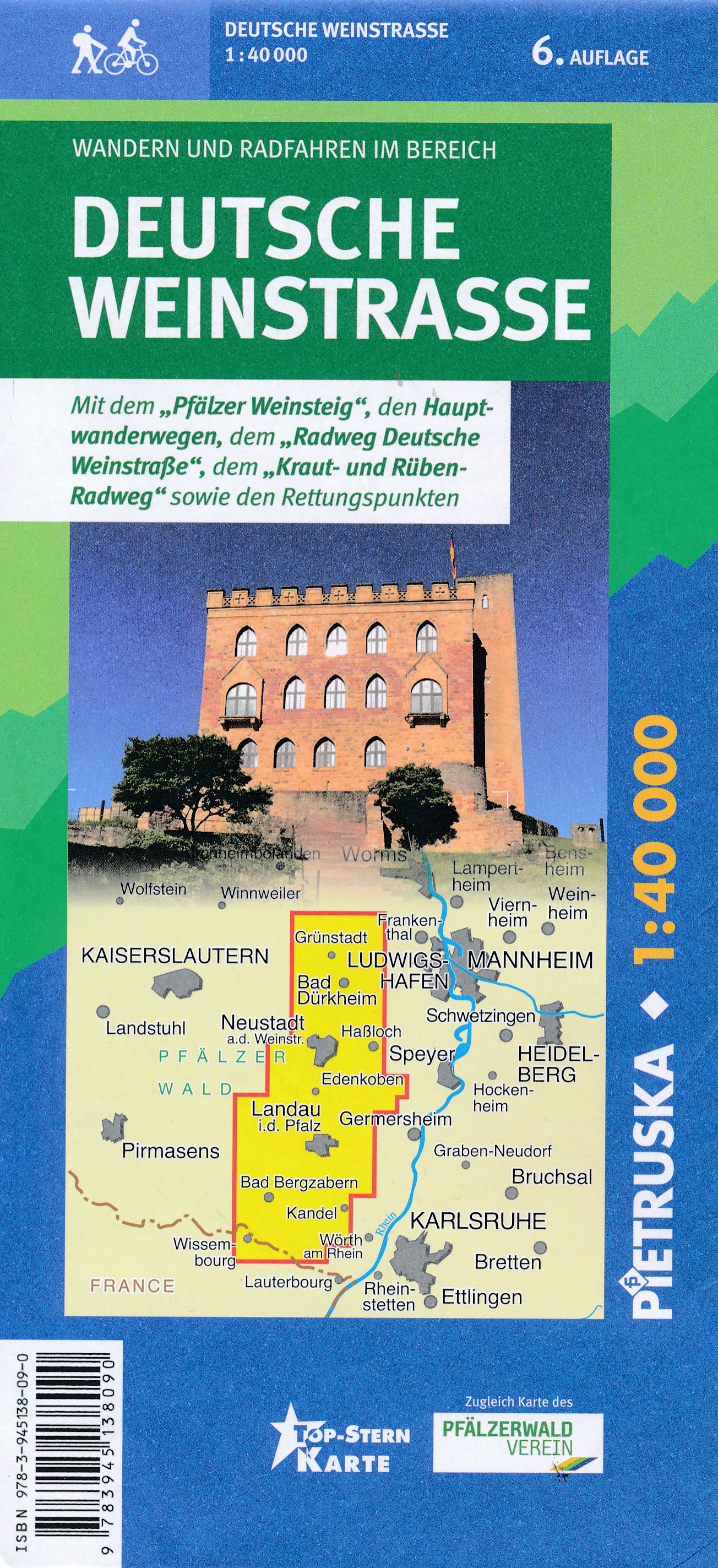
- Deutsche WeinstrasseGPX
- E1GPX
- E8GPX
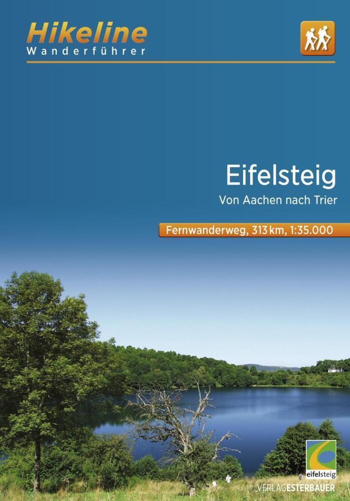
- EifelsteigGPX
- Erft-Lieser-Mosel-Weg GPX
- GR15 - AE - Ardennes-EifelGPX
- GR5GPX
- Hessenweg 7GPX
- Hunsrück Höhenweg
- Jakobsweg im Elsass
- Josef-Schramm-Weg GPX
- Karl-Kaufmann-WegGPX
- KarolingerwegGPX
- KrönungswegGPX
- Lahn WanderwegGPX
- LahnhöhenwegGPX
- LieserpfadGPX
- MatthiaswegGPX
- Mosel-OurwegGPX
- MoselhöhenwegGPX
- MoselsteigGPX
- Nahe HöhenwegGPX
- NibelungenwegGPX
- Pfälzer WeinsteigGPX
- Rhein-Kyll-WegGPX
- Rhein-Rureifel-Weg GPX
- RheinburgenwegGPX
- Rheingauer Riesling Routen
- RheinhöhenwegGPX
- RheinsteigGPX
- Rotwein WanderwegGPX
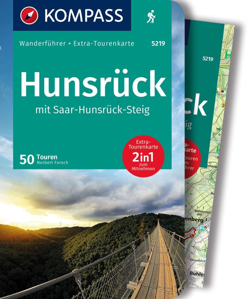
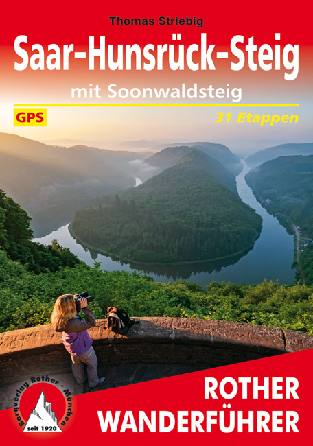
- Saar-HunsrücksteigGPX
- SchinderhannespfadGPX
- Siegerland HöhenringGPX
- SironawegGPX
- SoonwaldsteigGPX
- SponheimerwegGPX
- Taunus HöhenwegGPX
- VulkanwegGPX
- Weinwanderweg Rhein-NaheGPX
- WesterwaldsteigGPX
- Westpfalz WanderwegGPX
- WillibrorduswegGPX
Links
Feiten
Verslagen
Gidsen en kaarten
Overnachting
Organisaties
Reisorganisaties
GPS
Anders
Boeken
De Zwerver
Netherlands
2022
Netherlands
2022
De Zwerver
Netherlands
2022
Netherlands
2022
De Zwerver
Netherlands
2012
Netherlands
2012
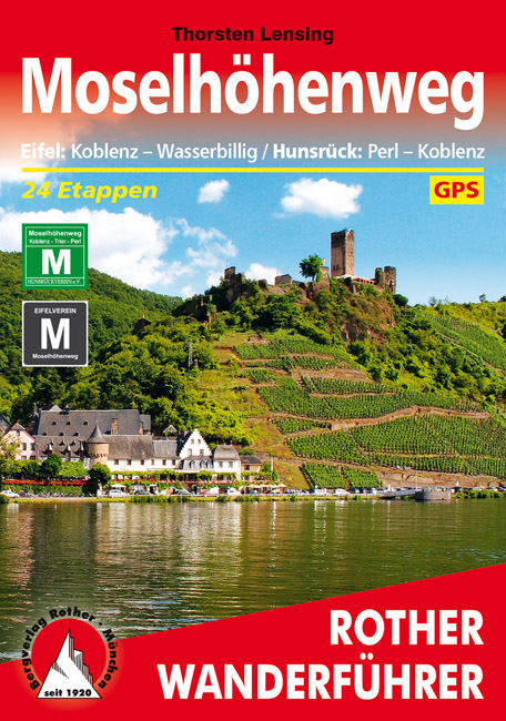
- Wandelgids Moselhöhenweg | Rother Bergverlag
- Duitstalige wandelgids met zeer goed beschreven wandelingen in de wandelgebieden. Redelijk kaartmateriaal, vooral de beschrijving van de route en de praktische info die er bij hoort is goed. 152 Seiten mit 86 Farbabbildungen 24 Höhenprofile, 25 Wanderkärtchen im Maßstab 1:75.000, eine Übersichtskarte im Maßstab 1:600.000 Wer einmal mit dem Zug... Read more

De Zwerver
Netherlands
2020
Netherlands
2020
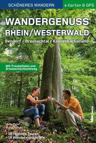
- Wandelgids Wandergenuss Rhein/Westerwald | IdeeMedia
- 365 Kilometer Wandergenuss von Perl bis Koblenz. Smartphone-Anbindung. Aktuellste GPS-Daten Read more

De Zwerver
Netherlands
2021
Netherlands
2021
- Wandelgids 265 Vogesen - Durchquerung: GR53 GR5 | Rother Bergverlag
- In 37 etappes over de Lange Astands Wandelingen GR 53, GR 5 en GR 531 van Wissembourg naar Giromagny en Masevaux door de prachtige Vogezen. Goed alternatief voor de langverwachte maar nog steeds niet uitgekomen Crete des Vosges wandelgids van FFRP. Duitse samenvatting: Die Vogesen sind nicht nur eines der urwüchsigsten Mittelgebirge in unseren... Read more
De Zwerver
Netherlands
2016
Netherlands
2016
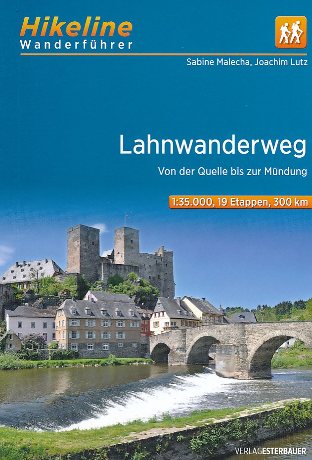
- Wandelgids Hikeline Lahnwanderweg | Esterbauer
- Handzame gids met een goede beschrijving van een groot aantal dagtochten in dit gebied. De gids is in spiraalbinding en elke pagina is op scheur- en watervast papier gedrukt. Daar is echt over nagedacht! Ein Wandertag auf dem Lahnwanderweg beginnt meist am Ufer der Lahn – oder an einem der zahlreichen Bahnhöfe entlang der Strecke. Der Wanderweg... Read more


De Zwerver
Netherlands
2017
Netherlands
2017
- Wandelgids 411 Kautokeino - Nordkap E1 | Conrad Stein Verlag
- Handzaam boekje met de routebeschrijving inclusief een heleboel praktische informatie. De beschrijving is uitstekend, maar kaarten zijn wat beperkt. Duits. Die 330 km lange Wanderung auf dem E1 von Kautokeino zum Nordkap ist ein unvergessliches Wanderabenteuer. In 15 Etappen laufen Sie durch die Wildnis Nordnorwegens und überqueren die... Read more
De Zwerver
Netherlands
2010
Netherlands
2010
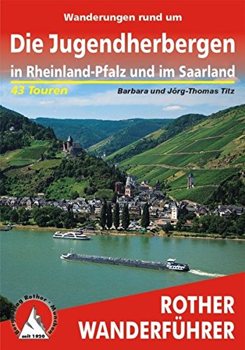
- Wandelgids Wanderungen rund um Die Jugendherbergen in Rheinland-Pfalz und im Saarland 43 Touren | Rother Bergverlag
- Uitstekende wandelgids met een groot aantal dagtochten in dal en hooggebergte. Met praktische informatie en beperkt kaartmateriaal! Wandelingen in verschillende zwaarte weergegeven in rood/blauw/zwart. 192 Seiten mit 113 Farbabbildungen 43 Höhenprofile, 43 Wanderkärtchen im Maßstab 1:50.000 und 1:75.000, drei Übersichtskarten 43 Jugendherbergen... Read more

De Zwerver
Netherlands
2022
Netherlands
2022

De Zwerver
Netherlands
2009
Netherlands
2009
- Wandelgids GR 5 Mer Du Nord-Mediterrannee Noordzee - Middellandse Zee deel Ardennen (Maastricht - Diekirch ) | GR Sentiers
- LET OP: deze wandelgids van dit deel van de GR5 is alleen nog maar in het Frans leverbaar. De Nederlandstalige versie is geheel uitverkocht, niet meer te bestellen en er komt naar alle waarschijnlijkheid geen nieuwe versie in het Nederlands! Uitstekende routegids met gedetailleerde kaarten en een routebeschrijving. Fout lopen wordt op deze... Read more
Kaarten

De Zwerver
Netherlands
Netherlands
- Wandelkaart - Wegenkaart - landkaart 7 Westelijke Rhodopen - Western Rhodopes | Domino
- Western Rhodope Mountains at 1:100,000 on a contoured GPS compatible map from Domino extending from just west of the Pirin National Park to Asenovgrad in the north-east. The map is double-sided with a good overlap between the sides. Topography is shown by contours at 50m intervals with relief shading and spot heights, plus colouring for... Read more
- Also available from:
- Stanfords, United Kingdom

Stanfords
United Kingdom
United Kingdom
- Western Rhodope Mountains Domino Map
- Western Rhodope Mountains at 1:100,000 on a contoured GPS compatible map from Domino extending from just west of the Pirin National Park to Asenovgrad in the north-east. The map is double-sided with a good overlap between the sides. Topography is shown by contours at 50m intervals with relief shading and spot heights, plus colouring for... Read more

De Zwerver
Netherlands
Netherlands
- Wandelkaart Strandzha - Bulgarije | Domino
- Strandzha Mountains in the south-eastern corner of Bulgaria between Burgas to the Turkish border on a contoured and GPS compatible map from Domino showing local hiking trails and highlighting various interesting sites, with three more detailed enlargements at 1:25,000. Most place names are in both Latin and Cyrillic alphabet; map legend... Read more
- Also available from:
- Stanfords, United Kingdom

Stanfords
United Kingdom
United Kingdom
- Strandzha Mountains: Burgas to the Turkish Border Domino Map
- Strandzha Mountains in the south-eastern corner of Bulgaria between Burgas to the Turkish border on a contoured and GPS compatible map from Domino showing local hiking trails and highlighting various interesting sites, with three more detailed enlargements at 1:25,000. Most place names are in both Latin and Cyrillic alphabet; map legend... Read more


De Zwerver
Netherlands
Netherlands
- Wandelkaart 1 Stara Planina gebergte | Domino
- Stara Planina Central: Zlatitsa to Kalofer map at 1:50,000 from Bulgarian publishers Domino, contoured and GPS compatible, with hiking trails, accommodation options including a list of local mountain refuges, etc. The map is double-sided and covers the mountains from just west of Ribaritsa and Zlatitsa eastwards beyond Kalofer to the peak of... Read more
- Also available from:
- Stanfords, United Kingdom

Stanfords
United Kingdom
United Kingdom
- Stara Planina Central: Zlatitsa to Kalofer Domino Map
- Stara Planina Central: Zlatitsa to Kalofer map at 1:50,000 from Bulgarian publishers Domino, contoured and GPS compatible, with hiking trails, accommodation options including a list of local mountain refuges, etc. The map is double-sided and covers the mountains from just west of Ribaritsa and Zlatitsa eastwards beyond Kalofer to the peak of... Read more

De Zwerver
Netherlands
Netherlands
- Wandelkaart 63 Eggegebirge (Nordteil) mit Eggeweg, E1, Jakobspilgerweg | GeoMap
- Topographische Wanderkarte für den nördlichen Teil des Eggegebirges mit Eggeweg, E1, Jakobspilgerweg. 4. Auflage. Read more

De Zwerver
Netherlands
Netherlands
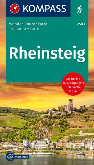
- Wandelkaart Rheinsteig 1 | Publicpress
- Die Wanderkarte stellt den ersten Teil des 320 km langen Rheinsteigs im praktischen Leporello-Format vor. Dieser Abschnitt führt von Bonn bis Lahnstein über 145 km am rechtsrheinischen Ufer entlang und in die angrenzenden Wälder und Weinberge. Auf schmalen Pfaden gelangt der Wanderer so zu tollen Aussichtspunkten über das Mittelrheintal. Welche... Read more
De Zwerver
Netherlands
Netherlands
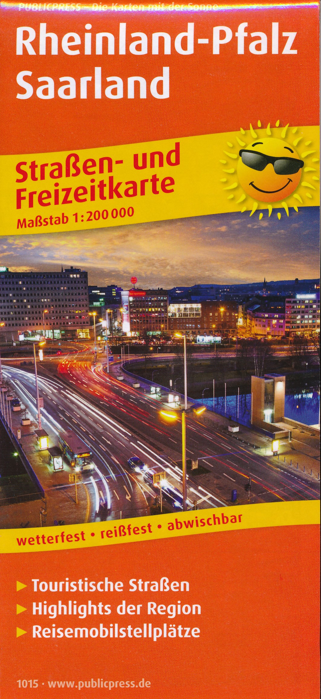
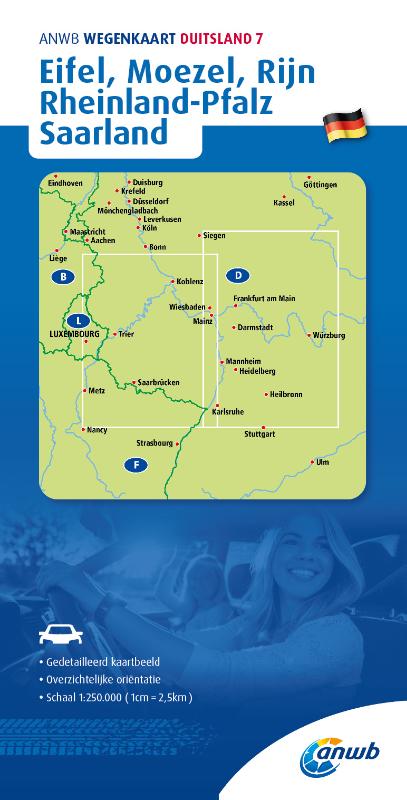
- Wegenkaart - landkaart 1015 Rheinland-Pfalz und Saarland | Publicpress
- Rheinland-Pfalz. Straßen- und Freizeitkarte 1 : 20 000 ab 10 EURO Straßen- und Freizeitkarte mit Touristischen Straßen, Highlights der Region und Reisemobilstellplätzen. 1:200000 PUBLICPRESS Straßen- und Freizeitkarte. 1. Auflage Read more
De Zwerver
Netherlands
2021
Netherlands
2021

De Zwerver
Netherlands
Netherlands
- Wandelkaart 2 Stara Planina gebergte | Domino
- Stara Planina Central: Uzana to Vratnik map at 1:50,000 from Bulgarian publishers Domino, contoured and GPS compatible, with hiking trails, accommodation options including a list of local mountain refuges, etc. The map is double-sided and covers the mountains from just west of the Uzana massif, the geographical centre of Bulgaria, eastwards to... Read more
- Also available from:
- Stanfords, United Kingdom

Stanfords
United Kingdom
United Kingdom
- Stara Planina Central: Uzana to Vratnik Domino Map
- Stara Planina Central: Uzana to Vratnik map at 1:50,000 from Bulgarian publishers Domino, contoured and GPS compatible, with hiking trails, accommodation options including a list of local mountain refuges, etc. The map is double-sided and covers the mountains from just west of the Uzana massif, the geographical centre of Bulgaria, eastwards to... Read more

De Zwerver
Netherlands
Netherlands
- Wandelkaart Sredna Gora - Bulgarije | Domino
- Pirin Mountains at 1:50,000 on a large, double-sided, contoured map with GPS waypoints for shelters and chalets, peaks, etc. and highlighting hiking routes. Topography is shown by contours at 40m intervals with additional relief shading and graphics and colouring for sandstone stacks, single rocks over 5m high, marshlands and different types of... Read more

De Zwerver
Netherlands
2014
Netherlands
2014
- Wandelkaart 07 Mercantour & Alpi-Maritieme | Didier Richard
- Mercantour National Park and the Maritime Alps on a large, double-sided, contoured and GPS compatible map from Editions Didier Richard highlighting local walking trails and long-distance hiking routes including the GR5. Coverage extends from well north of Col de Larch to Sospel, Levens and Roquestéron in the mountains north of the French... Read more
- Also available from:
- Stanfords, United Kingdom

Stanfords
United Kingdom
2014
United Kingdom
2014
- Mercantour & Alpi-Marittime Didier Richard 07
- Mercantour National Park and the Maritime Alps on a large, double-sided, contoured and GPS compatible map from Editions Didier Richard highlighting local walking trails and long-distance hiking routes including the GR5. Coverage extends from well north of Col de Larch to Sospel, Levens and Roquestéron in the mountains north of the French... Read more

De Zwerver
Netherlands
Netherlands
- Wandelkaart 3 Stara Planina gebergte | Domino
- Stara Planina Western: Belogradchik to Berkovita map at 1:50,000 from Bulgarian publishers Domino, contoured and GPS compatible, with hiking trails, accommodation options including a list of local mountain refuges, etc. The map is double-sided and covers the mountains from the peak of Byala Voda near Belogradchik eastwards to just beyond... Read more
- Also available from:
- Stanfords, United Kingdom

Stanfords
United Kingdom
United Kingdom
- Stara Planina Western: Belogradchik to Berkovita Domino Map
- Stara Planina Western: Belogradchik to Berkovita map at 1:50,000 from Bulgarian publishers Domino, contoured and GPS compatible, with hiking trails, accommodation options including a list of local mountain refuges, etc. The map is double-sided and covers the mountains from the peak of Byala Voda near Belogradchik eastwards to just beyond... Read more
De Zwerver
Netherlands
Netherlands
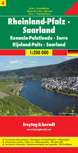
- Wegenkaart - landkaart 04 Rheinland-Pfalz - Saarland | Freytag & Berndt
- Deutschland 04 Rheinland Pfalz, Saarland 1 : 200 000 ab 10.9 EURO Touristische Informationen. Ortregister. GPS-tauglich Deutschland Freytag & Berndt Autokarte Read more