Cyclades Islands
Beschrijving
Links
Feiten
Verslagen
Gidsen en kaarten
Overnachting
Organisaties
Reisorganisaties
GPS
Anders
Boeken
De Zwerver
Netherlands
2015
Netherlands
2015
- Wandelgids Kythnos hiking guide | Terrain maps
- Kythnos Hiking Guide by Terrain Editions, includes eleven walks into history, nature and the most interesting sights of Kythnos, one of the beautiful Cyclades islands in the Aegean sea. Explore Kythnos on foot, a small island boasting ninety sheltered bays, sixty exceptional sandy beaches, famous hot springs and a spa centre by the sea, nine... Read more
- Also available from:
- Stanfords, United Kingdom

Stanfords
United Kingdom
2015
United Kingdom
2015
- Kythnos Hiking Guide
- Kythnos Hiking Guide by Terrain Editions, includes eleven walks into history, nature and the most interesting sights of Kythnos, one of the beautiful Cyclades islands in the Aegean sea. Explore Kythnos on foot, a small island boasting ninety sheltered bays, sixty exceptional sandy beaches, famous hot springs and a spa centre by the sea, nine... Read more
De Zwerver
Netherlands
2007
Netherlands
2007
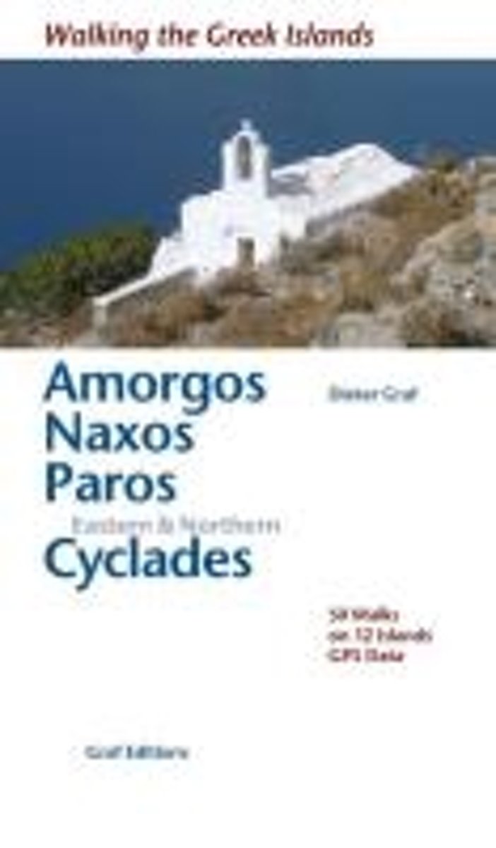
- Wandelgids Amorgos, Naxos, Paros & Kykladen | Graf editions
- Wandelgids met 50 wandelingen op 12 eilanden. Het boekje beschrijft de mooiste oude wandelroutes. Met gedetaileerde kaartjes, looptijden, GPS points en foto's van standpunten voor een betere orientatie. Met : Amorgós Ándros Antíparos Donoússa Irakliá Koufonísi Mýkonos Náxos Páros Schinoússa Sýros Tínos Read more
De Zwerver
Netherlands
2019
Netherlands
2019
De Zwerver
Netherlands
2020
Netherlands
2020
De Zwerver
Netherlands
2024
Netherlands
2024
De Zwerver
Netherlands
Netherlands
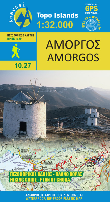
- Wandelkaart 10.27 Amorgos | Anavasi
- The island of Amorgos in the Cyclades on a light, waterproof and tear-resistant, contoured and GPS compatible map at 1:32,000 from Anavasi. 16 recommended walks are accompanied by brief descriptions and the map also includes a street plan of Chora.Landscape is vividly presented by contours at 20m intervals with hill shading and spot heights.... Read more
- Also available from:
- Stanfords, United Kingdom

Stanfords
United Kingdom
United Kingdom
- Amorgos Anavasi 10.27
- The island of Amorgos in the Cyclades on a light, waterproof and tear-resistant, contoured and GPS compatible map at 1:32,000 from Anavasi. 16 recommended walks are accompanied by brief descriptions and the map also includes a street plan of Chora.Landscape is vividly presented by contours at 20m intervals with hill shading and spot heights.... Read more
Bol.com
Netherlands
2007
Netherlands
2007
- Walking the Greek Islands
- Describes the best and oldest walking trails. It includes detailed maps, exact times, GPS points and colour photographs of outstanding places - and lots of information about the islands of light . Olive groves, forsaken monasteries, the scent of thyme, sleepy villages, Byzantine chapels, secluded coves, there is much to be discovered on the... Read more
- Also available from:
- Bol.com, Belgium
Bol.com
Belgium
2007
Belgium
2007
- Walking the Greek Islands
- Describes the best and oldest walking trails. It includes detailed maps, exact times, GPS points and colour photographs of outstanding places - and lots of information about the islands of light . Olive groves, forsaken monasteries, the scent of thyme, sleepy villages, Byzantine chapels, secluded coves, there is much to be discovered on the... Read more
De Zwerver
Netherlands
2016
Netherlands
2016
- Also available from:
- Bol.com, Netherlands
- Bol.com, Belgium
- Stanfords, United Kingdom
- The Book Depository, United Kingdom
Bol.com
Netherlands
2016
Netherlands
2016
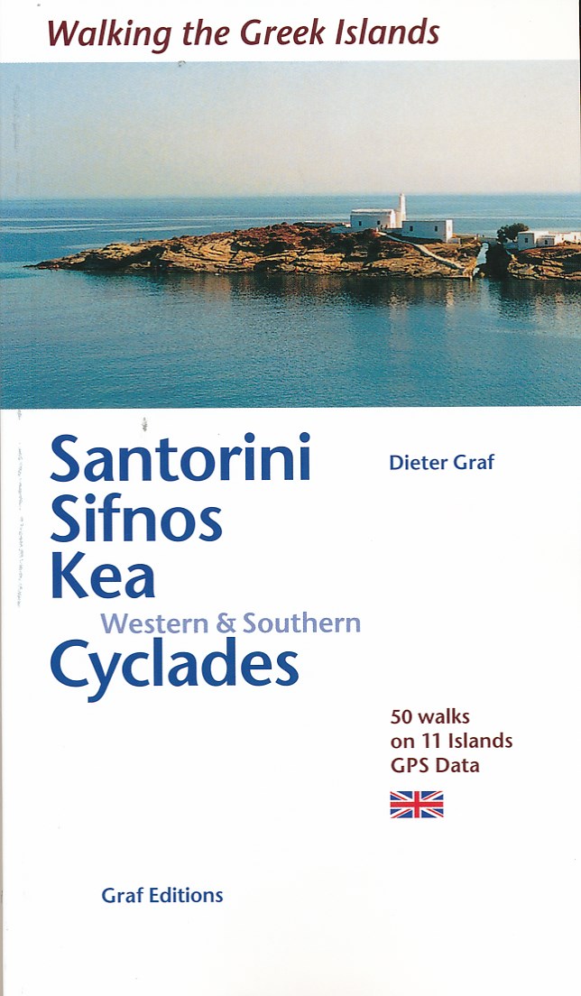
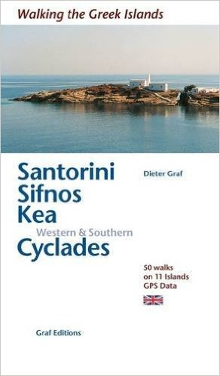
- Santorini, Sifnos, Kea, Western & Southern Cyclades
- This is in the Walking in the Greek Islands series by Dieter Graf. 50 walks with GPS data on 11 islands on and around Santorini, Sifnos, Kea and the Western & Southern Cyclades in the Aegean Sea.The Cyclades, south east of the Greek mainland are rich in history, culture, architecture and natural beauty and the book describes 50 walks on old... Read more
Bol.com
Belgium
2016
Belgium
2016
- Santorini, Sifnos, Kea, Western & Southern Cyclades
- This is in the Walking in the Greek Islands series by Dieter Graf. 50 walks with GPS data on 11 islands on and around Santorini, Sifnos, Kea and the Western & Southern Cyclades in the Aegean Sea.The Cyclades, south east of the Greek mainland are rich in history, culture, architecture and natural beauty and the book describes 50 walks on old... Read more

Stanfords
United Kingdom
2016
United Kingdom
2016
- Santorini, Sifnos, Kea, Western & Southern Cyclades: 50 Walks on 11 Islands
- This is in the Walking in the Greek Islands series by Dieter Graf. 50 walks with GPS data on 11 islands on and around Santorini, Sifnos, Kea and the Western & Southern Cyclades in the Aegean Sea.The Cyclades, south east of the Greek mainland are rich in history, culture, architecture and natural beauty and the book describes 50 walks on old... Read more

The Book Depository
United Kingdom
2016
United Kingdom
2016
- Santorini, Sifnos, Kea, Western & Southern Cyclades
- 50 Walks on 11 Islands Read more
Bol.com
Netherlands
Netherlands
- GRIEKSE KUSTEN
- In de jaren vijftig reisde Bertus Aafjes door Griekenland, toen daar nog nauwelijks sprake was van toerisme. Zijn speurtochten naar de plaatsen die bekend zijn uit de Odyssee en de andere beroemde plaatsen uit de oudheid zijn klassieke verhalen geworden in de Nederlandse letteren.Al zijn Griekse reisverhalen zijn door Bertus Aafjes nu gebundeld... Read more
- Also available from:
- Bol.com, Belgium
Bol.com
Belgium
Belgium
- GRIEKSE KUSTEN
- In de jaren vijftig reisde Bertus Aafjes door Griekenland, toen daar nog nauwelijks sprake was van toerisme. Zijn speurtochten naar de plaatsen die bekend zijn uit de Odyssee en de andere beroemde plaatsen uit de oudheid zijn klassieke verhalen geworden in de Nederlandse letteren.Al zijn Griekse reisverhalen zijn door Bertus Aafjes nu gebundeld... Read more
Bol.com
Netherlands
Netherlands
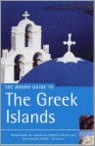
- The Rough Guide To The Greek Islands
- The Rough Guide to the Greek Islands is an essential guide to the varied and beautiful archipelagos of the Aegean and Ionian seas. The guide includes a 24-page ''Things not to Miss'' section - a full-colour introduction to the islands'' highlights. There is in-depth coverage of all the islands, from hedonistic Ios in the Cyclades to tranquil... Read more
- Also available from:
- Bol.com, Belgium
Bol.com
Belgium
Belgium
- The Rough Guide To The Greek Islands
- The Rough Guide to the Greek Islands is an essential guide to the varied and beautiful archipelagos of the Aegean and Ionian seas. The guide includes a 24-page ''Things not to Miss'' section - a full-colour introduction to the islands'' highlights. There is in-depth coverage of all the islands, from hedonistic Ios in the Cyclades to tranquil... Read more

Stanfords
United Kingdom
United Kingdom
- DK Eyewitness Travel Guide The Greek Islands
- Discover the Greek Islands with this essential travel guide, designed to help you create your own unique trip and to transport you to this beautiful region of Greece before you`ve even packed your case - explore Corfu`s atmospheric Old Town, admire Santorini`s brilliant white-and-blue-washed houses, explore archaeological sites on Delos, wander... Read more
De Zwerver
Netherlands
2018
Netherlands
2018
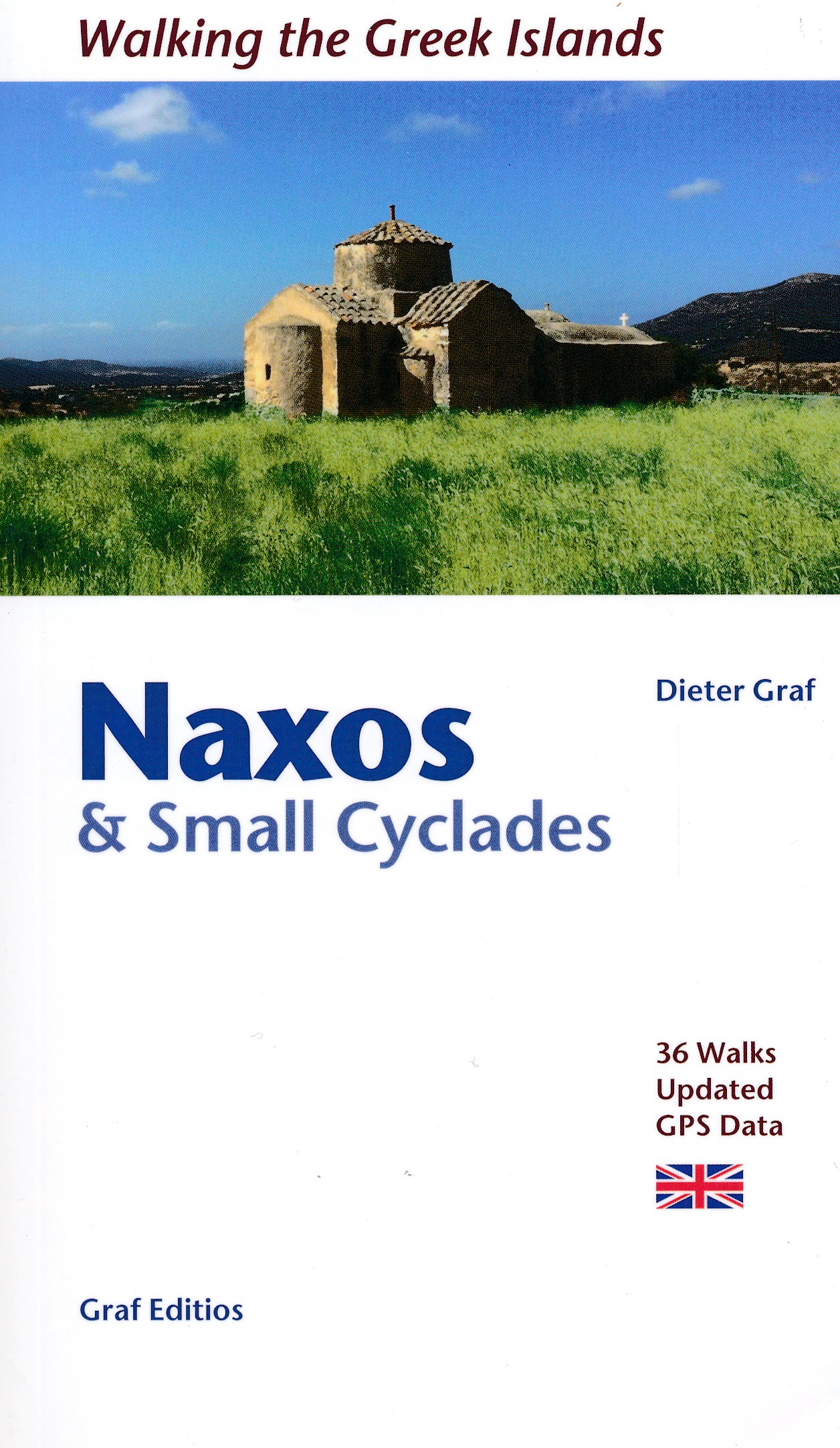
- Wandelgids Naxos and the Small Cyclades | Graf editions
- Walking the Greek Islands Read more
- Also available from:
- The Book Depository, United Kingdom


De Zwerver
Netherlands
2020
Netherlands
2020
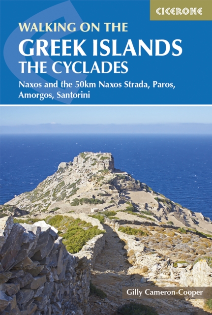
- Wandelgids Walking on the Greek Islands - The Cyclades | Cicerone
- This guidebook offers 35 day walks across the four Cycladic islands of Paros, Naxos, Amorgos and Santorini. Best explored in spring and autumn, each island offers a unique walking experience and the walks range from easy 4km town tours to 16km hikes visiting remote peaks in wild interiors. This is the first guide to feature the new 50km Naxos... Read more
- Also available from:
- Stanfords, United Kingdom
- The Book Depository, United Kingdom

Stanfords
United Kingdom
2020
United Kingdom
2020
- Walking on the Greek Islands - the Cyclades: Naxos and the 50km Naxos Strada, Paros, Amorgos, Santorini
- This guidebook offers 35 day walks across the four Cycladic islands of Paros, Naxos, Amorgos and Santorini. Best explored in spring and autumn, each island offers a unique walking experience and the walks range from easy 4km town tours to 16km hikes visiting remote peaks in wild interiors. This is the first guide to feature the new 50km Naxos... Read more

The Book Depository
United Kingdom
2020
United Kingdom
2020
- Walking on the Greek Islands - the Cyclades
- Naxos and the 50km Naxos Strada, Paros, Amorgos, Santorini Read more
Kaarten
De Zwerver
Netherlands
Netherlands
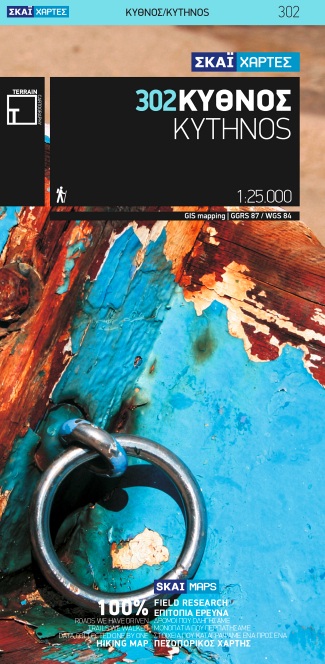
- Wandelkaart 302 Kythnos | Terrain maps
- Kythnos at 1:25,000 on a contoured, GPS compatible hiking map published by Terrain Cartography group together with Skai Maps, and printed on light, waterproof and tear-resistant Polyart plastic paper, with extensive tourist information.Topography is very well presented by contours, enhanced by spot heights, subtle relief shading and additional... Read more
- Also available from:
- Stanfords, United Kingdom

Stanfords
United Kingdom
United Kingdom
- Kythnos Terrain Editions 302
- Greek island of Kythnos on a light, waterproof and tear-resistant, contoured and GPS compatible map at 1:25,000 from Terrain Editions, with astreet plan of the Hora of Kythnos at 1:2,500, plus descriptions of 13 specially selected hiking trails. All place names are shown in both Greek and Latin alphabet. Map legend and all the text include... Read more
De Zwerver
Netherlands
Netherlands
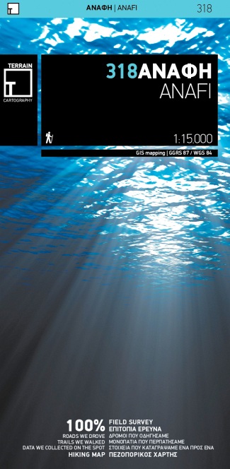
- Wandelkaart 318 Anafi | Terrain maps
- Gedetailleerde wegenkaart en wandelkaart met alle kleine wegen, wandelpaden, hoogtelijnen en toeristische informatie aangegeven. Alle tekst is tweetalig in Engels en Grieks en de waterproof kaart is geschikt voor gebruik met GPS. This is a great map because: First and foremost, it is the only existing –to date- GIS map of Anafi. It is made with... Read more
De Zwerver
Netherlands
Netherlands
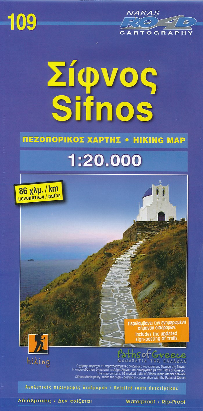
- Wegenkaart - landkaart 109 Sifnos | Road Editions
- Sifnos 1 : 20 000 ab 7.99 EURO Hiking Map. new edition Read more
De Zwerver
Netherlands
Netherlands
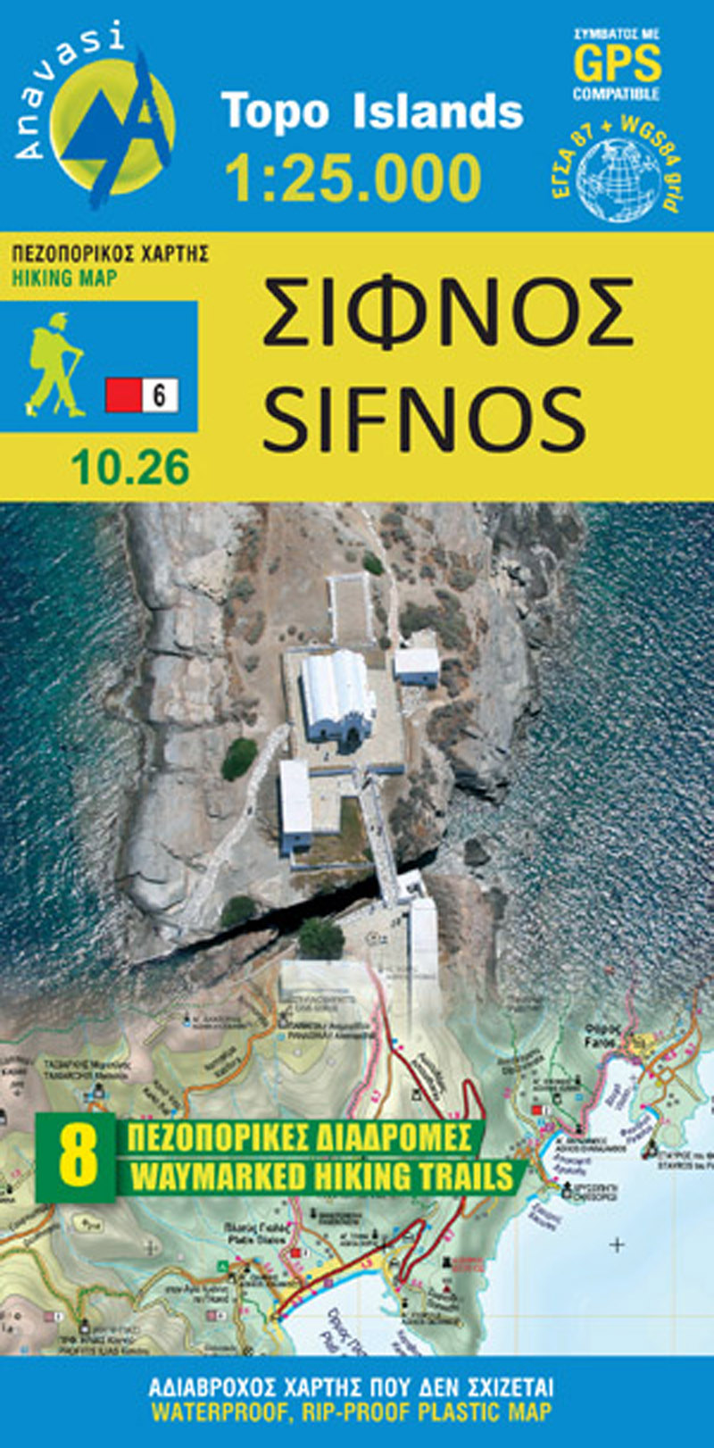
- Wandelkaart 10.26 Sifnos | Anavasi
- Sifnos in the Cyclades on light, a waterproof and tear-resistant, contoured and GPS compatible map at 1:25,000 from Anavasi for exploring the island on foot or by car, highlighting eight recommended hiking trails, plus descriptions of 11 most interesting locations on Sifnos.Landscape is vividly shown by contours at 20m with altitude colouring,... Read more
- Also available from:
- Stanfords, United Kingdom

Stanfords
United Kingdom
United Kingdom
- Sifnos Anavasi 10.26
- Sifnos in the Cyclades on light, a waterproof and tear-resistant, contoured and GPS compatible map at 1:25,000 from Anavasi for exploring the island on foot or by car, highlighting eight recommended hiking trails, plus descriptions of 11 most interesting locations on Sifnos.Landscape is vividly shown by contours at 20m with altitude colouring,... Read more
De Zwerver
Netherlands
Netherlands
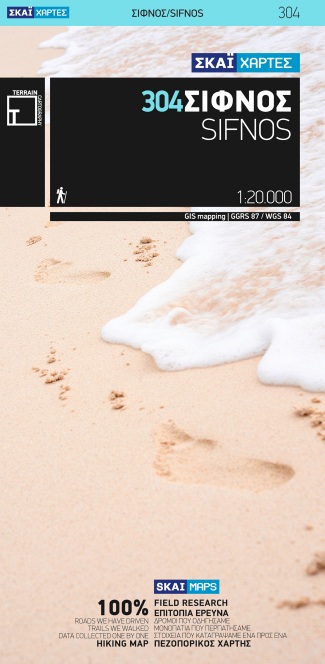
- Wandelkaart 304 Sifnos | Terrain maps
- Sifnos at 1:20,000 on a contoured, GPS compatible hiking map published by Terrain Cartography group together with Skai Maps, and printed on light, waterproof and tear-resistant Polyart plastic paper, with extensive tourist information.Topography is very well presented by contours, enhanced by spot heights, subtle relief shading and additional... Read more
- Also available from:
- Stanfords, United Kingdom

Stanfords
United Kingdom
United Kingdom
- Sifnos Terrain Editions 304
- Sifnos at 1:20,000 on a contoured, GPS compatible hiking map published by Terrain Cartography group together with Skai Maps, and printed on light, waterproof and tear-resistant Polyart plastic paper, with extensive tourist information.Topography is very well presented by contours, enhanced by spot heights, subtle relief shading and additional... Read more
De Zwerver
Netherlands
Netherlands
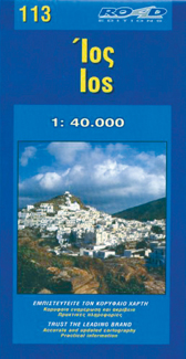
- Wegenkaart - landkaart 113 Ios | Road Editions
- Ios 1 : 40 000 ab 7.49 EURO Karte ohne Jahresangabe. Read more
De Zwerver
Netherlands
Netherlands
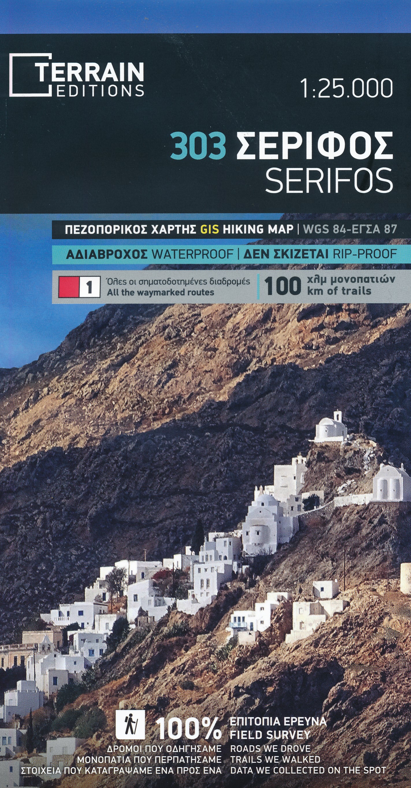
- Wandelkaart 303 Serifos | Terrain maps
- Serifos at 1:20,000 on a contoured, GPS compatible hiking map published by Terrain Cartography group together with Skai Maps, and printed on light, waterproof and tear-resistant Polyart plastic paper, with extensive tourist information.Topography is very well presented by contours, enhanced by spot heights, subtle relief shading and additional... Read more
- Also available from:
- Stanfords, United Kingdom

Stanfords
United Kingdom
United Kingdom
- Serifos Terrain Editions 303
- Serifos at 1:20,000 on a contoured, GPS compatible hiking map published by Terrain Cartography group together with Skai Maps, and printed on light, waterproof and tear-resistant Polyart plastic paper, with extensive tourist information.Topography is very well presented by contours, enhanced by spot heights, subtle relief shading and additional... Read more
De Zwerver
Netherlands
Netherlands
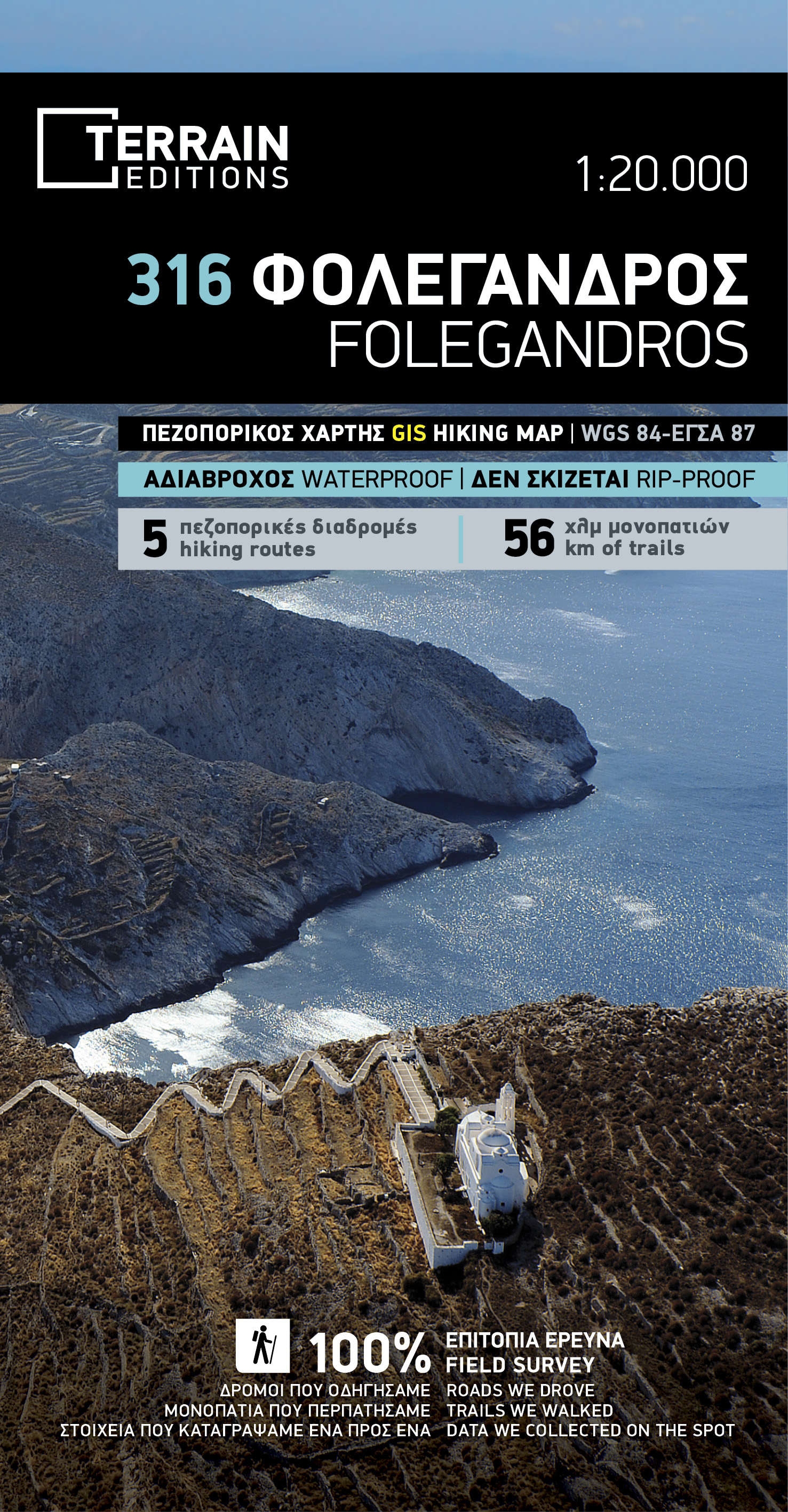
- Wandelkaart 316 Folegandros | Terrain maps
- Folegandros on a light, waterproof and tear-resistant, contoured and GPS compatible map at 1:20,000 from Terrain Editions, with a large street plan of the Hora of Folegandros at 1:2,000 annotated with various facilities. On the reverse is general information about the island, plus descriptions of eight hiking trails. All place names are shown... Read more
- Also available from:
- Stanfords, United Kingdom

Stanfords
United Kingdom
United Kingdom
- Folegandros Terrain Editions 316
- Folegandros on a light, waterproof and tear-resistant, contoured and GPS compatible map at 1:20,000 from Terrain Editions, with a large street plan of the Hora of Folegandros at 1:2,000 annotated with various facilities. On the reverse is general information about the island, plus descriptions of eight hiking trails. All place names are shown... Read more
De Zwerver
Netherlands
Netherlands
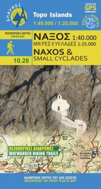
- Wandelkaart - Wegenkaart - landkaart 10.28 Naxos | Anavasi
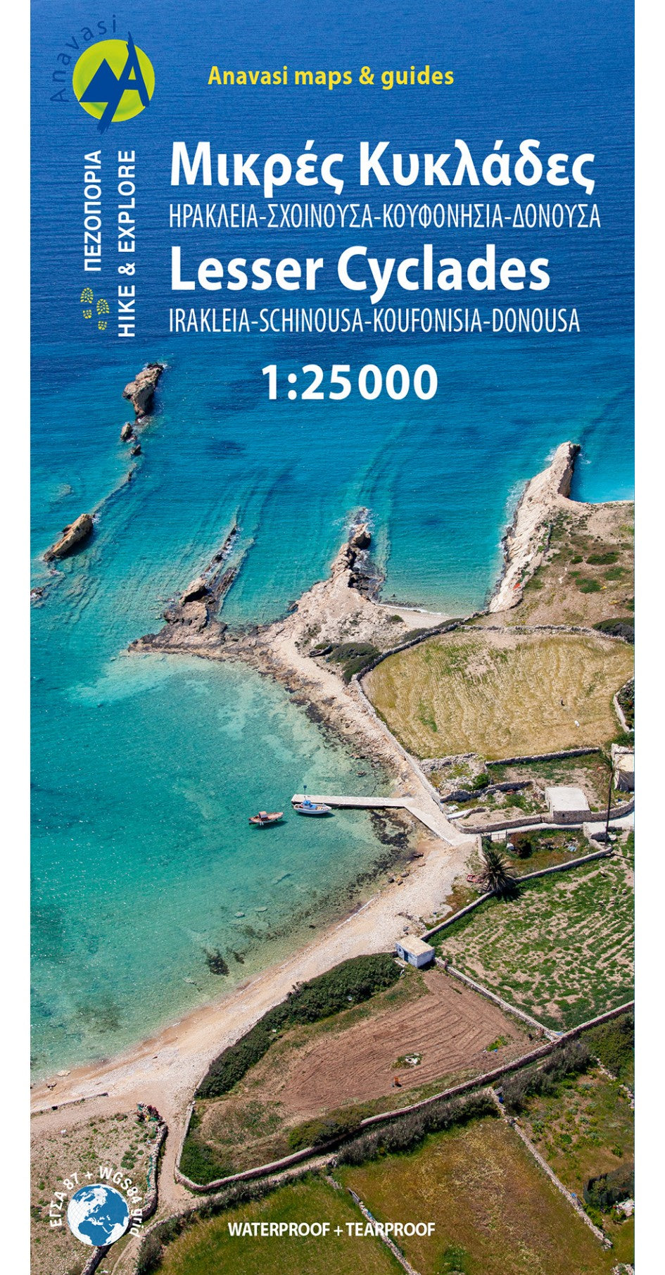
- Naxos on light, a waterproof and tear-resistant, contoured and GPS compatible map at 1:40,000 from Anavasi, highlighting 10 recommended hiking trails, plus on the reverse coverage of six smaller nearby islands in the Cyclades: Donoussa, Irakleia, Schoinousa / Schinousa, Upper and Lower Koufonisi, plus Keros.On one side is the map of Naxos.... Read more
- Also available from:
- Stanfords, United Kingdom

Stanfords
United Kingdom
United Kingdom
- Naxos & Small Cyclades Anavasi 10.28
- Naxos on light, a waterproof and tear-resistant, contoured and GPS compatible map at 1:40,000 from Anavasi, highlighting 10 recommended hiking trails, plus on the reverse coverage of six smaller nearby islands in the Cyclades: Donoussa, Irakleia, Schoinousa / Schinousa, Upper and Lower Koufonisi, plus Keros.On one side is the map of Naxos.... Read more
De Zwerver
Netherlands
2009
Netherlands
2009
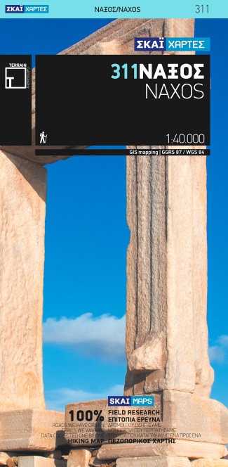
- Wandelkaart 311 Naxos | Terrain maps
- Naxos at 1:40,000 on a contoured, GPS compatible hiking map published by Terrain Cartography group together with Skai Maps, and printed on light, waterproof and tear-resistant Polyart plastic paper, with extensive tourist information.Topography is very well presented by contours, enhanced by spot heights, subtle relief shading and additional... Read more
- Also available from:
- Stanfords, United Kingdom

Stanfords
United Kingdom
2009
United Kingdom
2009
- Naxos Terrain Editions 311
- Naxos at 1:40,000 on a contoured, GPS compatible hiking map published by Terrain Cartography group together with Skai Maps, and printed on light, waterproof and tear-resistant Polyart plastic paper, with extensive tourist information.Topography is very well presented by contours, enhanced by spot heights, subtle relief shading and additional... Read more
De Zwerver
Netherlands
Netherlands
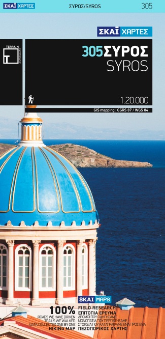
- Wandelkaart 305 Syros | Terrain maps
- Syros at 1:20,000 on a contoured, GPS compatible hiking map published by Terrain Cartography group together with Skai Maps, and printed on light, waterproof and tear-resistant Polyart plastic paper, with extensive tourist information.Topography is very well presented by contours, enhanced by spot heights, subtle relief shading and additional... Read more
- Also available from:
- Stanfords, United Kingdom

Stanfords
United Kingdom
United Kingdom
- Syros Terrain Editions 305
- Syros at 1:20,000 on a contoured, GPS compatible hiking map published by Terrain Cartography group together with Skai Maps, and printed on light, waterproof and tear-resistant Polyart plastic paper, with extensive tourist information.Topography is very well presented by contours, enhanced by spot heights, subtle relief shading and additional... Read more
De Zwerver
Netherlands
Netherlands
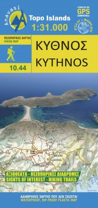
- Wandelkaart 10.44 Kythnos | Anavasi
- Het eiland Kithnos heeft twee charmante nederzettingen, Hora en Dryopida, wat zeker een bezoekje waard is. Ook heeft Kithnos prachtige stranden en een goed bewaard netwerk van paden. De kaarten van Anavasi zijn zeer gedetailleerd, beschikken over een helder kaartbeeld en zijn uitstekende kaarten voor diverse activiteiten. Ze beschikken over... Read more
Meer kaarten…