
Appennini
Beschrijving

The Apennine mountains, or Appennini as they are called in Italy, form the backbone of the Italian peninsula. In the northwest of Italy the Apennines touch on the Ligurian Alps. From there the range forms an arc reaching all the way to the island of Sicily in the south. The Apennines are sub-divided into the Northern, Central and Southern Apennines, with a total length of 1200 km. Including Sicily they even add up to 1500 km. The Central Apennines are the highest, culminating in Corno Grande (2912 m), home to the Calderone glacier.
Being such an extensive mountain range, the different parts of the Apennines are named after the provinces they are in, such as the Ligurian Apennines, the Tuscan-Emilian Apennines, the Umbrian Apennines, the Umbria-Marche Apennines and the Abruzzi Apennines. In turn these often consist of different chains, massifs and valleys. In general, the eastern slopes toward the Adriatic are the steepest, the western slopes being more gentle.
Clearly the Appennini are good hiking area. There are numerous short and long distance trails set out. European long distance trail E1 runs through the Northern and Central Apennines, and the Sentiero Italia crosses the entire Apennine range.
Paden in deze regio
Links
Feiten
Verslagen
Gidsen en kaarten
Overnachting
Organisaties
Reisorganisaties
GPS
Anders
Boeken
Netherlands
2022
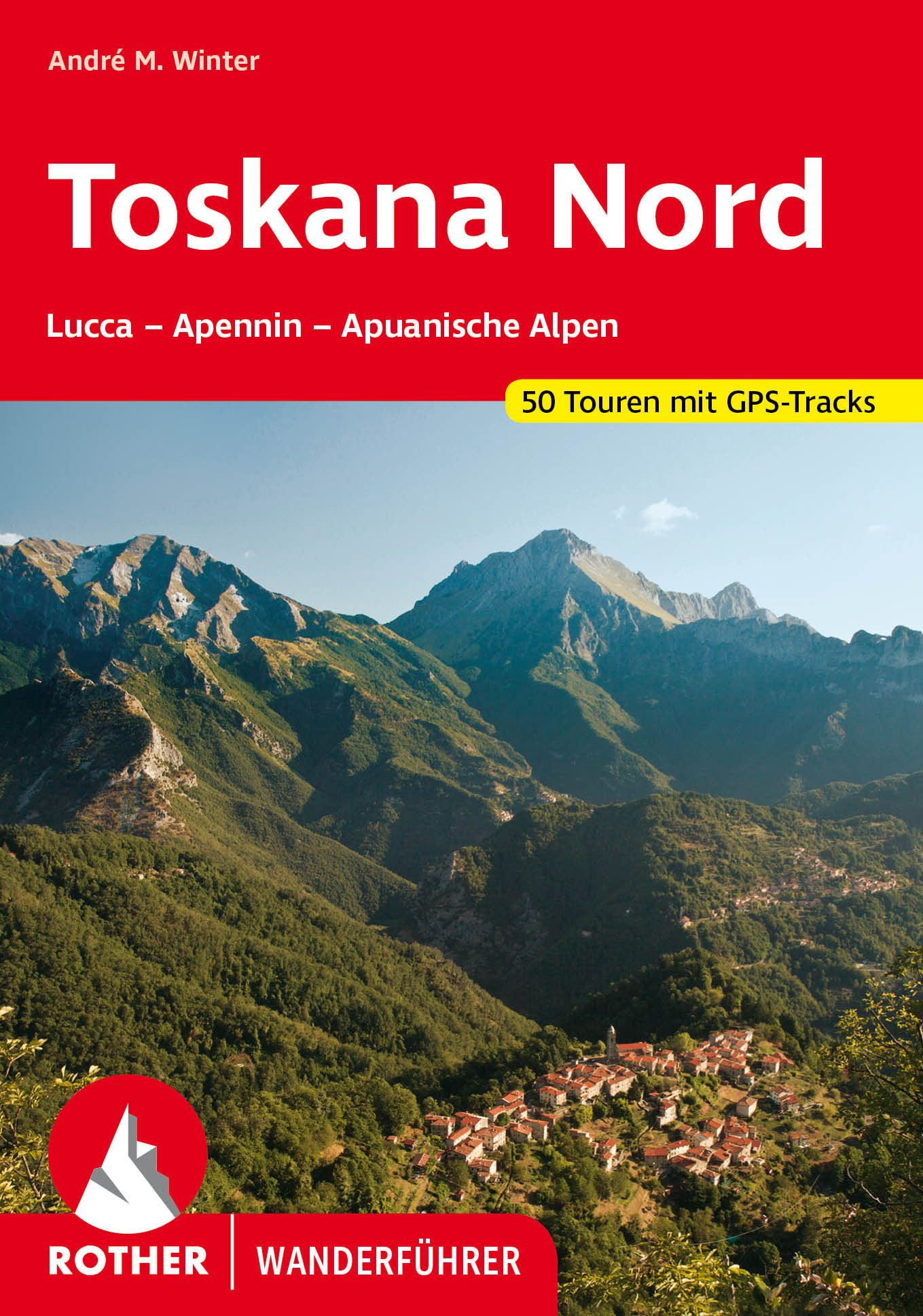
- Wandelgids 312 Toskana Nord (Toscane) | Rother Bergverlag
- Uitstekende wandelgids met een groot aantal dagtochten in dal en hooggebergte. Met praktische informatie en beperkt kaartmateriaal! Wandelingen in verschillende zwaarte weergegeven in rood/blauw/zwart. Non solo vino! Nicht nur für Weinkenner, auch für Wanderer und Bergsteiger bietet Italiens klassische Kunst- und Kulturlandschaft viele... Read more
Netherlands
2021
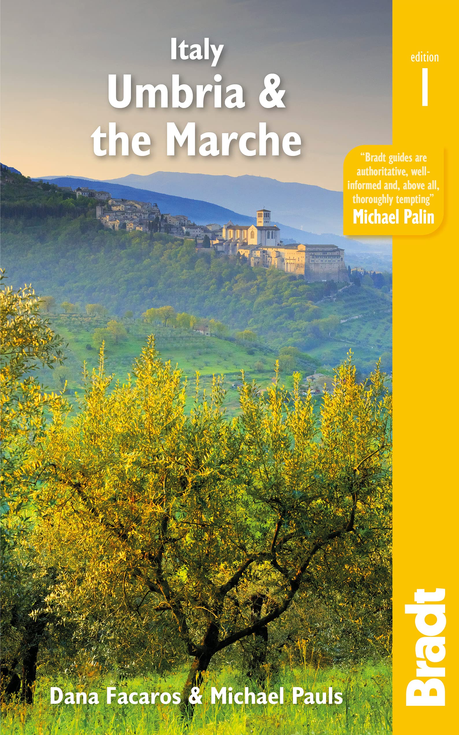
- Reisgids Italy: Umbria and the Marches | Bradt Travel Guides
- Bradt`s Umbria & the Marche is the most detailed guide to combine these two small central Italian regions, which offer all the beauty, history and culture of neighbouring Tuscany only without the crowds, the traffic or eye-popping prices. Dana Facaros and Michael Pauls (authors of the original Cadogan guide to the area) lived in Umbria in the... Read more
- Also available from:
- Stanfords, United Kingdom

United Kingdom
2021
- Italy: Umbria & The Marches
- Bradt`s Umbria & the Marche is the most detailed guide to combine these two small central Italian regions, which offer all the beauty, history and culture of neighbouring Tuscany only without the crowds, the traffic or eye-popping prices. Dana Facaros and Michael Pauls (authors of the original Cadogan guide to the area) lived in Umbria in the... Read more

Netherlands
2017
- Wandelgids 411 Kautokeino - Nordkap E1 | Conrad Stein Verlag
- Handzaam boekje met de routebeschrijving inclusief een heleboel praktische informatie. De beschrijving is uitstekend, maar kaarten zijn wat beperkt. Duits. Die 330 km lange Wanderung auf dem E1 von Kautokeino zum Nordkap ist ein unvergessliches Wanderabenteuer. In 15 Etappen laufen Sie durch die Wildnis Nordnorwegens und überqueren die... Read more
Netherlands
2012
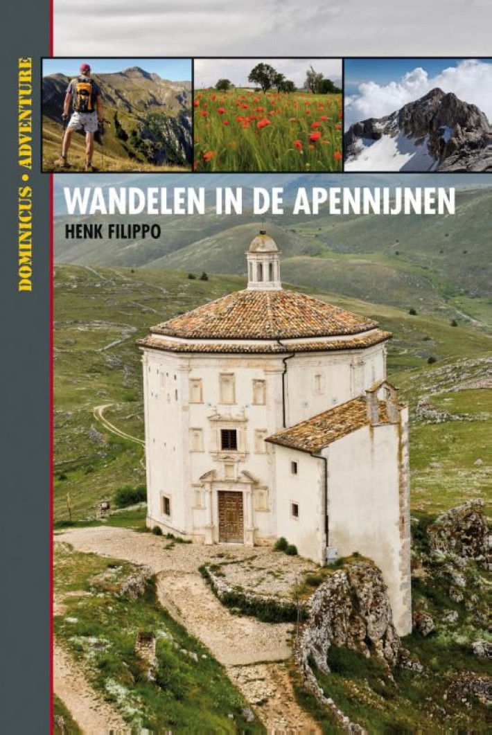
- Wandelgids Dominicus Wandelen in de Apennijnen | Gottmer
- Hoewel de Apennijnen midden in Italië liggen, zijn omgeven door grote steden en je ze van alle kanten snel kunt bereiken, zijn ze niettemin een afgelegen en stil natuurgebied gebleven. Je vindt hier niet het dolce vita of het lieflijke Italië van bijvoorbeeld Toscane. De Apennijnen zijn puur en ruig, en via de wandelingen in dit boek ontdek je... Read more
Netherlands
2012
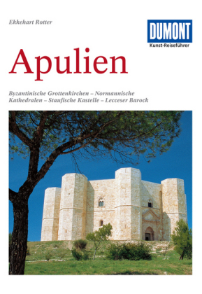
- Reisgids Kunstreiseführer Apulien - Apulië | Dumont
- Fahrten zu byzantinischen Grottenkirchen, normannischen Kathedralen, staufischen Kastellen und Barockbauten in Lecce DuMont Kunst-Reiseführer. 6. Auflage. Read more

Netherlands
2022
Netherlands
2013
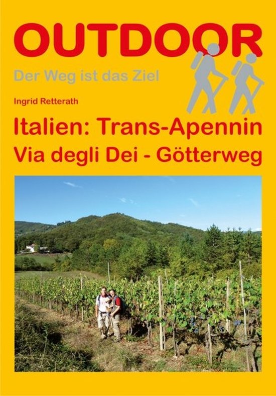
- Wandelgids - Pelgrimsroute Trans-Apennin, Via degli Dei - Gotterweg - Godenweg | Conrad Stein Verlag
- Der Weg ist das Ziel. 1. Auflage. Read more
- Also available from:
- Stanfords, United Kingdom

United Kingdom
2017
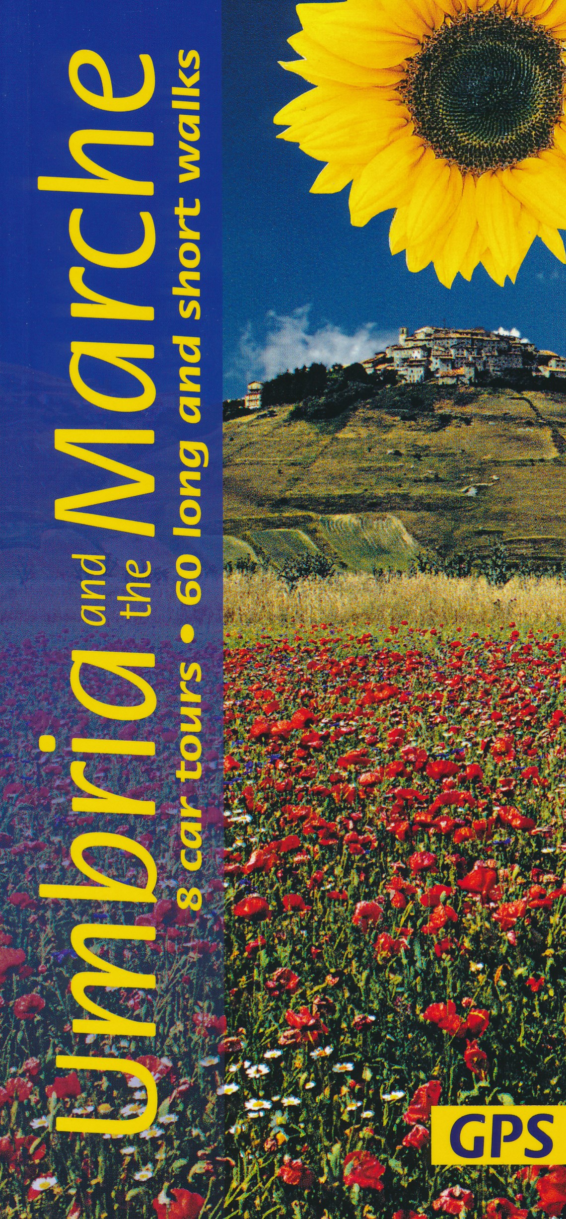
- Umbria and the Marche Sunflower Landscape Guide
- Umbria promotes itself as `Italy`s Green Heart`, and this description applies equally well to the lesser-known neighbouring region of the Marche. The main focal points of this guide are the two most beautiful areas of the Apennines in the region – the idyllic, deeply-etched valley of Valnerina in Umbria and the legendary Monti Sibillini which... Read more

Netherlands
2021
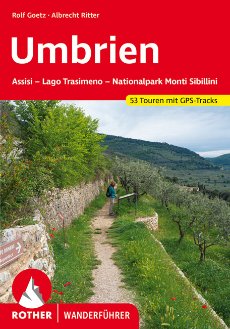
- Wandelgids 317 Umbrien - Umbrië | Rother Bergverlag
- Goede duitstalige wandelgids. Veel dagtochten, met gradaties en kleuren in zwaarte gerangschikt. Veel praktische informatie. Handzaam formaat. Ungeachtet der zentralen Lage im Städtedreieck Florenz, Ancona und Rom ist Umbrien eine Welt für sich, die schon gar nicht mit dem berühmten toskanischen Nachbarn in einen Topf geworfen werden will. Es... Read more

Netherlands
2013
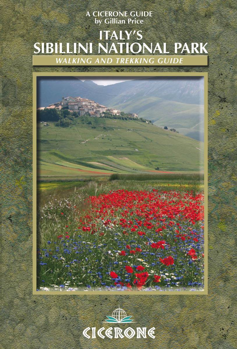
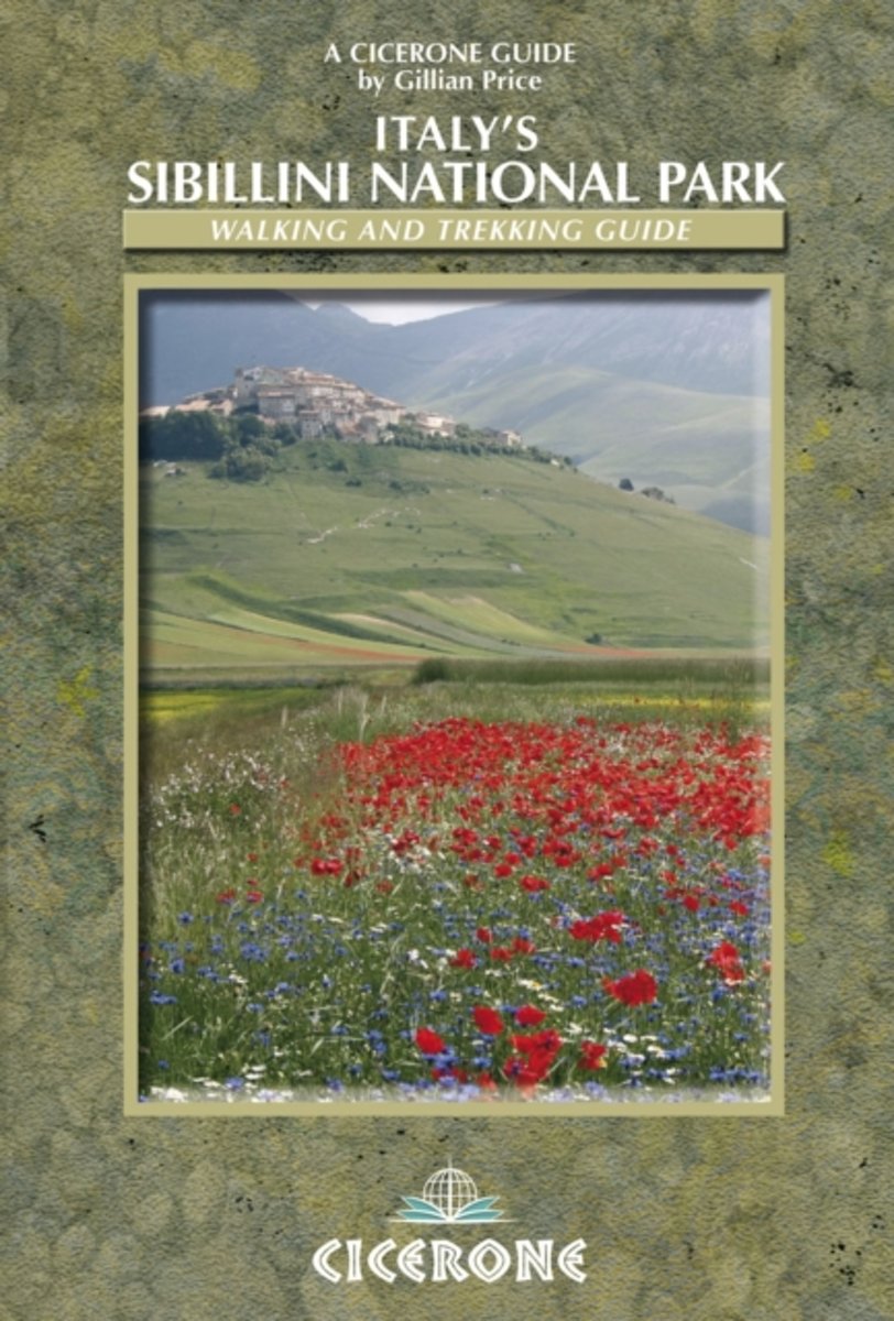
- Wandelgids Italy's Sibillini National Park | Cicerone
- Walking and trekking guidebook to Italy's Sibillini National Park in the Apennines. 21 day walks and an 8-stage multi-day trek, the 120km Grande Anello dei Sibillini are explored alongside sketch maps and plenty of practical information. Easily reached from airports on the Adriatic coast and Rome, the Sibillini straddles the Marche and Umbria. Read more
- Also available from:
- Bol.com, Netherlands
- Bol.com, Belgium
- Stanfords, United Kingdom
- The Book Depository, United Kingdom
Netherlands
2013
- Italy's Sibillini National Park
- This guidebook describes 21 day walks, and one 8-day trek (Grande Anello dei Sibillini) in Italy's Sibillini National Park. Including short strolls and suitable for all walkers, with day walks ranging from 3.5 to 20.5km, the Sibillini in Italy's Apennines are easily reached from the budget airline destinations on the Adriatic coast and from... Read more
Belgium
2013
- Italy's Sibillini National Park
- This guidebook describes 21 day walks, and one 8-day trek (Grande Anello dei Sibillini) in Italy's Sibillini National Park. Including short strolls and suitable for all walkers, with day walks ranging from 3.5 to 20.5km, the Sibillini in Italy's Apennines are easily reached from the budget airline destinations on the Adriatic coast and from... Read more

United Kingdom
2013
- Italy’s Sibillini National Park
- Italy’s Sibillini National Park is Gillian Price’s Cicerone guide to some of the finest walking opportunities near Monti Sibillini in the north-east of the country. The guide describes everything from short strolls to an eight-day trek that encircles the massif and its beautiful national park. This is the first English language guide to the... Read more

United Kingdom
2013
- Italy's Sibillini National Park
- Walking and Trekking Guide Read more
Netherlands
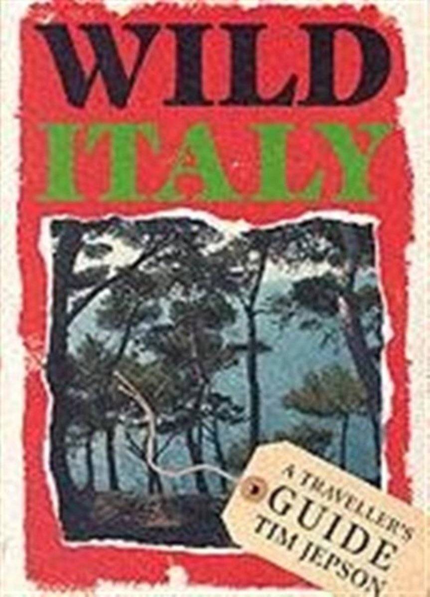
- Wild Italy 1E
- In Wild Italy, Tim Jepson leaves the well-worn tourist haunts of traditional guide books behind him in search of fresher pleasures. He offers a rural, rather than an urban Italy, revealing the best of the long walks, mountain hideaways, woods, plains, sea coasts and remote islands where travellers can still find a refuge from the modern world.... Read more
- Also available from:
- Bol.com, Belgium
Belgium
- Wild Italy 1E
- In Wild Italy, Tim Jepson leaves the well-worn tourist haunts of traditional guide books behind him in search of fresher pleasures. He offers a rural, rather than an urban Italy, revealing the best of the long walks, mountain hideaways, woods, plains, sea coasts and remote islands where travellers can still find a refuge from the modern world.... Read more
Netherlands
2014
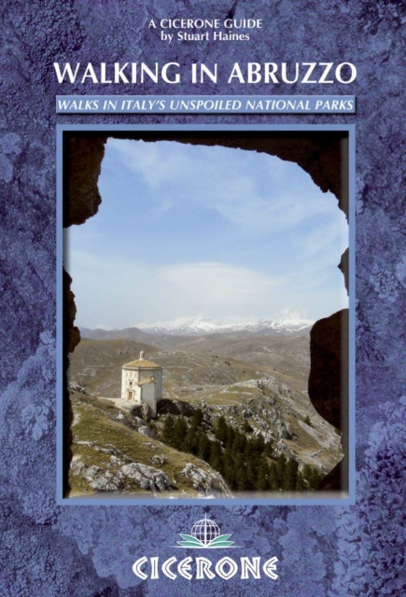
- Walking in Abruzzo
- Over 30 routes, this guide covers all the wonderful walking country to be found in Abruzzo, one of the wildest and least populated regions of Italy. The area is easily reached from the airport at Pescara, and the full- and half-day routes are graded to suit all walkers. About a third are easy going - a half day generally, most however are long... Read more
- Also available from:
- Bol.com, Belgium
Belgium
2014
- Walking in Abruzzo
- Over 30 routes, this guide covers all the wonderful walking country to be found in Abruzzo, one of the wildest and least populated regions of Italy. The area is easily reached from the airport at Pescara, and the full- and half-day routes are graded to suit all walkers. About a third are easy going - a half day generally, most however are long... Read more
- Also available from:
- Bol.com, Netherlands
- Bol.com, Belgium
- Stanfords, United Kingdom
- The Book Depository, United Kingdom

Netherlands
2017
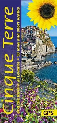
- Landscapes of the Cinque Terre and Riviera di Levante
- The Riviera di Levante between Genoa and La Spezia has become a much-loved hiking area - perhaps the most popular in all Italy apart from the Alps. And the 'Cinque Terre', the steep coast south of Levanto cradling the five villages of Monterosso, Vernazza, Corniglia, Manarola and Riomaggiore, is the best loved of all. If you enjoyed Sunflower's... Read more
Belgium
2017
- Landscapes of the Cinque Terre and Riviera di Levante
- The Riviera di Levante between Genoa and La Spezia has become a much-loved hiking area - perhaps the most popular in all Italy apart from the Alps. And the 'Cinque Terre', the steep coast south of Levanto cradling the five villages of Monterosso, Vernazza, Corniglia, Manarola and Riomaggiore, is the best loved of all. If you enjoyed Sunflower's... Read more

United Kingdom
2017
- Cinque Terre and the Riviera di Levante Sunflower Landscape Guide
- If you enjoyed Sunflower`s best-selling guide to Sorrento and the Amalfi Coast, you`re sure to love the Cinque Terre and Riviera di Levante - the steeply terraced vineyards, ancient mule trails and colourful villages. This was the birthplace of modern tourism in the early 1800s, but over the last 30 years it has become a much-loved hiking... Read more

United Kingdom
2017
- Cinque Terre and the Riviera di Levante
- 50 long and short walks with GPS Read more
Kaarten

Netherlands
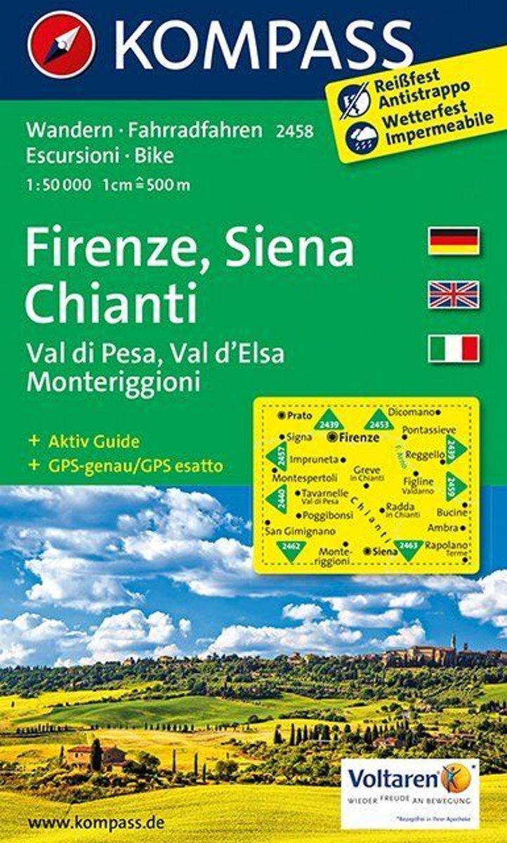
- Wandelkaart 2458 Firenze - Siena - Chianti | Kompass
- Florence - Siena - Chianti area on a double-sided map at 1:50,000 from Kompass, printed on durable, waterproof and tear-resistant synthetic paper. Coverage includes Val di Pesa, Val d’Elsa, Monteriggioni, etc. Contours are at 40m intervals, with a 2-km UTM grid. Extensive overprint includes GEA - Grande Escursione Appenninica, Sentiero Italia,... Read more
- Also available from:
- Stanfords, United Kingdom

United Kingdom
- Florence - Siena - Chianti Kompass 2458
- Florence - Siena - Chianti area on a double-sided map at 1:50,000 from Kompass, printed on durable, waterproof and tear-resistant synthetic paper. Coverage includes Val di Pesa, Val d’Elsa, Monteriggioni, etc. Contours are at 40m intervals, with a 2-km UTM grid. Extensive overprint includes GEA - Grande Escursione Appenninica, Sentiero Italia,... Read more
- Also available from:
- Stanfords, United Kingdom

United Kingdom
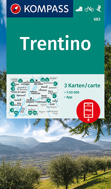
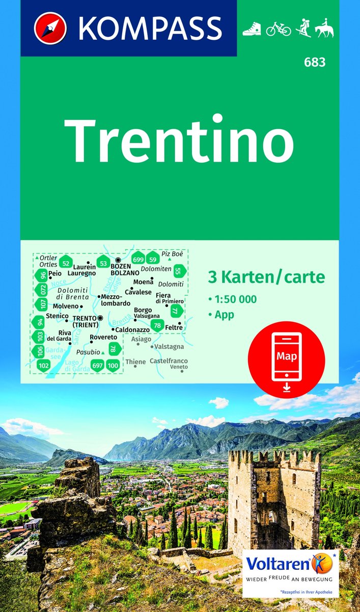
- Trentino 3-Map Set Kompass 683
- Trentino region of Italy on a set of three double-sided, GPS compatible and contoured maps at 1:50,000 from Kompass, with hiking trails, cycling, ski and horse riding routes, various recreational facilities, etc. The set provides very wide coverage of this popular part of Italy, extending from north of Bolzano southwards to include the northern... Read more

Netherlands
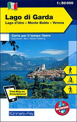
- Wandelkaart - Fietskaart 07 Outdoorkarte IT Gardasee - Gardameer | Kümmerly & Frey
- Lake Garda - Lake d'Idro - Monte Baldo - Verona area at 1:50,000 in a series of waterproof and tear-resistant, GPS compatible and contoured recreational maps from K Read more
- Also available from:
- Stanfords, United Kingdom
United Kingdom
- Lake Garda - Lake Idro - Monte Baldo - Verona K+F Outdoor Map 7
- Lake Garda - Lake d`Idro - Monte Baldo - Verona area at 1:50,000 in a series of waterproof and tear-resistant, GPS compatible and contoured recreational maps from Kümmerly + Frey with both local and long-distance hiking and cycling trails, ski routes, sites for other outdoor pursuits, accommodation, bus stops, etc. An inset provides a small... Read more

Netherlands
- Wandelkaart 63 Eggegebirge (Nordteil) mit Eggeweg, E1, Jakobspilgerweg | GeoMap
- Topographische Wanderkarte für den nördlichen Teil des Eggegebirges mit Eggeweg, E1, Jakobspilgerweg. 4. Auflage. Read more
Netherlands
- Florence, Siena, Chianti WK2458
- Deze kaart is ideaal voor het uitstippelen van wandel- en fietsroutes en om onderweg te gebruiken • goed leesbare kaart met heel veel topografische details • duidelijke symbolen maken de kaart extra overzichtelijk • wandel- en fietsroutes zijn aangegeven • praktische informatie over de regio • bruikbaar met GPS • nuttige informatie voor... Read more
- Also available from:
- Bol.com, Belgium
Belgium
- Florence, Siena, Chianti WK2458
- Deze kaart is ideaal voor het uitstippelen van wandel- en fietsroutes en om onderweg te gebruiken • goed leesbare kaart met heel veel topografische details • duidelijke symbolen maken de kaart extra overzichtelijk • wandel- en fietsroutes zijn aangegeven • praktische informatie over de regio • bruikbaar met GPS • nuttige informatie voor... Read more
Netherlands
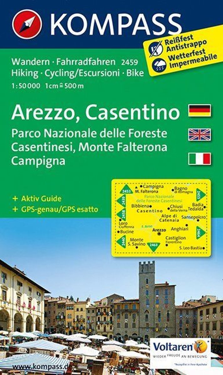
- Arezzo, Casentino WK 2459
- Deze kaart is ideaal voor het uitstippelen van wandel- en fietsroutes en om onderweg te gebruiken • goed leesbare kaart met heel veel topografische details • duidelijke symbolen maken de kaart extra overzichtelijk • wandel- en fietsroutes zijn aangegeven • praktische informatie over de regio • bruikbaar met GPS • nuttige informatie voor... Read more
- Also available from:
- Bol.com, Belgium
Belgium
- Arezzo, Casentino WK 2459
- Deze kaart is ideaal voor het uitstippelen van wandel- en fietsroutes en om onderweg te gebruiken • goed leesbare kaart met heel veel topografische details • duidelijke symbolen maken de kaart extra overzichtelijk • wandel- en fietsroutes zijn aangegeven • praktische informatie over de regio • bruikbaar met GPS • nuttige informatie voor... Read more
Netherlands
- Trentino 1:50 000
- -Die Provinz Trentino erstreckt sich vom Tonalepass im Westen bis zur Pala-Gruppe bei San Martino di Castrozza im Osten. In der Nord-Süd-Ausdehnung reicht sie von Canazei im Norden und im Süden bis zum Gardasee.-Geprägt wird die östliche Trentino-Region durch einzeln stehende Kalkmassive wie Pala- und Sellagruppe, Latemar-Rosengarten, Marmolata... Read more
- Also available from:
- Bol.com, Belgium
Belgium
- Trentino 1:50 000
- -Die Provinz Trentino erstreckt sich vom Tonalepass im Westen bis zur Pala-Gruppe bei San Martino di Castrozza im Osten. In der Nord-Süd-Ausdehnung reicht sie von Canazei im Norden und im Süden bis zum Gardasee.-Geprägt wird die östliche Trentino-Region durch einzeln stehende Kalkmassive wie Pala- und Sellagruppe, Latemar-Rosengarten, Marmolata... Read more
Netherlands
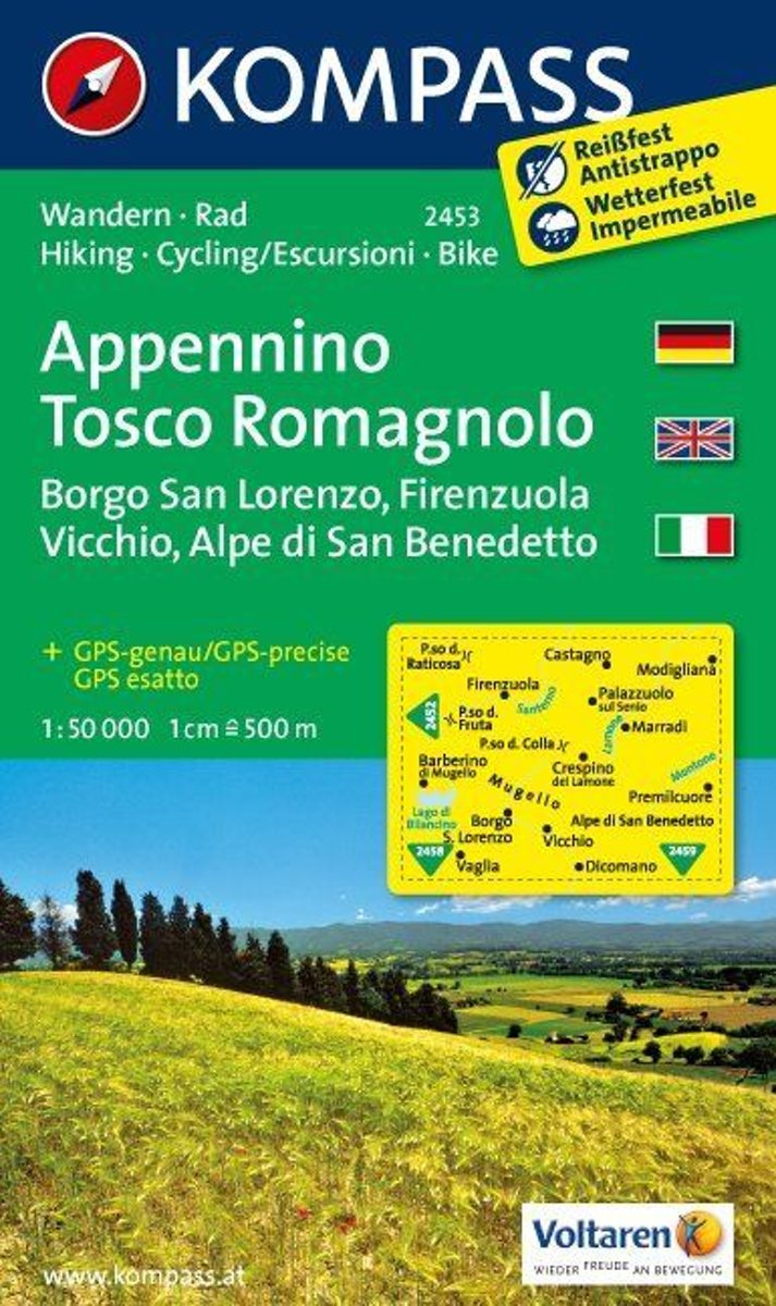
- Appennino Tosco-Romagnolo WK2453
- Deze kaart is ideaal voor het uitstippelen van wandel- en fietsroutes en om onderweg te gebruiken • goed leesbare kaart met heel veel topografische details • duidelijke symbolen maken de kaart extra overzichtelijk • wandel- en fietsroutes zijn aangegeven • praktische informatie over de regio • bruikbaar met GPS • nuttige informatie voor... Read more
- Also available from:
- Bol.com, Belgium
Belgium
- Appennino Tosco-Romagnolo WK2453
- Deze kaart is ideaal voor het uitstippelen van wandel- en fietsroutes en om onderweg te gebruiken • goed leesbare kaart met heel veel topografische details • duidelijke symbolen maken de kaart extra overzichtelijk • wandel- en fietsroutes zijn aangegeven • praktische informatie over de regio • bruikbaar met GPS • nuttige informatie voor... Read more
Netherlands
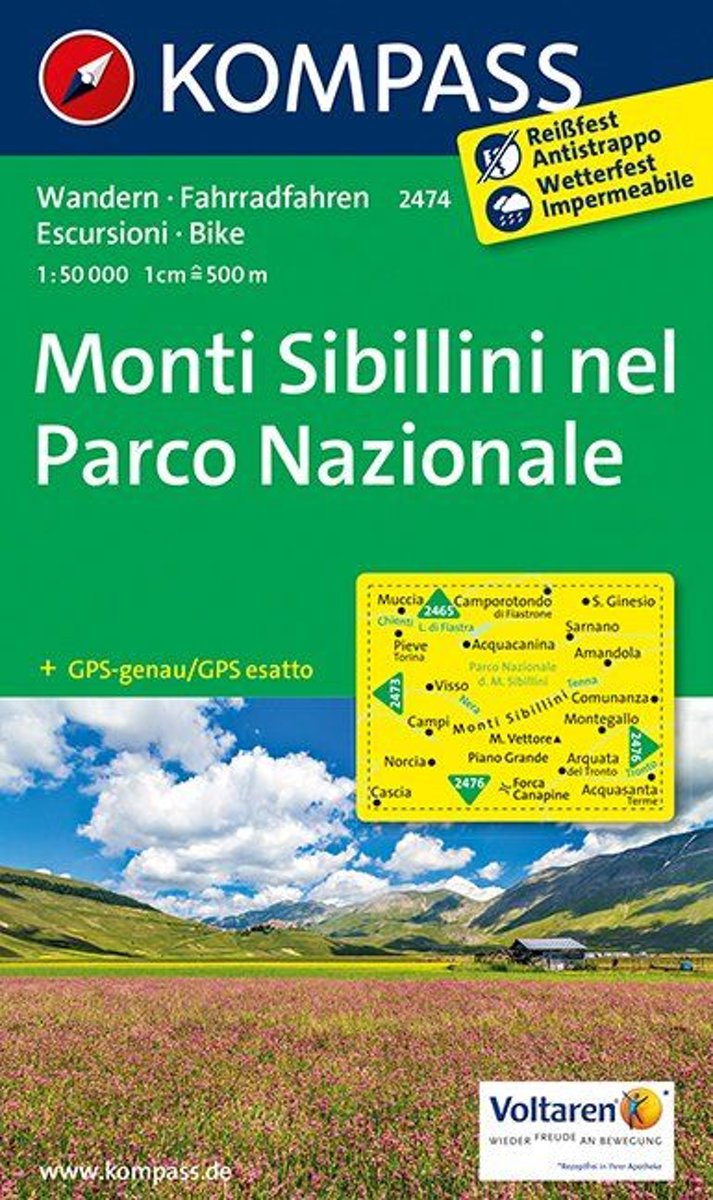
- Monti Sibillini WK2474
- Deze kaart is ideaal voor het uitstippelen van wandel- en fietsroutes en om onderweg te gebruiken • goed leesbare kaart met heel veel topografische details • duidelijke symbolen maken de kaart extra overzichtelijk • wandel- en fietsroutes zijn aangegeven • praktische informatie over de regio • bruikbaar met GPS • nuttige informatie voor... Read more
- Also available from:
- Bol.com, Belgium
Belgium
- Monti Sibillini WK2474
- Deze kaart is ideaal voor het uitstippelen van wandel- en fietsroutes en om onderweg te gebruiken • goed leesbare kaart met heel veel topografische details • duidelijke symbolen maken de kaart extra overzichtelijk • wandel- en fietsroutes zijn aangegeven • praktische informatie over de regio • bruikbaar met GPS • nuttige informatie voor... Read more

United Kingdom
- Foreste Casentinesi NP Monti Editore 20
- Map No. 20, Foreste Casentinesi: Campigna, Camaldoli, Chiusi dell Verna, in series of contoured, GPS compatible hiking maps at 1:25,000 from the Istituto Geografico Adriatico, covering mainly the spine of the Apennines along the borders of Tuscany, Emilia-Romagna, Umbria and the Marches.Map in this series have contours at 25m intervals with... Read more

United Kingdom
- Riviera di Ponente - Albisola Marina to Noli Edizioni Multigraphic 103
- Map No. 103, covering at 1:25,000 the coast of the Italian Riviera from Albisola Marina across Savona to Noli and inland to Altare. The map is part of a series of walking maps from Edizioni Multigraphic covering the Ligurian Alps and the coast, the crest of the Apennines along the border between Tuscany with the neighbouring regions, and parts... Read more

United Kingdom
- Appennino Tosco-Romagnolo East
- Map No. 135, Appennino Tosco-Romagnolo East, in a series of GPS compatible hiking maps at 1:50,000 from the Istituto Geografico Adriatico, covering parts of central Italy: eastern Tuscany, with northern Umbria and the Marches, plus the south-eastern of part of Emilia-Romagna.The maps have contours at 50m intervals with additional shading and... Read more

United Kingdom
- Gruppi Argentera e Marguareis Edizioni Multigraphic 109/115
- Gruppi Argentera e Marguareis, map no. 109/115 at 1:25,000 from Edizioni Multigraphic covering the Italian Alps along the southern part of the border between Piedmont and France, south of Cuneo. Coverage includes the Pallanfre Reserve, Colle di Tenda / Col de Tende, and Parco Naturale Valle Pesio. Map corners give latitude and longitude based... Read more
United Kingdom
- Colline di Rimini
- Map No. 124, Colline di Rimini, in a series of GPS compatible hiking maps at 1:50,000 from the Istituto Geografico Adriatico, covering parts of central Italy: eastern Tuscany, with northern Umbria and the Marches, plus the south-eastern of part of Emilia-Romagna. This title covers the holiday resorts on the Adriatic coast around Rimini,... Read more
United Kingdom
- Riviera di Ponente: Finale Ligure to Albenga 25K Ed. Multigraphic Map No. 104
- Map No. 104, covering at 1:25,000 the coast of the Italian Riviera from Finale Ligure to Albenga and inland beyond Monte Carmo. The map is part of a series of walking maps from Edizioni Multigraphic covering the Ligurian Alps and the coast, the crest of the Apennines along the border between Tuscany with the neighbouring regions, and parts of... Read more