
Garda
Beschrijving
Kaart

Paden in deze regio
Links
Feiten
Verslagen
Gidsen en kaarten
Overnachting
Organisaties
Reisorganisaties
GPS
Anders
Boeken
De Zwerver
Netherlands
2017
Netherlands
2017
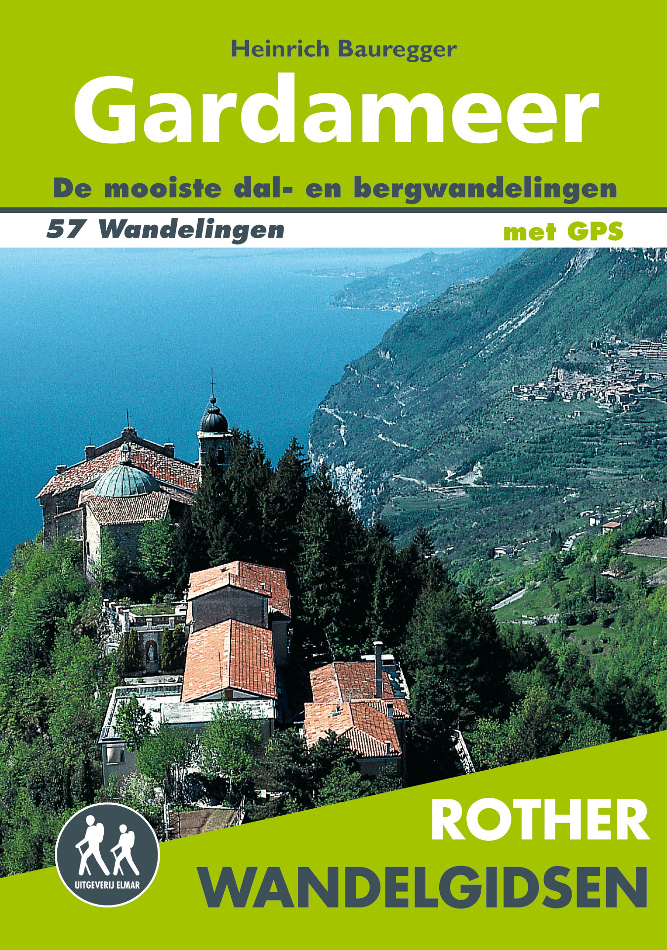
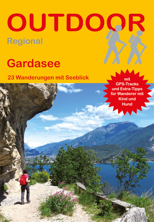
- Wandelgids Gardameer | Uitgeverij Elmar
- de mooiste dal- en bergwandelingen Read more
De Zwerver
Netherlands
2022
Netherlands
2022
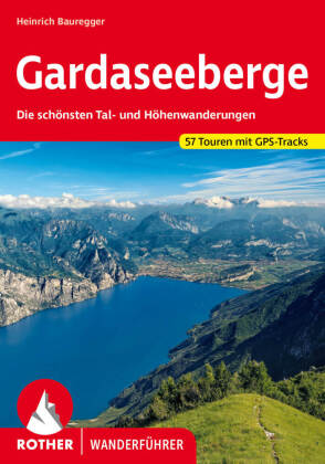
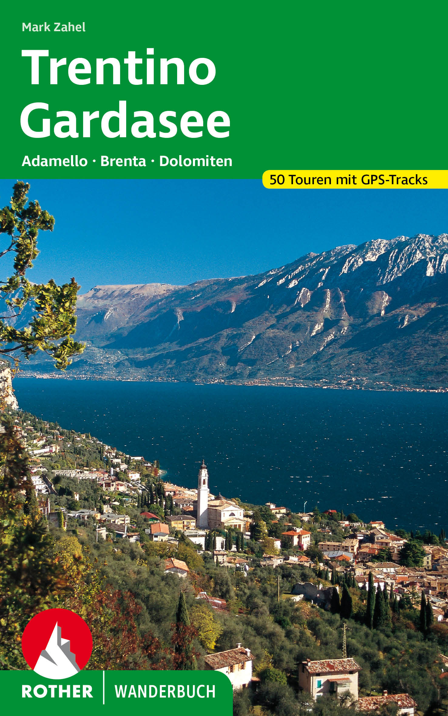
- Wandelgids 41 Gardaseegeberge - Gardameer | Rother Bergverlag
- Uitstekende wandelgids met 52 dagtochten in dal en hoger gelegen delen van het gebergte. Met praktische informatie en beperkt kaartmateriaal! Wandelingen in verschillende zwaarte weergegeven in rood/blauw/zwart. Deze wandelgidsen uitgever staat hoog aangeschreven en is een begrip onder de wandelaars! Eingebettet in steil aufragende Berge,... Read more
De Zwerver
Netherlands
2022
Netherlands
2022
De Zwerver
Netherlands
2018
Netherlands
2018
- Wandelgids Gardameer - Gardasee- Lago di Garda | Conrad Stein Verlag
- Handzaam boekje met de routebeschrijving inclusief een heleboel praktische informatie. De beschrijving is uitstekend, maar kaarten zijn beperkt en schetsmatig aanwezig. Duits.. Spektakul�re Wege, weite Ausblicke, alte Festungen, Str�nde � der Gardasee hat f�r Wanderer viel zu bieten. Das Buch stellt 23 der sch�nsten Tagestouren rund um den n�... Read more
De Zwerver
Netherlands
2018
Netherlands
2018
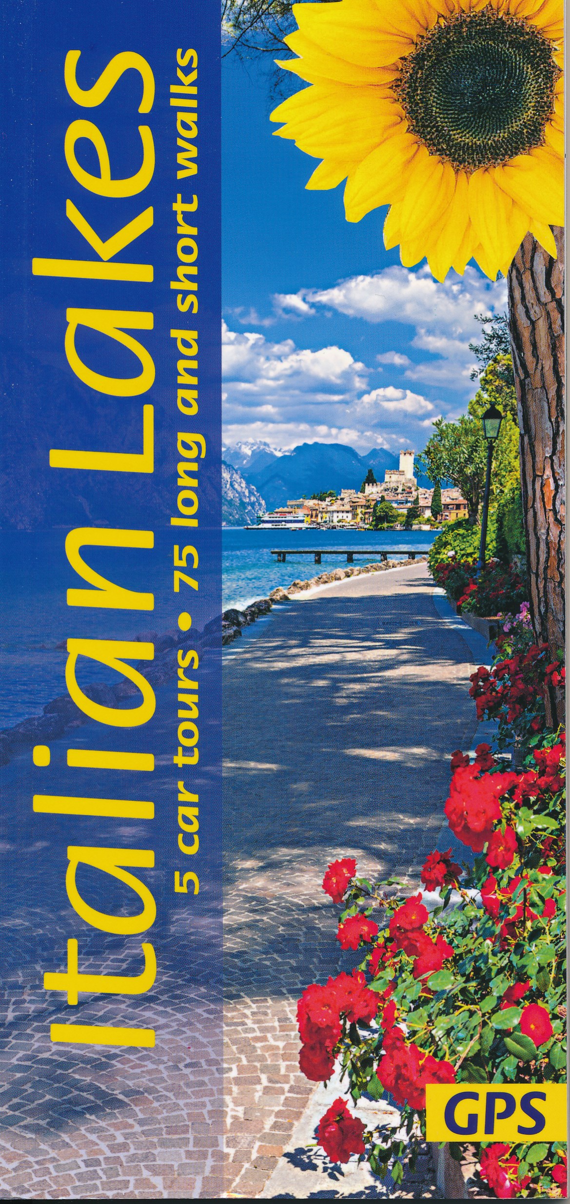
- Wandelgids Italiaanse Meren - Italian Lakes | Sunflower books
- Wandelgids: vele dagtochten worden degelijk beschreven met openbaar vervoer informatie, goede routebeschrijvingen en kaartmateriaal. Tevens enkele autotochten. Deze gids staat goed bekend! Engelstalig 5 car tours, 38 main walks plus many alternative and shorter variations, 21 picnic suggestions The Italian Lakes have long been a 'must' for... Read more
- Also available from:
- Stanfords, United Kingdom

Stanfords
United Kingdom
2018
United Kingdom
2018
- Italian Sunflower Landscape Guide
- This new 3rd edition of Italian Lakes has been carefully revised just a few months prior to publication. The topo maps now show waypoints, and free downloadable GPS tracks are available for all the walks. Colour coding on the Contents page enables you to see at a glance the grading of various walks. These great expanses of water, bound to the... Read more
De Zwerver
Netherlands
2022
Netherlands
2022
De Zwerver
Netherlands
2011
Netherlands
2011
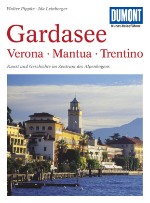
- Reisgids Kunstreiseführer Gardasee: Verona - Mantua - Trentino | Dumont
- Bis vor wenigen Jahrzehnten genossen der Lago Maggiore und der Comer See mit ihren Villen, Palästen und Gärten die ´´Kulturhoheit´´ unter den oberitalienischen Seen. Der Gardasee dagegen galt schon seit Goethes ´´Italienischer Reise´´ vorwiegend als beeindruckendes Landschaftserlebnis, als ´´Anblick der Südsee mitten im Gebirge´´. Der... Read more

De Zwerver
Netherlands
2024
Netherlands
2024
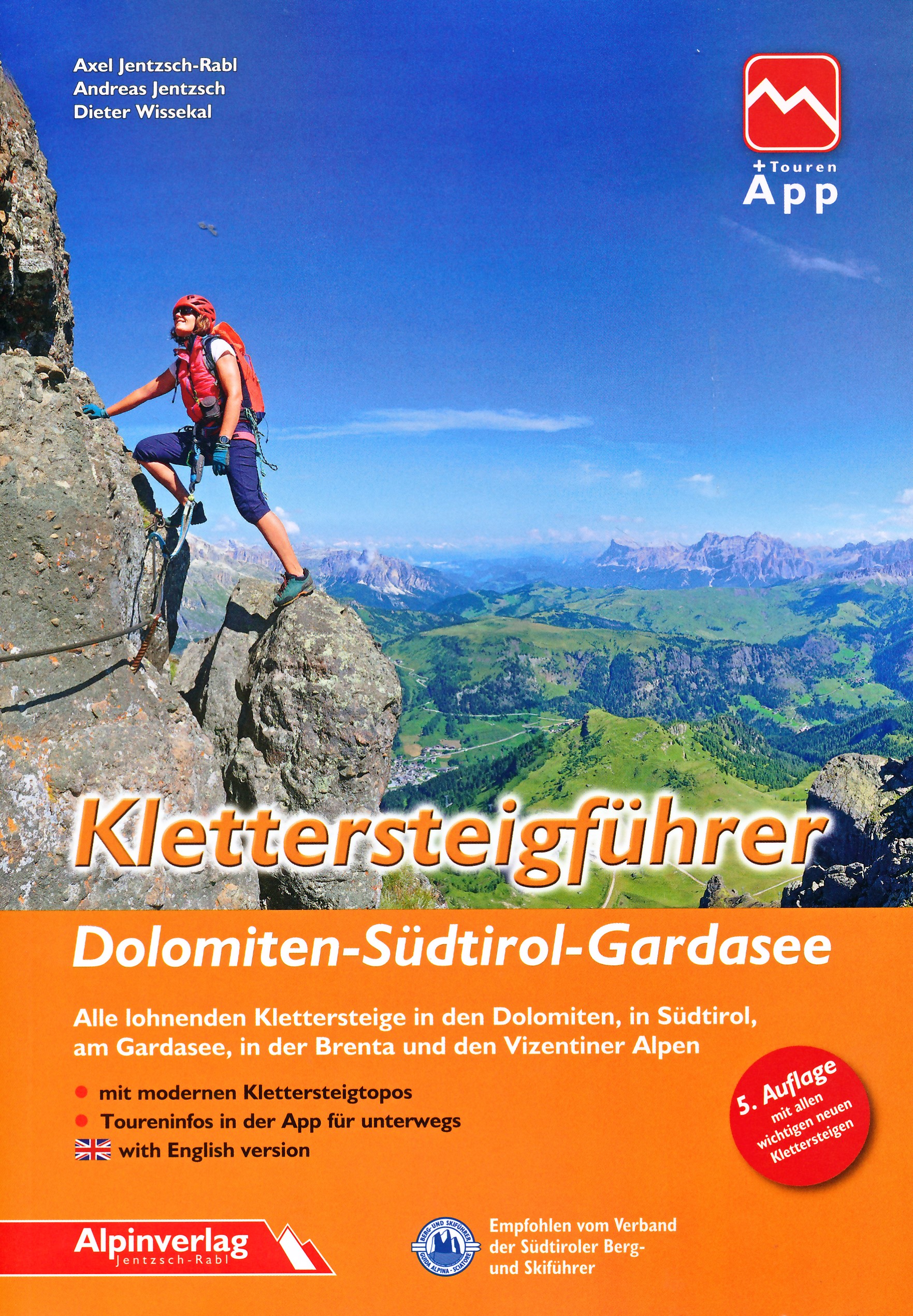
- Klimgids - Klettersteiggids Alpine Klettersteige Ostalpen | Rother Bergverlag
- 70 spannende Touren zwischen Wien, Bodensee und Gardasee Rother Selection. 1. Auflage. Read more
De Zwerver
Netherlands
Netherlands
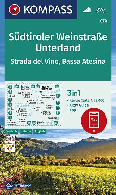
- Wandelkaart 074 Südtiroler Weinstraße - Unterland | Kompass
- Die 3in1 Wanderkarte ist jetzt noch übersichtlicher und besser lesbar. Der Aktiv Guide informiert Sie rund um das Thema Outdoor und die kostenlose App für unterwegs gibt es auch noch dazu. Das bildet die perfekte Grundlage für die Planung einer Wandertour. Die präzise Kartografie zeigt alle begehbaren Wanderwege inklusive Klassifizierung.... Read more
- Also available from:
- Stanfords, United Kingdom

Stanfords
United Kingdom
United Kingdom
- South Tyrol Wine Route - Unterland / Bassa Atesina Kompass 074
- Map No. 074, Südtiroler Weinstrasse - Unterland, from Kompass in a series providing detailed coverage of the Dolomites and Lake Garda area and supplementing their main series of walking maps of Italy at 1:50,000. Maps in this series have a more detailed base and smaller contour interval than coverage at 1:50,000.*Cartography:* maps at 1:25,000... Read more
Kaarten
- Also available from:
- Stanfords, United Kingdom

Stanfords
United Kingdom
2021
United Kingdom
2021
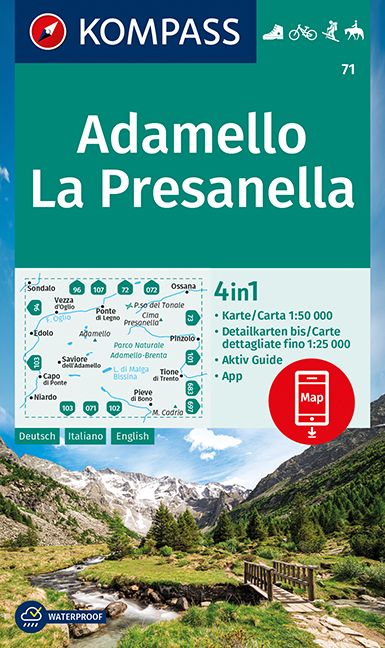
- Adamello - La Presanella Kompass 71
- Adamello - La Presanella area just north of Lake Garda on a GPS compatible hiking and recreational map at 1:50,000 from Kompass, printed on durable, waterproof and tear-resistant synthetic paper. KOMPASS HIKING MAPS OF ITALY: this title is part of an extensive series of walking maps from Kompass covering selected areas of Italy at mainly... Read more
De Zwerver
Netherlands
Netherlands
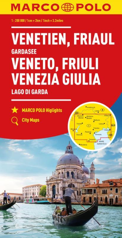
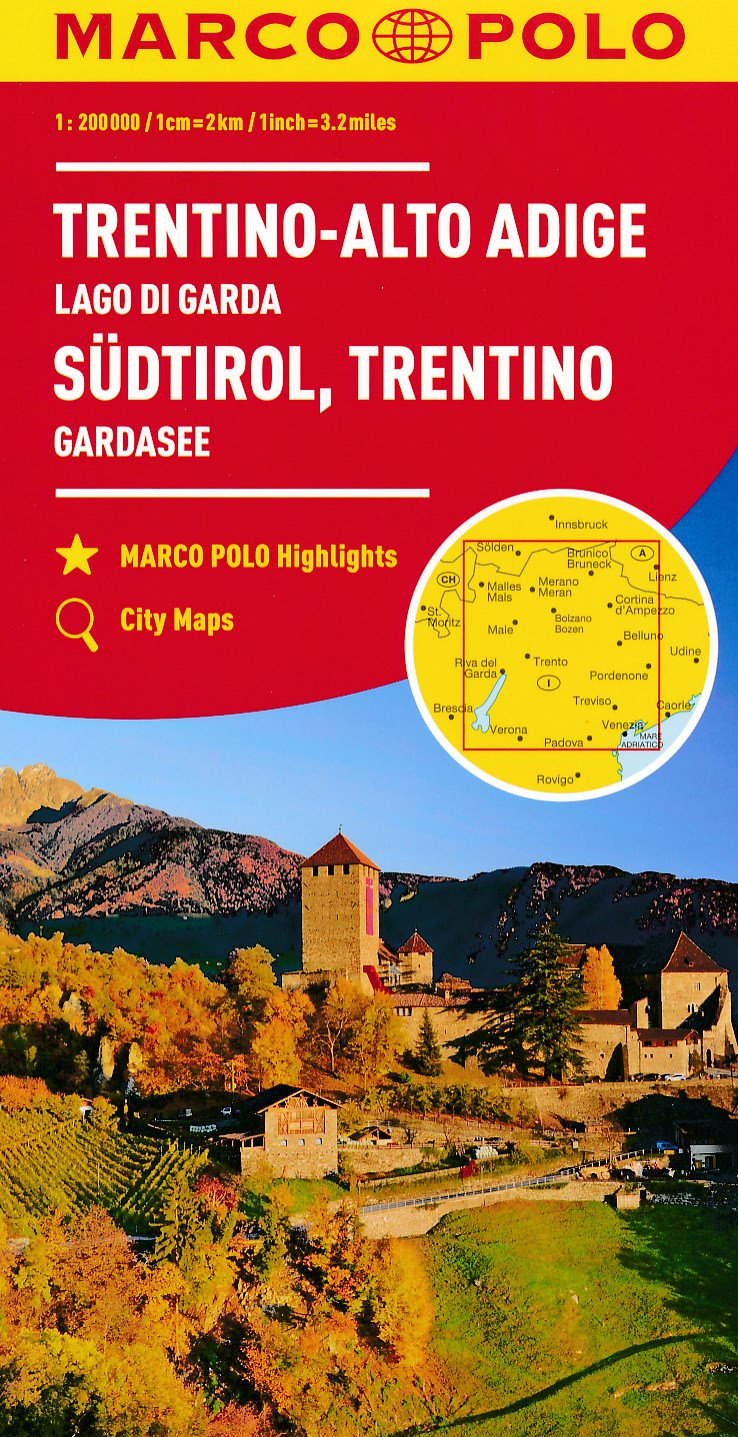
- Wegenkaart - landkaart 03 Zuid Tirol Südtirol - Trentino | Marco Polo
- MARCO POLO Karte Italien 03. Südtirol, Trentino, Gardasee 1:200 000 ab 9.99 EURO MARCO POLO Highlights, City Maps Marco Polo Karte Italien. 6. Auflage Read more
- Also available from:
- Stanfords, United Kingdom

Stanfords
United Kingdom
2020
United Kingdom
2020
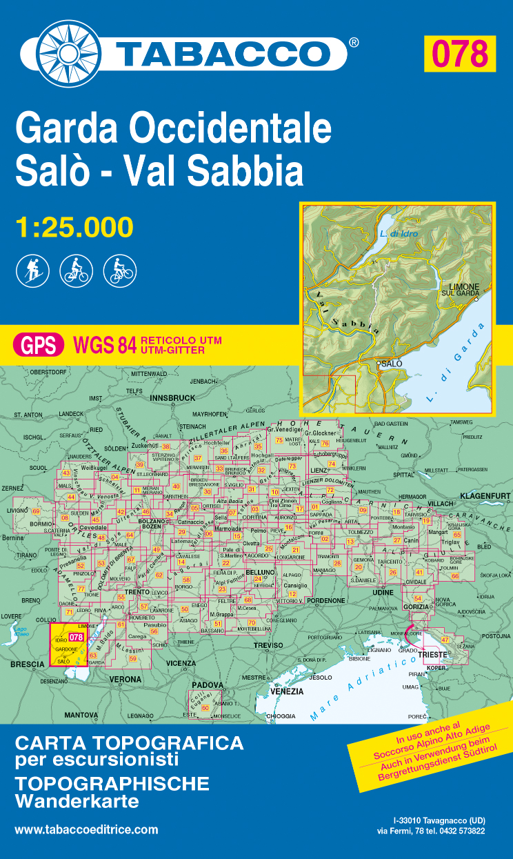
- Garda Occidentale - Salo - Val Sabbia - Lago d`Idro Tabacco 078
- The northern part of Lake Garda and the Monte Baldo area to the east of the lake in a series of Tabacco maps at 1:25,000 covering the Dolomites and the mountains of north-eastern Italy - Stanfords’ most popular coverage for this region, with excellent cartography and extensive overprint for hiking routes and other recreational activities, local... Read more
De Zwerver
Netherlands
2023
Netherlands
2023
De Zwerver
Netherlands
Netherlands
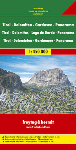
- Wegenkaart - landkaart Panoramakaart Tirol - Dolomieten - Gardameer | Freytag & Berndt
- Tirol - Dolomiten - Gardasee Panorama 1 : 450 000 ab 10.9 EURO Touristische Informationen / Alpenstraßen / Entfernungen in km Freytag & Berndt Autokarte. Neuauflage Read more
- Also available from:
- Stanfords, United Kingdom

Stanfords
United Kingdom
United Kingdom
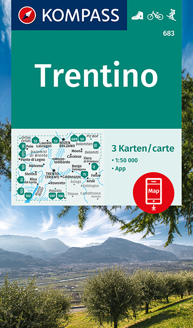
- Trentino 3-Map Set Kompass 683
- Trentino region of Italy on a set of three double-sided, GPS compatible and contoured maps at 1:50,000 from Kompass, with hiking trails, cycling, ski and horse riding routes, various recreational facilities, etc. The set provides very wide coverage of this popular part of Italy, extending from north of Bolzano southwards to include the northern... Read more
De Zwerver
Netherlands
2019
Netherlands
2019
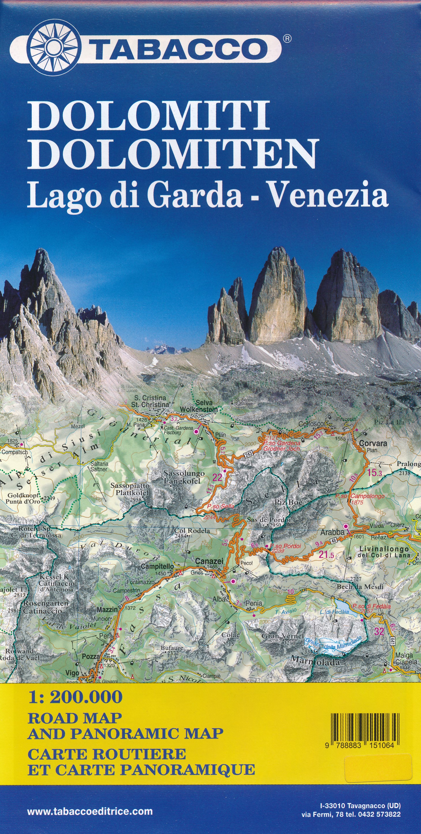
- Wegenkaart - landkaart Dolomiti - Dolomieten - Lago di Garda - Venezia | Tabacco Editrice
- Dolomites Road Panoramic Map 1 : 200 000 ab 8.99 EURO Panoramakarte und Strassenkarte Tabacco Editrice Straßenkarte. Neuauflage Read more
De Zwerver
Netherlands
Netherlands
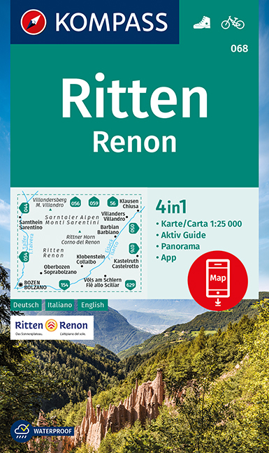
- Wandelkaart 068 Ritten - Renon | Kompass
- Map No. 068, Renon/Ritten - with a panorama map on the reverse, from Kompass in a series providing detailed coverage of the Dolomites and Lake Garda area and supplementing their main series of walking maps of Italy at 1:50,000. Maps in this series have a more detailed base and smaller contour interval than coverage at 1:50,000.*Cartography:*... Read more
- Also available from:
- Stanfords, United Kingdom

Stanfords
United Kingdom
United Kingdom
- Renon / Ritten Kompass 068
- Map No. 068, Renon/Ritten - with a panorama map on the reverse, from Kompass in a series providing detailed coverage of the Dolomites and Lake Garda area and supplementing their main series of walking maps of Italy at 1:50,000. Maps in this series have a more detailed base and smaller contour interval than coverage at 1:50,000.*Cartography:*... Read more
De Zwerver
Netherlands
Netherlands
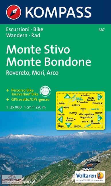
- Wandelkaart 687 Monte Stivo - Monte Bondone | Kompass
- Map No. 687, Monte Stivo - Monte Bondone - Rovereto, from Kompass in a series providing detailed coverage of the Dolomites and Lake Garda area and supplementing their main series of walking maps of Italy at 1:50,000. Maps in this series have a more detailed base and smaller contour interval than coverage at 1:50,000.Cartography: maps at... Read more
- Also available from:
- Stanfords, United Kingdom

Stanfords
United Kingdom
United Kingdom
- Monte Stivo - Monte Bondone - Rovereto Kompass 687
- Map No. 687, Monte Stivo - Monte Bondone - Rovereto, from Kompass in a series providing detailed coverage of the Dolomites and Lake Garda area and supplementing their main series of walking maps of Italy at 1:50,000. Maps in this series have a more detailed base and smaller contour interval than coverage at 1:50,000.*Cartography:* maps at... Read more
De Zwerver
Netherlands
Netherlands
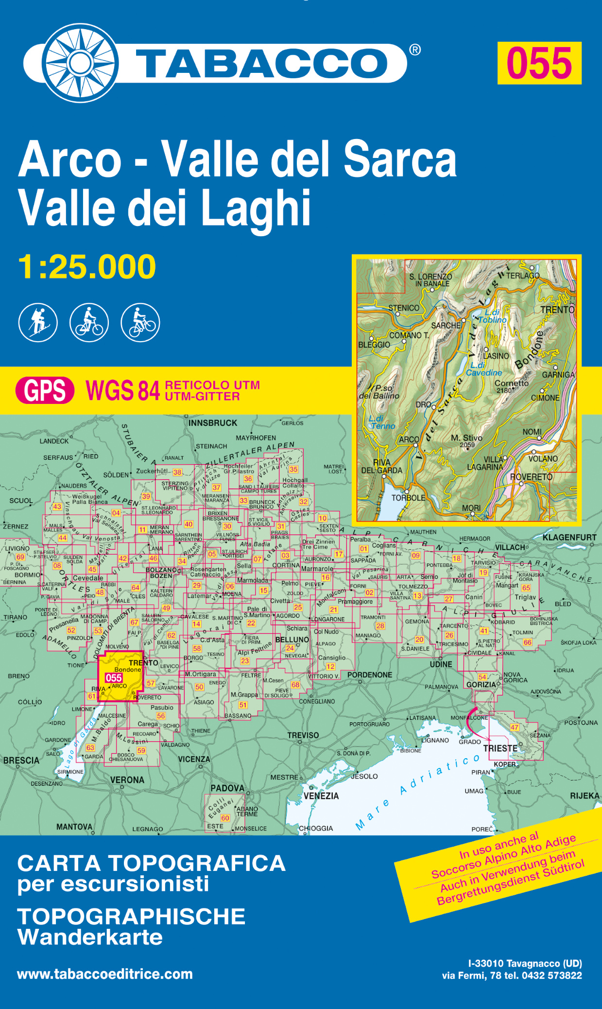
- Wandelkaart 055 Arco - Valle del Sarca - Valle dei Laghi | Tabacco Editrice
- Valle del Sacra – Arco – Riva del Garda area in a series of Tabacco maps at 1:25,000 covering the Dolomites and the mountains of north-eastern Italy - Stanfords’ most popular coverage for this region, with excellent cartography and extensive overprint for hiking routes and other recreational activities, local bus stops, etc. Additional... Read more
- Also available from:
- Stanfords, United Kingdom

Stanfords
United Kingdom
United Kingdom
- Valle del Sacra – Arco – Riva del Garda Tabacco 055
- Valle del Sacra – Arco – Riva del Garda area in a series of Tabacco maps at 1:25,000 covering the Dolomites and the mountains of north-eastern Italy - Stanfords’ most popular coverage for this region, with excellent cartography and extensive overprint for hiking routes and other recreational activities, local bus stops, etc. Additional... Read more
De Zwerver
Netherlands
Netherlands
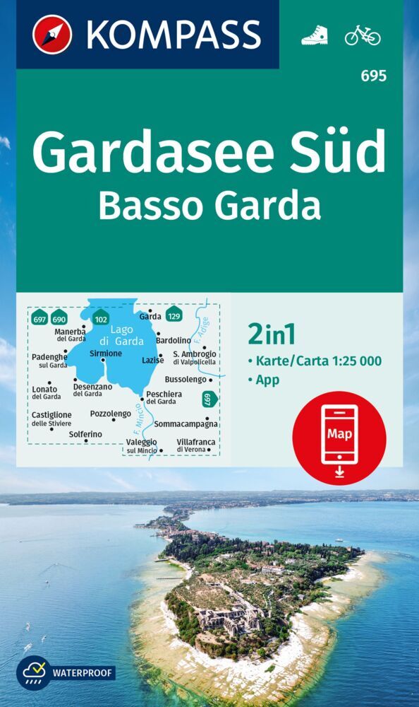
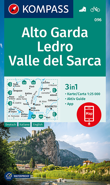
- Wandelkaart 096 Alto Garda - Ledro - Val di Sarca | Kompass
- The area around and north of the northern tip of Lake Garda, including Riva del Garda, on a double-sided, waterproof and tear-resistant, contoured and GPS compatible map at 1:25,000 from Kompass. Contour interval is 20m, with extensive overprint for hiking trails, cycle routes including a selection of mountain bike routes), ski routes,... Read more
- Also available from:
- Stanfords, United Kingdom
Stanfords
United Kingdom
United Kingdom
- Alto Garda - Ledro - Valle del Sacra Kompass 096
- The area around and north of the northern tip of Lake Garda, including Riva del Garda, on a double-sided, waterproof and tear-resistant, contoured and GPS compatible map at 1:25,000 from Kompass. Contour interval is 20m, with extensive overprint for hiking trails, cycle routes including a selection of mountain bike routes), ski routes,... Read more