
Galicia
Beschrijving
Kaart

Paden in deze regio
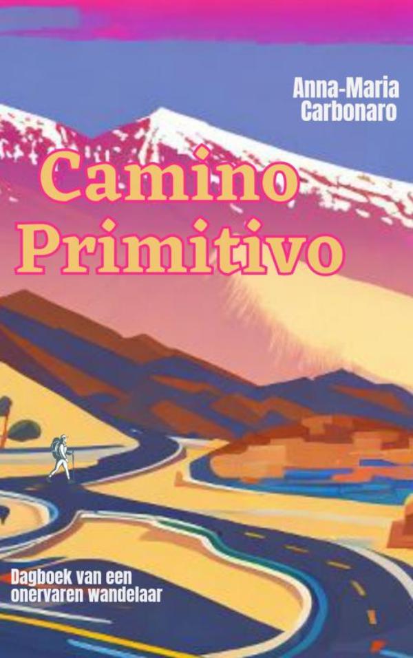
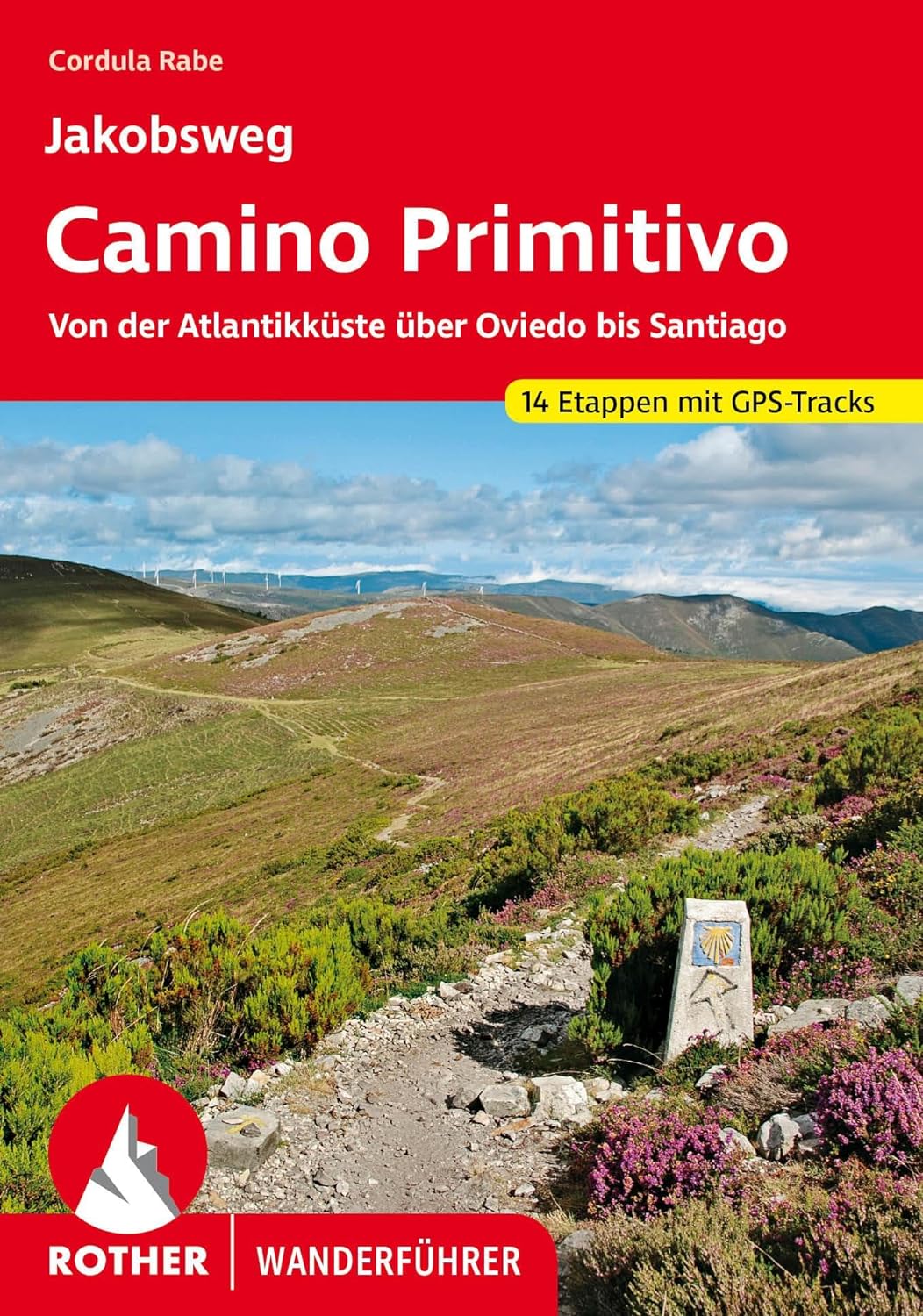
- Camino PrimitivoGPX
- GR1 Sendero Histórico, Senda TransversalGPX
- GR50 Ruta do MedievoGPX
- GR52 Ruta dos RíosGPX
- GR53 Sendero Panorámico de VigoGPX
- GR56 TransourensanoGPX
- GR57 Camí da FranqueiraGPX
- GR58 Sendero As GreasGPX
- GR59 Sender Roteiro Ecolóxico do MorrazoGPX
- GR65 Camino de SantiagoGPX
- GR94 Sendero Rural de GaliciaGPX
Links
Feiten
Verslagen
Gidsen en kaarten
Overnachting
Organisaties
Reisorganisaties
GPS
Anders
Boeken

De Zwerver
Netherlands
2021
Netherlands
2021
- Wandelgids 265 Vogesen - Durchquerung: GR53 GR5 | Rother Bergverlag
- In 37 etappes over de Lange Astands Wandelingen GR 53, GR 5 en GR 531 van Wissembourg naar Giromagny en Masevaux door de prachtige Vogezen. Goed alternatief voor de langverwachte maar nog steeds niet uitgekomen Crete des Vosges wandelgids van FFRP. Duitse samenvatting: Die Vogesen sind nicht nur eines der urwüchsigsten Mittelgebirge in unseren... Read more


De Zwerver
Netherlands
2023
Netherlands
2023

De Zwerver
Netherlands
2022
Netherlands
2022

De Zwerver
Netherlands
2014
Netherlands
2014
- Wandelgids 901 Tours et traversées dans l'Ain GR9, GR9A, GR59 | FFRP
- Guide FFRandonnée Tours et Traversée dans l'ain. GR 59, 9, 9A. Etangs de la Dombes, monts et cluses du Revermont ou bocages de la Bresse. Plus de 50 jours de randonnée.Depuis les Monts du Jura, du Revermont ou du Bugey, ces itinéraires en boucle ou en ligne offrent aux randonneurs des vues imprenables. voici à l'est le Mont Blanc et les... Read more
- Also available from:
- Stanfords, United Kingdom

Stanfords
United Kingdom
2014
United Kingdom
2014
- GR59/GR9/GRP: Tours et Traversées de l`Ain FFRP Topo-guide No. 901
- Tours et Traversées de l`Ain, FFRP topoguide, Ref. No. 901, covering in all 949km of hiking trails in the French Jura between Lons-le-Saunier and the confluence of the Ain and the Rhône, including sections of GR 5, 9 and 9A. Current edition of this title was published in June 2014.ABOUT THE FFRP (Fédération française de la randonnée pédestre)... Read more

De Zwerver
Netherlands
2023
Netherlands
2023
De Zwerver
Netherlands
2024
Netherlands
2024


Meer boeken…
Kaarten

De Zwerver
Netherlands
2020
Netherlands
2020
- Wandelatlas - Pelgrimsroute (kaart) 160 Camino de Santiago | Michelin
- Parcourez le Chemin Français (Camino Francés) avec ce petit atlas de poche Michelin. L'outil idéal pour mieux s'y retrouver lors de la préparation du voyage de randonnée sur ce sentier historique qui part de Saint-Jean-Pied-de-Port, dans le Pays basque français, et qui traverse tout le nord de l'Espagne... Read more

De Zwerver
Netherlands
2021
Netherlands
2021
- Also available from:
- Stanfords, United Kingdom

Stanfords
United Kingdom
2021
United Kingdom
2021
- France - Ways of St James IGN Map 922
- France: Ways of St James to Compostela Map from the IGN presents an overview of all the routes across France taken by pilgrims on their way to Santiago de Compostela and the tomb of the apostle St James - the greatest of all goals for thousands of pilgrims in Europe during the Middle Ages. The map was prepared by the IGN and the Association de... Read more

De Zwerver
Netherlands
2020
Netherlands
2020
- Wandelatlas - Pelgrimsroute (kaart) 161 Chemins de Compostelle GR65 | Michelin
- Véritable petit atlas détaillant chaque étape avec indications précises concernant les villes de départ et d'arrivée ainsi que pour les localités traversées (auberges, refuges, restaurants, pharmacies, gare, épiceries, Km parcourus, Km restants....).Ce petit atlas suit le chemin du... Read more

De Zwerver
Netherlands
Netherlands
- Pelgrimsroute (kaart) - Wandelkaart Camino de Santiago in Spanje | CNIG - Instituto Geográfico Nacional
- All roads leading to Santiago de Compostela in the Iberian Peninsula are represented on this Caminos de Santiago / The Way of St. James Map. Routes highlighted on a physical map of the Iberian Peninsula at 1:1,250,000 from IGN/CNIG, Spain civilian topographic survey organization. The base map with altitude colouring and relief shading provides... Read more
- Also available from:
- Stanfords, United Kingdom

Stanfords
United Kingdom
United Kingdom
- Caminos de Santiago / Ways of St. James on the Iberian Peninsula CNIG Overview Map
- All roads leading to Santiago de Compostela in the Iberian Peninsula are represented on this Caminos de Santiago / The Way of St. James Map. Routes highlighted on a physical map of the Iberian Peninsula at 1:1,250,000 from IGN/CNIG, Spain civilian topographic survey organization. The base map with altitude colouring and relief shading provides... Read more
De Zwerver
Netherlands
Netherlands
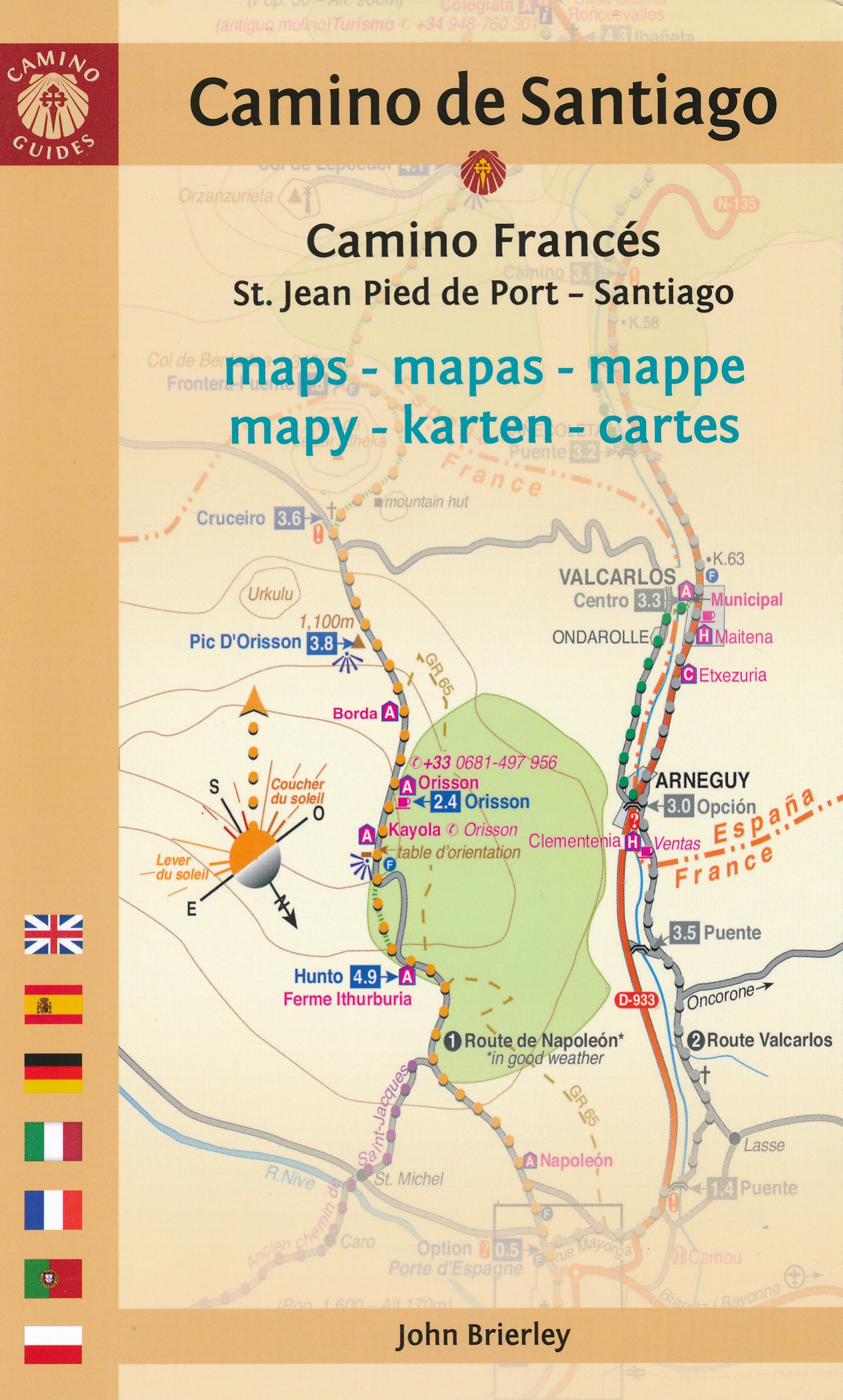
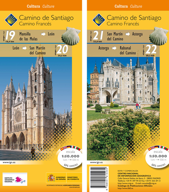
- Wandelkaart 19-22 Camino Santiago de Compostella Mansilla - Rabanal | CNIG - Instituto Geográfico Nacional
- Camino de Santiago: Stages 19/20/21/22, Mansilla de las Mulas/Rabanal del Camino, in a series of double-sided topographic maps at 1:50,000 from the Spanish civilian survey organization, overprinted with the route and sights, plus information of accommodation and other facilities, route profiles, etc.Each 1:50,000 map is double-sided and has... Read more
- Also available from:
- Stanfords, United Kingdom

Stanfords
United Kingdom
United Kingdom
- Camino de Santiago: Stages 19/20/21/22, Mansilla de las Mulas/Rabanal del Camino 50K CNIG Map
- Camino de Santiago: Stages 19/20/21/22, Mansilla de las Mulas/Rabanal del Camino, in a series of double-sided topographic maps at 1:50,000 from the Spanish civilian survey organization, overprinted with the route and sights, plus information of accommodation and other facilities, route profiles, etc.Each 1:50,000 map is double-sided and has... Read more
De Zwerver
Netherlands
Netherlands
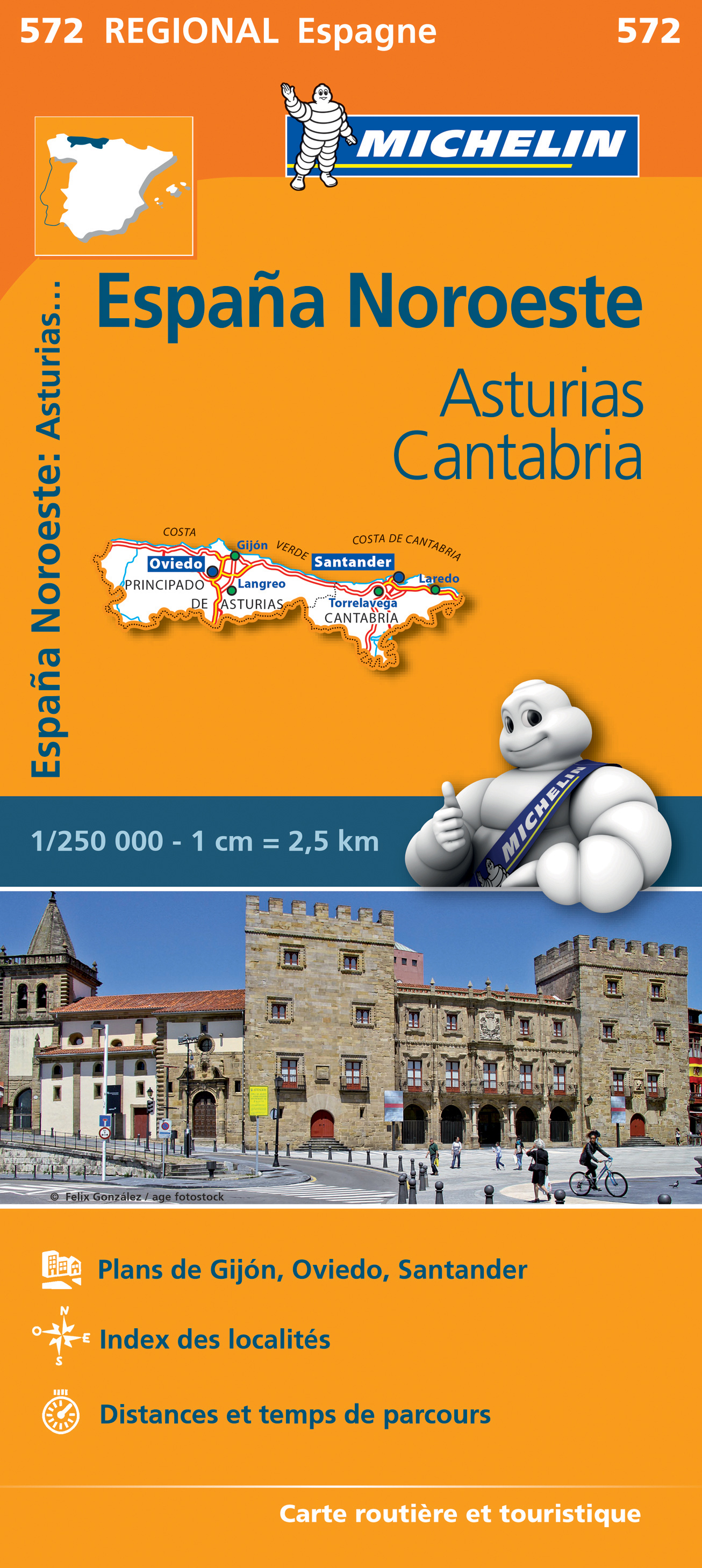
- Wegenkaart - landkaart 572 Asturias - Cantabria - Oviedo - Santander | Michelin
- Une carte fiable pour parcourir les régions d'Europe Read more
De Zwerver
Netherlands
2017
Netherlands
2017
De Zwerver
Netherlands
Netherlands
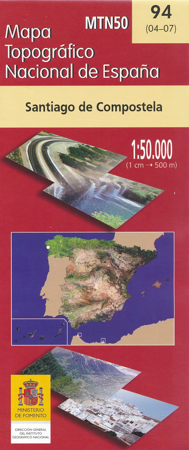
- Wandelkaart - Topografische kaart 94 Santiago de Compostela | CNIG - Instituto Geográfico Nacional
- Topographic coverage of mainland Spain at 1:50,000 in the MTN50 (Mapa Topogr Read more
- Also available from:
- Stanfords, United Kingdom

Stanfords
United Kingdom
United Kingdom
- Santiago de Compostella CNIG Topo 94
- Topographic coverage of mainland Spain at 1:50,000 in the MTN50 (Mapa Topográfico Nacional) series from the Centro Nacional de Información Geografica, the country’s civilian survey organization. The maps have contours at 20m intervals, enhanced by relief shading, plus colouring and/or graphics to show different types of terrain, vegetation or... Read more
De Zwerver
Netherlands
2013
Netherlands
2013
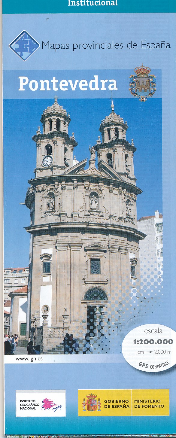
- Wegenkaart - landkaart Mapa Provincial Pontevedra | CNIG - Instituto Geográfico Nacional
- Pontevedra Province in a series of contoured, GPS-compatible, indexed road maps at 1:200,000 from the IGN - CNIG, Spain Read more
- Also available from:
- Stanfords, United Kingdom

Stanfords
United Kingdom
2013
United Kingdom
2013
- Pontevedra Province 200K CNIG Map No. 36
- Contoured, GPS-compatible, indexed road map at 1:200,000 from CNIG - Spain’s civilian survey organization, with exceptionally informative presentation of the landscape and highlighting for facilities and places of interest including campsites and paradors.Maps in CNIG’s 200K Provincial Series provide an excellent picture the topography through... Read more
De Zwerver
Netherlands
Netherlands
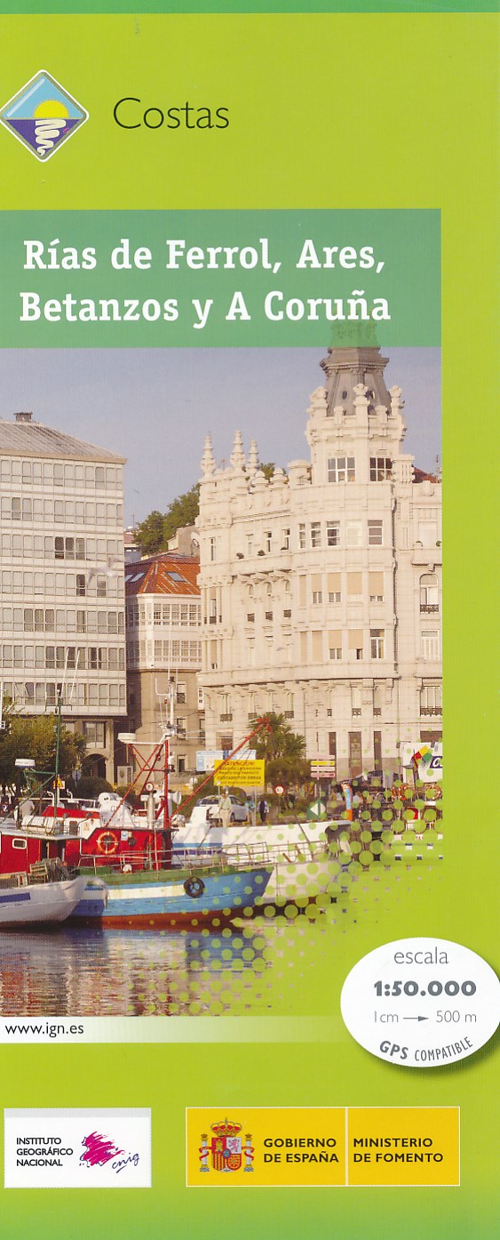
- Wandelkaart Costas - Rias de Ferrol - Ares - Betanzos - A Coruna | CNIG - Instituto Geográfico Nacional
- Topografische wandelkaart Spanje 1:50.000 met 20m hoogtelijnen en UTM grid. Verschillen in landgebruik en vegetatie zijn op de kaart aangeven, alsmede de grenzen van nationale parken. Read more
- Also available from:
- Stanfords, United Kingdom

Stanfords
United Kingdom
United Kingdom
- Rias de Ferrol - Ares - Betanzos and A Coruna CNIG Map
- The coast of Galicia between the towns of A Coruña and Ferrol on a detailed, GPS compatible topographic map at 1:50,000 from the country’s civilian survey organization, with additional nautical information in the bays of Ferrol, Ares, Betanzos and Coruña. The map has the cartography of Spain’s civilian topographic survey at 1:50,000 with... Read more

De Zwerver
Netherlands
Netherlands
- Wandelkaart 23-26 Camino Santiago de Compostella Rabanal - Triacastela | CNIG - Instituto Geográfico Nacional
- Camino de Santiago: Stages 23/24/25/26, Rabanal del Camino/Triacastela, in a series of double-sided topographic maps at 1:50,000 from the Spanish civilian survey organization, overprinted with the route and sights, plus information of accommodation and other facilities, route profiles, etc.Each 1:50,000 map is double-sided and has four 57 x... Read more
- Also available from:
- Stanfords, United Kingdom

Stanfords
United Kingdom
United Kingdom
- Camino de Santiago: Stages 23/24/25/26, Rabanal del Camino/Triacastela 50K CNIG Map
- Camino de Santiago: Stages 23/24/25/26, Rabanal del Camino/Triacastela, in a series of double-sided topographic maps at 1:50,000 from the Spanish civilian survey organization, overprinted with the route and sights, plus information of accommodation and other facilities, route profiles, etc.Each 1:50,000 map is double-sided and has four 57 x... Read more
De Zwerver
Netherlands
Netherlands
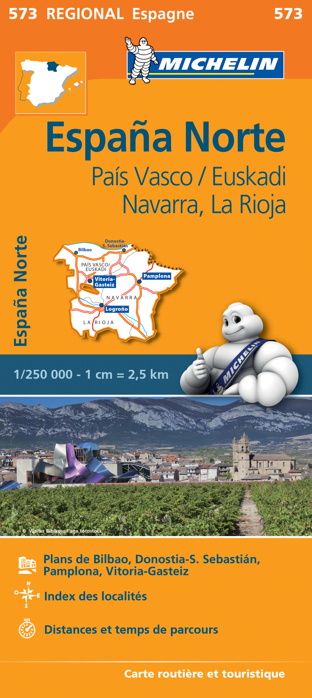
- Wegenkaart - landkaart 573 Pais Vasco - Euskadi - Navarra -La Rioja - Pamplona - Baskenland | Michelin
- Une carte fiable pour parcourir les régions d'Europe Read more
De Zwerver
Netherlands
2017
Netherlands
2017
De Zwerver
Netherlands
2014
Netherlands
2014
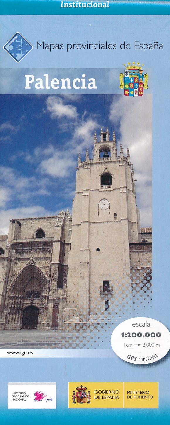
- Wegenkaart - landkaart Mapa Provincial Palencia | CNIG - Instituto Geográfico Nacional
- Palencia Province of Spain at 1:200,000 in a series of contoured, GPS-compatible, indexed road maps at 1:200,000 from the IGN/CNIG, the country’s civilian survey organization, with exceptionally informative presentation of the landscape and highlighting for facilities and places of interest including campsites and paradors.Maps in this series... Read more
- Also available from:
- Stanfords, United Kingdom

Stanfords
United Kingdom
2014
United Kingdom
2014
- Palencia Province 200K CNIG Map No. 35
- Contoured, GPS-compatible, indexed road map at 1:200,000 from CNIG - Spain’s civilian survey organization, with exceptionally informative presentation of the landscape and highlighting for facilities and places of interest including campsites and paradors.Maps in CNIG’s 200K Provincial Series provide an excellent picture the topography through... Read more
De Zwerver
Netherlands
Netherlands
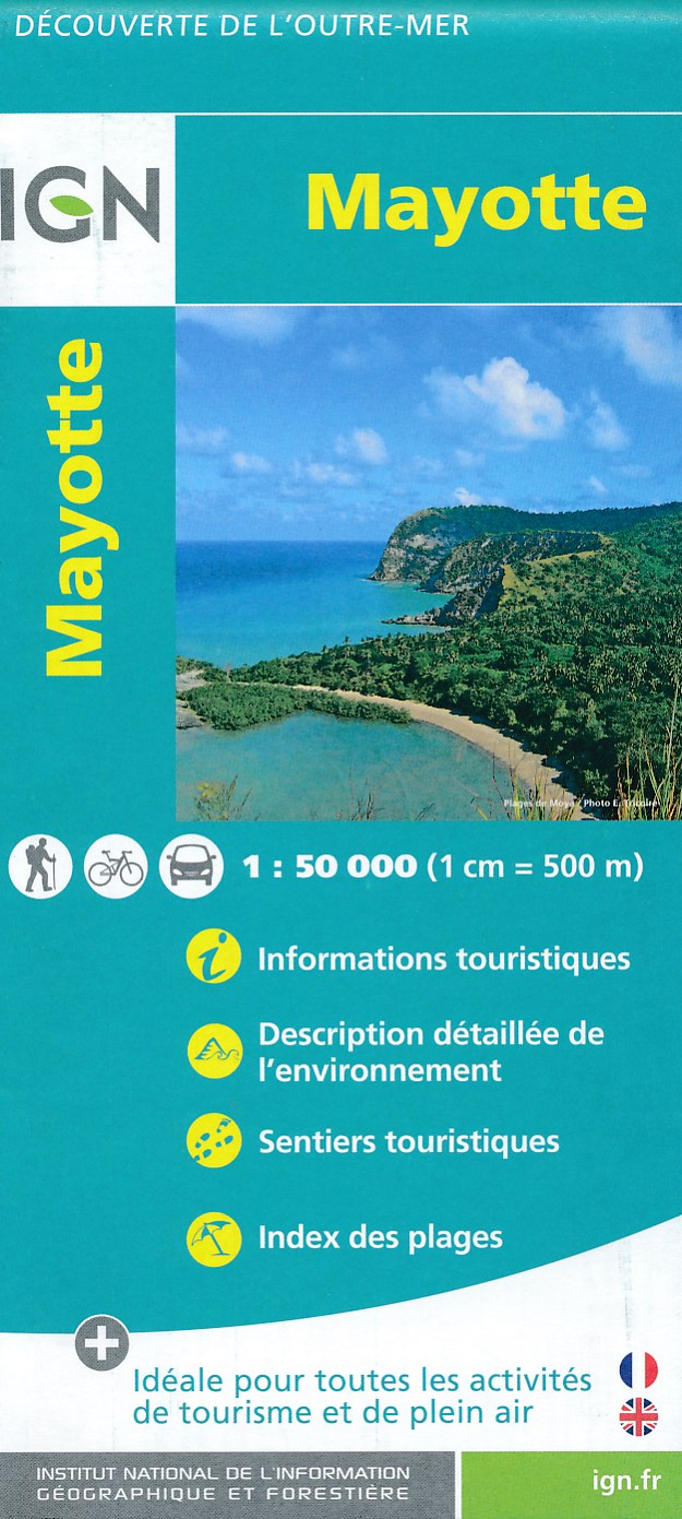
- Fietskaart - Wandelkaart Mayotte | IGN - Institut Géographique National
- MayotteLes cartes routières et touristiques de l?Outre-mer vous permettent de découvrir ces destinations exotiques. Read more
- Also available from:
- Stanfords, United Kingdom

Stanfords
United Kingdom
United Kingdom
- Mayotte IGN Map 84976
- Mayotte at 1:50,000 on a contoured and GPS compatible map from the IGN, with plans of Mazoudzou and Dzaoudzi, plus an index of beaches. Topography is shown by contours at 20m intervals with relief shading and spot heights, plus colouring and/or graphics for different types of vegetation. In the surrounding waters coral reefs are prominently... Read more