
Snowdonia
Beschrijving
Paden in deze regio
Links
Feiten
Verslagen
Gidsen en kaarten
Overnachting
Organisaties
Reisorganisaties
GPS
Anders
Boeken

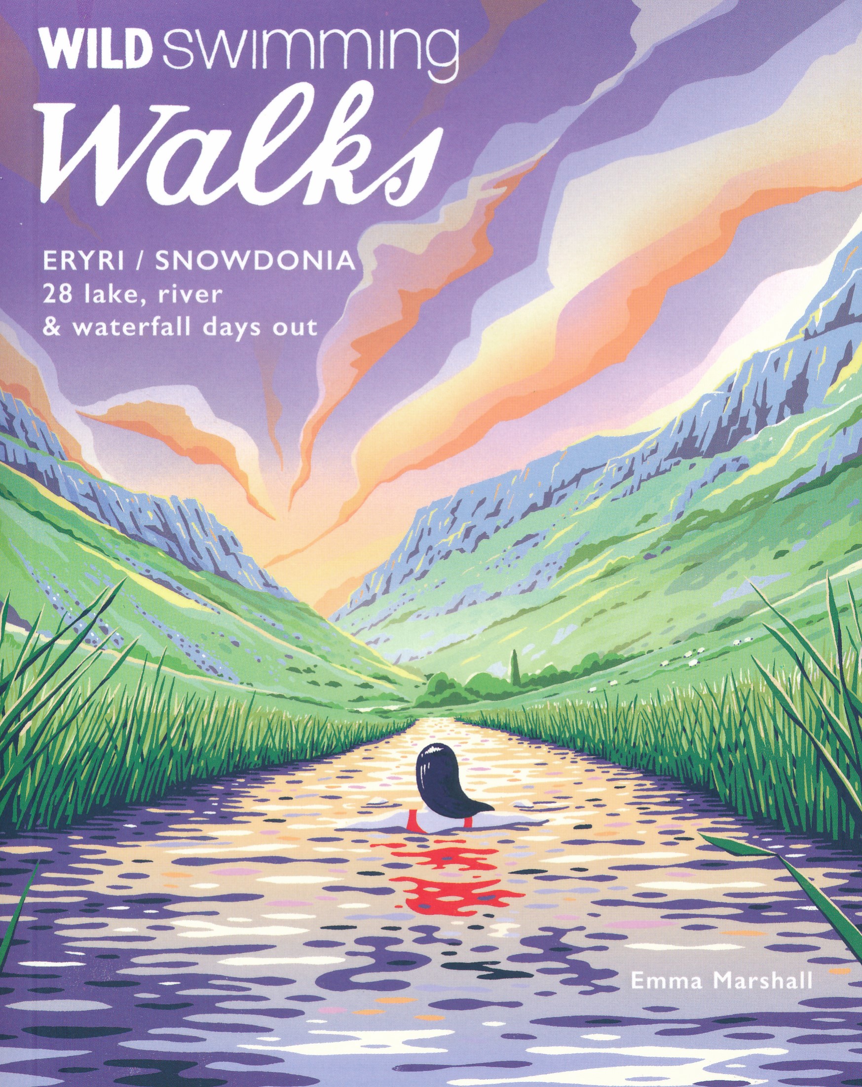
De Zwerver
Netherlands
2024
Netherlands
2024
- Reisgids Snowdonia & North Wales | Rough Guides
- Rough Guides Staycations Snowdonia & North WalesMake the most of your time on Earth with the ultimate travel guides.Inspirational and informative new pocket guide, with free eBook, making the most of holidaying at home in the UK through clearly laid-out walks and tours.Explore the best of Snowdonia & North Wales with this unique travel guide,... Read more
- Also available from:
- Stanfords, United Kingdom

Stanfords
United Kingdom
2021
United Kingdom
2021
- Pocket Rough Guide Staycations Snowdonia & North Wales (Travel Guide with Free eBook)
- Rough Guides Staycations Snowdonia & North WalesMake the most of your time on Earth with the ultimate travel guides.Inspirational and informative new pocket guide, with free eBook, making the most of holidaying at home in the UK through clearly laid-out walks and tours.Explore the best of Snowdonia & North Wales with this unique travel guide,... Read more
De Zwerver
Netherlands
2024
Netherlands
2024
- Also available from:
- Stanfords, United Kingdom

De Zwerver
Netherlands
2019
Netherlands
2019
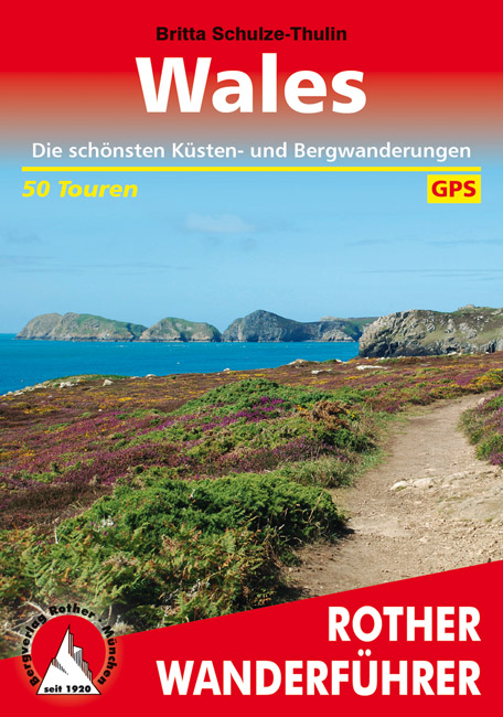
- Wandelgids Wales | Rother Bergverlag
- Uitstekende wandelgids met 50 dagtochten in dal en hoger gelegen delen van het gebergte. Met praktische informatie en beperkt kaartmateriaal! Wandelingen in verschillende zwaarte weergegeven in rood/blauw/zwart. Deze wandelgidsen uitgever staat hoog aangeschreven en is een begrip onder de wandelaars! Dieser Wanderführer führt in die schönsten... Read more
De Zwerver
Netherlands
2020
Netherlands
2020
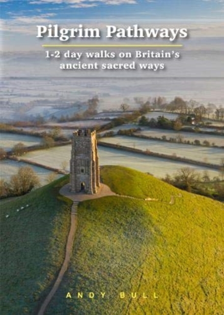
- Wandelgids Pilgrim Pathways | Trailblazer Guides
- Many people are inspired by the idea of going on a pilgrimage. TV series such as The Road to Rome and The Road to Santiago have shown that even the averagely unfit celeb can hobble through one. However, few of us have time for such long routes. So what to do?Pilgrim Pathways has the answer: 20 answers in fact. The pilgrimages in this guidebook... Read more
- Also available from:
- Stanfords, United Kingdom

Stanfords
United Kingdom
2020
United Kingdom
2020
- Pilgrim Pathways: 1-2 day walks on Britain`s Ancient Sacred Ways: 2020
- Many people are inspired by the idea of going on a pilgrimage. TV series such as The Road to Rome and The Road to Santiago have shown that even the averagely unfit celeb can hobble through one. However, few of us have time for such long routes. So what to do?Pilgrim Pathways has the answer: 20 answers in fact. The pilgrimages in this guidebook... Read more
De Zwerver
Netherlands
2021
Netherlands
2021
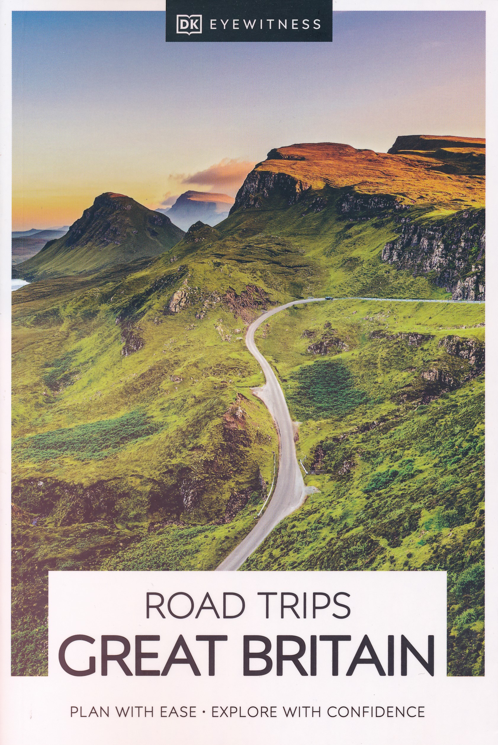
- Reisgids Road Trips Great Britain | Dorling Kindersley
- With its idyllic market towns, romantic castle ruins and stunning natural landscapes, Great Britain is the perfect destination for a leisurely road trip. It`s yours to explore with Road Trips Great Britain, which contains 25 drives across the country, from the sweeping sandy beaches of Cornwall to the dramatic peaks of the Scottish... Read more
- Also available from:
- Stanfords, United Kingdom

Stanfords
United Kingdom
2021
United Kingdom
2021
- DK Eyewitness Road Trips Great Britain
- With its idyllic market towns, romantic castle ruins and stunning natural landscapes, Great Britain is the perfect destination for a leisurely road trip. It`s yours to explore with Road Trips Great Britain, which contains 25 drives across the country, from the sweeping sandy beaches of Cornwall to the dramatic peaks of the Scottish... Read more
De Zwerver
Netherlands
2022
Netherlands
2022
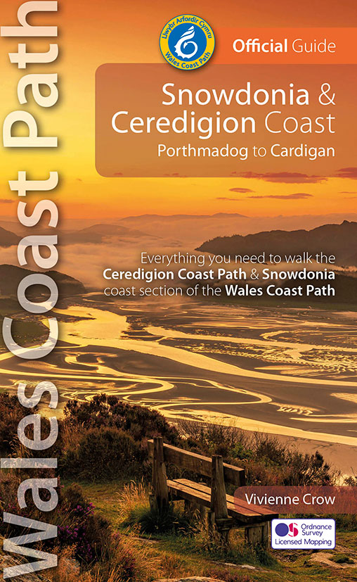
- Wandelgids Wales Coast Path: Snowdonia and Ceredigion | Northern Eye Books
- Porthmadog to Cardigan Read more
De Zwerver
Netherlands
2022
Netherlands
2022
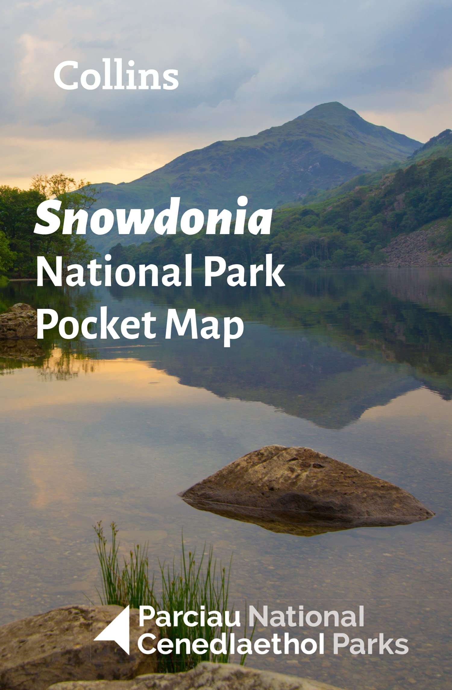
- Wegenkaart - landkaart National Park Pocket Map Snowdonia | Collins
- Handy little full colour map of Snowdonia National Park. Detailed mapping and visitor information to the National Park along with a selection of photographs. Map at a scale of 1:119 000 (1.2cm to 1km, 1.9 miles to 1 inch). This small map gives a great overview of the Snowdonia National Park, and is the perfect companion for... Read more
De Zwerver
Netherlands
2014
Netherlands
2014
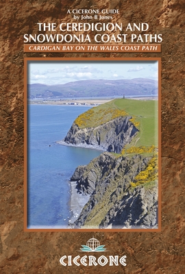
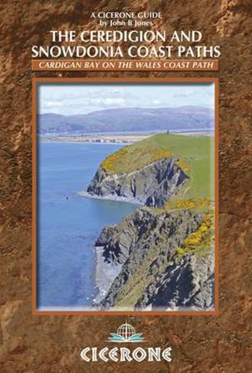
- Wandelgids Wales: The Ceredigion and Snowdonia Coast Paths | Cicerone
- As part of the Wales Coast Path, the Ceredigion Coast Path and Snowdonia Coast Path trace a curve of 233km (145 miles) of coastal and inland walking down Cardigan Bay. This guidebook describes a 16-stage guide to the walk from Porthmadog to St Dogmaels covering the trail between the Lleyn Peninsula and the Pembrokeshire Coast Path. Read more
- Also available from:
- Bol.com, Netherlands
- Bol.com, Belgium
- Stanfords, United Kingdom
- The Book Depository, United Kingdom
Bol.com
Netherlands
2014
Netherlands
2014
- The Ceredigion and Snowdonia Coast Paths
- As part of the Wales Coast Path, the Ceredigion Coast Path and Snowdonia Coast Path trace a curve of 233km (145 miles) of coastal and inland walking down Cardigan Bay. This guidebook describes a 16-stage guide to the walk from Porthmadog to St Dogmaels covering the trail between the Llyn Peninsula and the Pembrokeshire Coast Path. The route is... Read more
Bol.com
Belgium
2014
Belgium
2014
- The Ceredigion and Snowdonia Coast Paths
- As part of the Wales Coast Path, the Ceredigion Coast Path and Snowdonia Coast Path trace a curve of 233km (145 miles) of coastal and inland walking down Cardigan Bay. This guidebook describes a 16-stage guide to the walk from Porthmadog to St Dogmaels covering the trail between the Llyn Peninsula and the Pembrokeshire Coast Path. The route is... Read more

Stanfords
United Kingdom
2014
United Kingdom
2014
- The Ceredigion and Snowdonia Coast Paths - Cardigan Bay on the Wales Coast Path
- Step-by-step guide to backpacking along the Ceredigion and Snowdonia Coast Paths, down the coast of mid-Wales between Porthmadog and the Llyn Peninsula and St Dogmaels and the Pembrokeshire Coast Path, 233km (147 miles) of varied long-distance walking to fill an extended fortnight`s holiday or a series of long weekends and day walks. The route... Read more

The Book Depository
United Kingdom
2014
United Kingdom
2014
- The Ceredigion and Snowdonia Coast Paths
- The Wales Coast Path from Porthmadog to St Dogmaels Read more
Bol.com
Netherlands
Netherlands
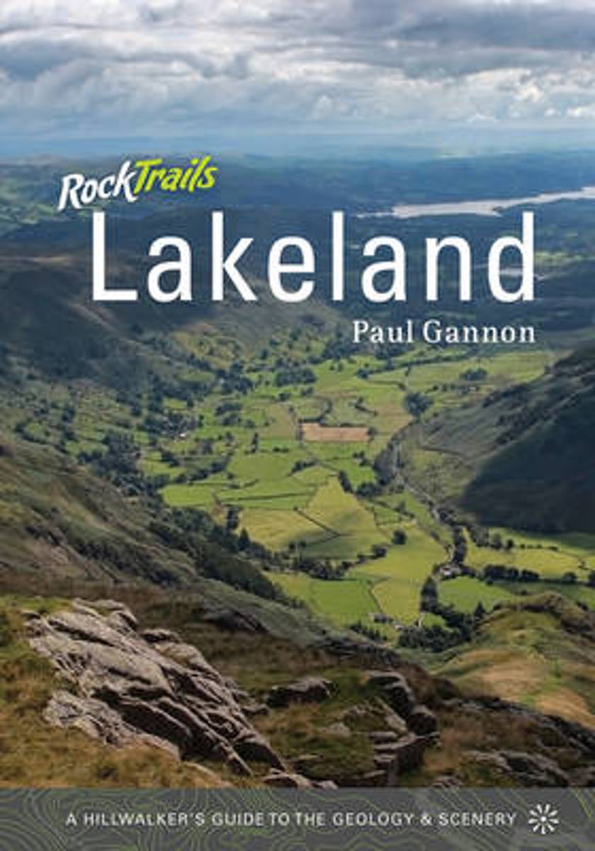
- Rock Trails Lakeland
- This book explains to the hillwalker, in easy to understand but accurate terms, how geology has shaped the landscape of the Lake District. A selection of fifteen guided walks is used to illustrate this in terms of what can be seen on the ground. Rock Trails Lakeland , divided into two parts, is intended to help those who love the Lake... Read more
- Also available from:
- Bol.com, Belgium
- Stanfords, United Kingdom
Bol.com
Belgium
Belgium
- Rock Trails Lakeland
- This book explains to the hillwalker, in easy to understand but accurate terms, how geology has shaped the landscape of the Lake District. A selection of fifteen guided walks is used to illustrate this in terms of what can be seen on the ground. Rock Trails Lakeland , divided into two parts, is intended to help those who love the Lake... Read more

Stanfords
United Kingdom
United Kingdom
- Rock Trails Lakeland
- This book explains to the hillwalker, in easy to understand but accurate terms, how geology has shaped the landscape of the Lake District. A selection of fifteen guided walks is used to illustrate this in terms of what can be seen on the ground. ”Rock Trails Lakeland”, divided into two parts, is intended to help those who love the Lake... Read more
Bol.com
Netherlands
Netherlands
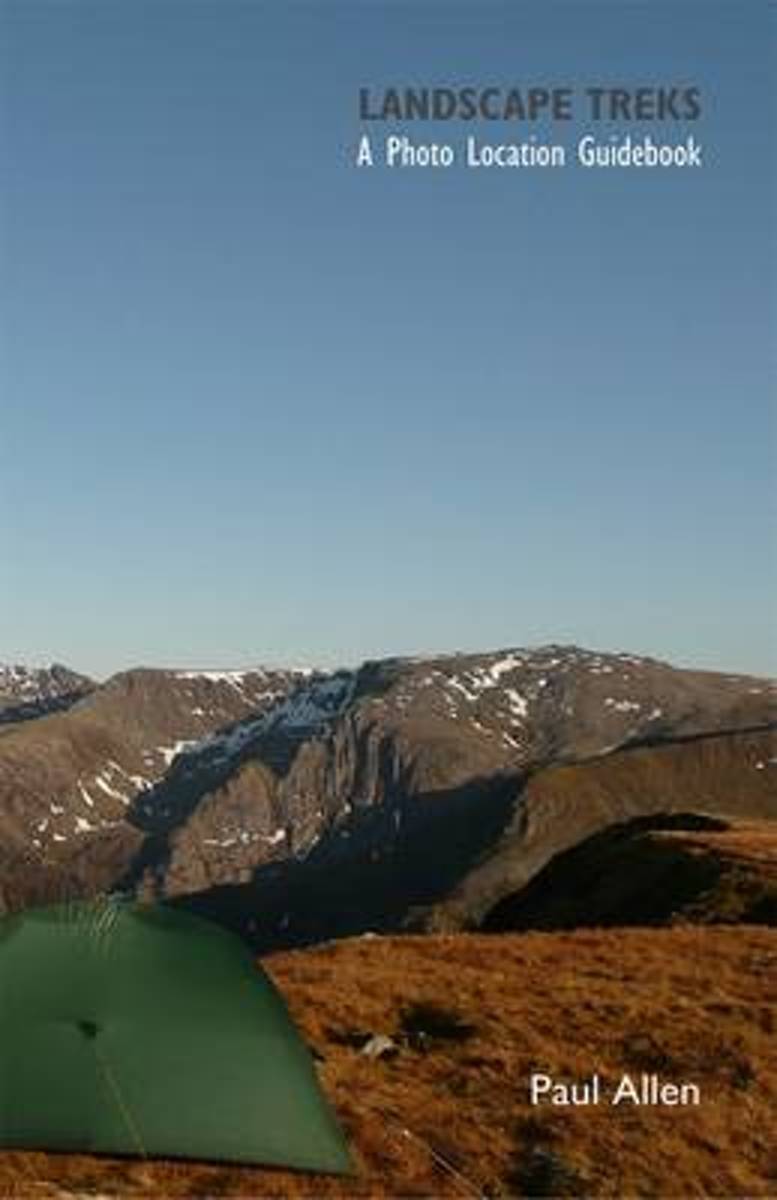
- Landscape Treks
- Landscape Treks is a photo location guidebook that takes you round some of the UK's wildest and most photogenic mountain scenery. The walks are based around getting the best images from a visit to an area by delivering in depth and well researched route descriptions, getting you off the beaten track. They set out a number of key photographic... Read more
- Also available from:
- Bol.com, Belgium
Bol.com
Belgium
Belgium
- Landscape Treks
- Landscape Treks is a photo location guidebook that takes you round some of the UK's wildest and most photogenic mountain scenery. The walks are based around getting the best images from a visit to an area by delivering in depth and well researched route descriptions, getting you off the beaten track. They set out a number of key photographic... Read more

Bol.com
Netherlands
Netherlands
- Countryside Dog Walks - Snowdonia
- Written for all dog owners looking for hassle-free walks to enjoy with their dogs, this guidebook is beautifully designed and packed with stunning photography - giving dog owners access to 20 of the finest walks in Snowdonia. Areas include: Betws y Coed, Capel Curig, Conwy, Snowdon, Dolgellau and Coed y Brenin. With clear information, an... Read more
- Also available from:
- Bol.com, Belgium
- Stanfords, United Kingdom
- The Book Depository, United Kingdom
Bol.com
Belgium
Belgium
- Countryside Dog Walks - Snowdonia
- Written for all dog owners looking for hassle-free walks to enjoy with their dogs, this guidebook is beautifully designed and packed with stunning photography - giving dog owners access to 20 of the finest walks in Snowdonia. Areas include: Betws y Coed, Capel Curig, Conwy, Snowdon, Dolgellau and Coed y Brenin. With clear information, an... Read more

Stanfords
United Kingdom
United Kingdom
- Countryside Dog Walks - Snowdonia: 20 Graded Walks with No Stiles for Your Dogs
- Written for all dog owners looking for hassle-free walks to enjoy with their dogs, this guidebook is beautifully designed and packed with stunning photography - giving dog owners access to 20 of the finest walks in Snowdonia. Areas include: Betws y Coed, Capel Curig, Conwy, Snowdon, Dolgellau and Coed y Brenin. With clear information, an... Read more

The Book Depository
United Kingdom
United Kingdom
- Countryside Dog Walks - Snowdonia
- 20 Graded Walks with No Stiles for Your Dogs Read more
Bol.com
Netherlands
Netherlands
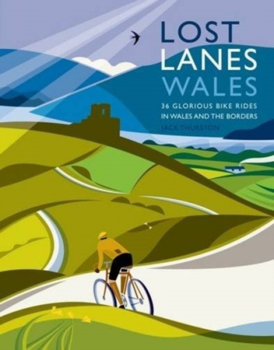
- Lost Lanes Wales
- Travelling at a leisurely pace Jack explores the Wales and the border counties taking in mountain summits, enchanted woodlands, wild seashores, shimmering lakes and ancient ways. Enjoy 36 rides with maps: * Ride on traffic free cycle tracks from the seashore into the heart of Snowdonia and the birthplace of British mountaineering. * Cruise from... Read more
- Also available from:
- Bol.com, Belgium
Bol.com
Belgium
Belgium
- Lost Lanes Wales
- Travelling at a leisurely pace Jack explores the Wales and the border counties taking in mountain summits, enchanted woodlands, wild seashores, shimmering lakes and ancient ways. Enjoy 36 rides with maps: * Ride on traffic free cycle tracks from the seashore into the heart of Snowdonia and the birthplace of British mountaineering. * Cruise from... Read more
Bol.com
Netherlands
Netherlands
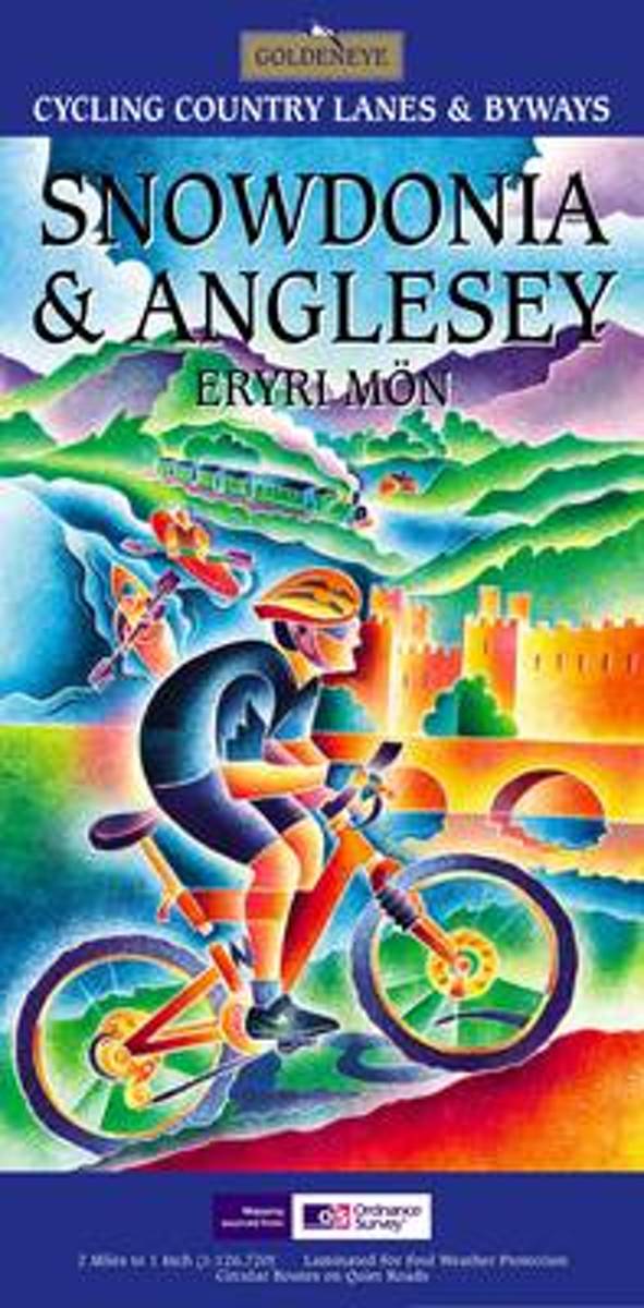
- Snowdonia and Anglesey
- Presents 17 circular routes, national cycle network routes, cycle hire centres, and mountain bike centres. Read more
- Also available from:
- Bol.com, Belgium
Bol.com
Belgium
Belgium
- Snowdonia and Anglesey
- Presents 17 circular routes, national cycle network routes, cycle hire centres, and mountain bike centres. Read more
Kaarten
De Zwerver
Netherlands
2021
Netherlands
2021
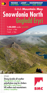
- Wandelkaart Snowdonia Noord | Harvey Maps
- Waterproof mountain map of Snowdonia from Harvey at 1:40,000, with a geological map of the region on the reverse, enlargements of Snowdon and Tryfan, and advice on navigating the region safely.MAIN MAP: Topography is shown through clear altitude shading, spot heights, contours at 15m intervals, and index contours at 75m intervals. A variety of... Read more
- Also available from:
- Stanfords, United Kingdom

Stanfords
United Kingdom
2021
United Kingdom
2021
- Snowdonia North / Gogledd Eryri Harvey British Mountain Map XT40
- Waterproof mountain map of Snowdonia North from Harvey at 1:40,000, with a geological map of the region on the reverse, enlargements of Snowdon and Tryfan, and advice on navigating the region safely.*MAIN MAP:* Topography is shown through clear altitude shading, spot heights, contours at 15m intervals, and index contours at 75m intervals. A... Read more
De Zwerver
Netherlands
2021
Netherlands
2021
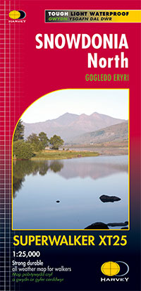
- Wandelkaart Snowdonia Noord /Snowdon,Glyders,Carnedds | Harvey Maps
- The northern part of Snowdonia with Snowdon and the Glyders and Carnedds peaks at 1:25,000 on a waterproof and tear-resistant map from Harvey Map Services in their Superwalker series. The map is double-sided with an overlap between the sides; coverage extends from west of Llanberis eastwards to Betws-y-Coed. Map legend and additional notes are... Read more
- Also available from:
- Stanfords, United Kingdom

Stanfords
United Kingdom
2021
United Kingdom
2021
- Snowdonia North Harvey Superwalker XT25
- The northern part of Snowdonia with Snowdon and the Glyders and Carnedds peaks at 1:25,000 on a light, waterproof and tear-resistant map from Harvey Map Services. The map is double-sided with an overlap between the sides; coverage extends from west of Llanberis eastwards to Betws-y-Coed. Map legend and additional notes are also in Welsh.PLEASE... Read more

Bol.com
Netherlands
Netherlands
- Wales Mountain Biking
- Wales Mountain Biking is the 12th title in Vertebrate Publishing's bestselling series of UK mountain biking guidebooks. This book showcases 20 routes in Wales, between 12km and 50km in length, suitable for all levels of mountain bikers. Split into three sections, South Wales, Mid Wales and North Wales, this book includes classic loops in the... Read more
- Also available from:
- Bol.com, Belgium
- Stanfords, United Kingdom
Bol.com
Belgium
Belgium
- Wales Mountain Biking
- Wales Mountain Biking is the 12th title in Vertebrate Publishing's bestselling series of UK mountain biking guidebooks. This book showcases 20 routes in Wales, between 12km and 50km in length, suitable for all levels of mountain bikers. Split into three sections, South Wales, Mid Wales and North Wales, this book includes classic loops in the... Read more

Stanfords
United Kingdom
United Kingdom
- Wales Mountain Biking
- Vertebrate’s guide to mountain biking in Wales covers 20 recommended mountain bike trails, routes and rides ranging from 12km to 50km. The routes themselves have been devised and tested by local riders to help you get the very best out of the Welsh trails.Each route is described with easy-to-follow instructions, information on difficulty,... Read more

Stanfords
United Kingdom
United Kingdom
- Snowdon / Yr Wyddfa 1922
- Map No. 115, Snowdon / Yr Wyddfa 1922, in the Cassini Historical Series of old Ordnance Survey mapping of England and Wales at 1:50,000 in a format designed to offer a convenient comparison with the present day coverage from the OS, and most locations in three different editions. Old historical maps have been combined so that the sheet lines... Read more
Stanfords
United Kingdom
United Kingdom
- Bala and Lake Vyrnwy / Y Bala a Llyn Efyrnwy 1836-1922 (3-map set)
- Map No. 125, Bala and Lake Vyrnwy / Y Bala a Llyn Efyrnwy 1836-1922 (3-map set), in the Cassini Historical Series of old Ordnance Survey mapping of England and Wales at 1:50,000 in a format designed to offer a convenient comparison with the present day coverage from the OS, and most locations in three different editions. Old historical maps... Read more
Stanfords
United Kingdom
United Kingdom
- Denbigh and Colwyn Bay / Dinbych a Bae Colwyn 1838-1841
- Map No. 116, Denbigh and Colwyn Bay / Dinbych a Bae Colwyn 1838-1841, in the Cassini Historical Series of old Ordnance Survey mapping of England and Wales at 1:50,000 in a format designed to offer a convenient comparison with the present day coverage from the OS, and most locations in three different editions. Old historical maps have been... Read more
Stanfords
United Kingdom
United Kingdom
- Porthmadog and Dolgellau 1921-1922
- Map No. 124, Porthmadog and Dolgellau 1921-1922, in the Cassini Historical Series of old Ordnance Survey mapping of England and Wales at 1:50,000 in a format designed to offer a convenient comparison with the present day coverage from the OS, and most locations in three different editions. Old historical maps have been combined so that the... Read more
Stanfords
United Kingdom
United Kingdom
- Aberystwyth and Machynlleth 1833-1837
- Map No. 135, Aberystwyth and Machynlleth 1833-1837, in the Cassini Historical Series of old Ordnance Survey mapping of England and Wales at 1:50,000 in a format designed to offer a convenient comparison with the present day coverage from the OS, and most locations in three different editions. Old historical maps have been combined so that the... Read more

Stanfords
United Kingdom
United Kingdom
- Cycling Lon Las Cymru: 250 miles through the heart of Wales on traffic-free paths and quiet roads
- Guidebook to cycling Lon Las Cymru, a 255 mile (410km) route from Cardiff, or 242 mile (390km) from Chepstow to Holyhead, showcasing Wales`s beautiful rural heartland. Passing through the Brecon Beacons National Park, Snowdonia National Park, and over the Black Mountains, the Brecon Beacons and the Cambrian Mountains, the route is as scenic as... Read more
Stanfords
United Kingdom
United Kingdom
- Bala and Lake Vyrnwy / Y Bala a Llyn Efyrnwy 1921-1922
- Map No. 125, Bala and Lake Vyrnwy / Y Bala a Llyn Efyrnwy 1921-1922, in the Cassini Historical Series of old Ordnance Survey mapping of England and Wales at 1:50,000 in a format designed to offer a convenient comparison with the present day coverage from the OS, and most locations in three different editions. Old historical maps have been... Read more
Stanfords
United Kingdom
United Kingdom
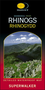
- Rhinogs / Rhinogydd - Snowdonia Harvey Superwalker
- The Rhinogs and the nearby peaks of Snowdonia at 1:25,000 on a waterproof and tear-resistant map from Harvey Map Services in their Superwalker series. Coverage extends from Harlech and Llanrair in the west to Trawsfynydd in the east, with Barmouth and Dolgellau on the southern edge of the map. Map legend and additional notes are also in Welsh.... Read more
Stanfords
United Kingdom
United Kingdom
- Denbigh & Colwyn Bay / Dinbych a Bae Colwyn 1921-1924
- Map No. 116, Denbigh and Colwyn Bay / Dinbych a Bae Colwyn 1921-1924, in the Cassini Historical Series of old Ordnance Survey mapping of England and Wales at 1:50,000 in a format designed to offer a convenient comparison with the present day coverage from the OS, and most locations in three different editions. Old historical maps have been... Read more
Stanfords
United Kingdom
United Kingdom
- Snowdon / Yr Wyddfa 1903-1910
- Map No. 115, Snowdon / Yr Wyddfa 1903-1910, in the Cassini Historical Series of old Ordnance Survey mapping of England and Wales at 1:50,000 in a format designed to offer a convenient comparison with the present day coverage from the OS, and most locations in three different editions. Old historical maps have been combined so that the sheet... Read more
Stanfords
United Kingdom
United Kingdom
- Aberystwyth and Machynlleth 1921-1923
- Map No. 135, Aberystwyth and Machynlleth 1921-1923, in the Cassini Historical Series of old Ordnance Survey mapping of England and Wales at 1:50,000 in a format designed to offer a convenient comparison with the present day coverage from the OS, and most locations in three different editions. Old historical maps have been combined so that the... Read more
Stanfords
United Kingdom
United Kingdom
- Porthmadog and Dolgellau 1902-1903
- Map No. 124, Porthmadog and Dolgellau 1902-1903, in the Cassini Historical Series of old Ordnance Survey mapping of England and Wales at 1:50,000 in a format designed to offer a convenient comparison with the present day coverage from the OS, and most locations in three different editions. Old historical maps have been combined so that the... Read more