
England
Beschrijving
Kaart


Paden in deze landsdeel
- A Dales Highway
- Allerdale RambleGPX
- Beacon WayGPX
- Borders Abbeys WayGPX
- Calderdale WayGPX
- Cheshire Ring Canal WalkGPX
- Cleveland WayGPX
- Coast to Coast WalkGPX
- Coleridge WayGPX
- Copper Trail
- Cotswold WayGPX
- Cumbria WayGPX
- Dales WayGPX
- Dartmoor WayGPX
- Downs LinkGPX
- E2GPX
- E8GPX
- Essex WayGPX
- Fen Rivers WayGPX
- Geopark WayGPX
- Greensand Ridge WalkGPX
- Greensand WayGPX
- Guernsey Coastal Path
- Hadrian's WallGPX
- Heart of England WayGPX
- Hereward WayGPX
- High Weald Landscape TrailGPX
- Icknield WayGPX
- Isle of Jersey Coastal Path
- Isle of Man Coastal PathGPX
- Isle of Wight Coastal PathGPX
- Lady Anne's WayGPX
- Lands End to John o'GroatsGPX
- Lea Valley WalkGPX
- Leland TrailGPX
- Liberty TrailGPX
- Limestone LinkGPX
- Limestone WayGPX
- Mendip WayGPX
- Minster WayGPX
- Monarch's WayGPX
- Nene WayGPX
- North Buckinghamshire WayGPX
- North Downs WayGPX
- North Sea TrailGPX
- Northumberland Coast PathGPX
- Offa's Dyke PathGPX
- Oxford Canal WalkGPX
- Oxfordshire WayGPX
- Peddars Way and Norfolk Coast PathGPX
- Pendle WayGPX
- Pennine BridlewayGPX
- Pennine WayGPX
- Quantock GreenwayGPX
- Reivers Way
- Ribble WayGPX
- RidgewayGPX
- Robin Hood WayGPX
- Saint Cuthbert's WayGPX
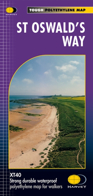
- Saint Oswald's Way
- Saints WayGPX
- Saxon Shore WayGPX
- Severn WayGPX
- Shakespeare's WayGPX
- Shropshire WayGPX
- Solent WayGPX
- South Downs WayGPX
- South West Coast PathGPX
- Staffordshire WayGPX
- Stour Valley PathGPX
- Suffolk Coast and Heaths Path
- Tamar Valley Discovery TrailGPX
- Tarka TrailGPX
- Teesdale WayGPX
- Thames PathGPX
- Trans Pennine TrailGPX
- Two Moors WayGPX
- Via FrancigenaGPX
- Viking WayGPX
- Wayfarer's WalkGPX
- WealdwayGPX
- Weavers WayGPX
- Windermere WayGPX
- Worcestershire WayGPX
- Wychavon WayGPX
- Yorkshire Wolds WayGPX
Links
Feiten
Verslagen
Gidsen en kaarten
Overnachting
Organisaties
Reisorganisaties
GPS
Anders
Boeken

De Zwerver
Netherlands
2016
Netherlands
2016
- Wandelgids Wild Swimming Walks near London | Wild Things Publishing
- 28 River, Lake and Seaside Days Out by Train from London Read more
- Also available from:
- Stanfords, United Kingdom

Stanfords
United Kingdom
2016
United Kingdom
2016
- Wild Swimming with Walks: 28 River, Lake and Seaside Days Out by Train from London
- The Kenwood Ladies’ Pond Association (created in 1985 to represents users of the Ladies’ Pond on Hampstead Heath) proudly presents their Wild Swimming Walks guide, where the ladies share their favourite ”walks with a dip ”. The book leads you to 28 adventures into the beautiful countryside of southern England. An inspiring forward section... Read more
De Zwerver
Netherlands
2015
Netherlands
2015
- Reisgids Wild Guide Southern and Eastern England - Engeland | Wild Things Publishing
- This compendium of adventures features the best wild places to visit in Southern and Eastern England, including ideas for local food and accommodation. Explore hidden gems, from the swimming rivers, secret beaches and lost ruins of Norfolk and Suffolk, to the ancient woods, meadows and orchards of Kent and Sussex. Featuring inspiring... Read more
- Also available from:
- Stanfords, United Kingdom

Stanfords
United Kingdom
2015
United Kingdom
2015
- Wild Guide Southern and Eastern England: Hidden Places, Great Adventures and the Good Life
- This compendium of adventures features the best wild places to visit in Southern and Eastern England, including ideas for local food and accommodation. Explore hidden gems, from the swimming rivers, secret beaches and lost ruins of Norfolk and Suffolk, to the ancient woods, meadows and orchards of Kent and Sussex. Featuring inspiring... Read more

De Zwerver
Netherlands
2019
Netherlands
2019
- Reisgids Slow Travel Northumberland | Bradt Travel Guides
- This new, thoroughly updated second edition of Bradt`s best-selling, comprehensive guide to Northumberland including Newcastle, Hadrian`s Wall & the Coast remains the reliable source of information for discovering the far northeast of England, an area which is home to Europe`s largest area of protected night sky - and England`s first Dark Sky... Read more
- Also available from:
- Stanfords, United Kingdom
Stanfords
United Kingdom
2019
United Kingdom
2019
- Northumberland (Slow Travel) Bradt Guide
- This new, thoroughly updated second edition of Bradt`s best-selling, comprehensive guide to Northumberland including Newcastle, Hadrian`s Wall & the Coast remains the reliable source of information for discovering the far northeast of England, an area which is home to Europe`s largest area of protected night sky - and England`s first Dark Sky... Read more
De Zwerver
Netherlands
2015
Netherlands
2015
- Wandelgids the National Trails - Great British Walks - Engeland, Wales en Schotland | Cicerone
- This inspirational guidebook looks at each of the UK's 19 National Trails, with information that allows ease of comparison and contrast, inspiring you to find out more and to take up a long-distance challenge. Some Trails are short and easy, others much longer, many have strong themes - they may follow a coastline, or traverse ranges of hills. Read more
De Zwerver
Netherlands
2016
Netherlands
2016
- Wandelgids 23 Pathfinder Guides Loch Lomond , The Trossachs and Stirling | Ordnance Survey
- The walks in this guide introduce the many facets of the Southern Highlands and range from easy loch-side strolls to strenuous expeditions onto some of the area`s highest mountains. Walking in Scotland is quite different from walking south of the border. In England there are only eight summits that top 3000 ft, while in Scotland there are 277,... Read more
- Also available from:
- Stanfords, United Kingdom

Stanfords
United Kingdom
2016
United Kingdom
2016
- Loch Lomond, The Trossachs: 2016
- The walks in this guide introduce the many facets of the Southern Highlands and range from easy loch-side strolls to strenuous expeditions onto some of the area`s highest mountains. Walking in Scotland is quite different from walking south of the border. In England there are only eight summits that top 3000 ft, while in Scotland there are 277,... Read more
De Zwerver
Netherlands
2021
Netherlands
2021
- Reisgids Road Trips Great Britain | Dorling Kindersley
- With its idyllic market towns, romantic castle ruins and stunning natural landscapes, Great Britain is the perfect destination for a leisurely road trip. It`s yours to explore with Road Trips Great Britain, which contains 25 drives across the country, from the sweeping sandy beaches of Cornwall to the dramatic peaks of the Scottish... Read more
- Also available from:
- Stanfords, United Kingdom

Stanfords
United Kingdom
2021
United Kingdom
2021
- DK Eyewitness Road Trips Great Britain
- With its idyllic market towns, romantic castle ruins and stunning natural landscapes, Great Britain is the perfect destination for a leisurely road trip. It`s yours to explore with Road Trips Great Britain, which contains 25 drives across the country, from the sweeping sandy beaches of Cornwall to the dramatic peaks of the Scottish... Read more
De Zwerver
Netherlands
2022
Netherlands
2022
- Wandelgids Park Rangers Favourite Walks Peak District | Collins
- Walking guide to the Peak District National Park, with 20 best routes chosen by the park rangers. Each walk varies in length from 2 to 10 km and can be completed in less than 4 hours. 20 best routes chosen and written by National Park rangers Walks from 2 to 10kmDetailed description for each walk with highlights clearly marked... Read more
De Zwerver
Netherlands
2022
Netherlands
2022
De Zwerver
Netherlands
2013
Netherlands
2013
- Wandelgids - Pelgrimsroute Der Pilgerweg nach Rom | Tyrolia
- Auf der Brennerroute über Padua und Assisi. Abt-Albert-von Stade-Weg, Antoniusweg Cammino di Sant´Antonio, Franziskusweg Cammino di Assisi, Romweg Via di Roma. Mit detaillierten Karten für die gesamte Strecke. Read more

De Zwerver
Netherlands
2022
Netherlands
2022
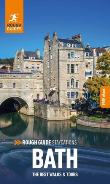
- Reisgids Bath | Rough Guides
- Rough Guides Staycations BathMake the most of your time on Earth with the ultimate travel guides. Inspirational and informative new pocket guide, with free eBook, making the most of holidaying at home in the UK through clearly laid-out walks and tours.Explore the best of Bath with this unique travel guide, packed full of insider information and... Read more
- Also available from:
- Stanfords, United Kingdom
Stanfords
United Kingdom
2022
United Kingdom
2022
- Rough Guide Staycations Bath (Travel Guide with Free eBook)
- Rough Guides Staycations BathMake the most of your time on Earth with the ultimate travel guides. Inspirational and informative new pocket guide, with free eBook, making the most of holidaying at home in the UK through clearly laid-out walks and tours.Explore the best of Bath with this unique travel guide, packed full of insider information and... Read more
De Zwerver
Netherlands
2004
Netherlands
2004
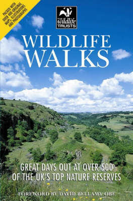
- Wandelgids Wildlife Walks | Wildlife Trust
- This guide offers both nature lovers and families everything they need to know when looking for a day out in the fresh air and being part of the UK's conservation drive. It provides the key to exploring these open spaces and the creatures great and small that inhabit them. Published in association with The Wildlife Trust. Read more
Kaarten

De Zwerver
Netherlands
Netherlands
- Wandelkaart Sredna Gora - Bulgarije | Domino
- Pirin Mountains at 1:50,000 on a large, double-sided, contoured map with GPS waypoints for shelters and chalets, peaks, etc. and highlighting hiking routes. Topography is shown by contours at 40m intervals with additional relief shading and graphics and colouring for sandstone stacks, single rocks over 5m high, marshlands and different types of... Read more

De Zwerver
Netherlands
Netherlands
- Wandelkaart 6 Pirin gebergte | Domino
- Pirin Mountains at 1:50,000 on a large, double-sided, contoured map with GPS waypoints for shelters and chalets, peaks, etc. and highlighting hiking routes. Topography is shown by contours at 40m intervals with additional relief shading and graphics and colouring for sandstone stacks, single rocks over 5m high, marshlands and different types of... Read more
- Also available from:
- Stanfords, United Kingdom

Stanfords
United Kingdom
United Kingdom
- Pirin Mountains Domino
- Pirin Mountains at 1:50,000 on a large, double-sided, contoured map with GPS waypoints for shelters and chalets, peaks, etc. and highlighting hiking routes. Topography is shown by contours at 40m intervals with additional relief shading and graphics and colouring for sandstone stacks, single rocks over 5m high, marshlands and different types of... Read more

De Zwerver
Netherlands
Netherlands
- Wandelkaart 2458 Firenze - Siena - Chianti | Kompass
- Florence - Siena - Chianti area on a double-sided map at 1:50,000 from Kompass, printed on durable, waterproof and tear-resistant synthetic paper. Coverage includes Val di Pesa, Val d’Elsa, Monteriggioni, etc. Contours are at 40m intervals, with a 2-km UTM grid. Extensive overprint includes GEA - Grande Escursione Appenninica, Sentiero Italia,... Read more
- Also available from:
- Stanfords, United Kingdom

Stanfords
United Kingdom
United Kingdom
- Florence - Siena - Chianti Kompass 2458
- Florence - Siena - Chianti area on a double-sided map at 1:50,000 from Kompass, printed on durable, waterproof and tear-resistant synthetic paper. Coverage includes Val di Pesa, Val d’Elsa, Monteriggioni, etc. Contours are at 40m intervals, with a 2-km UTM grid. Extensive overprint includes GEA - Grande Escursione Appenninica, Sentiero Italia,... Read more
De Zwerver
Netherlands
2022
Netherlands
2022
De Zwerver
Netherlands
2022
Netherlands
2022
De Zwerver
Netherlands
Netherlands
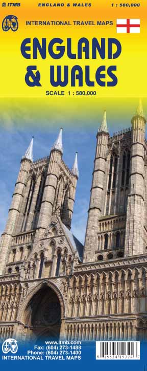
- Wegenkaart - landkaart England & Wales - Engeland | ITMB
- England / Wales Travel Reference Map 1 : 580 000 ab 10.49 EURO 2nd edition Read more
De Zwerver
Netherlands
2020
Netherlands
2020
De Zwerver
Netherlands
Netherlands
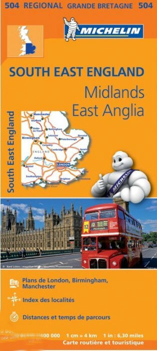
- Wegenkaart - landkaart 504 Southeast England - Zuid oost Engeland - Kent | Michelin
- MICHELIN REGION MIDLANDS EST-ANGLIELondres, Birmingham, Ile de Wight, Canterbury, Manchester , 3 régions sur une seule carte Read more

De Zwerver
Netherlands
Netherlands
- Wandelkaart - Wegenkaart - landkaart 7 Westelijke Rhodopen - Western Rhodopes | Domino
- Western Rhodope Mountains at 1:100,000 on a contoured GPS compatible map from Domino extending from just west of the Pirin National Park to Asenovgrad in the north-east. The map is double-sided with a good overlap between the sides. Topography is shown by contours at 50m intervals with relief shading and spot heights, plus colouring for... Read more
- Also available from:
- Stanfords, United Kingdom

Stanfords
United Kingdom
United Kingdom
- Western Rhodope Mountains Domino Map
- Western Rhodope Mountains at 1:100,000 on a contoured GPS compatible map from Domino extending from just west of the Pirin National Park to Asenovgrad in the north-east. The map is double-sided with a good overlap between the sides. Topography is shown by contours at 50m intervals with relief shading and spot heights, plus colouring for... Read more

De Zwerver
Netherlands
2021
Netherlands
2021
De Zwerver
Netherlands
2022
Netherlands
2022
De Zwerver
Netherlands
2013
Netherlands
2013
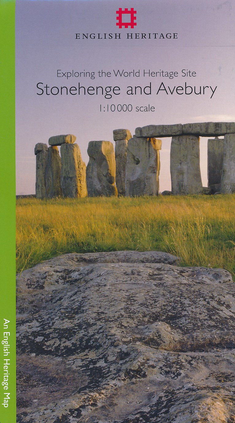
- Historische Kaart Exploring the World Heritage Site - Stonehenge and Avebury | English Heritage
- The Stonehenge and Avebury World Heritage Site is internationally important for its outstanding prehistoric monuments. Stonehenge is the most architecturally sophisticated prehistoric stone circle in the world, while Avebury is the largest. Around them lie numerous other monuments and sites, which demonstrate over 2,000 years of continuous use.... Read more
De Zwerver
Netherlands
Netherlands
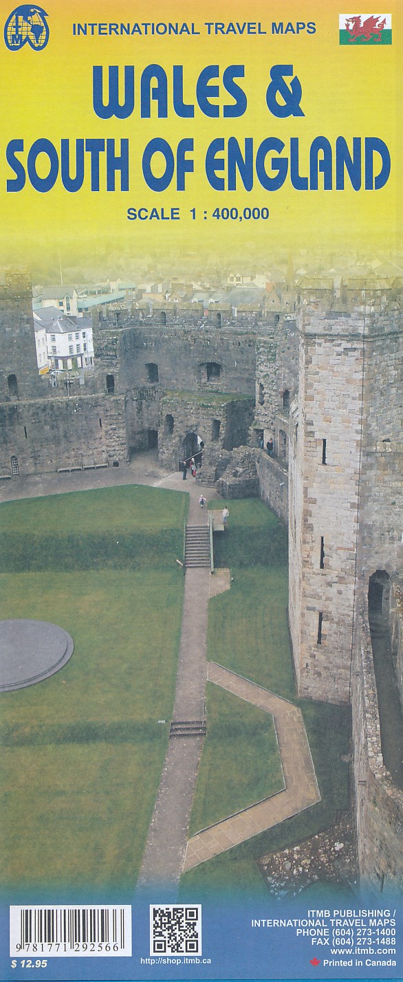
- Wegenkaart - landkaart Wales & south of England - Zuid Engeland | ITMB
- Topographische Karte England South incl. Wales 1 : 400.000 ab 10.49 EURO International Travel Map ITM. 1. Auflage Read more