
Cherokee National Forest
Beschrijving
Paden in deze regio
Links
Feiten
Verslagen
Gidsen en kaarten
Overnachting
Organisaties
Reisorganisaties
GPS
Anders
Boeken


De Zwerver
Netherlands
2018
Netherlands
2018
- Wandelgids USA: Appalachian Trail | Conrad Stein Verlag
- Handzame overzichtsgids van deze geweldige en uitdagende lange afstands wandeling in het oosten van de USA: de Appalachian Trail. Het is een ideale gids om de hele tocht voor te bereiden en als basisgids bij je te hebben. Goede beschrijvingen van etappes en veel praktische informatie. Het enige wat mager is zijn dekaarten: goed voor overzicht... Read more

De Zwerver
Netherlands
Netherlands
Bol.com
Netherlands
Netherlands
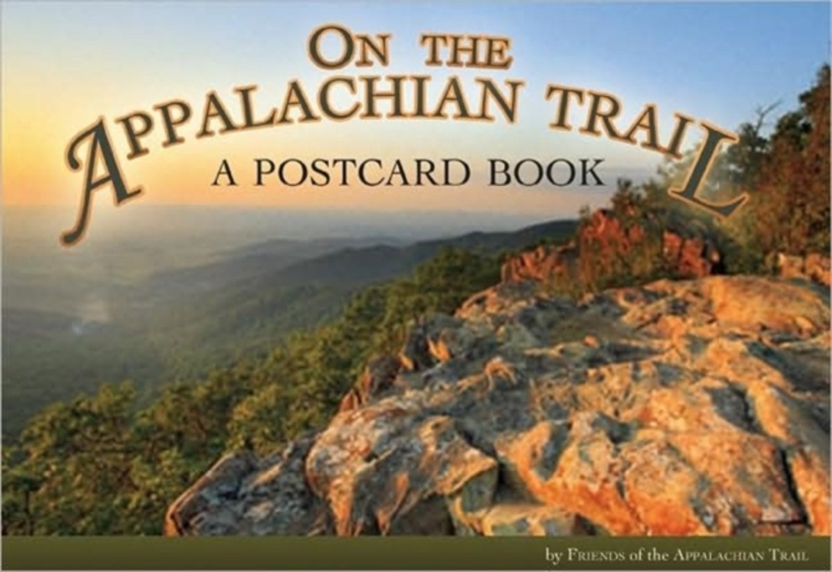
- On the Appalachian Trail
- Few areas of American wilderness are more impressive than the Appalachian Trail, with its extraordinary scenery stretching nearly 2,200 miles and covering 250,000 acres from Maine to Georgia. Maintenance of the trail depends in part on more than 6,000 volunteers who devote considerable time, energy, and personal resources to the task. These... Read more
- Also available from:
- Bol.com, Belgium
Bol.com
Belgium
Belgium
- On the Appalachian Trail
- Few areas of American wilderness are more impressive than the Appalachian Trail, with its extraordinary scenery stretching nearly 2,200 miles and covering 250,000 acres from Maine to Georgia. Maintenance of the trail depends in part on more than 6,000 volunteers who devote considerable time, energy, and personal resources to the task. These... Read more
Bol.com
Netherlands
Netherlands
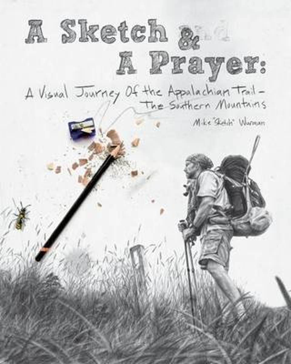
- A Sketch & a Prayer
- It's the story and artwork of an artist who had lost all inspiration to draw, until one day he walked across a bald mountain in North Carolina and took a photograph of a lone white blaze that marks the path of the 2189 mile long Appalachian Trail. In that instant, he was catapulted into a world only experienced by long distance hikers. With... Read more
- Also available from:
- Bol.com, Belgium
Bol.com
Belgium
Belgium
- A Sketch & a Prayer
- It's the story and artwork of an artist who had lost all inspiration to draw, until one day he walked across a bald mountain in North Carolina and took a photograph of a lone white blaze that marks the path of the 2189 mile long Appalachian Trail. In that instant, he was catapulted into a world only experienced by long distance hikers. With... Read more
Bol.com
Netherlands
Netherlands
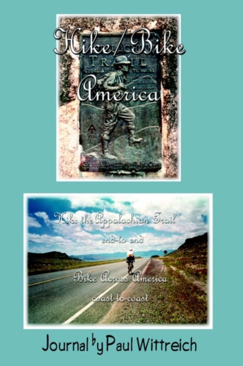
- Hike/Bike America
- This social study illuminates 100 years of family history in Western Zimbabwe from the colonial period to the present day. It follows several generations of the Kalanaga family through the post-colonial heritage of guerrilla wars, large-scale eviction and resettlement, and near starvation. Read more
- Also available from:
- Bol.com, Belgium
Bol.com
Belgium
Belgium
- Hike/Bike America
- This social study illuminates 100 years of family history in Western Zimbabwe from the colonial period to the present day. It follows several generations of the Kalanaga family through the post-colonial heritage of guerrilla wars, large-scale eviction and resettlement, and near starvation. Read more

De Zwerver
Netherlands
Netherlands
- Also available from:
- Bol.com, Netherlands
- Bol.com, Belgium
Bol.com
Netherlands
Netherlands
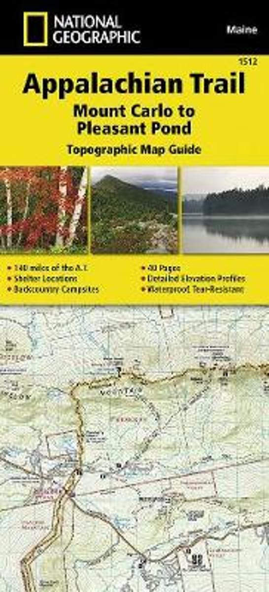
- Appalachian Trail, Mount Carlo To Pleasant Pond, Maine
- Waterproof Tear-Resistant Topographic Map GuideThe Mount Carlo to Pleasant Pond Topographic Map Guide makes a perfect traveling companion when traversing the southern Maine section of the Appalachian Trail (A.T.). The A.T. through Maine offers some of the most challenging sections of trail along the A.T., both in rugged terrain and... Read more
Bol.com
Belgium
Belgium
- Appalachian Trail, Mount Carlo To Pleasant Pond, Maine
- Waterproof Tear-Resistant Topographic Map GuideThe Mount Carlo to Pleasant Pond Topographic Map Guide makes a perfect traveling companion when traversing the southern Maine section of the Appalachian Trail (A.T.). The A.T. through Maine offers some of the most challenging sections of trail along the A.T., both in rugged terrain and... Read more
Bol.com
Netherlands
Netherlands
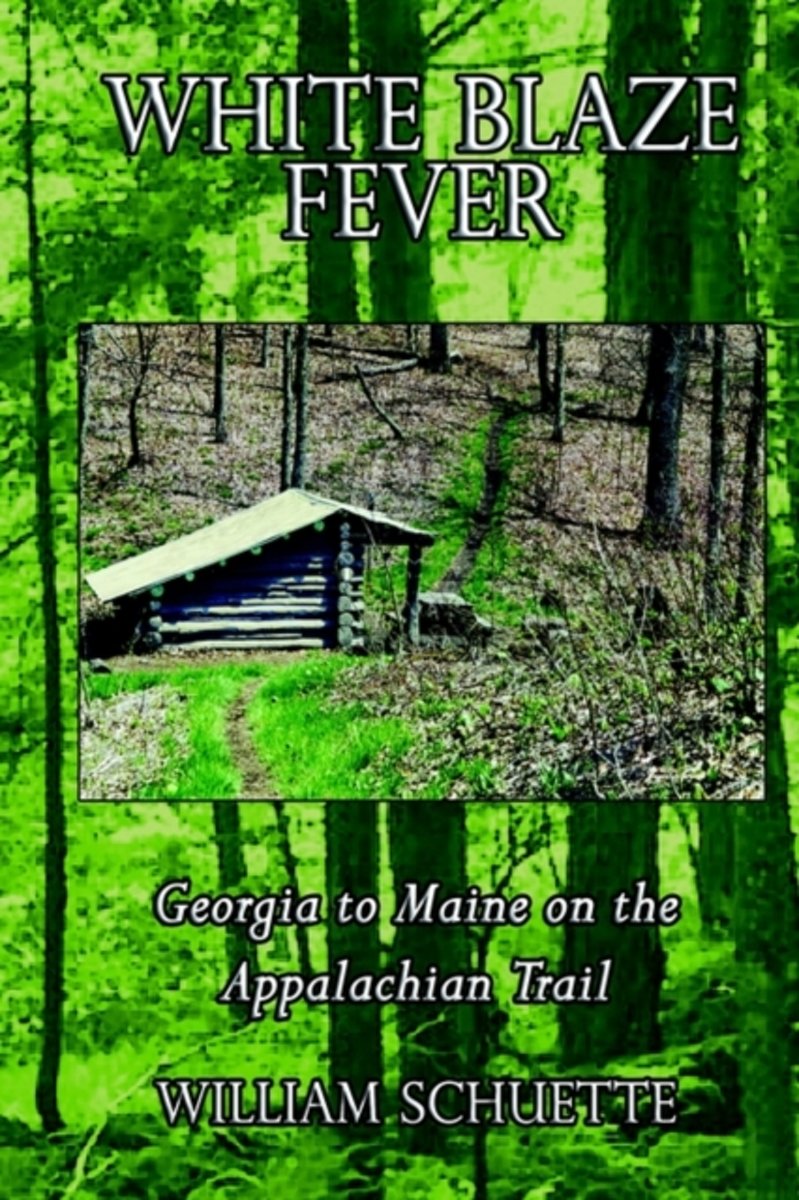
- White Blaze Fever
- It's called "White Blaze Fever" and although you will not find the fever mentioned in any medical journal, have no doubt in your mind - it does exist and no one is immune. Only the most casual, most minute contact with the Appalachian Trail is needed to catch the fever. I now welcome you to be my vicarious hiking partner as we pursue the... Read more
- Also available from:
- Bol.com, Belgium
Bol.com
Belgium
Belgium
- White Blaze Fever
- It's called "White Blaze Fever" and although you will not find the fever mentioned in any medical journal, have no doubt in your mind - it does exist and no one is immune. Only the most casual, most minute contact with the Appalachian Trail is needed to catch the fever. I now welcome you to be my vicarious hiking partner as we pursue the... Read more
Bol.com
Netherlands
Netherlands
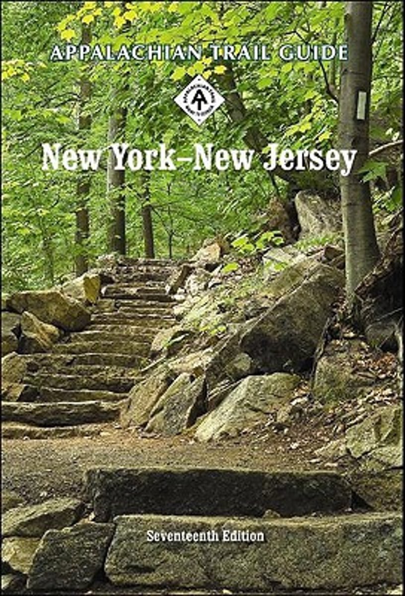
- Appalachian Trail Guide to New York-New Jersey Book and Maps
- Consists of a guidebook and two detached, double-sided maps (in a display box) for 172 miles of the Appalachian Trail, from Kent, Connecticut, to Delaware Water Gap National Recreation Area on the Pennsylvania/New Jersey border.The indexed book contains omnidirectional trail descriptions, natural and cultural history of the areas crossed, and... Read more
- Also available from:
- Bol.com, Belgium
Bol.com
Belgium
Belgium
- Appalachian Trail Guide to New York-New Jersey Book and Maps
- Consists of a guidebook and two detached, double-sided maps (in a display box) for 172 miles of the Appalachian Trail, from Kent, Connecticut, to Delaware Water Gap National Recreation Area on the Pennsylvania/New Jersey border.The indexed book contains omnidirectional trail descriptions, natural and cultural history of the areas crossed, and... Read more
De Zwerver
Netherlands
Netherlands
- Also available from:
- Bol.com, Netherlands
- Bol.com, Belgium
- The Book Depository, United Kingdom

Bol.com
Netherlands
Netherlands
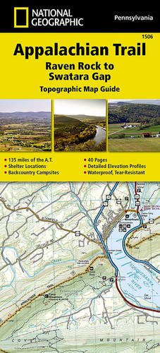
- Appalachian Trail, Raven Rock To Swatara Gap, Pennsylvania
- Waterproof Tear-Resistant Topographic MapThe Raven Rock to Swatara Gap Topographic Map Guide makes a perfect traveling companion when traversing the southeastern Pennsylvania section of the Appalachian Trail (A.T.). The map follows the ridges of the Appalachian Mountains, crosses the 12-mile wide, agriculturally rich Cumberland Valley,... Read more
Bol.com
Belgium
Belgium
- Appalachian Trail, Raven Rock To Swatara Gap, Pennsylvania
- Waterproof Tear-Resistant Topographic MapThe Raven Rock to Swatara Gap Topographic Map Guide makes a perfect traveling companion when traversing the southeastern Pennsylvania section of the Appalachian Trail (A.T.). The map follows the ridges of the Appalachian Mountains, crosses the 12-mile wide, agriculturally rich Cumberland Valley,... Read more

The Book Depository
United Kingdom
United Kingdom
- Appalachian Trail, Raven Rock To Swatara Gap, Pennsylvania
- Trails Illustrated Read more
Bol.com
Netherlands
Netherlands
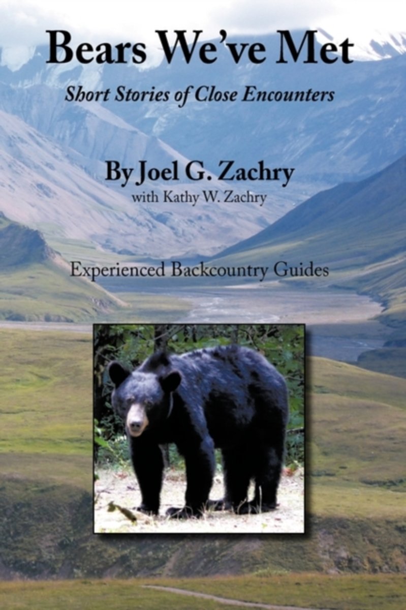
- Bears We've Met
- Bears We've Met is a compelling narrative of short stories of close encounters with bears spanning more than thirty years of the author's experiences in North America's remote regions. In this documentary the author shares early blunders and tense moments, including humorous and intriguing confrontations, as he and his wife confront the largest... Read more
- Also available from:
- Bol.com, Belgium
Bol.com
Belgium
Belgium
- Bears We've Met
- Bears We've Met is a compelling narrative of short stories of close encounters with bears spanning more than thirty years of the author's experiences in North America's remote regions. In this documentary the author shares early blunders and tense moments, including humorous and intriguing confrontations, as he and his wife confront the largest... Read more
Bol.com
Netherlands
Netherlands
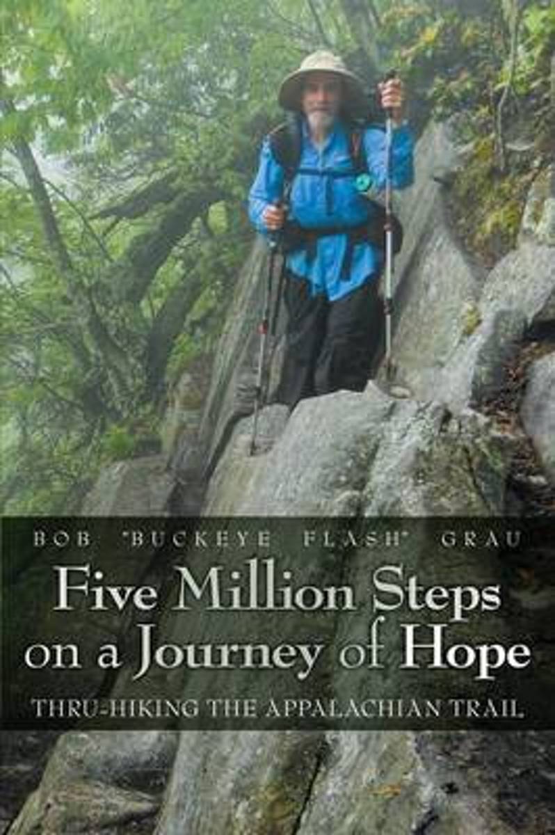
- Five Million Steps on a Journey of Hope
- On his 170-day hike, Bob traversed 14 states and climbed 270 mountains. He began his thru-hike in Georgia in March and completed it in Maine in September. Although the AT is described as "a footpath for those who seek fellowship with the wilderness," it is often steep, rocky, extremely demanding, and it looks nothing like a path. Less than 25%... Read more
- Also available from:
- Bol.com, Belgium
Bol.com
Belgium
Belgium
- Five Million Steps on a Journey of Hope
- On his 170-day hike, Bob traversed 14 states and climbed 270 mountains. He began his thru-hike in Georgia in March and completed it in Maine in September. Although the AT is described as "a footpath for those who seek fellowship with the wilderness," it is often steep, rocky, extremely demanding, and it looks nothing like a path. Less than 25%... Read more
De Zwerver
Netherlands
Netherlands
- Also available from:
- Bol.com, Netherlands
- Bol.com, Belgium
Bol.com
Netherlands
Netherlands
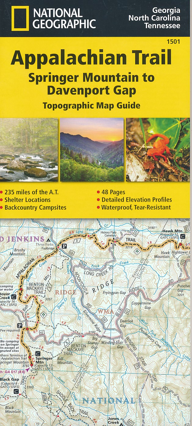
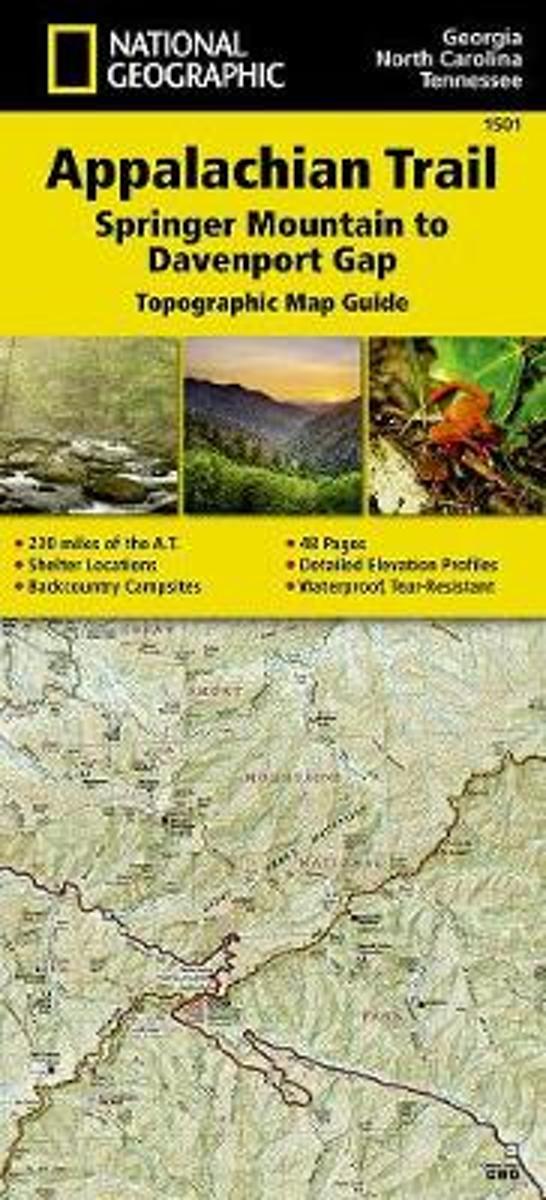
- Appalachian Trail, Springer Mountain To Davenport Gap, Georgia, North Carolina, Tennessee
- Waterproof Tear-Resistant Topographic Map GuideThe Springer Mountain to Davenport Gap Topographic Map Guide makes a perfect traveling companion when traversing the Georgia, southeastern Tennessee and southwestern North Carolina, section of the Appalachian Trail (A.T.). The southern most section of the A.T. which starts at Georgia's... Read more
Bol.com
Belgium
Belgium
- Appalachian Trail, Springer Mountain To Davenport Gap, Georgia, North Carolina, Tennessee
- Waterproof Tear-Resistant Topographic Map GuideThe Springer Mountain to Davenport Gap Topographic Map Guide makes a perfect traveling companion when traversing the Georgia, southeastern Tennessee and southwestern North Carolina, section of the Appalachian Trail (A.T.). The southern most section of the A.T. which starts at Georgia's... Read more

Bol.com
Netherlands
Netherlands
- A Walk In The Woods
- In the company of his friend Stephen Katz (last seen in the bestselling Neither Here nor There), Bill Bryson set off to hike the Appalachian Trail, the longest continuous footpath in the world. Ahead lay almost 2,200 miles of remote mountain wilderness filled with bears, moose, bobcats, rattlesnakes, poisonous plants, disease-bearing tics, the... Read more
- Also available from:
- Bol.com, Belgium
Bol.com
Belgium
Belgium
- A Walk In The Woods
- In the company of his friend Stephen Katz (last seen in the bestselling Neither Here nor There), Bill Bryson set off to hike the Appalachian Trail, the longest continuous footpath in the world. Ahead lay almost 2,200 miles of remote mountain wilderness filled with bears, moose, bobcats, rattlesnakes, poisonous plants, disease-bearing tics, the... Read more
Bol.com
Netherlands
Netherlands
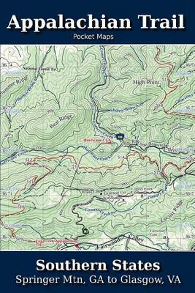
- Appalachian Trail Pocket Maps - Southern States
- Southern States - Springer Mtn, GA to Glasgow, VAOctober 1, 2014The Appalachian Trail Pocket Map Series is a complete and concise set of topographic maps created withdigitized base maps covering every step of the 2,180 mile trail from Georgia to Maine.These next generation maps are not created from 20-50 year old scanned topo maps. They are... Read more
- Also available from:
- Bol.com, Belgium
Bol.com
Belgium
Belgium
- Appalachian Trail Pocket Maps - Southern States
- Southern States - Springer Mtn, GA to Glasgow, VAOctober 1, 2014The Appalachian Trail Pocket Map Series is a complete and concise set of topographic maps created withdigitized base maps covering every step of the 2,180 mile trail from Georgia to Maine.These next generation maps are not created from 20-50 year old scanned topo maps. They are... Read more
Kaarten

Bol.com
Netherlands
Netherlands
- Springer & Cohutta Mountains, Chattahoochee National Forest
- Waterproof Tear-Resistant Topographic MapLocated just north of Atlanta, the Chattahoochee National Forest contains the southern terminus of the Appalachian Trail along with an abundance of recreational opportunities for outdoor enthusiasts of all interests.This detailed recreation map contains carefully researched trails, campsites,... Read more
- Also available from:
- Bol.com, Belgium
- Stanfords, United Kingdom
Bol.com
Belgium
Belgium
- Springer & Cohutta Mountains, Chattahoochee National Forest
- Waterproof Tear-Resistant Topographic MapLocated just north of Atlanta, the Chattahoochee National Forest contains the southern terminus of the Appalachian Trail along with an abundance of recreational opportunities for outdoor enthusiasts of all interests.This detailed recreation map contains carefully researched trails, campsites,... Read more

Stanfords
United Kingdom
United Kingdom
- Chattahoochee National Forest - Springer and Cohutta Mountains GA/SC 777
- Map No. 777, Chattahoochee National Forest: Springer and Cohutta Mountains, GA/SC, in an extensive series of GPS compatible, contoured hiking maps of USA’s national and state parks or forests and other popular recreational areas. Cartography based on the national topographic survey, with additional tourist information.The maps, with most titles... Read more

De Zwerver
Netherlands
Netherlands
- Wandelkaart - Topografische kaart 318 Mount Rogers High Country - Grayson Highlands State Park | National Geographic
- Prachtige geplastificeerde kaart van het bekende nationaal park. Met alle recreatieve voorzieningen als campsites, maar ook met topografische details en wandelroutes ed. Door uitgekiend kleurgebruik zeer prettig in gebruik. Scheur en watervast! National Geographic's Trails Illustrated map of Mount Rogers High Country and Grayson Highlands... Read more
- Also available from:
- Bol.com, Netherlands
- Bol.com, Belgium
- Stanfords, United Kingdom
- The Book Depository, United Kingdom

Bol.com
Netherlands
Netherlands
- Mount Rogers High Country
- Waterproof Tear-Resistant Topographic MapNational Geographic's Trails Illustrated map of Mount Rogers High Country and Grayson Highlands State Park, Southwest Virginia, is a two-sided, waterproof, topographic trail map designed to meet the needs of outdoor enthusiasts with unmatched durability and detail. This map was created in... Read more
Bol.com
Belgium
Belgium
- Mount Rogers High Country
- Waterproof Tear-Resistant Topographic MapNational Geographic's Trails Illustrated map of Mount Rogers High Country and Grayson Highlands State Park, Southwest Virginia, is a two-sided, waterproof, topographic trail map designed to meet the needs of outdoor enthusiasts with unmatched durability and detail. This map was created in... Read more

Stanfords
United Kingdom
United Kingdom
- Mount Rogers High Country VA
- Map No. 318 - Mount Rogers High Country in Virginia in an extensive series of GPS compatible, contoured hiking maps of USA’s national and state parks or forests and other popular recreational areas. Cartography based on the national topographic survey, with additional tourist information.The maps, with most titles now printed on light,... Read more

The Book Depository
United Kingdom
United Kingdom
- Mount Rogers High Country
- Trails Illustrated Other Rec. Areas Read more
De Zwerver
Netherlands
Netherlands
- Wandelkaart 229 Great Smoky Mountains National Park | National Geographic
- Prachtige geplastificeerde kaart van het bekende nationaal park. Met alle recreatieve voorzieningen als campsites, maar ook met topografische details en wandelroutes ed. Door uitgekiend kleurgebruik zeer prettig in gebruik. Scheur en watervast! Map No. 229, Great Smoky Mountains National Park, TN, in an extensive series of GPS compatible,... Read more
- Also available from:
- Bol.com, Netherlands
- Bol.com, Belgium
- Stanfords, United Kingdom
Bol.com
Netherlands
Netherlands
- Great Smoky Mountains National Park
- Waterproof Tear-Resistant Topographic MapAmerica's most visited national park and a UNESCO World Heritage Site, Great Smoky Mountains National Park is both renowned for its diversity of plant and animal life and rich in remnants of Southern Appalachian mountain culture. National Geographic's Trails Illustrated map of the park combines... Read more
Bol.com
Belgium
Belgium
- Great Smoky Mountains National Park
- Waterproof Tear-Resistant Topographic MapAmerica's most visited national park and a UNESCO World Heritage Site, Great Smoky Mountains National Park is both renowned for its diversity of plant and animal life and rich in remnants of Southern Appalachian mountain culture. National Geographic's Trails Illustrated map of the park combines... Read more

Stanfords
United Kingdom
United Kingdom
- Great Smoky Mountains National Park TN NGS Trails Illustrated Map 229
- Map No. 229, Great Smoky Mountains National Park, TN, in an extensive series of GPS compatible, contoured hiking maps of USA’s national and state parks or forests and other popular recreational areas. Cartography based on the national topographic survey, with additional tourist information.The maps, with most titles now printed on light,... Read more

De Zwerver
Netherlands
Netherlands
- Wandelkaart - Topografische kaart 747 Green Mountain National Forest North - Moosalamoo NRA - Rutland | National Geographic
- Prachtige geplastificeerde kaart van het bekende nationaal park. Met alle recreatieve voorzieningen als campsites, maar ook met topografische details en wandelroutes ed. Door uitgekiend kleurgebruik zeer prettig in gebruik. Scheur en watervast! National Geographic's Green Mountain National Forest North Trails Illustrated topographic map is... Read more
- Also available from:
- Bol.com, Netherlands
- Bol.com, Belgium
- Stanfords, United Kingdom
- The Book Depository, United Kingdom

Bol.com
Netherlands
Netherlands
- Green Mountains N.F., Moosalamoo NRA/Rutland
- Waterproof Tear-Resistant Topographic MapNational Geographic's Green Mountain National Forest North Trails Illustrated topographic map is the most comprehensive available for outdoor enthusiasts of all types. Designed to be easy-to-read, yet highly detailed this map includes a comprehensive road and trail network distinguishing between... Read more
Bol.com
Belgium
Belgium
- Green Mountains N.F., Moosalamoo NRA/Rutland
- Waterproof Tear-Resistant Topographic MapNational Geographic's Green Mountain National Forest North Trails Illustrated topographic map is the most comprehensive available for outdoor enthusiasts of all types. Designed to be easy-to-read, yet highly detailed this map includes a comprehensive road and trail network distinguishing between... Read more

Stanfords
United Kingdom
United Kingdom
- Green Mountain National Forest - Moosalamoo NRA - Rutland VT
- Map No. 747, Green Mountain National Forest: Moosalamoo NRA - Rutland area in Vermont, in an extensive series of GPS compatible, contoured hiking maps of USA’s national and state parks or forests and other popular recreational areas. Cartography based on the national topographic survey, with additional tourist information.The maps, with most... Read more

The Book Depository
United Kingdom
United Kingdom
- Green Mountains N.f., Moosalamoo Nra/rutland
- Trails Illustrated Other Rec. Areas Read more

De Zwerver
Netherlands
Netherlands
- Wandelkaart - Topografische kaart 316 Cades Cove - Elkmont - Great Smoky Mountains National Park | National Geographic
- Prachtige geplastificeerde kaart van het bekende nationaal park. Met alle recreatieve voorzieningen als campsites, maar ook met topografische details en wandelroutes ed. Door uitgekiend kleurgebruik zeer prettig in gebruik. Scheur en watervast! This title provides an increased scale of one of the most visited National Parks in the US, and one... Read more
- Also available from:
- Bol.com, Netherlands
- Bol.com, Belgium
- Stanfords, United Kingdom

Bol.com
Netherlands
Netherlands
- Cades Cove/elkmont, Great Smoky Mountains National Park
- Waterproof Tear-Resistant Topographic MapThis title provides an increased scale of one of the most visited National Parks in the US, and one of our more popular map titles. This increased scale will provide greater detail to the backcountry users and Appalachian Trail through-hikers.Park Introduction:Great Smoky Mountains National Park is... Read more
Bol.com
Belgium
Belgium
- Cades Cove/elkmont, Great Smoky Mountains National Park
- Waterproof Tear-Resistant Topographic MapThis title provides an increased scale of one of the most visited National Parks in the US, and one of our more popular map titles. This increased scale will provide greater detail to the backcountry users and Appalachian Trail through-hikers.Park Introduction:Great Smoky Mountains National Park is... Read more

Stanfords
United Kingdom
United Kingdom
- Cades Cove - Elkmont - Great Smoky Mountains National Park NC/TN
- Map No. 316, Great Smoky Mountains National Park: Cades Cove - Elkmont, NC/TN, in an extensive series of GPS compatible, contoured hiking maps of USA’s national and state parks or forests and other popular recreational areas. Cartography based on the national topographic survey, with additional tourist information.The maps, with most titles now... Read more