De Zwerver
Netherlands
2022
» Click to open
Stanfords
United Kingdom
2022
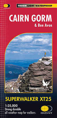
  • Cairn Gorm & Ben Avon Harvey Superwalker XT25
  • Cairn Gorm and Ben Avon area in the heart of the Scottish Highlands at 1:25,000 on a waterproof and tear-resistant map from Harvey Map Services in their Superwalker series. The peak of Cairn Gorm is on the eastern side of the map, with coverage extending north to Glanmore and the outskirts of Aviemore, west to Achlean and River Feshie and south... Read more
» Click to close
De Zwerver
Netherlands
2018
» Click to open
Bol.com
Netherlands
2018
  • West Highland Way XT40
  • The West Highland Way is 96 miles (153 km) long and links Milngavie (Glasgow) to Fort William. It run's from Scotland's largest city to the foot of its highest mountain, Ben Nevis, through the Loch Lomond and Trossachs National Park.Detailed mapping, full legend in English, French and German. National Grid. Read more
Bol.com
Belgium
2018
  • West Highland Way XT40
  • The West Highland Way is 96 miles (153 km) long and links Milngavie (Glasgow) to Fort William. It run's from Scotland's largest city to the foot of its highest mountain, Ben Nevis, through the Loch Lomond and Trossachs National Park.Detailed mapping, full legend in English, French and German. National Grid. Read more
Stanfords
United Kingdom
2018
  • West Highland Way Harvey National Trail XT40
  • The West Highland Way, Scotland’s premier 153km / 96 miles long trail from Milngavie near Glasgow along Loch Lomond to Fort William presented at 1:40,000 on a light, waterproof and tear-resistant map from Harvey Map Services. The whole route is covered by nine overlapping panels, and the map includes small street plan of Milngavie, Tyndrum,... Read more
» Click to close
Bol.com
Netherlands
2004
» Click to open
Bol.com
Belgium
2004
  • Cateran Trail
  • The Cateran Trail follows the footsteps of cattle rustlers (caterans) for 64 miles (104 km), starting from Blairgowrie. It runs through the heart of Scotland, rich in history, legend and wildlife. This waymarked trail can be completed comfortably in 5 days. The revised edition includes 8 pages of mapping at 1:50,000. Read more
» Click to close
De Zwerver
Netherlands
2014
» Click to open
Bol.com
Netherlands
2014
  • Cape Wrath Trail South XT40
  • Cape Wrath Trail is a challenging route from Fort William to Cape Wrath. It is around 200 miles long and passes through some of Scotland's wildest and most spectacular scenery. The trail has evolved from use and is not an officially recognised National Trail. There is no single definitive route. There are various ways of tackling the traverse... Read more
Bol.com
Belgium
2014
  • Cape Wrath Trail South XT40
  • Cape Wrath Trail is a challenging route from Fort William to Cape Wrath. It is around 200 miles long and passes through some of Scotland's wildest and most spectacular scenery. The trail has evolved from use and is not an officially recognised National Trail. There is no single definitive route. There are various ways of tackling the traverse... Read more
Stanfords
United Kingdom
2014
The Book Depository
United Kingdom
2014
» Click to close
Bol.com
Netherlands
2014
» Click to open
Bol.com
Belgium
2014
  • Great Glen Way
  • This guidebook (fully updated 2014) contains all you need to plan and enjoy a holiday walking or cycling along Scotland's historic Great Glen (77 miles/125 km). The Way runs between Fort William and Inverness, beside Scotland's highest mountain, along the historic Caledonian Canal and past beautiful lochs, including Loch Ness with its famous... Read more
» Click to close
De Zwerver
Netherlands
2014
» Click to open
Bol.com
Netherlands
2014
  • Cape Wrath Trail North XT40
  • The northern section of the Cape Wrath Trail, from Strathcarron via Ullapool to Cape Wrath - the most north-westerly point in the mainland United Kingdom, presented at 1:40,000 on a light, waterproof and tear-resistant map from Harvey Map Services. The map covers this section of the trail on 12 overlapping panels. The whole Cape Wrath Trail is... Read more
Bol.com
Belgium
2014
  • Cape Wrath Trail North XT40
  • The northern section of the Cape Wrath Trail, from Strathcarron via Ullapool to Cape Wrath - the most north-westerly point in the mainland United Kingdom, presented at 1:40,000 on a light, waterproof and tear-resistant map from Harvey Map Services. The map covers this section of the trail on 12 overlapping panels. The whole Cape Wrath Trail is... Read more
Stanfords
United Kingdom
2014
  • Cape Wrath Trail North - Strathcarron to Cape Wrath Harvey National Trail XT40
  • The northern section of the Cape Wrath Trail, from Strathcarron via Ullapool to Cape Wrath - the most north-westerly point in the mainland United Kingdom, presented at 1:40,000 on a light, waterproof and tear-resistant map from Harvey Map Services. The map covers this section of the trail on 12 overlapping panels. The whole Cape Wrath Trail is... Read more
The Book Depository
United Kingdom
2014
» Click to close
De Zwerver
Netherlands
» Click to open
Bol.com
Netherlands
  • FB WKE2 La Palma
  • Dubbelzijdige wandel- en vrijetijdskaart • toeristische tips • stadsplattegronden • fietspaden en mountainbikeroutes • GPS-punten • ski- en langlaufroutes Read more
Bol.com
Belgium
  • FB WKE2 La Palma
  • Dubbelzijdige wandel- en vrijetijdskaart • toeristische tips • stadsplattegronden • fietspaden en mountainbikeroutes • GPS-punten • ski- en langlaufroutes Read more
The Book Depository
United Kingdom
» Click to close
Stanfords
United Kingdom
Stanfords
United Kingdom
Stanfords
United Kingdom
Stanfords
United Kingdom
Stanfords
United Kingdom
Stanfords
United Kingdom
De Zwerver
Netherlands
2020
» Click to open
Stanfords
United Kingdom
2020
  • West Highland Way - Easy-to-use Folding Map and Essential Information
  • The 153-kilometre West Highland Way encompasses the variety of Scotland`s wild places. The route, which begins in Milngavie and finishes in Fort William, passes from Glasgow, Scotland`s friendliest city, through lochs and forests, and across wild moors in the shadows of Munros. Offering panoramic views and clear waymarking, it is no wonder this... Read more
The Book Depository
United Kingdom
2020
  • West Highland Way
  • Easy-to-use folding map and essential information, with custom itinerary planning for walkers, trekkers, fastpackers and trail runners Read more
» Click to close
De Zwerver
Netherlands
2013
» Click to open
Stanfords
United Kingdom
2013
  • South Loch Ness Trail Harvey National Trail XT40
  • The South Loch Ness Trail, a 45km / 28 mile long hiking route from Loch Tarff near Fort Augustus on the southern tip of Loch Ness to Torbreck on the outskirts of Inverness at 1:40,000 on GPS compatible, light, waterproof and tear-resistant map from Harvey Map Services. The map also highlights the course of the Trail of the 7 Lochs, an 80km / 50... Read more
The Book Depository
United Kingdom
2013
  • South Loch Ness Trail
  • The South Loch Ness Trail, a 45km / 28 mile long hiking route from Loch Tarff near Fort Augustus on the southern tip of Loch Ness to Torbreck on the outskirts of Inverness at 1:40,000 on GPS compatible, light, waterproof and tear-resistant map from Harvey Map Services. The map also highlights the course of the Trail of the 7 Lochs, an 80km / 50... Read more
» Click to close