Gedetailleerde wandelkaart van een deel van het bergmassief van de Monte Rosa en de uitlopers daarvan in het noordelijke deel van Piemonte. De kaart is gebaseerd op topografische kaarten met belangrijke zaken als hoogtelijnen, bergtoppen en woningen. Daarnaast zijn er voor de wandelaars nuttige feiten als hutten, campings maar ook markeringen...Read more
1:25,000 scale hiking map to Valle Isorno including Valle Antigorio, Val Vigezzo & Valle Maggia.Published in association with the CAI, the Italian Alpine Club, who are responsible for the trails. Trails are marked on the map. The key information and more detailed information on the rear of the sheet are in Italian, German and English. Printed...Read more
Monte Rosa - Alagna - Macugnaga, map no. 10, in a series contoured hiking maps at 1:50,000 with local trails, long-distance footpaths, mountain accommodation, etc. from the Turin based Istituto Geografico Centrale covering the Italian Alps and Piedmont, the lakes and northern Lombardy, and the Italian Riviera.The maps have contours at 50m...Read more
Monte Rosa - Alagna - Macugnaga in a series contoured hiking maps at 1:50,000 with local trails, long-distance footpaths, mountain accommodation, etc. from the Turin based Istituto Geografico Centrale.Maps in this series have contours at 50m intervals, enhanced by shading and graphic relief. An overprint highlights local footpaths and...Read more
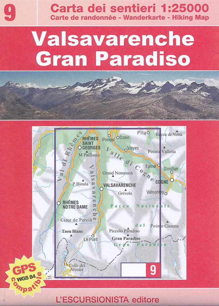
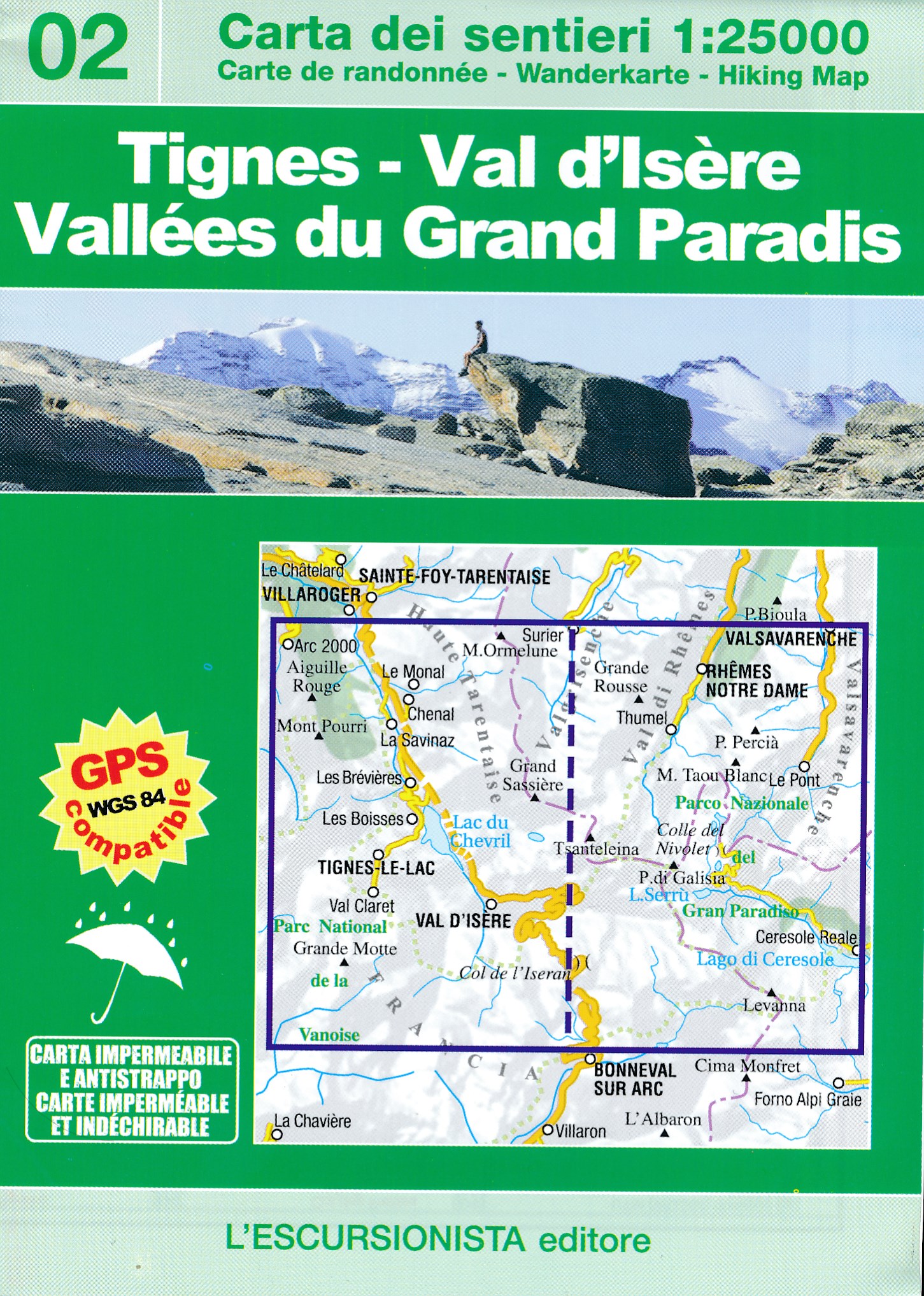
Mont Blanc - Courmayeur - Chamonix - La Thuile area at 1:25,000 in a series of contoured, GPS compatible walking maps from the Turin based Istituto Geografico Centrale, highlighting hiking trails including long-distance routes, ski routes and alpine accommodation. The maps have contours at 25m intervals, enhanced by shading and graphic relief...Read more
Mont Blanc - Courmayeur - Chamonix - La Thuile area at 1:25,000 in a series of contoured, GPS compatible walking maps from the Turin based Istituto Geografico Centrale, highlighting hiking trails including long-distance routes, ski routes and alpine accommodation. Maps in this series have contours at 25m intervals, enhanced by shading and...Read more
Dit is een grensoverschrijdende kaart die 2 interessante wandelgebieden en klimgebieden combineert op een zeer gedetailleerde schaal. Een uitstekende wandelkaart met ale noodzakelijke topografische details als hoogtelijnen, waterlopen en rotspartijen. Daarnaast zijn wandelroutes ingetekend, alsmede berghutten, campings in de dalen en zelfs MTB...Read more
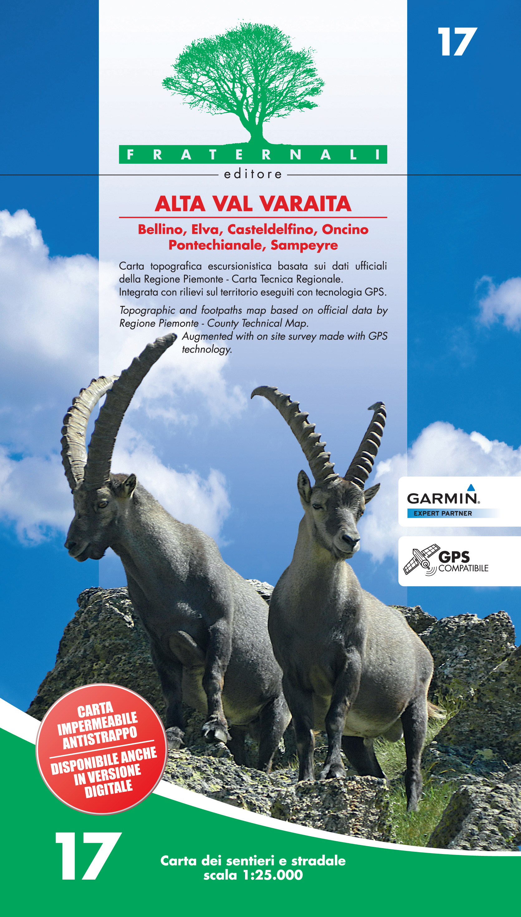
Alta Val Varaita in the Italian Alps presented at 1:25,000 in a series of large, contoured and GPS compatible walking maps from Fraternali Editore, printed on light, waterproof and tear-resistant synthetic paper. Maps in this series have topography shown by contour lines at 5m intervals with relief shading, spot heights, and colouring and/or...Read more
Alta Val Varaita in the Italian Alps presented at 1:25,000 in a series of large, contoured and GPS compatible walking maps from Fraternali Editore, printed on light, waterproof and tear-resistant synthetic paper. Maps in this series have topography shown by contour lines at 5m intervals with relief shading, spot heights, and colouring and/or...Read more
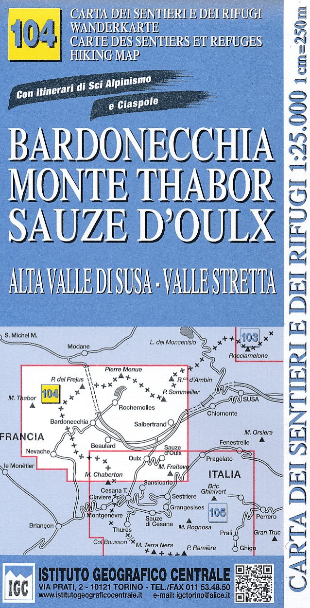
Bardonecchia - Monte Thabor - Sauze d`Oulx area at 1:25,000 in a series of contoured, GPS compatible walking maps from the Turin based Istituto Geografico Centrale, highlighting hiking trails including long-distance routes, ski routes and alpine accommodation. The maps have contours at 25m intervals, enhanced by shading and graphic relief for...Read more
Bardonecchia - Monte Thabor - Sauze d`Oulx area at 1:25,000 in a series of contoured, GPS compatible walking maps from the Turin based Istituto Geografico Centrale, highlighting hiking trails including long-distance routes, ski routes and alpine accommodation. Maps in this series have contours at 25m intervals, enhanced by shading and graphic...Read more
IGC heeft een serie gedetailleerde wandelkaarten voor het Italiaanse gedeelte van de Alpen (Piemonte). Voldoende gedetailleerd voor het volgen van het lokale wandelnetwerk. Voorzien van schaduwreliëf; hoogtelijnen en referentiehoogtes. Onderscheid in soort wandelpad ( bergpad, bergpad met hindernissen,gletsjerovergang). Ook zijn de...Read more
Susa, Chisone and Germanasca Valleys, with coverage including Sestiere, Sauze d`Oulx and Bardonecia, in a series of contoured hiking maps at 1:50,000 with local trails, long-distance footpaths, mountain accommodation, etc. from the Turin based Istituto Geografico Centrale.Maps in this series have contours at 50m intervals, enhanced by shading...Read more
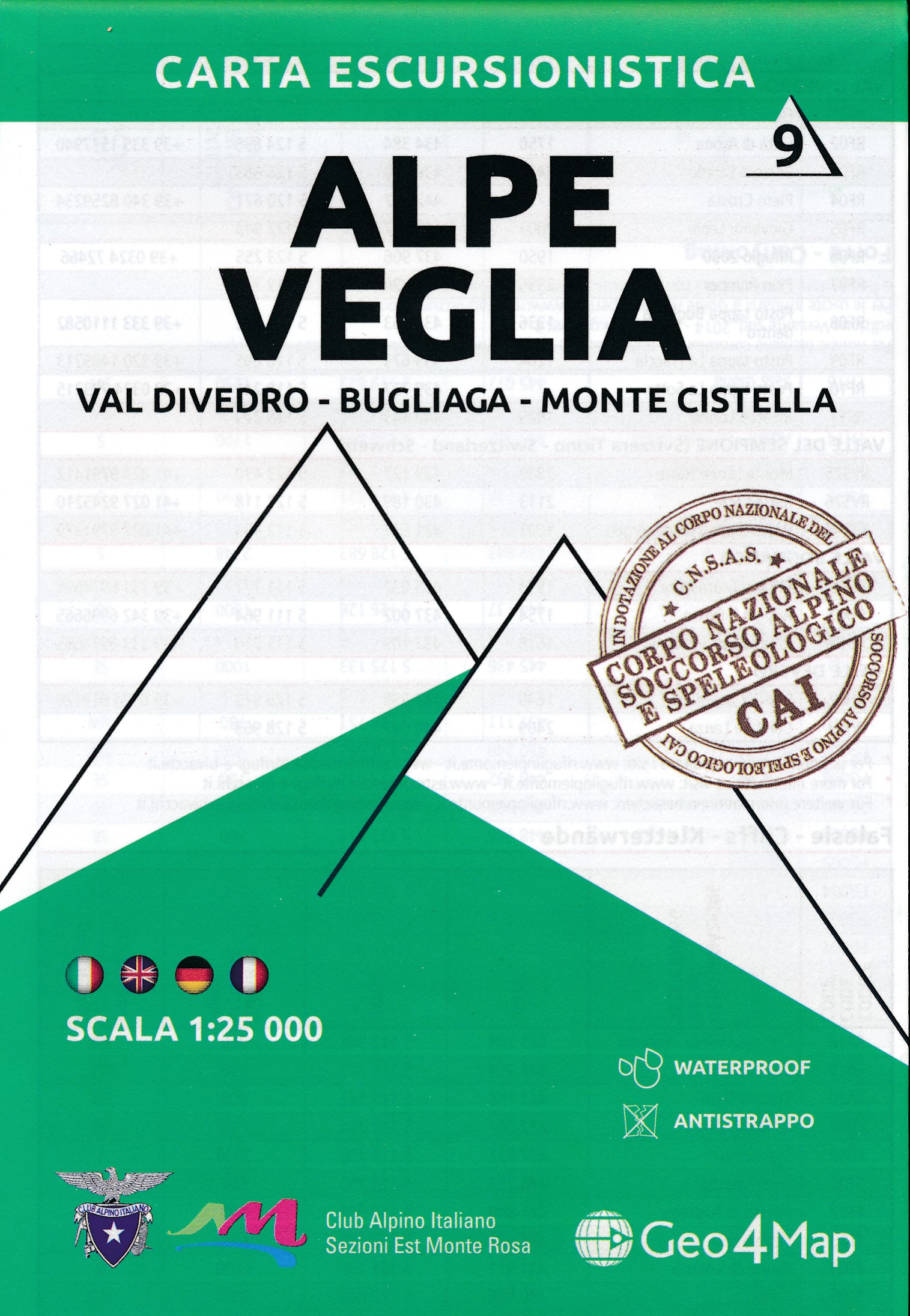
1:25,000 hiking map to Val Divedro, centred on Iselle and including Crodo.Published in association with the CAI, the Italian Alpine Club, who are responsible for the trails. Trails are marked on the map. The key information and more detailed information on the rear of the sheet are in Italian, German and English. Printed on waterproof,...Read more
1:25,000 hiking map to Val Divedro, centred on Iselle and including Crodo.Published in association with the CAI, the Italian Alpine Club, who are responsible for the trails. Trails are marked on the map. The key information and more detailed information on the rear of the sheet are in Italian, German and English. Printed on waterproof,...Read more