
Bregenzerwald
Beschrijving

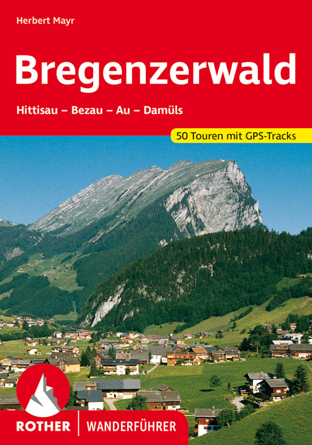
In the extreme northwest of Austria lies the Bregenzerwald. This mountain area is part of the Vorarlberg region. The area borders on Germany, the Allgäuer Alps.
These limestone mountains provide excellent hiking and count some 2000 km well marked trails. The summits rise to 2000 meters. In general it is easy walking, suitable for people who desire a less Alpine experience than climbing in the popular and nearby Rätikon or Silvretta mountains. For this reason the Bregenzerwald is also relatively quiet. For those hikers who like to take it easy, it is pleasant to know that there are many ski lifts in operation during summertime, bringing you halfway the valley and the ridges while humming your favorite melody.
The Nordalpenweg (01) runs right through the Bregenzerwald, and coincides here with the Via Alpina and the European Long Distance Trail E4. The Voralpenweg (04) touches the north side of the Brengenzerwald.
Kaart

Paden in deze regio
Links
Feiten
Verslagen
Gidsen en kaarten
Overnachting
Organisaties
Reisorganisaties
GPS
Anders
Boeken

Netherlands
2018
- Wandelgids Tourist route E4 in Bulgaria | Oilaripi
- Verrassend goede wandelgids van een deel van de E4 in Bulgarije. Goede kaarten, hoogteprofielen, prima beschrijvingen en praktische informatie maken het een volwaardige wandelgids die je in eerste instantie van dit gebied niet zou verwachten. Guidebook along the main ridge of the great alpine route E4 in Bulgaria, also known as �the fiv... Read more


Netherlands
2022

Netherlands
2022
- Wandelgids Maximiliansweg | Rother Bergverlag
- Bayerische Alpen - vom Bodensee zum Königssee. 21 Etappen. Mit GPS-Daten Rother Wanderführer. 1., Auflage. Read more

Netherlands
2021
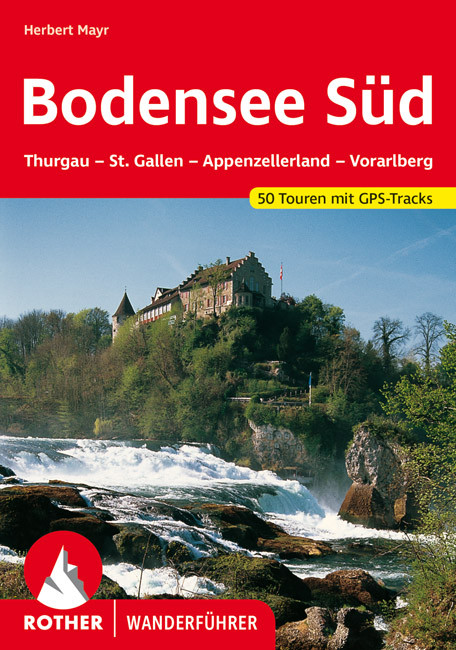
- Wandelgids Bodensee - Süd | Rother Bergverlag
- Goede duitstalige wandelgids. Veel dagtochten, met gradaties en kleuren in zwaarte gerangschikt. Veel praktische informatie. Handzaam formaat. Dem 2007 erschienenen Rother-Wanderführer "Bodensee Nord" stellt Herbert Mayr nun das südliche Pendant zur Seite: Zweifellos zählen das Schweizer und Vorarlberger Bodenseeufer zu den... Read more

Netherlands
2022

Netherlands
2007
- Wandelgids Across the eastern alps: E5 | Cicerone
- From Lake Constance in Germany, this guidebook describes walking the E5 trek that runs 600km through a remarkable kaleidoscope of landscapes and culture in Switzerland, Austria and Italy, to its destination at Verona. It traverses the Allgauer, Lechtaler and Ötztaler Alps. There is a good network of alpine refuges and guesthouses on the route. Read more

Netherlands
2022
- Wandelgids Munchen - Venetie, München - Venedig | Rother Bergverlag
- Beschrijving van een lange afstand pad dwars door de Alpen van Munchen naar Venetie: goede beschrijvingen van de etappes, kaarten redelijk. Die anspruchsvolle Alpenüberquerung von München nach Venedig verläuft auf einer der interessantesten aller möglichen Routen über das höchste Gebirge Europas. Im Herzen Münchens beginnt die Tour am... Read more

Netherlands
2023
Netherlands
2023


Netherlands
2019
- WF5966 Julische Alpen mit Karte Kompass
- De Kompass wandelgids + kaart geeft een overzicht van alle wandelroutes in het gebied met nauwkeurige routeaanwijzingen en hoogteaanduidingen, De extra grote kaart, schaal 1:35 000, is ideaal om van te voren uw route uit te stippelen en om onderweg te gebruiken; naast de bekende bestemmingen, worden ook de minder bekende vermeld; openbaar... Read more
- Also available from:
- Bol.com, Belgium
Belgium
2019
- WF5966 Julische Alpen mit Karte Kompass
- De Kompass wandelgids + kaart geeft een overzicht van alle wandelroutes in het gebied met nauwkeurige routeaanwijzingen en hoogteaanduidingen, De extra grote kaart, schaal 1:35 000, is ideaal om van te voren uw route uit te stippelen en om onderweg te gebruiken; naast de bekende bestemmingen, worden ook de minder bekende vermeld; openbaar... Read more

Netherlands
2019
- Wandelgids Trekking in the Alps | Cicerone
- An inspirational guidebook to 20 classic treks in the Alps. As well as introducing new hiking areas in the Alps, classics such as the Tour of Mont Blanc, and Chamonix to Zermatt are included. Trekking in the Alps is immensely satisfying, and this book celebrates the rich and scenic diversity for which this great mountain range is renowned. Read more
- Also available from:
- Bol.com, Netherlands
- Bol.com, Belgium
- Stanfords, United Kingdom
- The Book Depository, United Kingdom

Netherlands
2011
- Trekking in the Alps
- An inspirational guide to the delights of Alpine multi-day hikes. With 20 hikes described, including classics such as the Tour of Mont Blanc and the Tour of the Vanoise as well as new multi-day routes like the Traverse of the Slovenian Alps, this guide celebrates the rich scenic diversity for which the Alps are renowned.The eight talented... Read more
Belgium
2011
- Trekking in the Alps
- An inspirational guide to the delights of Alpine multi-day hikes. With 20 hikes described, including classics such as the Tour of Mont Blanc and the Tour of the Vanoise as well as new multi-day routes like the Traverse of the Slovenian Alps, this guide celebrates the rich scenic diversity for which the Alps are renowned.The eight talented... Read more

United Kingdom
2011
- Alps Trekking
- An inspirational walking guide to 20 summer treks in the European Alps in Italy, Austria, Switzerland, France and Slovenia, by 8 Alpine trekking experts, including the classics such as the Tour of Mont Blanc and lesser-known routes like the Traverse of the Slovenian Alps. All the rich scenic diversity for which the Alps are renowned is... Read more

United Kingdom
2011
- Trekking in the Alps
- An inspirational guidebook to 20 classic treks in the Alps. As well as introducing new hiking areas in the Alps, classics such as the Tour of Mont Blanc, and Chamonix to Zermatt are included. Trekking in the Alps is immensely satisfying, and this book celebrates the rich and scenic diversity for which this great mountain range is renowned. Read more
Kaarten

Netherlands
2016
- Wandelgids The Cretan Way E4 | Anavasi
- The Cretan Way is a 500km walking route which takes you from east to west across the varied and spectacular landscapes of Crete. It is the ideal way to discover the rural, mountainous and costal regions of this incredible island. This guide is based on a 28-day walk.This guide includes practical information, maps at a scale of 1:25.000 of... Read more
- Also available from:
- Stanfords, United Kingdom

United Kingdom
2016
- The Cretan Way - A 28 Day Walk
- The Cretan Way is a 500km walking route which takes you from east to west across the varied and spectacular landscapes of Crete. It is the ideal way to discover the rural, mountainous and costal regions of this incredible island. This guide is based on a 28-day walk.This guide includes practical information, maps at a scale of 1:25.000 of... Read more

Netherlands
- Wandelkaart 2558 Europäischer Fernwanderweg E5 | Kompass
- Ideal für die Planung und für unterwegs! • Übersichtliche Karten im idealen Maßstab 1:50 000 • Handliches Format 100 x 175 mm • Reiß- und wetterfestes Papier – ideal für jede Witterung • Kompakte Reiseführer-Infos zu den Highlights am Weg und Übernachtungsverzeichnis • Extra Stadtpläne mit Infos zu Apotheken, Geldautomaten, Werkstätten usw. Read more
- Also available from:
- Stanfords, United Kingdom

United Kingdom
- Lake Constance to Verona - E5 European Long-Distance Trail Kompass 2558
- The 601km eastern half of Europe’s E5 long distance footpaths from Lake Constance across the Austrian Alps to Verona on a waterproof and tear-resistant, contoured and GPS compatible concertina map from Kompass presenting the route on 40 panels, each 17.5x20cm. Plus accommodations recommendations and street plans.The route is highlighted on maps... Read more

Netherlands
- Wandelkaart 12 Laghi Maggiore, d'Orta e di Varese | IGC - Istituto Geografico Centrale
- Lake Maggiore - Lake Orta - Lake Varase, map no. 12, in a series contoured hiking maps at 1:50,000 with local trails, long-distance footpaths, mountain accommodation, etc. from the Turin based Istituto Geografico Centrale covering the Italian Alps and Piedmont, the lakes and northern Lombardy, and the Italian Riviera.The maps have contours at... Read more

Netherlands
- Wandelkaart 24 Il Cuneese - Cuneo | IGC - Istituto Geografico Centrale
- Il Cuneese, map no. 24, in a series contoured hiking maps at 1:50,000 with local trails, long-distance footpaths, mountain accommodation, etc. from the Turin based Istituto Geografico Centrale covering the Italian Alps and Piedmont, the lakes and northern Lombardy, and the Italian Riviera.The maps have contours at 50m intervals, enhanced by... Read more
- Also available from:
- Stanfords, United Kingdom

United Kingdom
- Il Cuneese: Cuneo - Saluzzo - Carmagnola 75K IGC Map No. 24
- Il Cuneese area of Piedmont, including Cuneo, Saluzzo and Carmagnola, at 1:75,000 in a series contoured hiking maps with local trails, long-distance footpaths, mountain accommodation, etc. from the Turin based Istituto Geografico Centrale. This title also includes an overprint showing cycle routes.Maps in this series have contours at 50m... Read more

Netherlands
- Wandelkaart 3 Stara Planina gebergte | Domino
- Stara Planina Western: Belogradchik to Berkovita map at 1:50,000 from Bulgarian publishers Domino, contoured and GPS compatible, with hiking trails, accommodation options including a list of local mountain refuges, etc. The map is double-sided and covers the mountains from the peak of Byala Voda near Belogradchik eastwards to just beyond... Read more
- Also available from:
- Stanfords, United Kingdom

United Kingdom
- Stara Planina Western: Belogradchik to Berkovita Domino Map
- Stara Planina Western: Belogradchik to Berkovita map at 1:50,000 from Bulgarian publishers Domino, contoured and GPS compatible, with hiking trails, accommodation options including a list of local mountain refuges, etc. The map is double-sided and covers the mountains from the peak of Byala Voda near Belogradchik eastwards to just beyond... Read more

Netherlands
- Wandelkaart - Fietskaart - Wegenkaart - landkaart 450 Eastern Crete - Kreta Oost | Terrain maps
- Eastern Crete at 1:100,000 on an indexed, GPS compatible road map from Terrain Editions, printed on light, waterproof and tear-resistant plastic paper, with a street plan of central Aghios Nikolaos.This title is part of a series which covers Crete in three sheets. The maps have contours at 100m intervals, enhanced by relief shading with spot... Read more
- Also available from:
- Stanfords, United Kingdom

United Kingdom
- Eastern Crete Terrain Editions 450
- Eastern Crete at 1:100,000 on an indexed, GPS compatible road map from Terrain Editions, printed on light, waterproof and tear-resistant plastic paper, with a street plan of central Aghios Nikolaos.This title is part of a series which covers Crete in three sheets. The maps have contours at 100m intervals, enhanced by relief shading with spot... Read more

Netherlands
- Wandelkaart Sredna Gora - Bulgarije | Domino
- Pirin Mountains at 1:50,000 on a large, double-sided, contoured map with GPS waypoints for shelters and chalets, peaks, etc. and highlighting hiking routes. Topography is shown by contours at 40m intervals with additional relief shading and graphics and colouring for sandstone stacks, single rocks over 5m high, marshlands and different types of... Read more

Netherlands
- Wandelkaart 10 Monte Rosa, Alagna e Macugnaga | IGC - Istituto Geografico Centrale
- Monte Rosa - Alagna - Macugnaga, map no. 10, in a series contoured hiking maps at 1:50,000 with local trails, long-distance footpaths, mountain accommodation, etc. from the Turin based Istituto Geografico Centrale covering the Italian Alps and Piedmont, the lakes and northern Lombardy, and the Italian Riviera.The maps have contours at 50m... Read more
- Also available from:
- Stanfords, United Kingdom

United Kingdom
- Monte Rosa - Alagna - Macugnaga 50K IGC Map No. 10
- Monte Rosa - Alagna - Macugnaga in a series contoured hiking maps at 1:50,000 with local trails, long-distance footpaths, mountain accommodation, etc. from the Turin based Istituto Geografico Centrale.Maps in this series have contours at 50m intervals, enhanced by shading and graphic relief. An overprint highlights local footpaths and... Read more

Netherlands
- Wandelkaart 11 Domodossola e Val Formazza | IGC - Istituto Geografico Centrale
- IGC heeft een serie gedetailleerde wandelkaarten voor het Italiaanse gedeelte van de Alpen (Piemonte). Voldoende gedetailleerd voor het volgen van het lokale wandelnetwerk. Voorzien van schaduwreliëf, hoogtelijnen en referentiehoogtes. Onderscheid in soort wandelpad ( bergpad, bergpad met hindernissen,gletsjerovergang). Ook zijn de... Read more
- Also available from:
- Stanfords, United Kingdom

United Kingdom
- Domodossola - Val Formazza 50K IGC Map No. 11
- Domodossola - Val Formazza area of the Italian Alps in a series contoured hiking maps at 1:50,000 with local trails, long-distance footpaths, mountain accommodation, etc. from the Turin based Istituto Geografico Centrale.Maps in this series have contours at 50m intervals, enhanced by shading and graphic relief. An overprint highlights local... Read more

Netherlands
- Wandelkaart 4 Stara Planina gebergte | Domino
- Stara Planina Western: Berkovita to Zlatitsa map at 1:50,000 from Bulgarian publishers Domino, contoured and GPS compatible, with hiking trails, accommodation options including a list of local mountain refuges, etc. The map is double-sided and covers the mountains from Varshets (directly north of Sofia) to just beyond Etrepole.Maps in the... Read more
- Also available from:
- Stanfords, United Kingdom

United Kingdom
- Stara Planina Western: Berkovita to Zlatitsa Domino Map
- Stara Planina Western: Berkovita to Zlatitsa map at 1:50,000 from Bulgarian publishers Domino, contoured and GPS compatible, with hiking trails, accommodation options including a list of local mountain refuges, etc. The map is double-sided and covers the mountains from Varshets (directly north of Sofia) to just beyond Etrepole.Maps in the... Read more

Netherlands
- Wandelkaart - Fietskaart - Wegenkaart - landkaart 449 Central Crete - Kreta centraal | Terrain maps
- Central Crete at 1:100,000 on an indexed, GPS compatible road map from Terrain Editions, printed on light, waterproof and tear-resistant plastic paper, with street plans of central Heraklion and Rethymno.This title is part of a series which covers Crete in three sheets. The maps have contours at 100m intervals, enhanced by relief shading with... Read more
- Also available from:
- Stanfords, United Kingdom

United Kingdom
- Central Crete Terrain Editions 449
- Central Crete at 1:100,000 on an indexed, GPS compatible road map from Terrain Editions, printed on light, waterproof and tear-resistant plastic paper, with street plans of central Heraklion and Rethymno.This title is part of a series which covers Crete in three sheets. The maps have contours at 100m intervals, enhanced by relief shading with... Read more

Netherlands
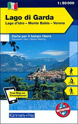
- Wandelkaart - Fietskaart 07 Outdoorkarte IT Gardasee - Gardameer | Kümmerly & Frey
- Lake Garda - Lake d'Idro - Monte Baldo - Verona area at 1:50,000 in a series of waterproof and tear-resistant, GPS compatible and contoured recreational maps from K Read more
- Also available from:
- Stanfords, United Kingdom
United Kingdom
- Lake Garda - Lake Idro - Monte Baldo - Verona K+F Outdoor Map 7
- Lake Garda - Lake d`Idro - Monte Baldo - Verona area at 1:50,000 in a series of waterproof and tear-resistant, GPS compatible and contoured recreational maps from Kümmerly + Frey with both local and long-distance hiking and cycling trails, ski routes, sites for other outdoor pursuits, accommodation, bus stops, etc. An inset provides a small... Read more

Netherlands
- Wandelkaart 2.1 Mt. Parnassos | Anavasi
- Parnassos - Kirfis area in a series of waterproof and tear-resistant hiking maps at scales varying from 1:50,000 to 1:10,000, with a UTM grid for GPS users. Contour interval varies depending on the scale, on most maps it is 20m. Relief shading, spot heights, springs, seasonal streams and, in most titles, landscape/land-use variations, e.g.... Read more

Netherlands
- Wandelkaart 02 Valli di lanzo e Moncenisio | IGC - Istituto Geografico Centrale
- Lanzo and Moncenisio Valleys, map no. 2, in a series contoured hiking maps at 1:50,000 with local trails, long-distance footpaths, mountain accommodation, etc. from the Turin based Istituto Geografico Centrale covering the Italian Alps and Piedmont, the lakes and northern Lombardy, and the Italian Riviera.The maps have contours at 50m... Read more
- Also available from:
- Stanfords, United Kingdom

United Kingdom
- Lanzo and Moncenisio Valleys IGC 2
- Lanzo and Moncenisio Valleys in a series contoured hiking maps at 1:50,000 with local trails, long-distance footpaths, mountain accommodation, etc. from the Turin based Istituto Geografico Centrale. This title also includes an overprint showing cycle routes.Maps in this series have contours at 50m intervals, enhanced by shading and graphic... Read more