Dachstein
Beschrijving

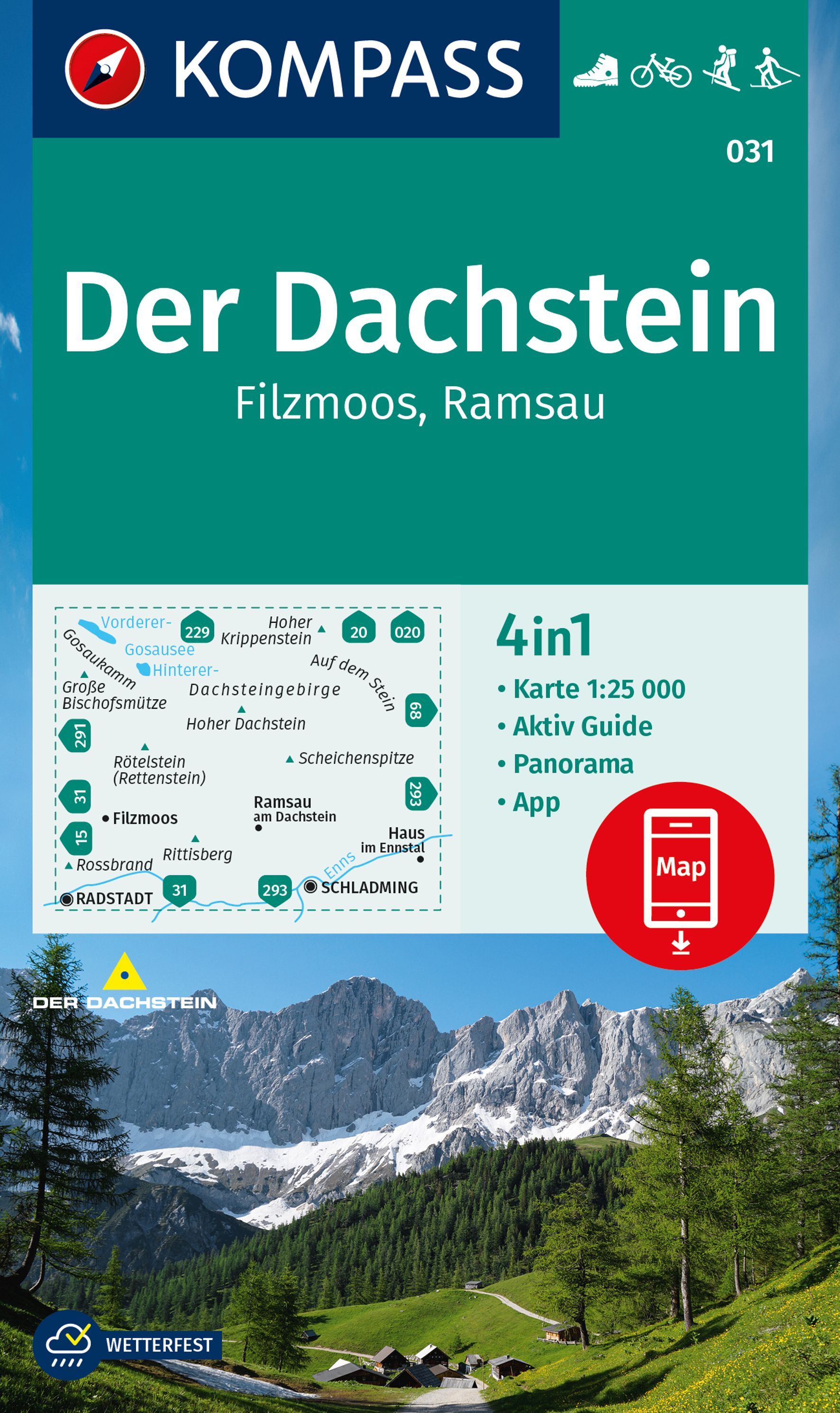
The well-known Dachstein massif is situated southeast of Salzburg. The highest peak in these wild mountains, the Hohe Dachstein, reaches 2995 metres and is the second highest peak in the Northern Limestone Alps. The area counts three glaciers as well. From the many huts you will be able to explore this impressive karst landscape in any direction you want.
The area is popular with walkers and climbers alike. Good options for the experienced hiker are the Gosaukamm ("Salzburg Dolomites") or a multi-day tour from Ramsau through the Dachstein massif proper.
Kaart

Paden in deze regio
Links
Feiten
Verslagen
Gidsen en kaarten
Overnachting
Organisaties
Reisorganisaties
GPS
Anders
Boeken


De Zwerver
Netherlands
2013
Netherlands
2013
- Wandelgids Salzburger Almenweg | Conrad Stein Verlag
- Der Salzburger Almenweg ist 350 Kilometer lang und führt zum Ausgangspunkt zurück. Meist geht es über Pfade, die mit etwas Kondition und Trittsicherheit von jedem bewältigt werden können, Bergerfahrung ist nicht nötig. In diesem Buch wird jede der 31 Etappen detailliert beschrieben, so dass sich die Nutzer nicht verlaufen können. Unterwegs gibt... Read more

De Zwerver
Netherlands
2022
Netherlands
2022
- Wandelgids Dachstein-Tauern Ost | Rother Bergverlag
- Uitstekende wandelgids met een groot aantal dagtochten in dal en hooggebergte. Met praktische informatie en beperkt kaartmateriaal! Wandelingen in verschillende zwaarte weergegeven in rood/blauw/zwart. Dachstein und Tauern Ost– das sind Begriffe, die unter Bergsteigern und Wanderern schon seit jeher Klang und Namen haben. Es sind aber auch... Read more

De Zwerver
Netherlands
2008
Netherlands
2008
- Wandelgids Arnoweg - Der Salzburger Rundwanderweg | Rother Bergverlag
- Dieser gemeinsam mit dem Tourismusverband SalzburgerLand herausgegebene Wanderführer beschreibt detailliert alle Etappen des erst 1999 aus der Taufe gehobenen Arnowegs. Anlaß für die Errichtung dieses Weitwanderwegs war das 1200jährige Jubiläum der Erzdiözese Salzburg, 798 nämlich wurde Bischof Arno zum Erzbischof dieser großen Kirchenprovinz... Read more

De Zwerver
Netherlands
2018
Netherlands
2018
- Wandelgids Tourist route E4 in Bulgaria | Oilaripi
- Verrassend goede wandelgids van een deel van de E4 in Bulgarije. Goede kaarten, hoogteprofielen, prima beschrijvingen en praktische informatie maken het een volwaardige wandelgids die je in eerste instantie van dit gebied niet zou verwachten. Guidebook along the main ridge of the great alpine route E4 in Bulgaria, also known as �the fiv... Read more
De Zwerver
Netherlands
2021
Netherlands
2021
- Wandelgids Dachstein-Tauern West | Rother Bergverlag
- Uitstekende wandelgids met een groot aantal dagtochten in dal en hooggebergte. Met praktische informatie en beperkt kaartmateriaal! Wandelingen in verschillende zwaarte weergegeven in rood/blauw/zwart. Der Rother Wanderführer »Dachstein-Tauern West« ersetzt den bisherigen Wanderführer »Pongau«. Das neue Tourenprogramm wurde mit zusätzlichen... Read more
De Zwerver
Netherlands
2019
Netherlands
2019
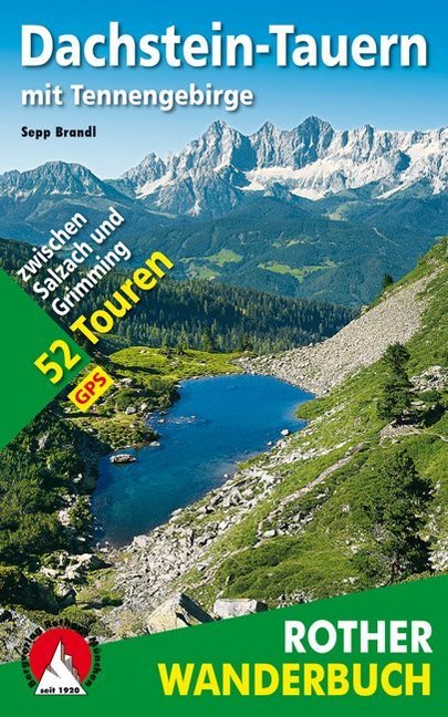
- Wandelgids Dachstein-Tauern mit Tennengebirge | Rother Bergverlag
- De ‘Rother Wanderbücher’ behandelen telkens de 50 mooiste wandelingen, die variëren van eenvoudige kindvriendelijke wandelingen tot routes die aanzienlijk meer ervaring vereisen. Uitvoerige routebeschrijvingen, een aantrekkelijke lay-out met vele kleurenfoto’s, niets aan duidelijkheid te wensen gelaten hoogteprofielen, kaartjes met de... Read more


De Zwerver
Netherlands
2022
Netherlands
2022

De Zwerver
Netherlands
2023
Netherlands
2023
De Zwerver
Netherlands
2022
Netherlands
2022
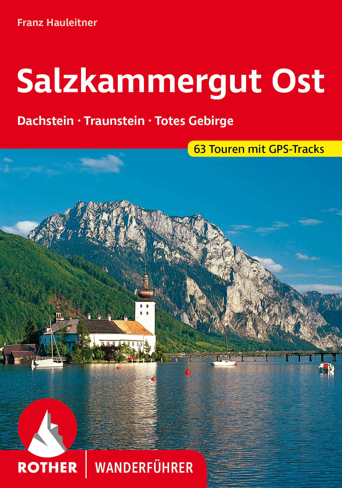
- Wandelgids Salzkammergut Ost | Rother Bergverlag
- Uitstekende wandelgids met een groot aantal dagtochten in dal en hooggebergte. Met praktische informatie en beperkt kaartmateriaal! Wandelingen in verschillende zwaarte weergegeven in rood/blauw/zwart. Das Salzkammergut zählt zu den reizvollsten Urlaubsgebieten Europas. Wo sonst vereinen sich unterschiedliche Landschaftsformen zu einem so... Read more

Bol.com
Netherlands
2019
Netherlands
2019
- WF5966 Julische Alpen mit Karte Kompass
- De Kompass wandelgids + kaart geeft een overzicht van alle wandelroutes in het gebied met nauwkeurige routeaanwijzingen en hoogteaanduidingen, De extra grote kaart, schaal 1:35 000, is ideaal om van te voren uw route uit te stippelen en om onderweg te gebruiken; naast de bekende bestemmingen, worden ook de minder bekende vermeld; openbaar... Read more
- Also available from:
- Bol.com, Belgium
Bol.com
Belgium
2019
Belgium
2019
- WF5966 Julische Alpen mit Karte Kompass
- De Kompass wandelgids + kaart geeft een overzicht van alle wandelroutes in het gebied met nauwkeurige routeaanwijzingen en hoogteaanduidingen, De extra grote kaart, schaal 1:35 000, is ideaal om van te voren uw route uit te stippelen en om onderweg te gebruiken; naast de bekende bestemmingen, worden ook de minder bekende vermeld; openbaar... Read more
Bol.com
Netherlands
Netherlands
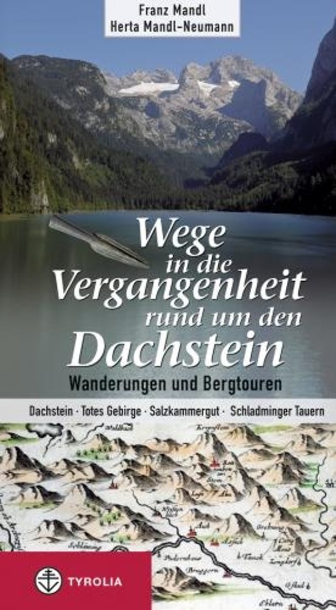
- Wege in die Vergangenheit rund um den Dachstein
- Vor 25 Jahren gelang Franz Mandl ein sensationeller Fund: Er entdeckte die mehr als 4000 Jahre alten bronzezeitlichen Almen Hallstatts auf dem Dachsteingebirge. Weitere hochalpine Projekte mit arch ologischen Untersuchungen folgten, und man darf festhalten, dass es Mandls Initiative zu verdanken ist, wenn sich heute die Geschichte und Kultur... Read more
- Also available from:
- Bol.com, Belgium
Bol.com
Belgium
Belgium
- Wege in die Vergangenheit rund um den Dachstein
- Vor 25 Jahren gelang Franz Mandl ein sensationeller Fund: Er entdeckte die mehr als 4000 Jahre alten bronzezeitlichen Almen Hallstatts auf dem Dachsteingebirge. Weitere hochalpine Projekte mit arch ologischen Untersuchungen folgten, und man darf festhalten, dass es Mandls Initiative zu verdanken ist, wenn sich heute die Geschichte und Kultur... Read more
Kaarten

De Zwerver
Netherlands
2016
Netherlands
2016
- Wandelgids The Cretan Way E4 | Anavasi
- The Cretan Way is a 500km walking route which takes you from east to west across the varied and spectacular landscapes of Crete. It is the ideal way to discover the rural, mountainous and costal regions of this incredible island. This guide is based on a 28-day walk.This guide includes practical information, maps at a scale of 1:25.000 of... Read more
- Also available from:
- Stanfords, United Kingdom

Stanfords
United Kingdom
2016
United Kingdom
2016
- The Cretan Way - A 28 Day Walk
- The Cretan Way is a 500km walking route which takes you from east to west across the varied and spectacular landscapes of Crete. It is the ideal way to discover the rural, mountainous and costal regions of this incredible island. This guide is based on a 28-day walk.This guide includes practical information, maps at a scale of 1:25.000 of... Read more

De Zwerver
Netherlands
Netherlands
- Wandelkaart 19 Asti, Alba, Acqui terme | IGC - Istituto Geografico Centrale
- Asti - Alba - Acqui Terme area in a series contoured hiking maps at 1:50,000 with local trails, long-distance footpaths, mountain accommodation, etc. from the Turin based Istituto Geografico Centrale.Maps in this series have contours at 50m intervals, enhanced by shading and graphic relief. An overprint highlights local footpaths and... Read more
- Also available from:
- Stanfords, United Kingdom

Stanfords
United Kingdom
United Kingdom
- Asti - Alba - Acqui Terme IGC 19
- Asti - Alba - Acqui Terme area in a series contoured hiking maps at 1:50,000 with local trails, long-distance footpaths, mountain accommodation, etc. from the Turin based Istituto Geografico Centrale.Maps in this series have contours at 50m intervals, enhanced by shading and graphic relief. An overprint highlights local footpaths and... Read more

De Zwerver
Netherlands
Netherlands
- Wandelkaart 17 Torino, Pinerolo e Bassa val di Susa | IGC - Istituto Geografico Centrale
- Turin - Pinerolo - Lower Susa Valley, map no. 17, in a series contoured hiking maps at 1:50,000 with local trails, long-distance footpaths, mountain accommodation, etc. from the Turin based Istituto Geografico Centrale covering the Italian Alps and Piedmont, the lakes and northern Lombardy, and the Italian Riviera.The maps have contours at 50m... Read more
- Also available from:
- Stanfords, United Kingdom

Stanfords
United Kingdom
United Kingdom
- Turin - Pinerolo - Lower Susa Valley 50K IGC Map No. 17
- Turin - Pinerolo - Lower Susa Valley area of Piedmont in a series contoured hiking maps at 1:50,000 with local trails, long-distance footpaths, mountain accommodation, etc. from the Turin based Istituto Geografico Centrale.Maps in this series have contours at 50m intervals, enhanced by shading and graphic relief. An overprint highlights local... Read more

De Zwerver
Netherlands
Netherlands
- Wandelkaart 5 Rila gebergte | Domino
- Rila Mountains at 1:50,000 on a large, double-sided, contoured map with GPS waypoints for shelters and chalets, peaks, etc. and highlighting hiking routes. Topography is shown by contours at 50m intervals with additional relief shading and graphics and colouring for scree, single rocks over 5m high, marshlands and pine scrub and forests. An... Read more
- Also available from:
- Stanfords, United Kingdom

Stanfords
United Kingdom
United Kingdom
- Rila Mountains Domino
- Rila Mountains at 1:50,000 on a large, double-sided, contoured map with GPS waypoints for shelters and chalets, peaks, etc. and highlighting hiking routes. Topography is shown by contours at 50m intervals with additional relief shading and graphics and colouring for scree, single rocks over 5m high, marshlands and pine scrub and forests. An... Read more
De Zwerver
Netherlands
Netherlands
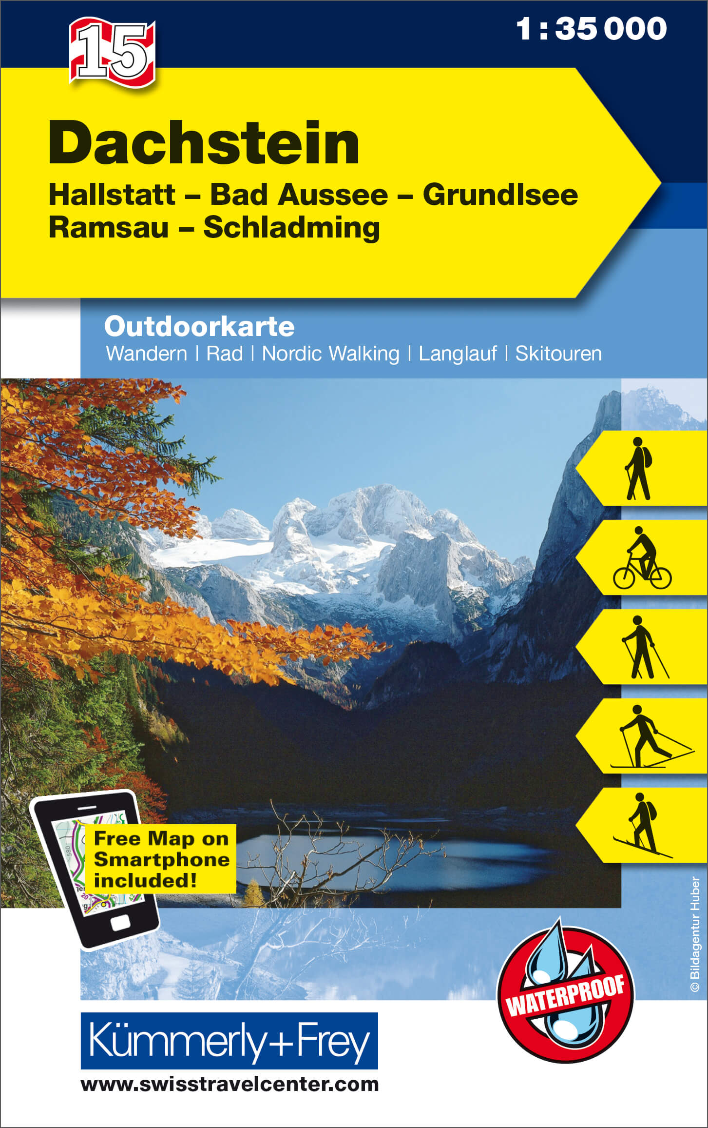
- Wandelkaart 15 Outdoorkarte AT Dachstein | Kümmerly & Frey
- Dachstein - Ausseerlnad - Bad Goisern - Hallstatt area of the Austrian Alps at 1:35,000 on a GPS compatible, double-sided map from Kümmerly+Frey printed on sturdy, waterproof and tear-resistant synthetic paper; contoured, with hiking, cycling and ski routes, accommodation facilities, locations for other recreational activities, etc.Maps in the... Read more
- Also available from:
- Stanfords, United Kingdom

Stanfords
United Kingdom
United Kingdom
- Dachstein - Ausseerlnad - Bad Goisern - Hallstatt K+F Outdoor Map 15
- Dachstein - Ausseerlnad - Bad Goisern - Hallstatt area of the Austrian Alps at 1:35,000 on a GPS compatible, double-sided map from Kümmerly+Frey printed on sturdy, waterproof and tear-resistant synthetic paper; contoured, with hiking, cycling and ski routes, accommodation facilities, locations for other recreational activities, etc.Maps in the... Read more

De Zwerver
Netherlands
Netherlands
- Wandelkaart 15 Finale Ligure Alassio Savona | IGC - Istituto Geografico Centrale
- The coast of the Italian Riviera around Albenga, Alassio and Savona in a series contoured hiking maps at 1:50,000 with local trails, long-distance footpaths, mountain accommodation, etc. from the Turin based Istituto Geografico Centrale.Maps in this series have contours at 50m intervals, enhanced by shading and graphic relief. An overprint... Read more
- Also available from:
- Stanfords, United Kingdom

Stanfords
United Kingdom
United Kingdom
- Finale Ligure - Alassio - Savona IGC 15
- The coast of the Italian Riviera around Albenga, Alassio and Savona in a series contoured hiking maps at 1:50,000 with local trails, long-distance footpaths, mountain accommodation, etc. from the Turin based Istituto Geografico Centrale.Maps in this series have contours at 50m intervals, enhanced by shading and graphic relief. An overprint... Read more

De Zwerver
Netherlands
Netherlands
- Wandelkaart 03 Il parco nazionale del Gran Paradiso | IGC - Istituto Geografico Centrale
- Gran Paradiso National Park in a series contoured hiking maps at 1:50,000 with local trails, long-distance footpaths, mountain accommodation, etc, from the Turin based Istituto Geografico Centrale. This new edition published in late 2013 highlights, among other routes, the GTA (Grande Traversata delle Alpi), Via Alpina and Alta Via 2. Coverage... Read more
- Also available from:
- Stanfords, United Kingdom

Stanfords
United Kingdom
United Kingdom
- Gran Paradiso National Park IGC 3
- Gran Paradiso National Park in a series contoured hiking maps at 1:50,000 with local trails, long-distance footpaths, mountain accommodation, etc, from the Turin based Istituto Geografico Centrale. The map highlights, among other routes, the GTA (Grande Traversata delle Alpi), Via Alpina and Alta Via 2. Coverage extends from Aosta at the top of... Read more

De Zwerver
Netherlands
Netherlands
- Wandelkaart 20 Il Monferrato da Asti a Casale Monferrato | IGC - Istituto Geografico Centrale
- Il Monferrato, map no. 20, in a series contoured hiking maps at 1:50,000 with local trails, long-distance footpaths, mountain accommodation, etc. from the Turin based Istituto Geografico Centrale covering the Italian Alps and Piedmont, the lakes and northern Lombardy, and the Italian Riviera.The maps have contours at 50m intervals, enhanced by... Read more
- Also available from:
- Stanfords, United Kingdom

Stanfords
United Kingdom
United Kingdom
- Il Monferrato: Asti - Casale Monferrato 50K IGC Map No. 20
- The Monferrato region of Piedmont east of Turin, between Asti and Casale Monferrato, in a series contoured hiking maps at 1:50,000 with local trails, long-distance footpaths, mountain accommodation, etc. from the Turin based Istituto Geografico Centrale. This title also shows local cycle routes.Maps in this series have contours at 50m... Read more
De Zwerver
Netherlands
Netherlands
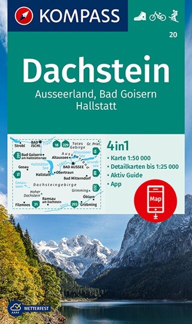
- Wandelkaart 20 Dachstein | Kompass
- Dachstein - Ausseerlnad - Bad Goisern - Hallstatt area of the Austrian Alps on a detailed, GPS compatible map at 1:50,000 from Kompass with local and long-distance footpaths, cycling routes, accommodation, etc, printed on durable, waterproof and tear-resistant synthetic paper. KOMPASS HIKING & RECREATIONAL MAPS: this title is part of an... Read more
- Also available from:
- Stanfords, United Kingdom

Stanfords
United Kingdom
United Kingdom
- Dachstein - Ausseerland - Bad Goisern - Hallstatt Kompass 20
- Dachstein - Ausseerlnad - Bad Goisern - Hallstatt area of the Austrian Alps on a detailed, GPS compatible map at 1:50,000 from Kompass with local and long-distance footpaths, cycling routes, accommodation, etc, printed on durable, waterproof and tear-resistant synthetic paper. KOMPASS HIKING & RECREATIONAL MAPS: this title is part of an... Read more

De Zwerver
Netherlands
Netherlands
- Wandelkaart 6 Pirin gebergte | Domino
- Pirin Mountains at 1:50,000 on a large, double-sided, contoured map with GPS waypoints for shelters and chalets, peaks, etc. and highlighting hiking routes. Topography is shown by contours at 40m intervals with additional relief shading and graphics and colouring for sandstone stacks, single rocks over 5m high, marshlands and different types of... Read more
- Also available from:
- Stanfords, United Kingdom

Stanfords
United Kingdom
United Kingdom
- Pirin Mountains Domino
- Pirin Mountains at 1:50,000 on a large, double-sided, contoured map with GPS waypoints for shelters and chalets, peaks, etc. and highlighting hiking routes. Topography is shown by contours at 40m intervals with additional relief shading and graphics and colouring for sandstone stacks, single rocks over 5m high, marshlands and different types of... Read more
De Zwerver
Netherlands
Netherlands
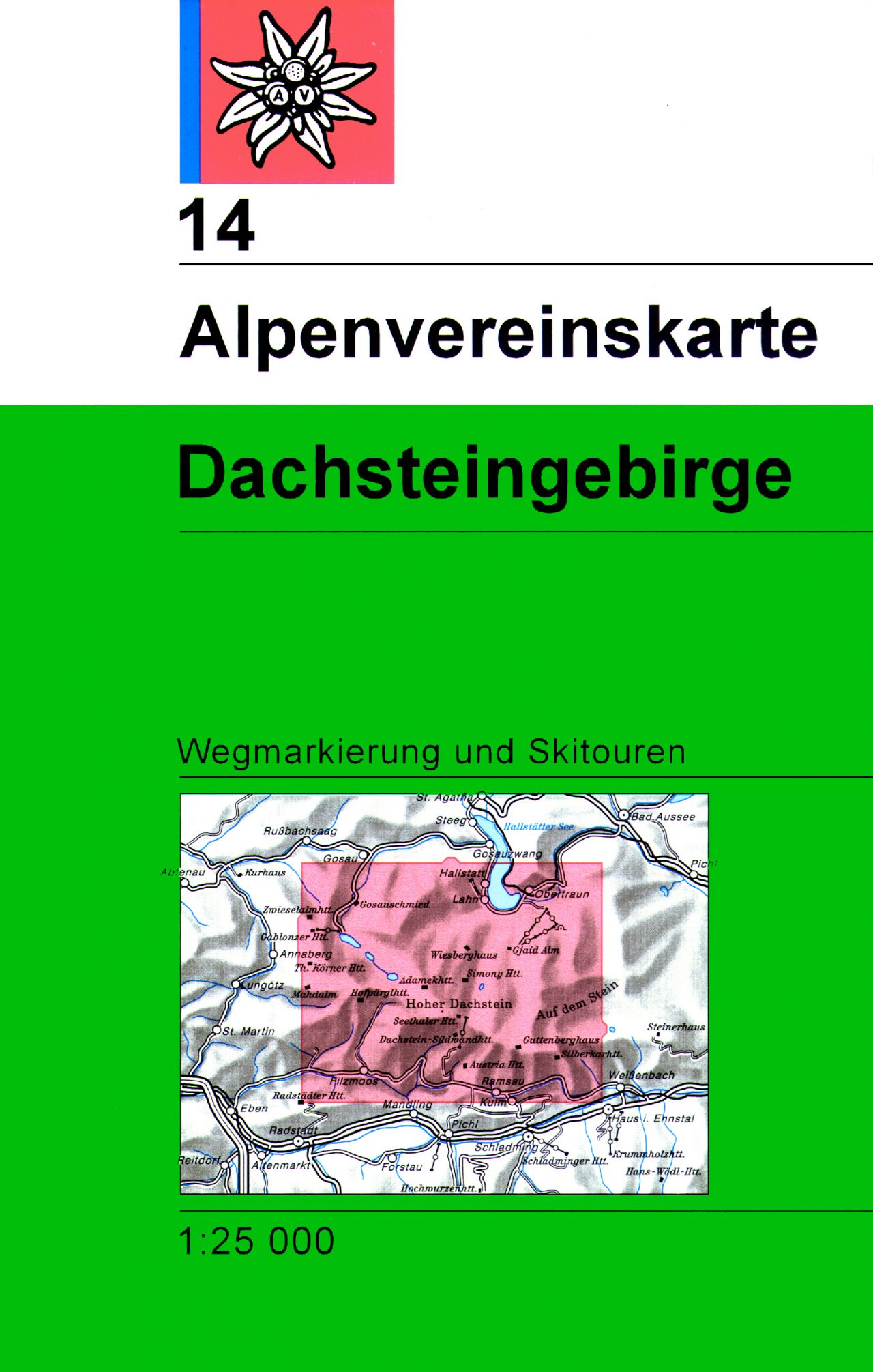
- Wandelkaart 14 Alpenvereinskarte Dachstein | Alpenverein
- Dachsteingruppe area of the Alps in a combined hiking and ski edition at 1:25,000 from a series of detailed, GPS compatible maps published by the DAV - Deutscher Alpenverein and produced by the German and Austrian Alpine Clubs using cartography from their respective survey organizations. Maps in this series have topography vividly presented by... Read more
- Also available from:
- Stanfords, United Kingdom

Stanfords
United Kingdom
United Kingdom
- Dachsteingruppe Alpenverein KOMBI Map 14
- Dachsteingruppe area of the Alps in a combined hiking and ski edition at 1:25,000 from a series of detailed, GPS compatible maps published by the DAV - Deutscher Alpenverein and produced by the German and Austrian Alpine Clubs using cartography from their respective survey organizations. Maps in this series have topography vividly presented by... Read more

De Zwerver
Netherlands
Netherlands
- Wandelkaart 06 Monviso | IGC - Istituto Geografico Centrale
- Monviso / Monte Viso cross-border area with coverage from Châteaux Queyras to Sampeyre and from the Grand Queyron to the Aiguille de Chambeyron in a series contoured hiking maps at 1:50,000 with local trails, long-distance footpaths, mountain accommodation, etc. from the Turin based Istituto Geografico Centrale.Maps in this series have contours... Read more
- Also available from:
- Stanfords, United Kingdom

Stanfords
United Kingdom
United Kingdom
- Monviso IGC 6
- Monviso / Monte Viso cross-border area with coverage from Châteaux Queyras to Sampeyre and from the Grand Queyron to the Aiguille de Chambeyron in a series contoured hiking maps at 1:50,000 with local trails, long-distance footpaths, mountain accommodation, etc. from the Turin based Istituto Geografico Centrale.Maps in this series have contours... Read more

De Zwerver
Netherlands
Netherlands
- Wandelkaart 04 Massiccio del Monte Bianco | IGC - Istituto Geografico Centrale
- The Mont Blanc Massif in a series contoured hiking maps at 1:50,000 with local trails, long-distance footpaths, mountain accommodation, etc, from the Turin based Istituto Geografico Centrale. This new edition published in late 2013 highlights, among other routes, the Alta Via 1 and the northern section of the Alta Via 2, both of which join up... Read more
- Also available from:
- Stanfords, United Kingdom

Stanfords
United Kingdom
United Kingdom
- Mont Blanc Massif IGC 4
- The Mont Blanc Massif in a series contoured hiking maps at 1:50,000 with local trails, long-distance footpaths, mountain accommodation, etc, from the Turin based Istituto Geografico Centrale. The map highlights, among other routes, the Alta Via 1 and the northern section of the Alta Via 2, both of which join up with TMB, as well as the local... Read more

De Zwerver
Netherlands
Netherlands
- Wandelkaart 21 Il Canavese da Ivrea a Chivasso | IGC - Istituto Geografico Centrale
- Il Canavese: Ivrea to Chiavasso, map no. 21, in a series contoured hiking maps at 1:50,000 with local trails, long-distance footpaths, mountain accommodation, etc. from the Turin based Istituto Geografico Centrale covering the Italian Alps and Piedmont, the lakes and northern Lombardy, and the Italian Riviera.The maps have contours at 50m... Read more
- Also available from:
- Stanfords, United Kingdom

Stanfords
United Kingdom
United Kingdom
- Il Canavese: Ivrea to Chiavasso 50K IGC Map No. 21
- Il Canavesea area including Ivrea and Chiavasso in a series contoured hiking maps at 1:50,000 with local trails, long-distance footpaths, mountain accommodation, etc. from the Turin based Istituto Geografico Centrale. This title also shows cycle routes.Maps in this series have contours at 50m intervals, enhanced by shading and graphic relief.... Read more
Meer kaarten…