
Greek Islands
Beschrijving
Links
Feiten
Verslagen
Gidsen en kaarten
Overnachting
Organisaties
Reisorganisaties
GPS
Anders
Boeken

De Zwerver
Netherlands
2021
Netherlands
2021
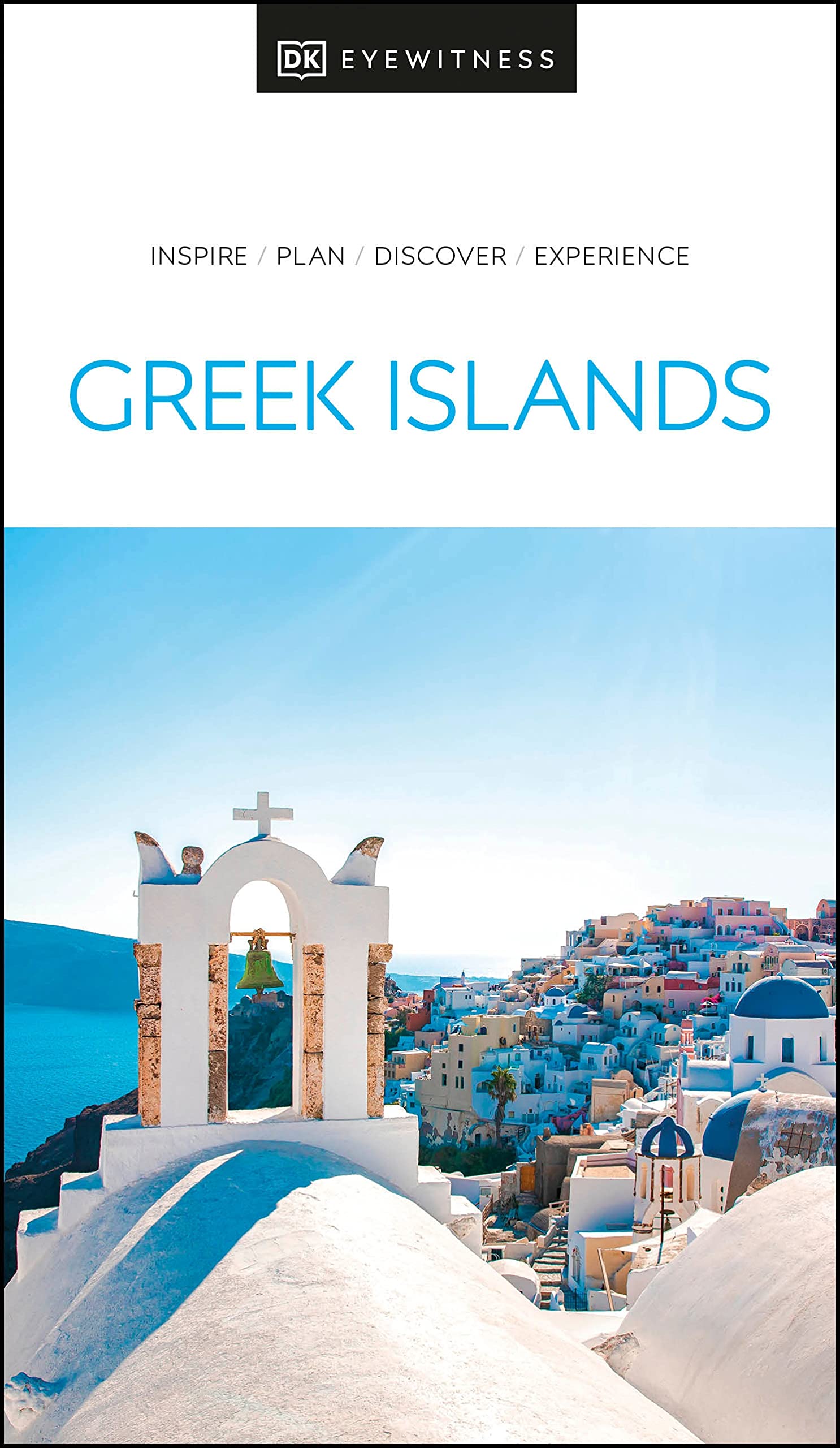
- Reisgids Eyewitness Travel The Greek Islands - Griekse Eilanden | Dorling Kindersley
- Explore hundreds of irresistible islands.Whether you want to follow in the footsteps of legendary heroes at the Minoan palace, swim in the turquoise waters of idyllic Zakynthos bay, or watch the sun set over Corfu from Kaiser`s throne, your DK Eyewitness travel guide makes sure you experience all that the Greek Islands have to offer.The perfect... Read more
- Also available from:
- Stanfords, United Kingdom

Stanfords
United Kingdom
2021
United Kingdom
2021
- DK Eyewitness Greek Islands
- Explore hundreds of irresistible islands.Whether you want to follow in the footsteps of legendary heroes at the Minoan palace, swim in the turquoise waters of idyllic Zakynthos bay, or watch the sun set over Corfu from Kaiser`s throne, your DK Eyewitness travel guide makes sure you experience all that the Greek Islands have to offer.The perfect... Read more

De Zwerver
Netherlands
2018
Netherlands
2018
- Reisgids Greek Islands - Griekse Eilanden | Insight Guides
- Een rijk geillustreerde reisgids met diepgaande teksten: één van de beste reisgidsen die er bestaan. Eerste deel bestaat uit een beschrijving van de unieke aspecten van de regio, daarna een deel echte reisgids en als afsluiting een deel met praktische informatie. De uitstekende informatie wordt vergezeld van prachtige foto's en heldere kaarten.... Read more
De Zwerver
Netherlands
Netherlands
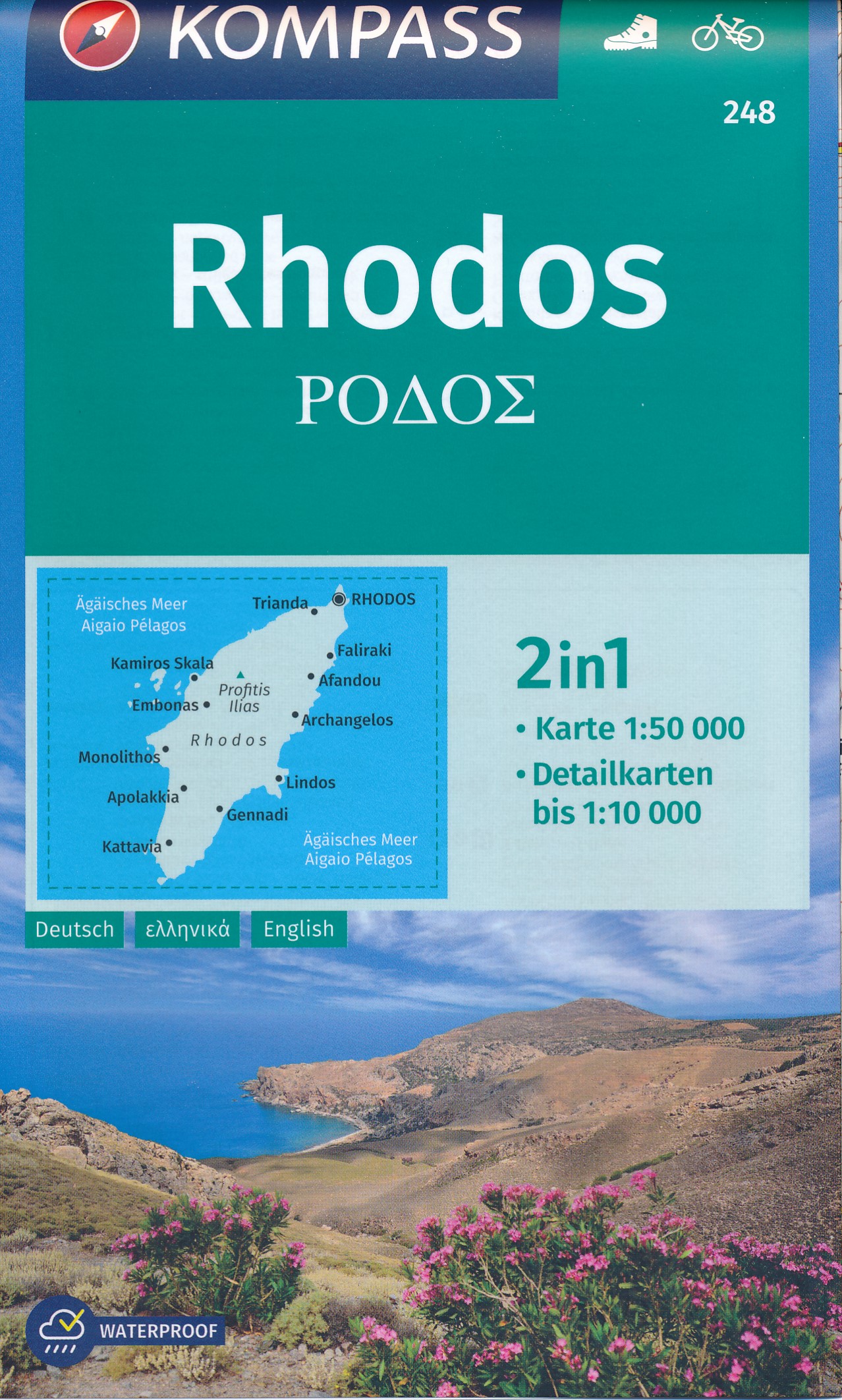
- Wandelkaart 248 Rhodos | Kompass
- Rhodos ist die Hauptinsel des Dodekanes, der „zwölf Inseln´´ in der östlichen Ägäis, 430 km von Athen entfernt und nahe der türkischen Küste. Auf einer Fläche von 1.398 km² leben dort etwa 125.000 Menschen, davon ungefähr die Hälfte in der Stadt Rhodos, dem Hauptort und touristisches Zentrum im Norden des Eilands. Der Begriff „Rhodos´´ wird vom... Read more
- Also available from:
- Stanfords, United Kingdom

Stanfords
United Kingdom
United Kingdom
- Rhodes Kompass 248
- Rhodes at 1:50,000 on a double-sided map from Kompass printed on sturdy waterproof and tear-resistant plastic paper, with street plan of Rhodos Town, an enlargement for its historic centre, a plan of Lindos, etc.The map divides the island north/south with a good overlap between the sides. The islands of Symi, Chalki and Alimia are included as... Read more
De Zwerver
Netherlands
Netherlands
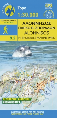
- Wandelkaart 9.2 Alonnisos | Anavasi
- The island of Alonisos on a waterproof and tear-resistant, contoured and GPS compatible map at 1:25,000 from Anavasi highlighting 14 recommended walks. Coverage includes the near-by Peristera, and a separate inset shows 16 archaeological sites across the Northern SporadesLandscape is presented by contours at 10m intervals with hill shading and... Read more
- Also available from:
- Stanfords, United Kingdom

Stanfords
United Kingdom
United Kingdom
- Alonisos - Northern Sporades Marine Park Anavasi 9.2
- The island of Alonnisos on a light, waterproof and tear-resistant, contoured and GPS compatible map at 1:30,000 from Anavasi highlighting 14 recommended walks. On the reverse is a map showing the nearby islands of the Northern Sporades Marine Park highlighting locations of 16 archaeological sites. All place names are in both Greek and Latin... Read more
De Zwerver
Netherlands
Netherlands
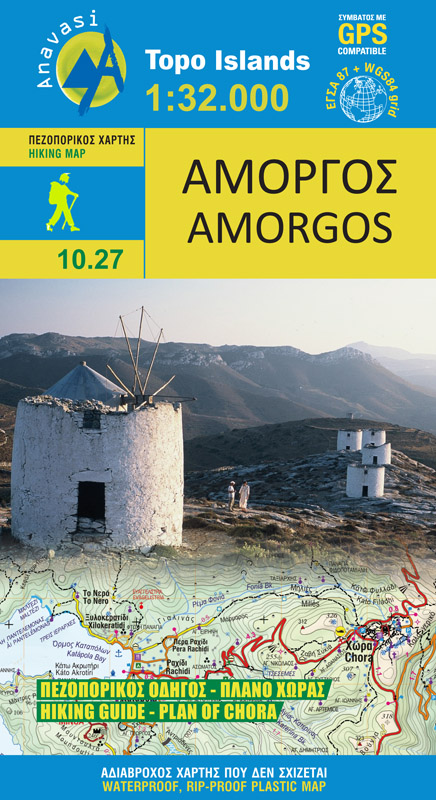
- Wandelkaart 10.27 Amorgos | Anavasi
- The island of Amorgos in the Cyclades on a light, waterproof and tear-resistant, contoured and GPS compatible map at 1:32,000 from Anavasi. 16 recommended walks are accompanied by brief descriptions and the map also includes a street plan of Chora.Landscape is vividly presented by contours at 20m intervals with hill shading and spot heights.... Read more
- Also available from:
- Stanfords, United Kingdom

Stanfords
United Kingdom
United Kingdom
- Amorgos Anavasi 10.27
- The island of Amorgos in the Cyclades on a light, waterproof and tear-resistant, contoured and GPS compatible map at 1:32,000 from Anavasi. 16 recommended walks are accompanied by brief descriptions and the map also includes a street plan of Chora.Landscape is vividly presented by contours at 20m intervals with hill shading and spot heights.... Read more
Bol.com
Netherlands
Netherlands
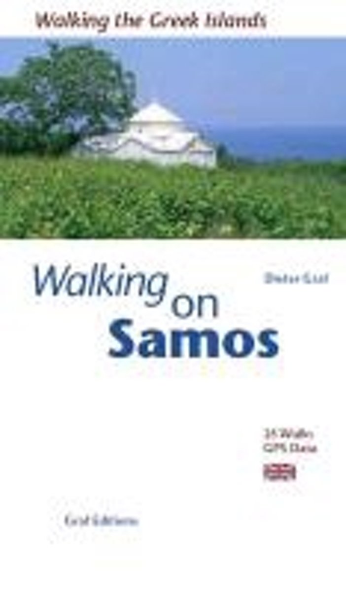
- Walking on Samos
- This is the first edition of the Walking on Samos guidebook, describing 25 walks on the Greek island of Samos, a paradise for walkers. The northern coast with its wooded slopes and vineyards is interlaced with old mule tracks and, together with the old monasteries and the archaeological sites around Pythagorio, these are strong features of the... Read more
- Also available from:
- Bol.com, Belgium
- Stanfords, United Kingdom
- The Book Depository, United Kingdom
Bol.com
Belgium
Belgium
- Walking on Samos
- This is the first edition of the Walking on Samos guidebook, describing 25 walks on the Greek island of Samos, a paradise for walkers. The northern coast with its wooded slopes and vineyards is interlaced with old mule tracks and, together with the old monasteries and the archaeological sites around Pythagorio, these are strong features of the... Read more

Stanfords
United Kingdom
United Kingdom
- Walking on Samos
- ”Walking on Samos” the Walking the Greek Islands series from Dieter Graf, describing 25 walks. The northern coast with its wooded slopes and vineyards is interlaced with old mule tracks and, together with the old monasteries and the archaeological sites around Pythagorio, these are strong features of the book. And in the south-west you can... Read more

Bol.com
Netherlands
2015
Netherlands
2015
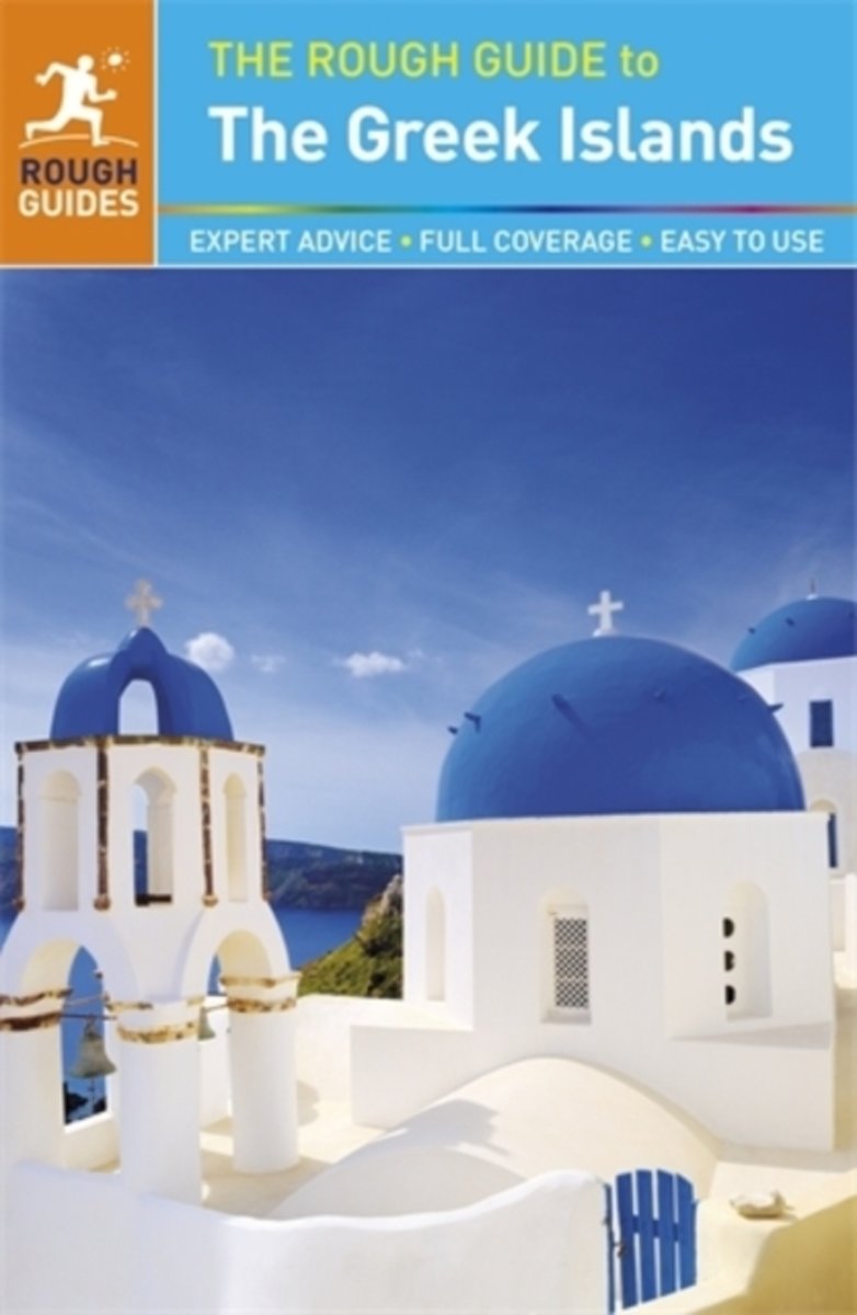
- Rough Guide - the Greek islands
- The Rough Guide to the Greek Islands is the definitive guidebook to this fantastic region. This full-color new edition has detailed coverage of all the best attractions these beautiful islands have to offer. With user-friendly accommodation and eating reviews, crystal-clear maps, detailed background and a journalistic eye for detail, this is... Read more
- Also available from:
- Bol.com, Belgium
Bol.com
Belgium
2015
Belgium
2015
- Rough Guide - the Greek islands
- The Rough Guide to the Greek Islands is the definitive guidebook to this fantastic region. This full-color new edition has detailed coverage of all the best attractions these beautiful islands have to offer. With user-friendly accommodation and eating reviews, crystal-clear maps, detailed background and a journalistic eye for detail, this is... Read more
Bol.com
Netherlands
Netherlands
- The Rough Guide To The Greek Islands
- The Rough Guide to the Greek Islands is an essential guide to the varied and beautiful archipelagos of the Aegean and Ionian seas. The guide includes a 24-page ''Things not to Miss'' section - a full-colour introduction to the islands'' highlights. There is in-depth coverage of all the islands, from hedonistic Ios in the Cyclades to tranquil... Read more
- Also available from:
- Bol.com, Belgium
Bol.com
Belgium
Belgium
- The Rough Guide To The Greek Islands
- The Rough Guide to the Greek Islands is an essential guide to the varied and beautiful archipelagos of the Aegean and Ionian seas. The guide includes a 24-page ''Things not to Miss'' section - a full-colour introduction to the islands'' highlights. There is in-depth coverage of all the islands, from hedonistic Ios in the Cyclades to tranquil... Read more
Bol.com
Netherlands
2007
Netherlands
2007
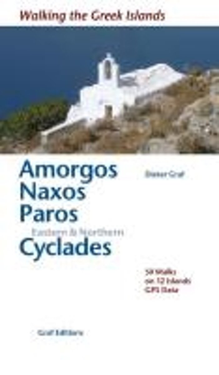
- Walking the Greek Islands
- Describes the best and oldest walking trails. It includes detailed maps, exact times, GPS points and colour photographs of outstanding places - and lots of information about the islands of light . Olive groves, forsaken monasteries, the scent of thyme, sleepy villages, Byzantine chapels, secluded coves, there is much to be discovered on the... Read more
- Also available from:
- Bol.com, Belgium
Bol.com
Belgium
2007
Belgium
2007
- Walking the Greek Islands
- Describes the best and oldest walking trails. It includes detailed maps, exact times, GPS points and colour photographs of outstanding places - and lots of information about the islands of light . Olive groves, forsaken monasteries, the scent of thyme, sleepy villages, Byzantine chapels, secluded coves, there is much to be discovered on the... Read more

Bol.com
Netherlands
Netherlands
- Lonely Planet Greek Islands
- Whether you want to wander through the medieval villages of southern Chios, escape to a secluded beach, or mix it with the jet set on Mykonos, this new guide has everything you need to know for your island holiday. Read more
- Also available from:
- Bol.com, Belgium
Bol.com
Belgium
Belgium
- Lonely Planet Greek Islands
- Whether you want to wander through the medieval villages of southern Chios, escape to a secluded beach, or mix it with the jet set on Mykonos, this new guide has everything you need to know for your island holiday. Read more
Bol.com
Netherlands
Netherlands
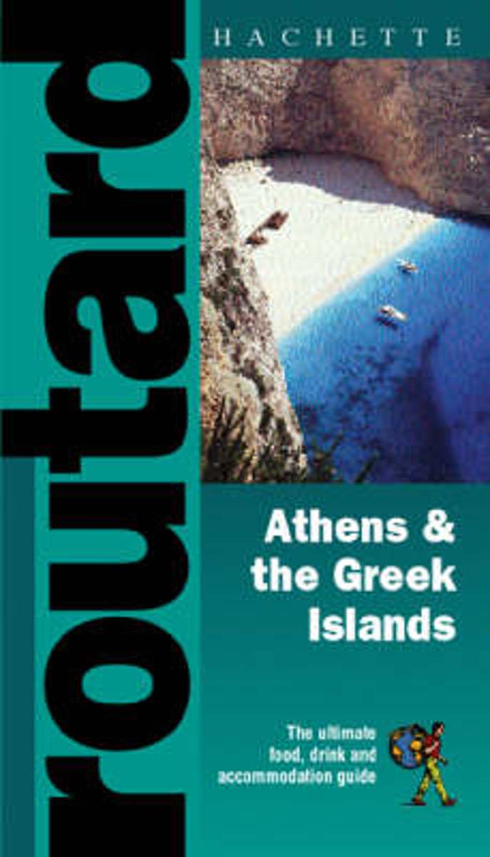
- Athens and the Greek Islands
- From the source of Belgian brew to the redwood forest of California, from a castle in Brittany to Pad Thai in the heart of Asia...When you're young and on the go, here's the information you need to know! Is off-the-beaten-path your ultimate destination? Before you sling that backpack over your shoulder and head on your merry way, better find... Read more
- Also available from:
- Bol.com, Belgium
Bol.com
Belgium
Belgium
- Athens and the Greek Islands
- From the source of Belgian brew to the redwood forest of California, from a castle in Brittany to Pad Thai in the heart of Asia...When you're young and on the go, here's the information you need to know! Is off-the-beaten-path your ultimate destination? Before you sling that backpack over your shoulder and head on your merry way, better find... Read more
Bol.com
Netherlands
Netherlands
- Explore Secret Greece
- Secrets of Greece Did you know that the only desert in Europe is located in Greece? Did you know that Greece has an exotic beach full of palm trees, or that one of the most important Neolithic Age settlements in Europe is located in northern Greece? Perhaps you would like to know which uninhabited islands are best for exploring, or where to... Read more
- Also available from:
- Bol.com, Belgium
Bol.com
Belgium
Belgium
- Explore Secret Greece
- Secrets of Greece Did you know that the only desert in Europe is located in Greece? Did you know that Greece has an exotic beach full of palm trees, or that one of the most important Neolithic Age settlements in Europe is located in northern Greece? Perhaps you would like to know which uninhabited islands are best for exploring, or where to... Read more
De Zwerver
Netherlands
2015
Netherlands
2015
- Wandelgids Korfoe - The Corfu Trail and 20 Day-Walks | Cicerone
- Guidebook to 22 day walks on the Greek island of Corfu and the Corfu Trail, a 150km route described in 10 stages. The day walks are spread across the whole island and visit olive groves, coastal paths, sandy beaches, lush green hillsides and picturesque villages. The Corfu Trail runs the length of the island from Kavos north to Agios Spyridonas. Read more
- Also available from:
- Bol.com, Netherlands
- Bol.com, Belgium
- Stanfords, United Kingdom
- The Book Depository, United Kingdom
Bol.com
Netherlands
2015
Netherlands
2015
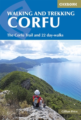
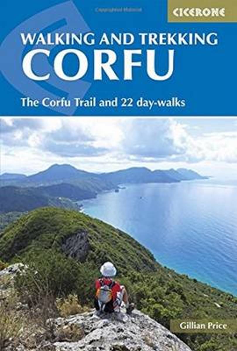
- Walking and trekking on Corfu
- Guidebook to 22 day walks on the Greek island of Corfu and the Corfu Trail, a 150km route described in 10 stages. The day walks are spread across the whole island and visit olive groves, coastal paths, sandy beaches, lush green hillsides and picturesque villages. The Corfu Trail runs the length of the island from Kavos north to Agios Spyridonas. Read more
Bol.com
Belgium
2015
Belgium
2015
- Walking and trekking on Corfu
- Guidebook to 22 day walks on the Greek island of Corfu and the Corfu Trail, a 150km route described in 10 stages. The day walks are spread across the whole island and visit olive groves, coastal paths, sandy beaches, lush green hillsides and picturesque villages. The Corfu Trail runs the length of the island from Kavos north to Agios Spyridonas. Read more

Stanfords
United Kingdom
2015
United Kingdom
2015
- Walking and Trekking on Corfu: The Corfu Trail and 22 Outstanding Day-Walks
- This guidebook to the Greek island of Corfu presents a selection of 22 superb day walks along with the 150km Corfu Trail. The day walks range from 3.5 to 18km in length and begin from a number of popular holiday destinations across the island, including Corfu Town, Kalami, Paleokastritsa, Agios Georgios north and south, Liapades and Benitses.... Read more

The Book Depository
United Kingdom
2015
United Kingdom
2015
- Walking and Trekking on Corfu
- The Corfu Trail and 22 day-walks Read more
Kaarten
De Zwerver
Netherlands
Netherlands
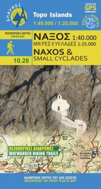
- Wandelkaart - Wegenkaart - landkaart 10.28 Naxos | Anavasi
- Naxos on light, a waterproof and tear-resistant, contoured and GPS compatible map at 1:40,000 from Anavasi, highlighting 10 recommended hiking trails, plus on the reverse coverage of six smaller nearby islands in the Cyclades: Donoussa, Irakleia, Schoinousa / Schinousa, Upper and Lower Koufonisi, plus Keros.On one side is the map of Naxos.... Read more
- Also available from:
- Stanfords, United Kingdom

Stanfords
United Kingdom
United Kingdom
- Naxos & Small Cyclades Anavasi 10.28
- Naxos on light, a waterproof and tear-resistant, contoured and GPS compatible map at 1:40,000 from Anavasi, highlighting 10 recommended hiking trails, plus on the reverse coverage of six smaller nearby islands in the Cyclades: Donoussa, Irakleia, Schoinousa / Schinousa, Upper and Lower Koufonisi, plus Keros.On one side is the map of Naxos.... Read more
De Zwerver
Netherlands
Netherlands
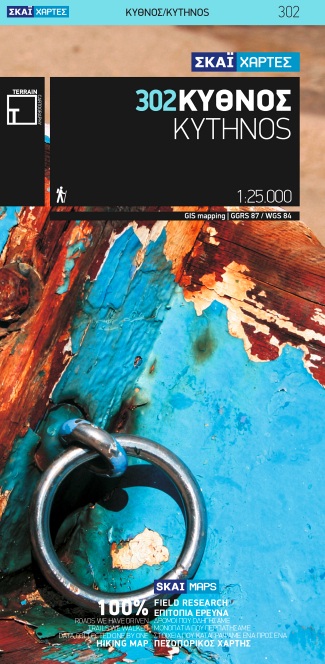
- Wandelkaart 302 Kythnos | Terrain maps
- Kythnos at 1:25,000 on a contoured, GPS compatible hiking map published by Terrain Cartography group together with Skai Maps, and printed on light, waterproof and tear-resistant Polyart plastic paper, with extensive tourist information.Topography is very well presented by contours, enhanced by spot heights, subtle relief shading and additional... Read more
- Also available from:
- Stanfords, United Kingdom

Stanfords
United Kingdom
United Kingdom
- Kythnos Terrain Editions 302
- Greek island of Kythnos on a light, waterproof and tear-resistant, contoured and GPS compatible map at 1:25,000 from Terrain Editions, with astreet plan of the Hora of Kythnos at 1:2,500, plus descriptions of 13 specially selected hiking trails. All place names are shown in both Greek and Latin alphabet. Map legend and all the text include... Read more
De Zwerver
Netherlands
2010
Netherlands
2010
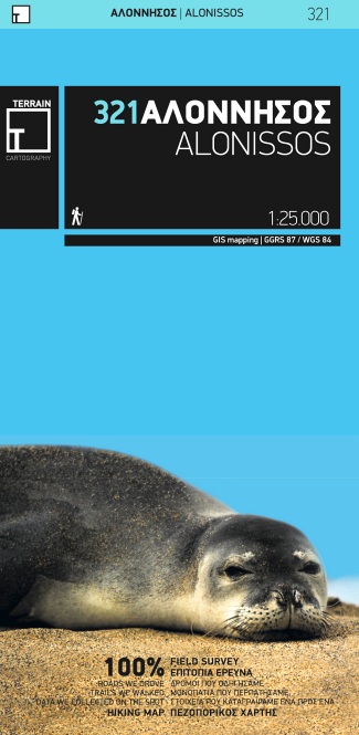
- Wandelkaart 321 Alonissos | Terrain maps
- Aloniossos at 1:25,000 on a contoured, GPS compatible hiking map published by Terrain Cartography group and printed on light, waterproof and tear-resistant Polyart plastic paper, with extensive tourist information.Topography is very well presented by contours, enhanced by spot heights, subtle relief shading and additional altitude colouring.... Read more
- Also available from:
- Stanfords, United Kingdom

Stanfords
United Kingdom
2010
United Kingdom
2010
- Alonissos Terrain Editions 321
- Alonissos on a light, waterproof and tear-resistant, contoured and GPS compatible map at 1:25,000 from Terrain Editions with extensive tourist information. Coverage includes the nearby islands of Peristera (Ksero), Lechousa, Mikro and Meghalo Adhelphi, with Kyra Panaghia shown as an inset. On the reverse is a street plan of Patitiri at 1:5,500,... Read more
De Zwerver
Netherlands
2010
Netherlands
2010
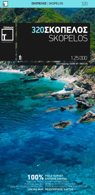
- Wandelkaart 320 Skopelos | Terrain maps
- Gedetailleerde wegenkaart en wandelkaart met alle kleine wegen, wandelpaden, hoogtelijnen en toeristische informatie aangegeven. Alle tekst is tweetalig in Engels en Grieks en de waterproof kaart is geschikt voor gebruik met GPS. De uitgever: THIS IS THE BEST MAP OF SKOPELOS, BECAUSE: • It is the only GIS map of Skopelos made with data... Read more
- Also available from:
- Stanfords, United Kingdom

Stanfords
United Kingdom
2010
United Kingdom
2010
- Skopelos Terrain Editions 320
- Skopelos at 1:25,000 on a contoured, GPS compatible map published by Terrain Editions, printed on light, waterproof and tear-resistant synthetic paper. Beaches indicate their surface and facilities. All place names are shown in both Greek and Latin alphabet. On the reverse are brief descriptions of seven hiking trails, plus general information... Read more
De Zwerver
Netherlands
Netherlands
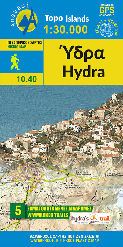
- Wandelkaart 10.40 Hydra | Anavasi
- Greek island of Hydra at 1:25,000 on a waterproof and tear-resistant, contoured and GPS compatible map from Anavasi, showing hiking trails annotated with useful tips.On one side is a map of Hydra with contours at 20m intervals and hill shading to show the topography. The map indicates dirt roads in poor condition and distinguishes between cart... Read more
- Also available from:
- Stanfords, United Kingdom

Stanfords
United Kingdom
United Kingdom
- Hydra Anavasi 10.40
- Greek island of Hydra at 1:25,000 on a waterproof and tear-resistant, contoured and GPS compatible map from Anavasi, showing hiking trails annotated with useful tips.On one side is a map of Hydra with contours at 20m intervals and hill shading to show the topography. The map indicates dirt roads in poor condition and distinguishes between cart... Read more
De Zwerver
Netherlands
Netherlands
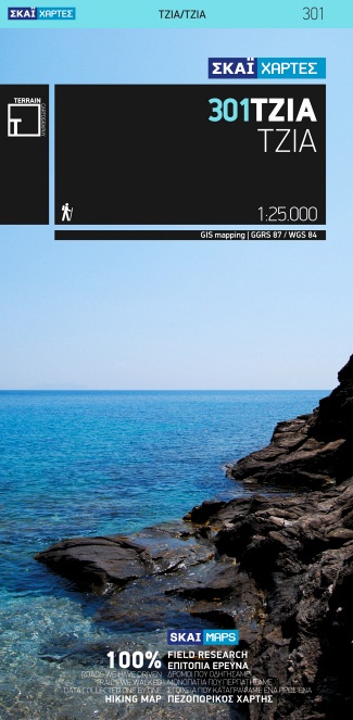
- Wandelkaart 301 Tzia ( Kea ) | Terrain maps
- Kea (Tzia) at 1:25,000 on a contoured, GPS compatible hiking map published by Terrain Cartography group together with Skai Maps, and printed on light, waterproof and tear-resistant Polyart plastic paper, with extensive tourist information.Topography is very well presented by contours, enhanced by spot heights, subtle relief shading and... Read more
- Also available from:
- Stanfords, United Kingdom

Stanfords
United Kingdom
United Kingdom
- Kea / Tzia Terrain Editions 301
- Greek island of Kea (Tzia) on a light, waterproof and tear-resistant, contoured and GPS compatible map at 1:25,000 from Terrain Editions. The reverse side includes descriptions of ten specially selected hiking trails. All place names are shown in both Greek and Latin alphabet. Map legend and all the text include English.Maps of the Greek... Read more
De Zwerver
Netherlands
Netherlands
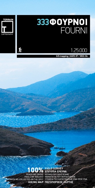
- Wandelkaart 333 Fourni | Terrain maps
- Fourni at 1:25,000 on a contoured, GPS compatible hiking map published by Terrain Cartography group and printed on light, waterproof and tear-resistant Polyart plastic paper, with extensive tourist information.Topography is very well presented by contours, enhanced by spot heights, subtle relief shading and additional altitude colouring.... Read more
- Also available from:
- Stanfords, United Kingdom

Stanfords
United Kingdom
United Kingdom
- Fourni Terrain Editions 333
- Greek island of Fourni on a light, waterproof and tear-resistant, contoured and GPS compatible map at 1:25,000 from Terrain Editions. Coverage includes the nearby islands of Aghios Minas, Thymena, and several small islands off the southern coast of Fourni. On the reverse is general information about the island. All place names are shown in both... Read more
De Zwerver
Netherlands
Netherlands
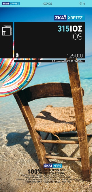
- Wandelkaart 315 Ios | Terrain maps
- Ios at 1:25,000 on a contoured, GPS compatible hiking map published by Terrain Cartography group together with Skai Maps, and printed on light, waterproof and tear-resistant Polyart plastic paper, with extensive tourist information.Topography is very well presented by contours, enhanced by spot heights, subtle relief shading and additional... Read more
- Also available from:
- Stanfords, United Kingdom

Stanfords
United Kingdom
United Kingdom
- Ios Terrain Editions 315
- Greek island of Ios on a light, waterproof and tear-resistant, contoured and GPS compatible map at 1:25,000 from Terrain Editions, with on the reverse descriptions of seven selected hiking trails. All place names are shown in both Greek and Latin alphabet. Map legend and all the text include English.Maps of the Greek islands from Terrain... Read more
De Zwerver
Netherlands
Netherlands
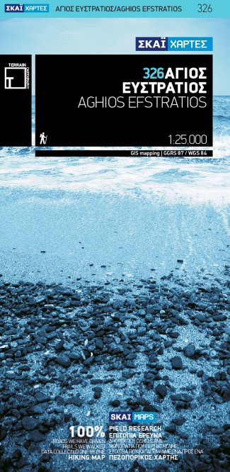
- Wandelkaart 326 Aghios Efstratios | Terrain maps
- Aghios Efstratios at 1:20,000 on a contoured, GPS compatible hiking map published by Terrain Cartography group together with Skai Maps, and printed on light, waterproof and tear-resistant Polyart plastic paper, with extensive tourist information.Topography is very well presented by contours, enhanced by spot heights, subtle relief shading and... Read more
- Also available from:
- Stanfords, United Kingdom

Stanfords
United Kingdom
United Kingdom
- Aghios Efstratios Terrain Editions 326
- Aghios Efstratios island in the northern Aegean Sea on a light, waterproof and tear-resistant, contoured and GPS compatible map at 1:20,000 from Terrain Editions with extensive tourist information. All place names are shown in both Greek and Latin alphabet. Map legend and all the text include English.Maps of the Greek islands from Terrain... Read more
De Zwerver
Netherlands
Netherlands
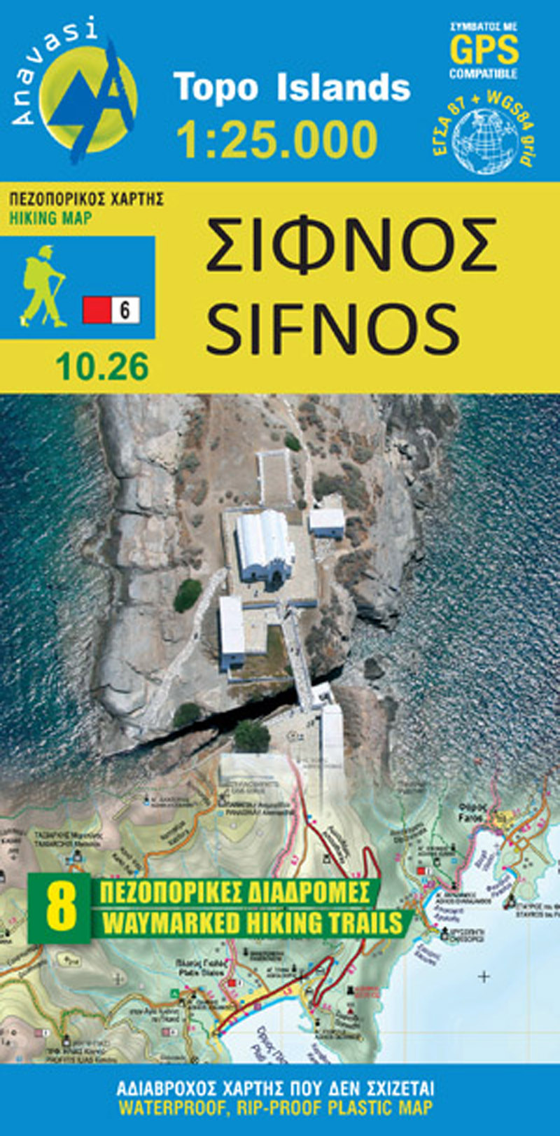
- Wandelkaart 10.26 Sifnos | Anavasi
- Sifnos in the Cyclades on light, a waterproof and tear-resistant, contoured and GPS compatible map at 1:25,000 from Anavasi for exploring the island on foot or by car, highlighting eight recommended hiking trails, plus descriptions of 11 most interesting locations on Sifnos.Landscape is vividly shown by contours at 20m with altitude colouring,... Read more
- Also available from:
- Stanfords, United Kingdom

Stanfords
United Kingdom
United Kingdom
- Sifnos Anavasi 10.26
- Sifnos in the Cyclades on light, a waterproof and tear-resistant, contoured and GPS compatible map at 1:25,000 from Anavasi for exploring the island on foot or by car, highlighting eight recommended hiking trails, plus descriptions of 11 most interesting locations on Sifnos.Landscape is vividly shown by contours at 20m with altitude colouring,... Read more
De Zwerver
Netherlands
Netherlands
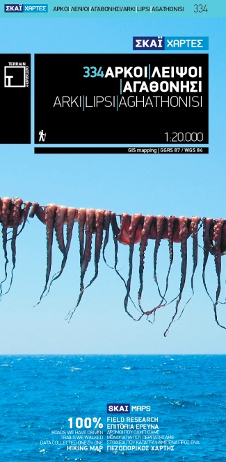
- Wandelkaart 334 Arki - Lipsi - Aghathonisi | Terrain maps
- Arki (Arkoi), Lipsi and Aghathonisi at 1:20,000 on a contoured, GPS compatible hiking map published by Terrain Cartography group together with Skai Maps, and printed on light, waterproof and tear-resistant Polyart plastic paper, with extensive tourist information.Topography is very well presented by contours, enhanced by spot heights, subtle... Read more
- Also available from:
- Stanfords, United Kingdom

Stanfords
United Kingdom
United Kingdom
- Arki - Lipsi - Aghathonisi Terrain Editions 334
- Greek islands of Arki (Arkoi), Lipsi and Aghathonisi on a light, waterproof and tear-resistant, contoured and GPS compatible map at 1:20,000 from Terrain Editions. On the reverse are notes about the three islands, illustrated with colour photos. All place names are shown in both Greek and Latin alphabet. Map legend and all the text include... Read more
De Zwerver
Netherlands
Netherlands
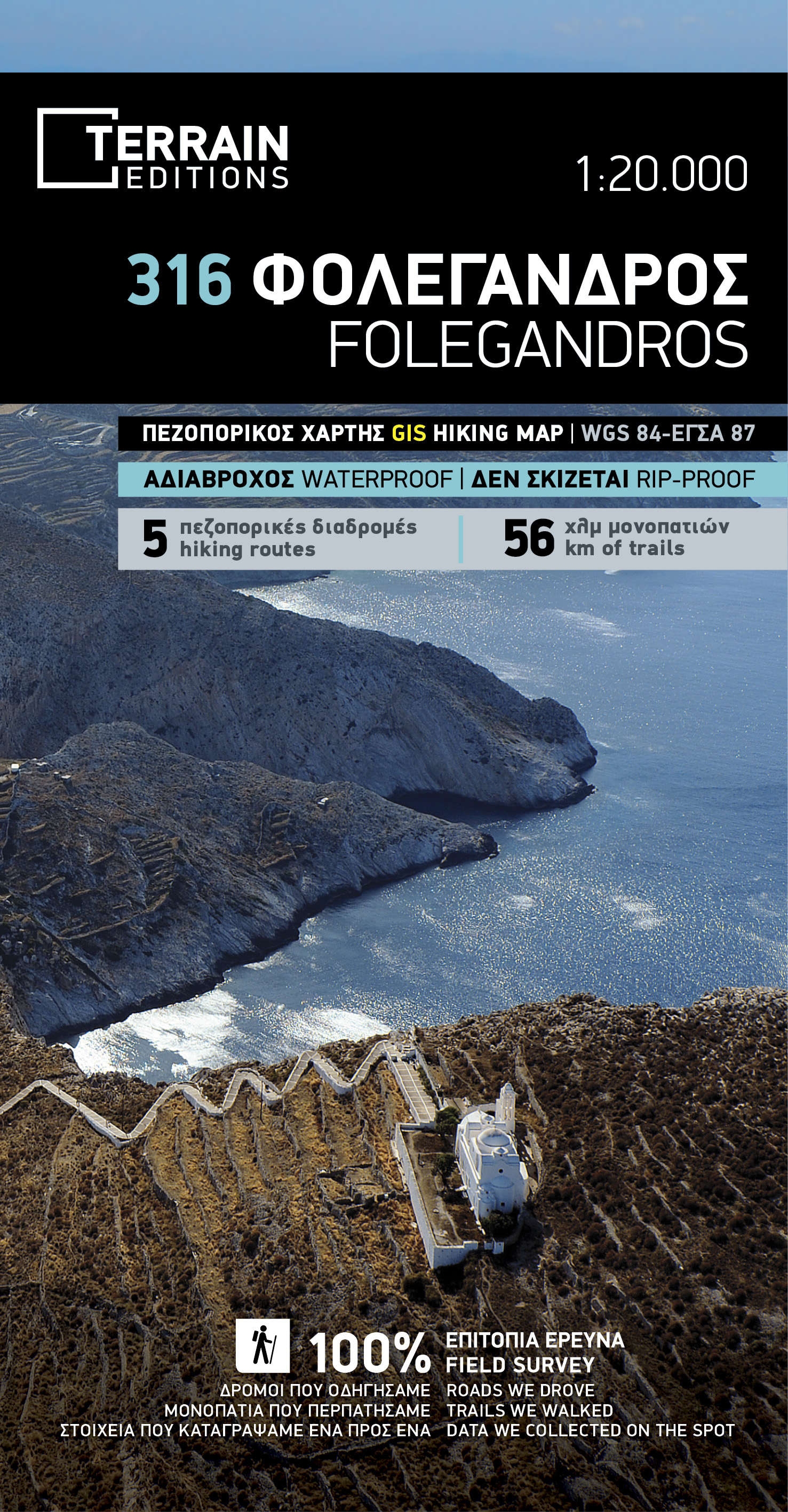
- Wandelkaart 316 Folegandros | Terrain maps
- Folegandros on a light, waterproof and tear-resistant, contoured and GPS compatible map at 1:20,000 from Terrain Editions, with a large street plan of the Hora of Folegandros at 1:2,000 annotated with various facilities. On the reverse is general information about the island, plus descriptions of eight hiking trails. All place names are shown... Read more
- Also available from:
- Stanfords, United Kingdom

Stanfords
United Kingdom
United Kingdom
- Folegandros Terrain Editions 316
- Folegandros on a light, waterproof and tear-resistant, contoured and GPS compatible map at 1:20,000 from Terrain Editions, with a large street plan of the Hora of Folegandros at 1:2,000 annotated with various facilities. On the reverse is general information about the island, plus descriptions of eight hiking trails. All place names are shown... Read more
De Zwerver
Netherlands
Netherlands
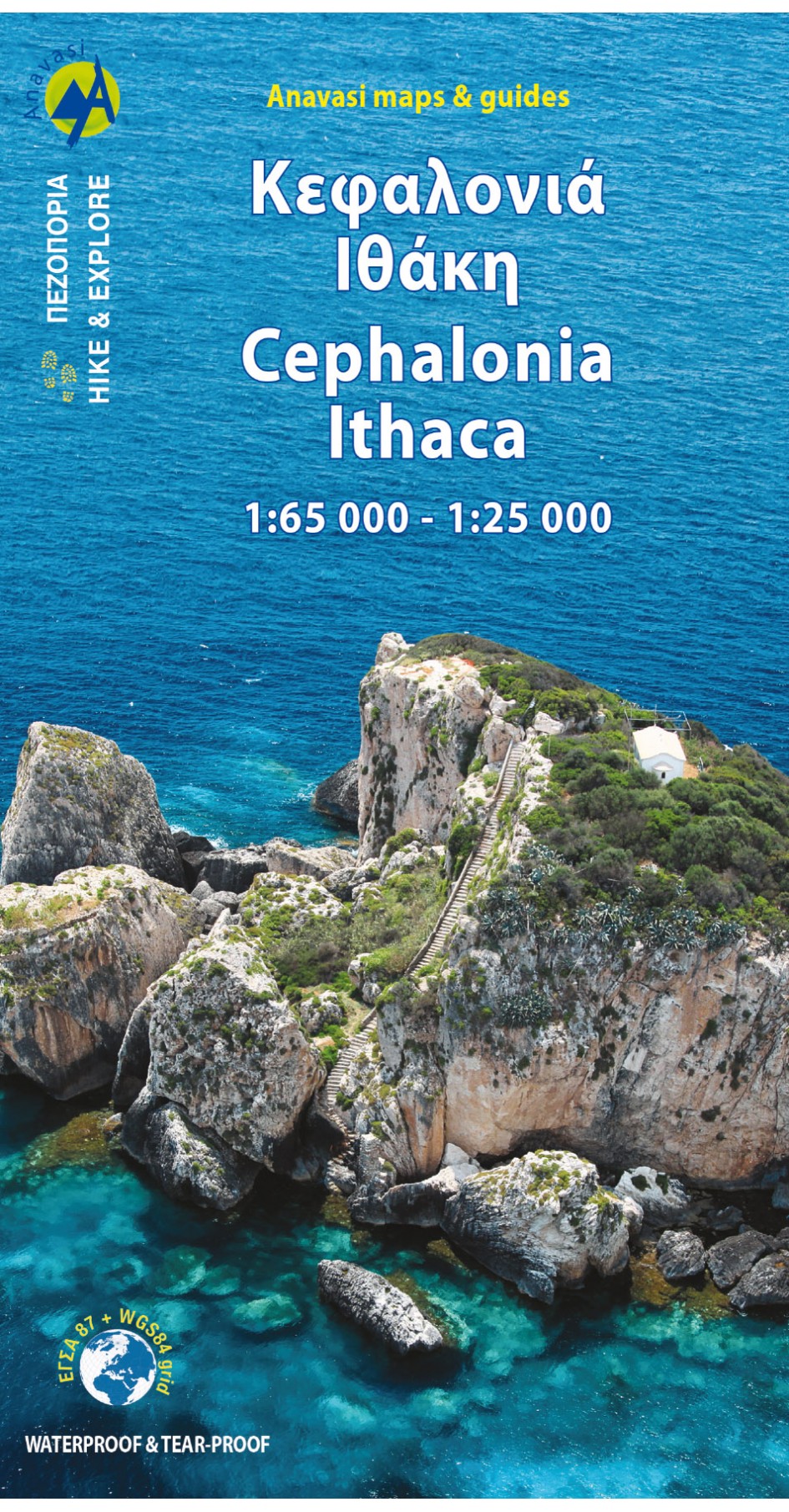
- Wandelkaart - Wegenkaart - landkaart 9.3 Kefalonia - Ithaca | Anavasi
- Dubbelzijdige topografische kaart met wandelroutes van Kefalonia op schaal 1:65.000 en Ithaka schaal 1:25.000 - wandelkaart met hoogtelijnen, wandelpaden, toeristische informatie en UTM grid, de kaart is geschikt voor gebruik met GPS. Kefalonia is well-known for its marvelous beaches. However the island has big mountains and large tracts of... Read more
- Also available from:
- Stanfords, United Kingdom

Stanfords
United Kingdom
United Kingdom
- Cephalonia / Kefalonia - Ithaca Anavasi 9.3
- Kefalonia at 1:65,000 with Ithaca at 1:25,000 on a contoured, GPS compatible double-sided map from Anavasi, with recommended hiking trails on both islands and printed on light, waterproof and tear-resistant plastic paper. On one side are both islands at 1:65,000, with an enlargement of Ithaca at 1:25,000 shown on the reverse. Topography is... Read more
De Zwerver
Netherlands
Netherlands
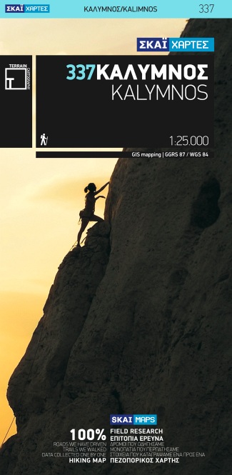
- Wandelkaart 337 Kalymnos | Terrain maps
- Kalymnos at 1:25,000 on a contoured, GPS compatible hiking map published by Terrain Cartography group together with Skai Maps, and printed on light, waterproof and tear-resistant Polyart plastic paper, with extensive tourist information.Topography is very well presented by contours, enhanced by spot heights, subtle relief shading and additional... Read more
- Also available from:
- Stanfords, United Kingdom

Stanfords
United Kingdom
United Kingdom
- Kalymnos Terrain Editions 337
- Greek island of Kalymnos on a light, waterproof and tear-resistant, contoured and GPS compatible map at 1:25,000 from Terrain Editions, with a street plan of Kalymnos Town (Pothia) at 1:3,500. The reverse side includes information on the island’s rock climbing sites, plus descriptions of 13 specially selected hiking trails. All place names are... Read more
- Also available from:
- Stanfords, United Kingdom

Stanfords
United Kingdom
United Kingdom
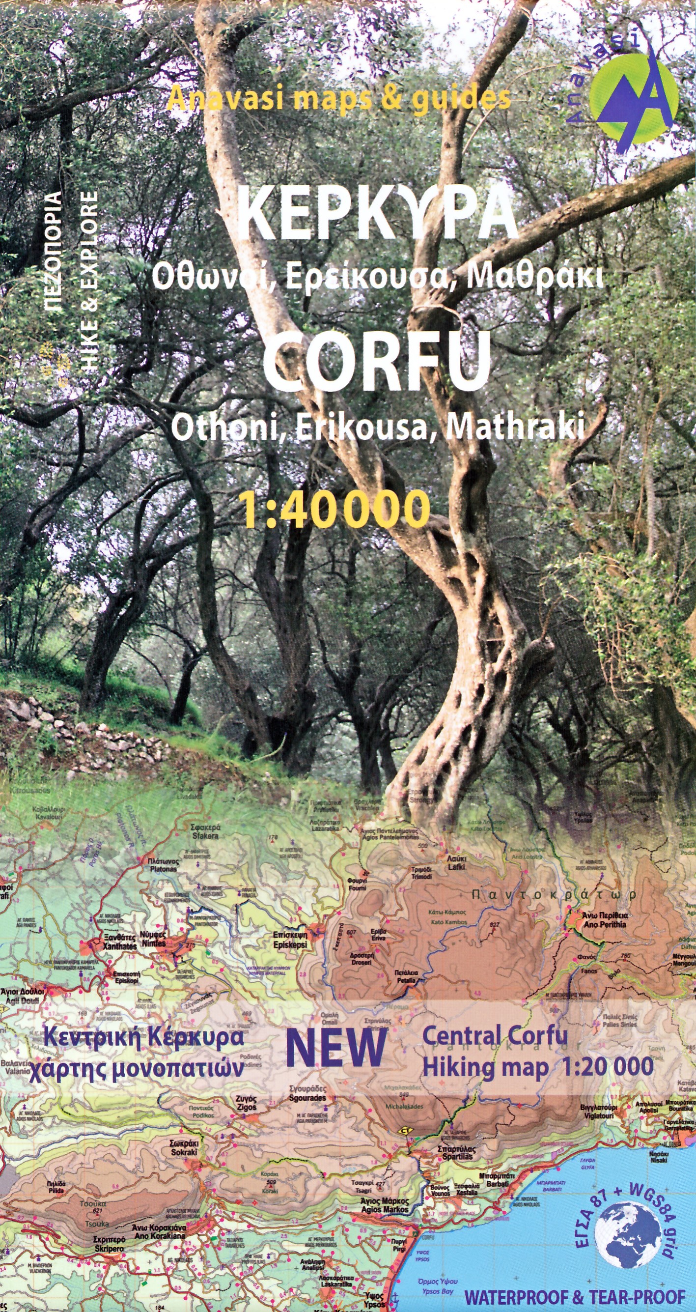
- Corfu - Othoni - Erikouse - Mathraki Anavasi 9.4
- Corfu on a handy size, light, waterproof and tear-resistant, contoured and GPS compatible map at 1:40,000 from Anavasi, highlighting the course of the Corfu Trail across the whole length of the island. The map is double-sided with a narrow overlap between the sides.Landscape is shown by contours at 50m with hill shading and spot heights. The... Read more