
Castilla y León
Beschrijving
Kaart

Paden in deze regio
- GR1 Sendero Histórico, Senda TransversalGPX
- GR10 Senderos de la MielGPX
- GR100 Ruta de la PlataGPX
- GR14 Sendero del DueroGPX
- GR186 Caminos de MedinaGPX
- GR26 Senda de Tierra de CamposGPX
- GR260 Vuelta al Moncayo-Calcenada
- GR27 Sendero del Valle Esgueva
- GR28 Sendero de Tierra de PinaresGPX
- GR29 Sendero del río Pisuerga
- GR30 Sendero de los Montes de TorozosGPX
- GR65 Camino de SantiagoGPX
- GR69 Circular de HueteGPX
- GR82 Sierra de la DemandaGPX
- GR84 Canal del DueroGPX
- GR85 Ruta de los SentidosGPX
- GR86 Sendero Ibérico SorianoGPX
- GR89 Canales de CastillaGPX
- GR99 Sendero del EbroGPX
Links
Feiten
Verslagen
Gidsen en kaarten
Overnachting
Organisaties
Reisorganisaties
GPS
Anders
Boeken
De Zwerver
Netherlands
2012
Netherlands
2012
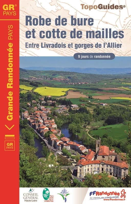
- Wandelgids 4303 Robe de bure et cotte de mailles | FFRP
- Guide FFRandonnée Robe de bure et cotte de mailles - 4303 - GR Pays, 163 km de sentiers GR 'Robe de bure et cotte de maille'… un intitulé pour le moins énigmatique pour un GR® de Pays ! Lieux de culte - la bure - et châteaux - la cotte de maille - tels sont les édifices que cette boucle de 9 jours vous invite à découvrir dans cette moitié... Read more
- Also available from:
- Stanfords, United Kingdom

Stanfords
United Kingdom
2012
United Kingdom
2012
- GRP Robe de Bure et Cotte de Mailles FFRP Topo-guide No. 4303
- Robe de Bure et Cotte de Mailles, FFRP topoguide Ref. no. 4303, a 163km circuit in the Haute-Loire area of the Massif Central between Le-Puy-en-Velay and Brioude. Current edition of this title was published in September 2012.ABOUT THE FFRP (Fédération française de la randonnée pédestre) TOPOGUIDES: published in a handy A5 paperback format, the... Read more

De Zwerver
Netherlands
2023
Netherlands
2023
De Zwerver
Netherlands
2018
Netherlands
2018

De Zwerver
Netherlands
2015
Netherlands
2015
- Wandelgids 6543 Sentier vers Saint-Jacques-de-Compostelle via Vezelay : Périgueux - Roncevaux - GR654 | FFRP
- Guide FFRandonnée Sentier vers St-Jacques-de-Compostelle : Périgueux-Ronceveaux. GR 654. Voie de Vézelay vers Compostelle : suite de l'itinéraire décrit dans le topo-guide réf. 6542 'Sentier vers St-Jacques-de-Compostelle : Vézelay-Périgueux'.Passé le seuil du Périgord blanc,... Read more
- Also available from:
- Stanfords, United Kingdom

Stanfords
United Kingdom
2015
United Kingdom
2015
- GR654 Sentier St-Jacques: Perigueux - Roncevaux FFRP Topo-guide No. 6543
- Sentier St-Jacques: Perigueux - Roncevaux, FFRP topoguide Ref. no. 6543, covering the second part of the Way of St James route along the GR654 which starts in Vézelay, the section from Perigueux to the Pyrenees. Also covered is an eastern route from Bergerac to Montréal-de-Gers. Current edition of this title was published in June 2014.ABOUT THE... Read more
De Zwerver
Netherlands
2023
Netherlands
2023

De Zwerver
Netherlands
2023
Netherlands
2023


De Zwerver
Netherlands
2013
Netherlands
2013
- Wandelgids 1451 La Via Francigena à travers le Pas-de-Calais GR145 | FFRP
- Guide FFRandonnée La Via Francigena à travers le Pas-de-Calais - GR 145 - 245 Km de sentiers GR.Ancienne voie de pèlerinage, au même titre que les chemins de Saint-Jacques ou du Mont-Saint-Michel, ce topo-guide bilingue français/anglais (une grande première !) comprend les 245 premiers kilomètres français de l'itinéraire ancestral reliant... Read more
- Also available from:
- Stanfords, United Kingdom

Stanfords
United Kingdom
2013
United Kingdom
2013
- GR145: The Via Francigena in Pas-de-Calais FFRP Topo-guide No. 1451
- The first stage in France of the Via Francigena, one of the great medieval pilgrim routes, in a bilingual English / French topoguide with colour extracts from IGN’s topographic survey at 1:50,000, accommodation recommendations, etc.The guide covers a 12 day - 235km long section from Calais to Rocquigny, including parts of WWI Western Front in... Read more
De Zwerver
Netherlands
2024
Netherlands
2024
- Also available from:
- Stanfords, United Kingdom

Stanfords
United Kingdom
2020
United Kingdom
2020
- Les Yvelines à pied D078
- Les Yvelines à pied, FFRP topo-guide Ref. No. D078, with 43 day walks of varying length and difficulty in the department of Les Yvelines. The guide, which also includes two GR de Pays routes totaling 150 kms, covers an area west and south-west of Paris with Versailles, Saint-Germain-en-Laye and the forest of Rambouillet. Each walk is presented... Read more

De Zwerver
Netherlands
2014
Netherlands
2014
- Wandelgids 901 Tours et traversées dans l'Ain GR9, GR9A, GR59 | FFRP
- Guide FFRandonnée Tours et Traversée dans l'ain. GR 59, 9, 9A. Etangs de la Dombes, monts et cluses du Revermont ou bocages de la Bresse. Plus de 50 jours de randonnée.Depuis les Monts du Jura, du Revermont ou du Bugey, ces itinéraires en boucle ou en ligne offrent aux randonneurs des vues imprenables. voici à l'est le Mont Blanc et les... Read more
- Also available from:
- Stanfords, United Kingdom

Stanfords
United Kingdom
2014
United Kingdom
2014
- GR59/GR9/GRP: Tours et Traversées de l`Ain FFRP Topo-guide No. 901
- Tours et Traversées de l`Ain, FFRP topoguide, Ref. No. 901, covering in all 949km of hiking trails in the French Jura between Lons-le-Saunier and the confluence of the Ain and the Rhône, including sections of GR 5, 9 and 9A. Current edition of this title was published in June 2014.ABOUT THE FFRP (Fédération française de la randonnée pédestre)... Read more

De Zwerver
Netherlands
2022
Netherlands
2022
Meer boeken…
Kaarten

De Zwerver
Netherlands
2021
Netherlands
2021
- Also available from:
- Stanfords, United Kingdom

Stanfords
United Kingdom
2021
United Kingdom
2021
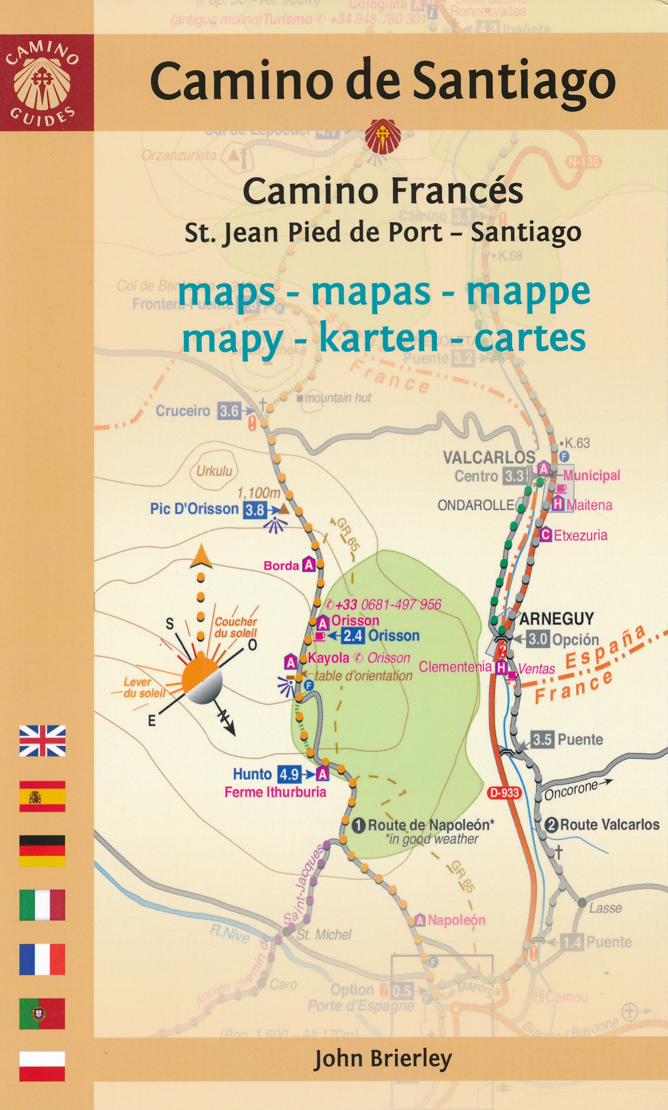
- France - Ways of St James IGN Map 922
- France: Ways of St James to Compostela Map from the IGN presents an overview of all the routes across France taken by pilgrims on their way to Santiago de Compostela and the tomb of the apostle St James - the greatest of all goals for thousands of pilgrims in Europe during the Middle Ages. The map was prepared by the IGN and the Association de... Read more

De Zwerver
Netherlands
2020
Netherlands
2020
- Wandelatlas - Pelgrimsroute (kaart) 161 Chemins de Compostelle GR65 | Michelin
- Véritable petit atlas détaillant chaque étape avec indications précises concernant les villes de départ et d'arrivée ainsi que pour les localités traversées (auberges, refuges, restaurants, pharmacies, gare, épiceries, Km parcourus, Km restants....).Ce petit atlas suit le chemin du... Read more

De Zwerver
Netherlands
Netherlands
- Pelgrimsroute (kaart) - Wandelkaart Camino de Santiago in Spanje | CNIG - Instituto Geográfico Nacional
- All roads leading to Santiago de Compostela in the Iberian Peninsula are represented on this Caminos de Santiago / The Way of St. James Map. Routes highlighted on a physical map of the Iberian Peninsula at 1:1,250,000 from IGN/CNIG, Spain civilian topographic survey organization. The base map with altitude colouring and relief shading provides... Read more
- Also available from:
- Stanfords, United Kingdom

Stanfords
United Kingdom
United Kingdom
- Caminos de Santiago / Ways of St. James on the Iberian Peninsula CNIG Overview Map
- All roads leading to Santiago de Compostela in the Iberian Peninsula are represented on this Caminos de Santiago / The Way of St. James Map. Routes highlighted on a physical map of the Iberian Peninsula at 1:1,250,000 from IGN/CNIG, Spain civilian topographic survey organization. The base map with altitude colouring and relief shading provides... Read more

De Zwerver
Netherlands
2020
Netherlands
2020
- Wandelatlas - Pelgrimsroute (kaart) 160 Camino de Santiago | Michelin
- Parcourez le Chemin Français (Camino Francés) avec ce petit atlas de poche Michelin. L'outil idéal pour mieux s'y retrouver lors de la préparation du voyage de randonnée sur ce sentier historique qui part de Saint-Jean-Pied-de-Port, dans le Pays basque français, et qui traverse tout le nord de l'Espagne... Read more

De Zwerver
Netherlands
Netherlands
- Wandelkaart 07 Haute Ariege | Rando Editions
- Itinéraires de rando, infos culturelles, touristiques et sportives, gîtes, refuges : toutes ces infos sont disponibles sur cette carte à cheval sur France et Espagne. Read more
- Also available from:
- Stanfords, United Kingdom

Stanfords
United Kingdom
United Kingdom
- Haute-Ariége Rando Editions 7
- The Haute-Ariége region of the French Pyrenees, from Foix to Pica d`Estats and the Col de Puymorens, on a contoured and GPS compatible map at 1:50,000 from Rando Editions with topographic base provided by the IGN, highlighting local and long-distance hiking trails, etc. Topography is vividly presented by contours at 20m intervals enhanced by... Read more

- Also available from:
- Stanfords, United Kingdom

Stanfords
United Kingdom
United Kingdom
- Pays Basque West Rando Editions 1
- The westernmost section of the French Pyrenees between the Atlantic coast and St-Jean-Pied-de-Port on a contoured and GPS compatible map at 1:50,000 from Rando Editions with topographic base provided by the IGN, highlighting local and long-distance hiking trails, cycle and mountain bike routes, etc. Coverage along the Atlantic coast starts at... Read more
De Zwerver
Netherlands
Netherlands
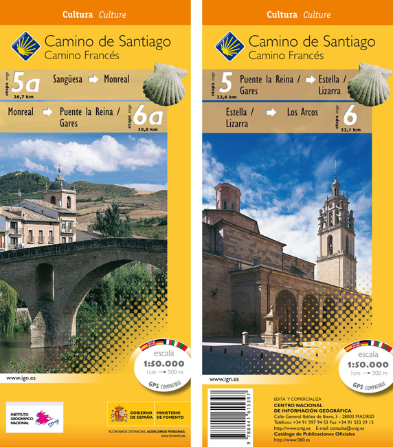
- Wandelkaart 5A-6 Camino Santiago de Compostella Sangüesa - Los Arcos | CNIG - Instituto Geográfico Nacional
- The Way of St James: Stages 5/5a/6/6a, Sangüesa/Puente la Reina/Los Arcos in a series of double-sided topographic maps at 1:50,000 from the Spanish civilian survey organization, overprinted with the route and sights, plus information of accommodation and other facilities, route profiles, etc.Each 1:50,000 map is double-sided and has four 57 x... Read more
- Also available from:
- Stanfords, United Kingdom

Stanfords
United Kingdom
United Kingdom
- Camino de Santiago: Stages 5/5a/6/6a, Sangüesa/Puente la Reina/Los Arcos 50K CNIG Map
- The Way of St James: Stages 5/5a/6/6a, Sangüesa/Puente la Reina/Los Arcos in a series of double-sided topographic maps at 1:50,000 from the Spanish civilian survey organization, overprinted with the route and sights, plus information of accommodation and other facilities, route profiles, etc.Each 1:50,000 map is double-sided and has four 57 x... Read more

De Zwerver
Netherlands
Netherlands
- Wegenkaart - landkaart Camino de Santiago - Camino Frances | CNIG - Instituto Geográfico Nacional
- Northern Spain on an overview map at 1:500,000 highlighting the course of the Camino Francés route of the Way of St James from the Pyrenees to Santiago de Compostela via Burgos and León. Published by Spain’s civilian survey organization as part of their set providing topographic coverage of the route at 1:50,000, the map is also available... Read more
- Also available from:
- Stanfords, United Kingdom

Stanfords
United Kingdom
United Kingdom
- Way of St James / Camino de Santiago CNIG Overview Map
- Northern Spain on an overview map at 1:500,000 highlighting the course of the Camino Francés route of the Way of St James from the Pyrenees to Santiago de Compostela via Burgos and León. Published by Spain’s civilian survey organization as part of their set providing topographic coverage of the route at 1:50,000, the map is also available... Read more

De Zwerver
Netherlands
Netherlands
- Wandelkaart 08 Cerdagne Capcir | Rando Editions
- Uitstekende wandelkaart met veel toeristische informatie en bijzonder gedetailleerd. Wandelroute en hutten / campings zijn ingetekend, met hoogtelijnen. Andere dorpen op deze kaart: Ax les Thermes - Massif de l'Aston - Canillo - Soldeu - Mérens les Vals - Porté Puymorens - Mijanès - Puyvalador - Olette - Mont Louis - Font Romeu - Núria -... Read more
- Also available from:
- Stanfords, United Kingdom

Stanfords
United Kingdom
United Kingdom
- Cerdagne-Capcir Rando Editions 8
- The Cerdagne-Capcir region of the French Pyrenees, from Ax-les Thermes to Font Romeu and Bourg-Madame, on a contoured and GPS compatible map at 1:50,000 from Rando Editions with topographic base provided by the IGN, highlighting local and long-distance hiking trails, etc. Topography is vividly presented by contours at 20m intervals enhanced by... Read more

De Zwerver
Netherlands
Netherlands
- Wandelkaart 02 Pays Basque Est | Rando Editions
- Uitstekende wandelkaart met veel toeristische informatie en bijzonder gedetailleerd. Wandelroutes en GR paden en hutten / campings zijn ingetekend, met hoogtelijnen. Andere dorpen op deze kaart: Arrette - la Pierre St. Martin - St. Jean Pied de Port (Frankrijk - Pyreneeen) Versant français et espagnol : Barétous; Soule, Basse-Navarre, vallée... Read more
- Also available from:
- Stanfords, United Kingdom

Stanfords
United Kingdom
United Kingdom
- Pays Basque East Rando Editions 2
- Western Pyrenees in France from the peaks of Iguzuki and Iparla, across St-Jean-Pied-de-Port and Larrau, to Pic d’Anie on a contoured and GPS compatible map at 1:50,000 from Rando Editions with topographic base provided by the IGN, highlighting local and long-distance hiking trails, cycle and mountain bike routes, etc. Topography is vividly... Read more

De Zwerver
Netherlands
2021
Netherlands
2021
- Also available from:
- Stanfords, United Kingdom

De Zwerver
Netherlands
Netherlands
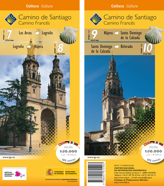
- Wandelkaart 7-10 Camino Santiago de Compostella Los Arcos - Belorado | CNIG - Instituto Geográfico Nacional
- Camino de Santiago: Stages 7/8/9/10, Los Arcos/Belorado, in a series of double-sided topographic maps at 1:50,000 from the Spanish civilian survey organization, overprinted with the route and sights, plus information of accommodation and other facilities, route profiles, etc.Each 1:50,000 map is double-sided and has four 57 x 35cm panels with... Read more
- Also available from:
- Stanfords, United Kingdom
Stanfords
United Kingdom
United Kingdom
- Camino de Santiago: Stages 7/8/9/10, Los Arcos/Belorado 50K CNIG Map
- Camino de Santiago: Stages 7/8/9/10, Los Arcos/Belorado, in a series of double-sided topographic maps at 1:50,000 from the Spanish civilian survey organization, overprinted with the route and sights, plus information of accommodation and other facilities, route profiles, etc.Each 1:50,000 map is double-sided and has four 57 x 35cm panels with... Read more

De Zwerver
Netherlands
Netherlands
- Wandelkaart 05 Luchon | Rando Editions
- Uitstekende wandelkaart met veel toeristische informatie en bijzonder gedetailleerd. Wandelroute en hutten / campings zijn ingetekend, met hoogtelijnen. Andere dorpen op deze kaart: Col d'Aspin - Barbazan - Aspet - le Pla d'Adet - St. Lary Soulan - Val Louran - Col de Peyresourde - Bagnères de Luchon (Frankrijk - Pyreneeen). Carte topographique... Read more
- Also available from:
- Stanfords, United Kingdom

Stanfords
United Kingdom
United Kingdom
- Luchon Rando Editions 5
- The Luchon region of the French Pyrenees, around St.Gaudens, the Louron Valley and Bagnères-de-Luchon, on a contoured and GPS compatible map at 1:50,000 from Rando Editions with topographic base provided by the IGN, highlighting local and long-distance hiking trails, cycle and mountain bike routes, etc. Topography is vividly presented by... Read more
De Zwerver
Netherlands
Netherlands
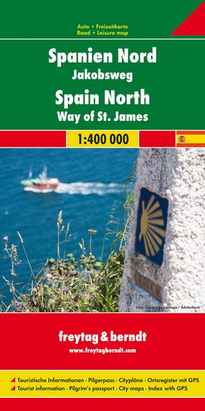
- Wegenkaart - landkaart Spanje Noord - Camino de Santiago | Freytag & Berndt
- Spanien - Jakobsweg, Autokarte 1:400.000 ab 10.9 EURO Touristische Informationen, Pilgerpass, Citypläne, Ortsregister mit GPS Freytag & Berndt Autokarte Read more
De Zwerver
Netherlands
Netherlands
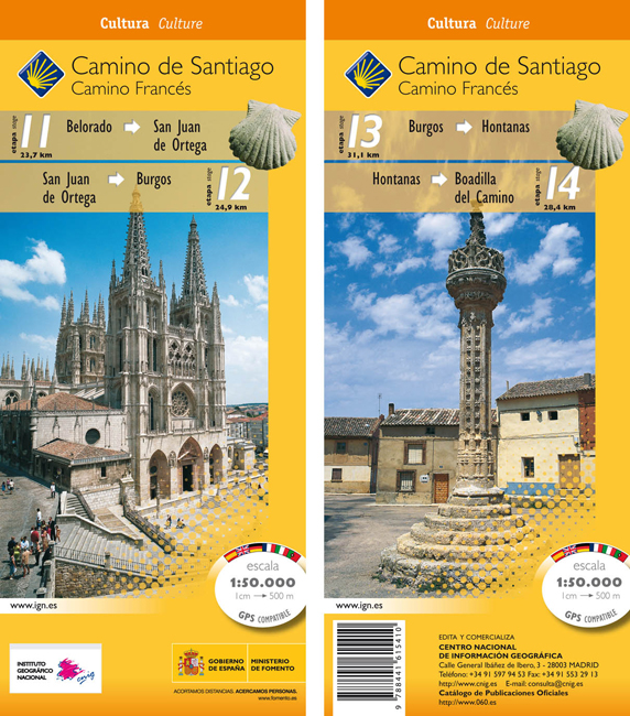
- Wandelkaart 11-14 Camino Santiago de Compostella Belorado - Boadilla | CNIG - Instituto Geográfico Nacional
- Camino de Santiago: Stages 11/12/13/14, Belorado/Boadilla del Camino, in a series of double-sided topographic maps at 1:50,000 from the Spanish civilian survey organization, overprinted with the route and sights, plus information of accommodation and other facilities, route profiles, etc.Each 1:50,000 map is double-sided and has four 57 x 35cm... Read more
- Also available from:
- Stanfords, United Kingdom
Stanfords
United Kingdom
United Kingdom
- Camino de Santiago: Stages 11/12/13/14, Belorado/Boadilla del Camino 50K CNIG Map
- Camino de Santiago: Stages 11/12/13/14, Belorado/Boadilla del Camino, in a series of double-sided topographic maps at 1:50,000 from the Spanish civilian survey organization, overprinted with the route and sights, plus information of accommodation and other facilities, route profiles, etc.Each 1:50,000 map is double-sided and has four 57 x 35cm... Read more