Prättigau
Beschrijving
Region in the canton of Graubünden.
Links
Feiten
Verslagen
Gidsen en kaarten
Overnachting
Organisaties
Reisorganisaties
GPS
Anders
Boeken
De Zwerver
Netherlands
2022
Netherlands
2022
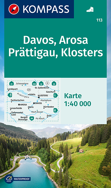
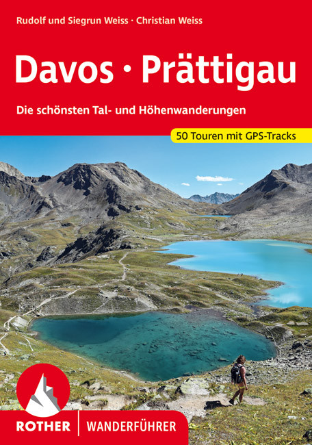
- Wandelgids Davos - Prättigau | Rother Bergverlag
- Uitstekende wandelgids met een groot aantal dagtochten in dal en hooggebergte. Met praktische informatie en beperkt kaartmateriaal! Wandelingen in verschillende zwaarte weergegeven in rood/blauw/zwart. Die Landschaft Davos und das Prättigau mit den bekannten Orten Davos, Klosters und Landquart bieten ein schier unerschöpfliches Angebot an... Read more
Kaarten
De Zwerver
Netherlands
Netherlands
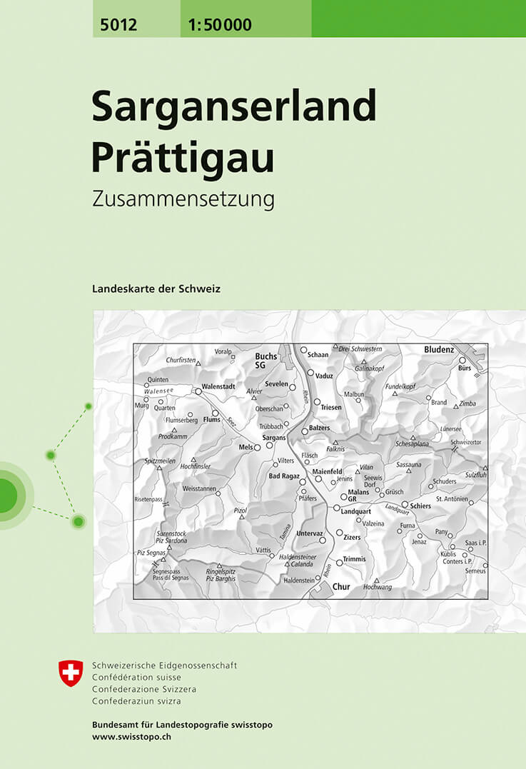
- Wandelkaart - Topografische kaart 5012 Sarganserland - Prättigau | Swisstopo
- Samengestelde kaart van de normale 50.000 serie, daardoor bestrijkt deze kaart een veel groter gebied. Deze kaarten zijn beroemd en gewaardeerd om het geweldige kleurgebruik voor reliëf en hoogte door schaduwwerking. De kaarten geven bijna een 3-D beeld van het landschap. De hoogtelijnen kennen een interval van 20 meter. Wandelroutes en... Read more
- Also available from:
- Stanfords, United Kingdom

Stanfords
United Kingdom
United Kingdom
- Flumserberge - Prättigau Swisstopo 5012
- Flumserberge - Prättigau area, map No. 5012, in the standard topographic survey of Switzerland at 1:50,000 from Swisstopo, i.e. without the special overprint highlighting walking trails, local bus stops, etc, presented in Swisstopo’s hiking editions of the 50K survey. Highly regarded for their superb use of graphic relief and hill shading, the... Read more
De Zwerver
Netherlands
Netherlands
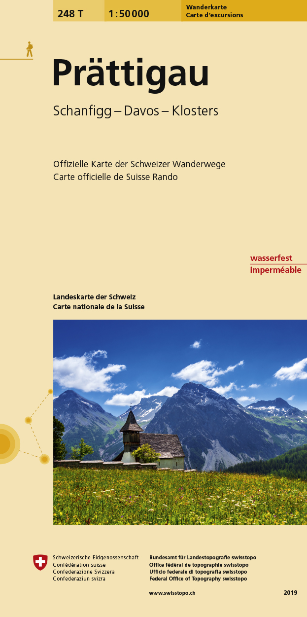
- Wandelkaart 248T Prattigau | Swisstopo
- Deze kaart is onderdeel van de 1:50.000 serie van de topografische kaarten van de Zwitserse topografische dienst, die in 78 delen het hele land bestrijkt. Deze kaarten zijn beroemd en gewaardeerd om het geweldige kleurgebruik voor reliëf en hoogte door schaduwwerking. De kaarten geven bijna een 3-D beeld van het landschap. De hoogtelijnen... Read more
- Also available from:
- Stanfords, United Kingdom

Stanfords
United Kingdom
United Kingdom
- Prättigau Swisstopo Hiking 248T
- Prättigau area, map No. 248T, at 1:50,000 in a special hiking edition of the country’s topographic survey, published by Swisstopo in cooperation with the Swiss Hiking Federation. Coverage includes Davos, Klosters and Arosa.Cartography, identical to the standard version of the survey, is highly regarded for its superb use of graphic relief and... Read more
De Zwerver
Netherlands
Netherlands
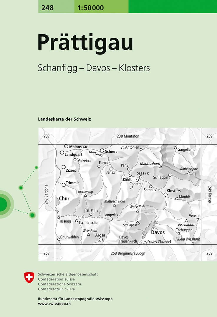
- Wandelkaart - Topografische kaart 248 Prättigau | Swisstopo
- Deze kaart is onderdeel van de 1:50.000 serie van de topografische kaarten van de Zwitserse topografische dienst, die in 78 delen het hele land bestrijkt. Deze kaarten zijn beroemd en gewaardeerd om het geweldige kleurgebruik voor reliëf en hoogte door schaduwwerking. De kaarten geven bijna een 3-D beeld van het landschap. De hoogtelijnen... Read more
- Also available from:
- Stanfords, United Kingdom
Stanfords
United Kingdom
United Kingdom
- Prättigau Swisstopo 248
- Prättigau, map No. 248, in the standard topographic survey of Switzerland at 1:50,000 from Swisstopo, i.e. without the special overprint highlighting walking trails, local bus stops, etc, presented in Swisstopo’s hiking editions of the 50K survey. Coverage includes Davos, Klosters and Arosa.Highly regarded for their superb use of graphic relief... Read more
Meer kaarten…