
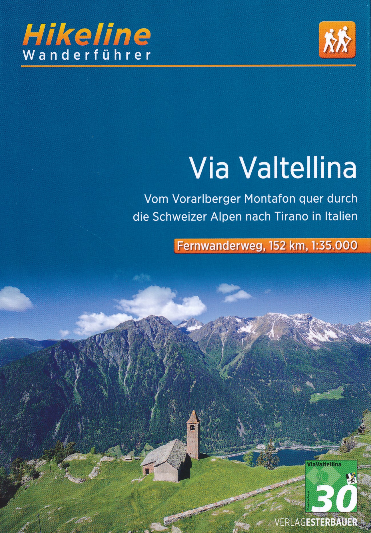
Silvretta
Beschrijving

In the west of Austria and east of Switzerland, the Silvretta constitues the border between both countries. The Silvretta is one of the most exciting areas in this region. The glaciers that make Silvretta famous, are mostly located on the Austrian side. A better contrast with the sunny green pastures is hard to think of. On the Swiss side, there are virtually no glaciers, and that's probably the reason that most visitors think the Silvretta is solely an Austrian matter.
Still, the highest peaks of the Silvretta are on the Swiss side. Piz Linard, 3411 m, is the highest. A second reason for exploring the Swiss side are the many old towns in this region, the Engadine. With some patience you might hear people speak Rhaeto-Romance. A multi-day hike through the Swiss Silvretta is a good option and perfectly possible.
However, as said, most hikers prefer the Austrian side. Armed with ropes, ax and crampons, they indulge in this high alpine landscape of ice and rock. By the way, if you plan to walk the Via Alpina, you will pass through the Silvretta.
Kaart


Paden in deze regio
Links
Feiten
Verslagen
Gidsen en kaarten
Overnachting
Organisaties
Reisorganisaties
GPS
Anders
Boeken
Netherlands
2022
- Wandelgids Davos - Prättigau | Rother Bergverlag
- Uitstekende wandelgids met een groot aantal dagtochten in dal en hooggebergte. Met praktische informatie en beperkt kaartmateriaal! Wandelingen in verschillende zwaarte weergegeven in rood/blauw/zwart. Die Landschaft Davos und das Prättigau mit den bekannten Orten Davos, Klosters und Landquart bieten ein schier unerschöpfliches Angebot an... Read more

Netherlands
2011
- Wandelgids Tirol Oberinntal | Rother Bergverlag
- 50 Touren zwischen Innsbruck und Arlberg Rother Wanderbuch. 1. Auflage. Read more
Netherlands
2024
Netherlands
2022
- Wandelgids Montafon, mit Bielerhöhe und Zeinisjoch-Gebiet | Rother Bergverlag
- Uitstekende wandelgids met een groot aantal dagtochten in dal en hooggebergte. Met praktische informatie en beperkt kaartmateriaal! Wandelingen in verschillende zwaarte weergegeven in rood/blauw/zwart. Die reizvoll gelegene Tallandschaft des Montafon ist von ganz unterschiedlichen, in ihrer Art unverwechselbaren Alpenregionen umgeben: Im Norden... Read more
Netherlands
2010
- Wandelgids Hikeline Paznaun | Esterbauer
- Handzame gids met een goede beschrijving van een groot aantal dagtochten in dit gebied. De gids is in spiraalbinding en elke pagina is op scheur- en watervast papier gedrukt. Daar is echt over nagedacht! Streckencharakteristik Länge, Höhenmeter und Anforderungen Die 40 Touren dieses Buches decken eine große Bandbreite von kurzen Spaziergängen... Read more


Netherlands
2021
- Wandelgids Arlberg - Paznaun | Rother Bergverlag
- Uitstekende wandelgids met een groot aantal dagtochten in dal en hooggebergte. Met praktische informatie en beperkt kaartmateriaal! Wandelingen in verschillende zwaarte weergegeven in rood/blauw/zwart. Zwischen den Allgäuer Alpen und der Silvretta liegt ein wahres Wanderparadies. Dabei darf man sich von den im Untertitel erwähnten Alpin-Zentren... Read more


Netherlands
- Over the Top & Back Again
- Book of the Year Bronze Award 2010 (travel essays category), ForeWord Magazine After hiking some of the world's great trails, Brandon Wilson was excited to hear about the Via Alpina, paths running across eight countries on the backbone of the Alps. Besides promising immersion into Alpine life and wilderness, it was the ultimate adventure. It... Read more
- Also available from:
- Bol.com, Belgium
Belgium
- Over the Top & Back Again
- Book of the Year Bronze Award 2010 (travel essays category), ForeWord Magazine After hiking some of the world's great trails, Brandon Wilson was excited to hear about the Via Alpina, paths running across eight countries on the backbone of the Alps. Besides promising immersion into Alpine life and wilderness, it was the ultimate adventure. It... Read more
Netherlands
2016
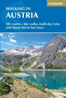
- Wandelgids Oostenrijk - Walking in Austria | Cicerone
- A comprehensive guidebook to walking routes in Austria. 101 routes, day walks, multi-day treks and classic hut-to-hut tours in the Ratikon, Silvretta, Stubai, and Zillertal Alps, the Hohe Tauern, and the Karawanken. With information on transport, accommodation, gear and safety, plus full details of over a hundred Austrian mountain huts. Read more
- Also available from:
- Bol.com, Netherlands
- Bol.com, Belgium
- The Book Depository, United Kingdom
Netherlands
2016
- Walking in Austria
- A comprehensive guidebook detailing walking routes in Austria. The 101 walks reflect the diversity of this popular region and cover Austria's magnificent Alps - including the Ratikon, Silvretta, Stubai and Zillertal - as well as the Dachsteingebirge, Hohe Tauern and the Karawanken. Graded according to difficulty and ranging from short walks of... Read more
Belgium
2016
- Walking in Austria
- A comprehensive guidebook detailing walking routes in Austria. The 101 walks reflect the diversity of this popular region and cover Austria's magnificent Alps - including the Ratikon, Silvretta, Stubai and Zillertal - as well as the Dachsteingebirge, Hohe Tauern and the Karawanken. Graded according to difficulty and ranging from short walks of... Read more

United Kingdom
2016
- Walking in Austria
- 101 routes - day walks, multi-day treks and classic hut-to-hut tours Read more
Netherlands
2012
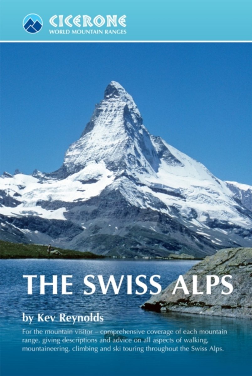
- The Swiss Alps
- The Swiss Alps are home to the highest and most spectacular mountains in Western Europe, beloved not only of mountaineers, from the earliest days of alpinism to the present day, but also those content simply to gaze and wonder. This unique resource for the climber, walker, trekker and ski mountaineer, the latest volume in Cicerone's World... Read more
- Also available from:
- Bol.com, Belgium
- The Book Depository, United Kingdom
Belgium
2012
- The Swiss Alps
- The Swiss Alps are home to the highest and most spectacular mountains in Western Europe, beloved not only of mountaineers, from the earliest days of alpinism to the present day, but also those content simply to gaze and wonder. This unique resource for the climber, walker, trekker and ski mountaineer, the latest volume in Cicerone's World... Read more

United Kingdom
2012
- The Swiss Alps
- A comprehensive guidebook to every mountain area in the Swiss Alps. This handy resource includes information for walking, hiking, trekking, climbing and ski mountaineering. Access, accommodation and facilities in the valley bases and full information about Swiss mountain huts is included to help you make the most out of a trip there. Read more
Netherlands
2017
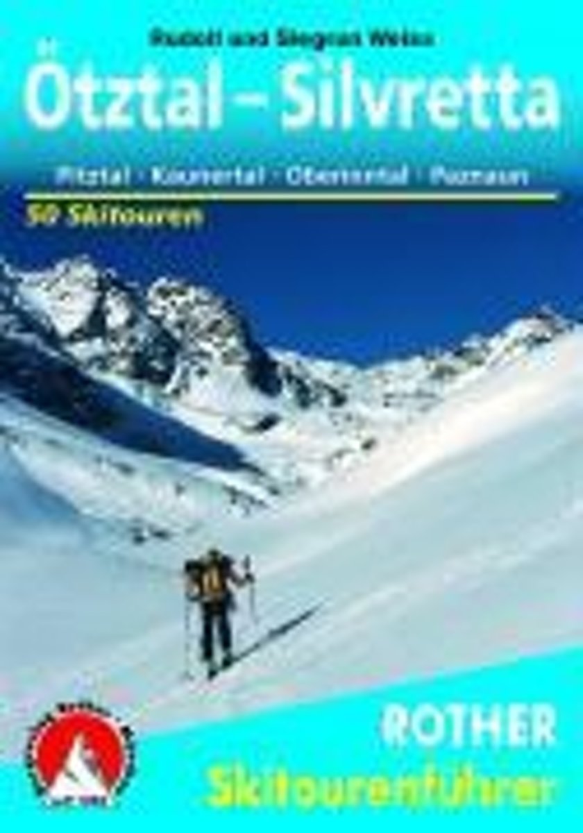
- Ötztal - Silvretta
- Der Skitourenf hrer tztal - Silvretta beschreibt vor allem das >>Tiroler Oberlandblauen>roten Reihe Read more
- Also available from:
- Bol.com, Belgium
Belgium
2017
- Ötztal - Silvretta
- Der Skitourenf hrer tztal - Silvretta beschreibt vor allem das >>Tiroler Oberlandblauen>roten Reihe Read more

Netherlands
2017
- The Swiss alpine pass route - Via Alpina route 1
- This guidebook presents the stunning Alpine Pass Route, now fully waymarked as Via Alpina 1. The 360km trail traverses Switzerland from east to west, from Sargans near the Liechtenstein border to Montreux on Lac Léman (Lake Geneva). Crossing sixteen Alpine passes, it showcases some of the country's most breathtaking mountain landscapes,... Read more
- Also available from:
- Bol.com, Belgium
- Stanfords, United Kingdom
Belgium
2017
- The Swiss alpine pass route - Via Alpina route 1
- This guidebook presents the stunning Alpine Pass Route, now fully waymarked as Via Alpina 1. The 360km trail traverses Switzerland from east to west, from Sargans near the Liechtenstein border to Montreux on Lac Léman (Lake Geneva). Crossing sixteen Alpine passes, it showcases some of the country's most breathtaking mountain landscapes,... Read more

United Kingdom
2017
- The Swiss Alpine Pass Route - via Alpina Route 1: Trekking East to West Across Switzerland
- This guidebook presents the stunning Alpine Pass Route, now fully waymarked as Via Alpina 1. The 360km trail traverses Switzerland from east to west, from Sargans near the Liechtenstein border to Montreux on Lac Leman (Lake Geneva). Crossing sixteen Alpine passes, it showcases some of the country`s most breathtaking mountain landscapes,... Read more
Kaarten

Netherlands
2012
- Wandelkaart 03 Il parco nazionale del Gran Paradiso | IGC - Istituto Geografico Centrale
- Gran Paradiso National Park in a series contoured hiking maps at 1:50,000 with local trails, long-distance footpaths, mountain accommodation, etc, from the Turin based Istituto Geografico Centrale. This new edition published in late 2013 highlights, among other routes, the GTA (Grande Traversata delle Alpi), Via Alpina and Alta Via 2. Coverage... Read more
- Also available from:
- Stanfords, United Kingdom

United Kingdom
2012
- Gran Paradiso National Park IGC 3
- Gran Paradiso National Park in a series contoured hiking maps at 1:50,000 with local trails, long-distance footpaths, mountain accommodation, etc, from the Turin based Istituto Geografico Centrale. The map highlights, among other routes, the GTA (Grande Traversata delle Alpi), Via Alpina and Alta Via 2. Coverage extends from Aosta at the top of... Read more

Netherlands
2010
- Wandelkaart 17 Torino, Pinerolo e Bassa val di Susa | IGC - Istituto Geografico Centrale
- Turin - Pinerolo - Lower Susa Valley, map no. 17, in a series contoured hiking maps at 1:50,000 with local trails, long-distance footpaths, mountain accommodation, etc. from the Turin based Istituto Geografico Centrale covering the Italian Alps and Piedmont, the lakes and northern Lombardy, and the Italian Riviera.The maps have contours at 50m... Read more
- Also available from:
- Stanfords, United Kingdom

United Kingdom
2010
- Turin - Pinerolo - Lower Susa Valley 50K IGC Map No. 17
- Turin - Pinerolo - Lower Susa Valley area of Piedmont in a series contoured hiking maps at 1:50,000 with local trails, long-distance footpaths, mountain accommodation, etc. from the Turin based Istituto Geografico Centrale.Maps in this series have contours at 50m intervals, enhanced by shading and graphic relief. An overprint highlights local... Read more
Netherlands
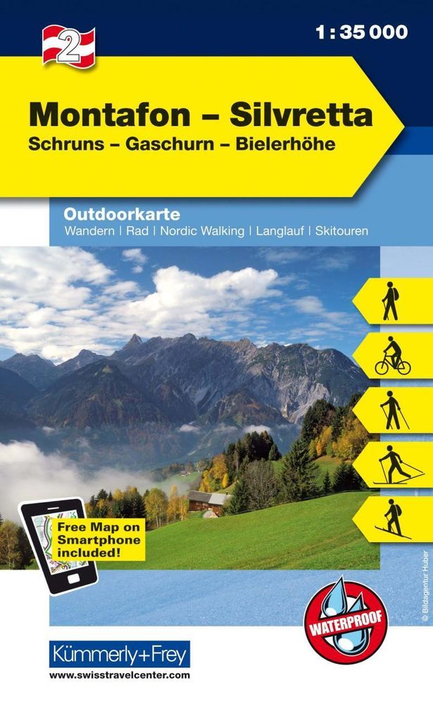
- Wandelkaart 02 Outdoorkarte AT Montafon - Silvretta | Kümmerly & Frey
- Montafon - Silvretta - Schruns - Gaschum - Bielerhöhe area of the Tyrol at 1:35,000 on a GPS compatible, double-sided map from Kümmerly+Frey printed on sturdy, waterproof and tear-resistant synthetic paper; contoured, with hiking, cycling and ski routes, accommodation facilities, locations for other recreational activities, etc.Maps in the K+F... Read more
- Also available from:
- Stanfords, United Kingdom

United Kingdom
- Montafon - Silvretta - Schruns - Gaschum - Bielerhöhe K+F Outdoor Map 2
- Montafon - Silvretta - Schruns - Gaschum - Bielerhöhe area of the Tyrol at 1:35,000 on a GPS compatible, double-sided map from Kümmerly+Frey printed on sturdy, waterproof and tear-resistant synthetic paper; contoured, with hiking, cycling and ski routes, accommodation facilities, locations for other recreational activities, etc.Maps in the K+F... Read more

Netherlands
2013
- Wandelkaart 04 Massiccio del Monte Bianco | IGC - Istituto Geografico Centrale
- The Mont Blanc Massif in a series contoured hiking maps at 1:50,000 with local trails, long-distance footpaths, mountain accommodation, etc, from the Turin based Istituto Geografico Centrale. This new edition published in late 2013 highlights, among other routes, the Alta Via 1 and the northern section of the Alta Via 2, both of which join up... Read more
- Also available from:
- Stanfords, United Kingdom

United Kingdom
2013
- Mont Blanc Massif IGC 4
- The Mont Blanc Massif in a series contoured hiking maps at 1:50,000 with local trails, long-distance footpaths, mountain accommodation, etc, from the Turin based Istituto Geografico Centrale. The map highlights, among other routes, the Alta Via 1 and the northern section of the Alta Via 2, both of which join up with TMB, as well as the local... Read more

Netherlands
2012
- Wandelkaart 20 Il Monferrato da Asti a Casale Monferrato | IGC - Istituto Geografico Centrale
- Il Monferrato, map no. 20, in a series contoured hiking maps at 1:50,000 with local trails, long-distance footpaths, mountain accommodation, etc. from the Turin based Istituto Geografico Centrale covering the Italian Alps and Piedmont, the lakes and northern Lombardy, and the Italian Riviera.The maps have contours at 50m intervals, enhanced by... Read more
- Also available from:
- Stanfords, United Kingdom

United Kingdom
2012
- Il Monferrato: Asti - Casale Monferrato 50K IGC Map No. 20
- The Monferrato region of Piedmont east of Turin, between Asti and Casale Monferrato, in a series contoured hiking maps at 1:50,000 with local trails, long-distance footpaths, mountain accommodation, etc. from the Turin based Istituto Geografico Centrale. This title also shows local cycle routes.Maps in this series have contours at 50m... Read more

Netherlands
2018
- Wandelkaart 19 Asti, Alba, Acqui terme | IGC - Istituto Geografico Centrale
- Asti - Alba - Acqui Terme area in a series contoured hiking maps at 1:50,000 with local trails, long-distance footpaths, mountain accommodation, etc. from the Turin based Istituto Geografico Centrale.Maps in this series have contours at 50m intervals, enhanced by shading and graphic relief. An overprint highlights local footpaths and... Read more
- Also available from:
- Stanfords, United Kingdom

United Kingdom
2018
- Asti - Alba - Acqui Terme IGC 19
- Asti - Alba - Acqui Terme area in a series contoured hiking maps at 1:50,000 with local trails, long-distance footpaths, mountain accommodation, etc. from the Turin based Istituto Geografico Centrale.Maps in this series have contours at 50m intervals, enhanced by shading and graphic relief. An overprint highlights local footpaths and... Read more

Netherlands
- Wandelkaart 05 Cervino Matterhorn e Monte Rosa | IGC - Istituto Geografico Centrale
- Matterhorn/M.Cervino and Monte Rosa, map no. 5, in a series contoured hiking maps at 1:50,000 with local trails, long-distance footpaths, mountain accommodation, etc. from the Turin based Istituto Geografico Centrale covering the Italian Alps and Piedmont, the lakes and northern Lombardy, and the Italian Riviera.The maps have contours at 50m... Read more
- Also available from:
- Stanfords, United Kingdom

United Kingdom
- Matterhorn / M. Cervino - Monte Rosa IGC 5
- The Italian side of the Matterhorn and Monte Rosa, with coverage extending from Zermatt to Aosta, in a series contoured hiking maps at 1:50,000 with local trails, long-distance footpaths, mountain accommodation, etc. from the Turin based Istituto Geografico Centrale. Maps in this series have contours at 50m intervals, enhanced by shading and... Read more

Netherlands
2011
- Wandelkaart 21 Il Canavese da Ivrea a Chivasso | IGC - Istituto Geografico Centrale
- Il Canavese: Ivrea to Chiavasso, map no. 21, in a series contoured hiking maps at 1:50,000 with local trails, long-distance footpaths, mountain accommodation, etc. from the Turin based Istituto Geografico Centrale covering the Italian Alps and Piedmont, the lakes and northern Lombardy, and the Italian Riviera.The maps have contours at 50m... Read more
- Also available from:
- Stanfords, United Kingdom

United Kingdom
2011
- Il Canavese: Ivrea to Chiavasso 50K IGC Map No. 21
- Il Canavesea area including Ivrea and Chiavasso in a series contoured hiking maps at 1:50,000 with local trails, long-distance footpaths, mountain accommodation, etc. from the Turin based Istituto Geografico Centrale. This title also shows cycle routes.Maps in this series have contours at 50m intervals, enhanced by shading and graphic relief.... Read more
Netherlands
2018
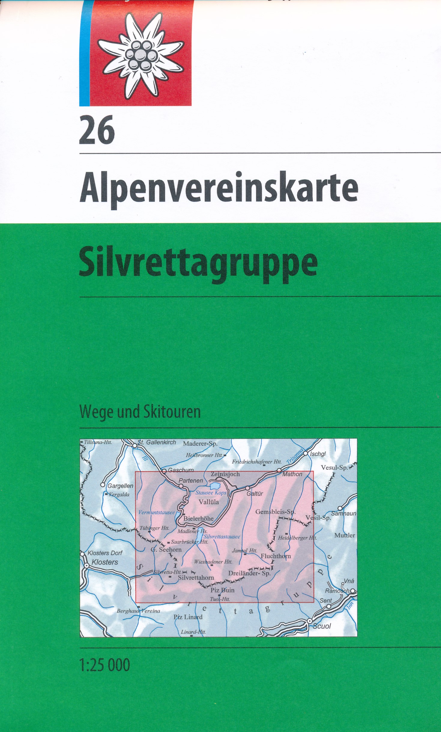
- Wandelkaart 26 Alpenvereinskarte Silvrettagruppe | Alpenverein
- De beste en meest gedetailleerde kaarten van met name de Oostenrijkse alpen: wandelroutes zijn naar zwaarte onderscheidend gemarkeerd, gletsjeroverschrijdingen staan aangegeven en de verschillende soorten hutten ingetekend. Met als ondergrond de topografische kaarten bieden ze een schat aan informatie voor elke beginnende en gevorderde... Read more
- Also available from:
- Stanfords, United Kingdom

United Kingdom
2018
- Silvretta Alpenverein KOMBI Map 26
- Silvretta area of the Alps in a hiking edition at 1:25,000 from a series of detailed, GPS compatible maps published by the DAV - Deutscher Alpenverein and produced by the German and Austrian Alpine Clubs using cartography from their respective survey organizations. Maps in this series have topography vividly presented by contours at 20 metres... Read more

Netherlands
2012
- Wandelkaart 07 Valli Maira, grana e stura | IGC - Istituto Geografico Centrale
- Maira, Grana and Stura Valleys, map no. 7, in a series contoured hiking maps at 1:50,000 with local trails, long-distance footpaths, mountain accommodation, etc. from the Turin based Istituto Geografico Centrale covering the Italian Alps and Piedmont, the lakes and northern Lombardy, and the Italian Riviera.The maps have contours at 50m... Read more
- Also available from:
- Stanfords, United Kingdom

United Kingdom
2012
- Maira, Grana and Stura Valleys IGC 7
- Maira, Grana and Stura Valleys in a series contoured hiking maps at 1:50,000 with local trails, long-distance footpaths, mountain accommodation, etc. from the Turin based Istituto Geografico Centrale.Maps in this series have contours at 50m intervals, enhanced by shading and graphic relief. An overprint highlights local footpaths and... Read more

Netherlands
2017
- Wandelkaart 15 Finale Ligure Alassio Savona | IGC - Istituto Geografico Centrale
- The coast of the Italian Riviera around Albenga, Alassio and Savona in a series contoured hiking maps at 1:50,000 with local trails, long-distance footpaths, mountain accommodation, etc. from the Turin based Istituto Geografico Centrale.Maps in this series have contours at 50m intervals, enhanced by shading and graphic relief. An overprint... Read more
- Also available from:
- Stanfords, United Kingdom

United Kingdom
2017
- Finale Ligure - Alassio - Savona IGC 15
- The coast of the Italian Riviera around Albenga, Alassio and Savona in a series contoured hiking maps at 1:50,000 with local trails, long-distance footpaths, mountain accommodation, etc. from the Turin based Istituto Geografico Centrale.Maps in this series have contours at 50m intervals, enhanced by shading and graphic relief. An overprint... Read more

Netherlands
2011
- Wandelkaart 09 Ivrea, Biella e Bassa Valle d'Aosta | IGC - Istituto Geografico Centrale
- Ivrea - Biela - Lower Aosta Valley, map no. 9, in a series contoured hiking maps at 1:50,000 with local trails, long-distance footpaths, mountain accommodation, etc. from the Turin based Istituto Geografico Centrale covering the Italian Alps and Piedmont, the lakes and northern Lombardy, and the Italian Riviera.The maps have contours at 50m... Read more
- Also available from:
- Stanfords, United Kingdom

United Kingdom
2011
- Ivrea - Biela - Lower Aosta Valley 50K IGC Map No. 9
- Ivrea - Biela - Lower Aosta Valley area in a series contoured hiking maps at 1:50,000 with local trails, long-distance footpaths, mountain accommodation, etc. from the Turin based Istituto Geografico Centrale. Maps in this series have contours at 50m intervals, enhanced by shading and graphic relief. An overprint highlights local footpaths and... Read more

Netherlands
2012
- Wandelkaart 24 Il Cuneese - Cuneo | IGC - Istituto Geografico Centrale
- Il Cuneese, map no. 24, in a series contoured hiking maps at 1:50,000 with local trails, long-distance footpaths, mountain accommodation, etc. from the Turin based Istituto Geografico Centrale covering the Italian Alps and Piedmont, the lakes and northern Lombardy, and the Italian Riviera.The maps have contours at 50m intervals, enhanced by... Read more
- Also available from:
- Stanfords, United Kingdom

United Kingdom
2012
- Il Cuneese: Cuneo - Saluzzo - Carmagnola 75K IGC Map No. 24
- Il Cuneese area of Piedmont, including Cuneo, Saluzzo and Carmagnola, at 1:75,000 in a series contoured hiking maps with local trails, long-distance footpaths, mountain accommodation, etc. from the Turin based Istituto Geografico Centrale. This title also includes an overprint showing cycle routes.Maps in this series have contours at 50m... Read more

Netherlands
2017
- Wandelkaart 06 Monviso | IGC - Istituto Geografico Centrale
- Monviso / Monte Viso cross-border area with coverage from Châteaux Queyras to Sampeyre and from the Grand Queyron to the Aiguille de Chambeyron in a series contoured hiking maps at 1:50,000 with local trails, long-distance footpaths, mountain accommodation, etc. from the Turin based Istituto Geografico Centrale.Maps in this series have contours... Read more
- Also available from:
- Stanfords, United Kingdom

United Kingdom
2017
- Monviso IGC 6
- Monviso / Monte Viso cross-border area with coverage from Châteaux Queyras to Sampeyre and from the Grand Queyron to the Aiguille de Chambeyron in a series contoured hiking maps at 1:50,000 with local trails, long-distance footpaths, mountain accommodation, etc. from the Turin based Istituto Geografico Centrale.Maps in this series have contours... Read more

- Also available from:
- Stanfords, United Kingdom

United Kingdom
2019
- Langhe Meridionali IGC 18
- The southern part of the Langhe region of Piedmont, famous for its wines, cheeses, and truffles, in a series contoured hiking maps at 1:50,000 with local trails, long-distance footpaths, mountain accommodation, etc. from the Turin based Istituto Geografico Centrale.Maps in this series have contours at 50m intervals, enhanced by shading and... Read more