
Jura
Beschrijving

The Jura is the mountain range west and north of the Lake of Geneva, roughly situated between Mulhouse and Lyon, shared by France and Switzerland. The Jurassic period of our geoglogical timescale derives its name of this mountain range. The mountains are much older than the Alps. Large forests, long worn ridges, rich grounds: it is a very good area for hiking. The GR5 - E2 traverses the northern part of the Jura. GR9 - E4 lie in the southern part.
Kaart


Paden in deze regio
Links
Feiten
Verslagen
Gidsen en kaarten
Overnachting
Organisaties
Reisorganisaties
GPS
Anders
Boeken
De Zwerver
Netherlands
2013
Netherlands
2013
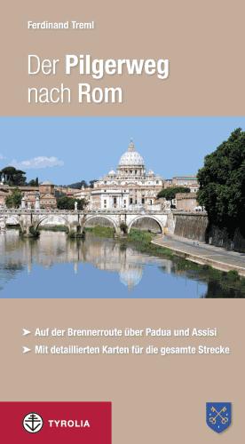
- Wandelgids - Pelgrimsroute Der Pilgerweg nach Rom | Tyrolia
- Auf der Brennerroute über Padua und Assisi. Abt-Albert-von Stade-Weg, Antoniusweg Cammino di Sant´Antonio, Franziskusweg Cammino di Assisi, Romweg Via di Roma. Mit detaillierten Karten für die gesamte Strecke. Read more

De Zwerver
Netherlands
2022
Netherlands
2022
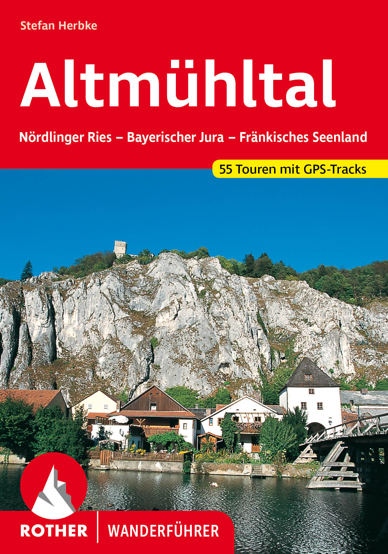
- Wandelgids Altmühltal | Rother Bergverlag
- Uitstekende wandelgids met een groot aantal dagtochten in dal en hooggebergte. Met praktische informatie en beperkt kaartmateriaal! Wandelingen in verschillende zwaarte weergegeven in rood/blauw/zwart. Über 50 Wanderungen in einer vielfältigen Mittelgebirgslandschaft Das gute liegt oft so nah, das Altmühltal liegt für Viele sogar fast vor der... Read more

De Zwerver
Netherlands
2019
Netherlands
2019
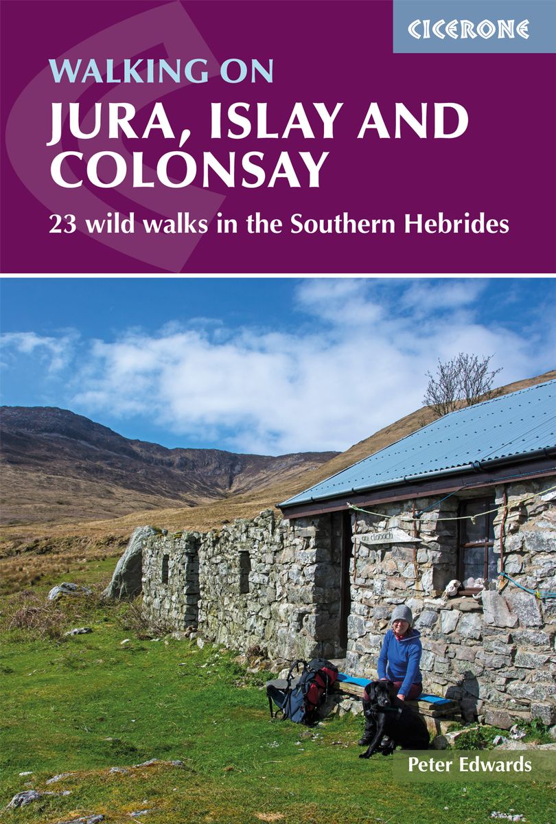
- Wandelgids Walking on Jura, Islay and Colonsay | Cicerone
- Guidebook to Jura, Scarba, Islay and Colonsay in the Hebrides, describing 22 walks plus a 5-day 89km trek along Jura's remote west coast. The routes range from 6.5 to 25km and cover rough - and often pathless - terrain suitable for fit, competent walkers. Even the coastal walks offer challenges. Read more
- Also available from:
- Stanfords, United Kingdom

Stanfords
United Kingdom
2019
United Kingdom
2019
- Walking on Jura, Islay and Colonsay: 23 wild walks in the Southern Hebrides
- This guidebook presents a selection of 23 walking routes on the wild and beautiful southern islands of Scotland`s Inner Hebrides, with nine walks on Jura, one on neighbouring Scarba, seven on Islay and five on Colonsay, plus a spectacular 5-day trek along Jura`s dramatic west coast. The wildest of the southern Hebrides, the walking on Jura is... Read more

De Zwerver
Netherlands
2022
Netherlands
2022
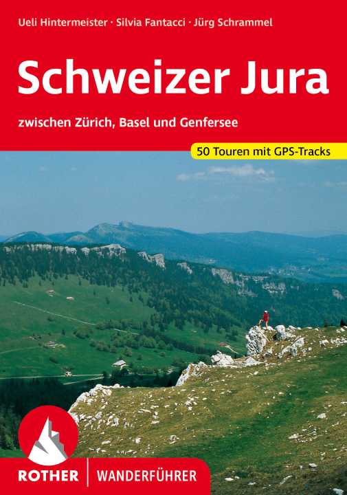
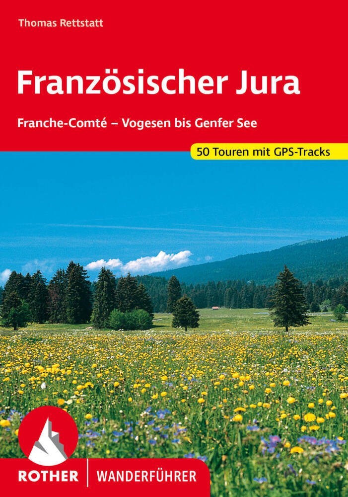
- Wandelgids 252 Französischer Jura | Rother Bergverlag
- Uitstekende wandelgids met 52 dagtochten in dal en hoger gelegen delen van het gebergte. Met praktische informatie en beperkt kaartmateriaal! Wandelingen in verschillende zwaarte weergegeven in rood/blauw/zwart. Deze wandelgidsen uitgever staat hoog aangeschreven en is een begrip onder de wandelaars! Der Jura ist eine der abwechslungsreichsten... Read more

De Zwerver
Netherlands
2023
Netherlands
2023
De Zwerver
Netherlands
2020
Netherlands
2020

De Zwerver
Netherlands
2009
Netherlands
2009
- Wandelgids GR 5 Mer Du Nord-Mediterrannee Noordzee - Middellandse Zee deel Ardennen (Maastricht - Diekirch ) | GR Sentiers
- LET OP: deze wandelgids van dit deel van de GR5 is alleen nog maar in het Frans leverbaar. De Nederlandstalige versie is geheel uitverkocht, niet meer te bestellen en er komt naar alle waarschijnlijkheid geen nieuwe versie in het Nederlands! Uitstekende routegids met gedetailleerde kaarten en een routebeschrijving. Fout lopen wordt op deze... Read more
De Zwerver
Netherlands
2013
Netherlands
2013
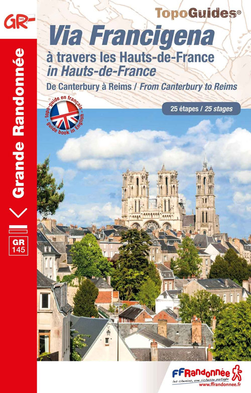
- Wandelgids 6551 Sentier vers Saint-Jacques-de-Compostela: Brussel - Parijs -Tours GR655 | FFRP
- Guide FFRandonnée Sentier vers Saint-Jacques-de-Compostelle : Bruxelles-Paris-Tours - 6551.La via Turonensis (ou voie de Tours/voie de Paris) est l'un des quatre chemins de France du pèlerinage de Saint-Jacques-de-Compostelle, le plus au nord. Voie la plus sereine et la plus ancienne, elle était historiquement la plus fréquentée.Au départ de... Read more


De Zwerver
Netherlands
2024
Netherlands
2024
Kaarten

De Zwerver
Netherlands
2020
Netherlands
2020
- Wandelatlas - Pelgrimsroute (kaart) 161 Chemins de Compostelle GR65 | Michelin
- Véritable petit atlas détaillant chaque étape avec indications précises concernant les villes de départ et d'arrivée ainsi que pour les localités traversées (auberges, refuges, restaurants, pharmacies, gare, épiceries, Km parcourus, Km restants....).Ce petit atlas suit le chemin du... Read more

De Zwerver
Netherlands
2016
Netherlands
2016
- Wandelgids The Cretan Way E4 | Anavasi
- The Cretan Way is a 500km walking route which takes you from east to west across the varied and spectacular landscapes of Crete. It is the ideal way to discover the rural, mountainous and costal regions of this incredible island. This guide is based on a 28-day walk.This guide includes practical information, maps at a scale of 1:25.000 of... Read more
- Also available from:
- Stanfords, United Kingdom

Stanfords
United Kingdom
2016
United Kingdom
2016
- The Cretan Way - A 28 Day Walk
- The Cretan Way is a 500km walking route which takes you from east to west across the varied and spectacular landscapes of Crete. It is the ideal way to discover the rural, mountainous and costal regions of this incredible island. This guide is based on a 28-day walk.This guide includes practical information, maps at a scale of 1:25.000 of... Read more
De Zwerver
Netherlands
2022
Netherlands
2022
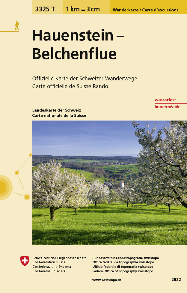
- Wandelkaart - Topografische kaart 3325T Hauenstein - Belchenflue | Swisstopo
- Hauenstein - Belchenflue area of the Swiss Jura at 1:33,333 on light, waterproof and tear-resistant map No. 3325T published by Swisstopo in cooperation with the Swiss Hiking Federation. Cartography is the same as in Swisstopo’s 50K hiking maps, simply enlarged to 1:33,333 for extra clarity but without additional information. The title includes... Read more
- Also available from:
- Stanfords, United Kingdom

Stanfords
United Kingdom
2022
United Kingdom
2022
- Hauenstein - Belchenflue Swisstopo Hiking 3325T
- Hauenstein - Belchenflue area of the Swiss Jura at 1:33,333 on light, waterproof and tear-resistant map No. 3325T published by Swisstopo in cooperation with the Swiss Hiking Federation. Cartography is the same as in Swisstopo’s 50K hiking maps, simply enlarged to 1:33,333 for extra clarity but without additional information. The title includes... Read more
De Zwerver
Netherlands
Netherlands
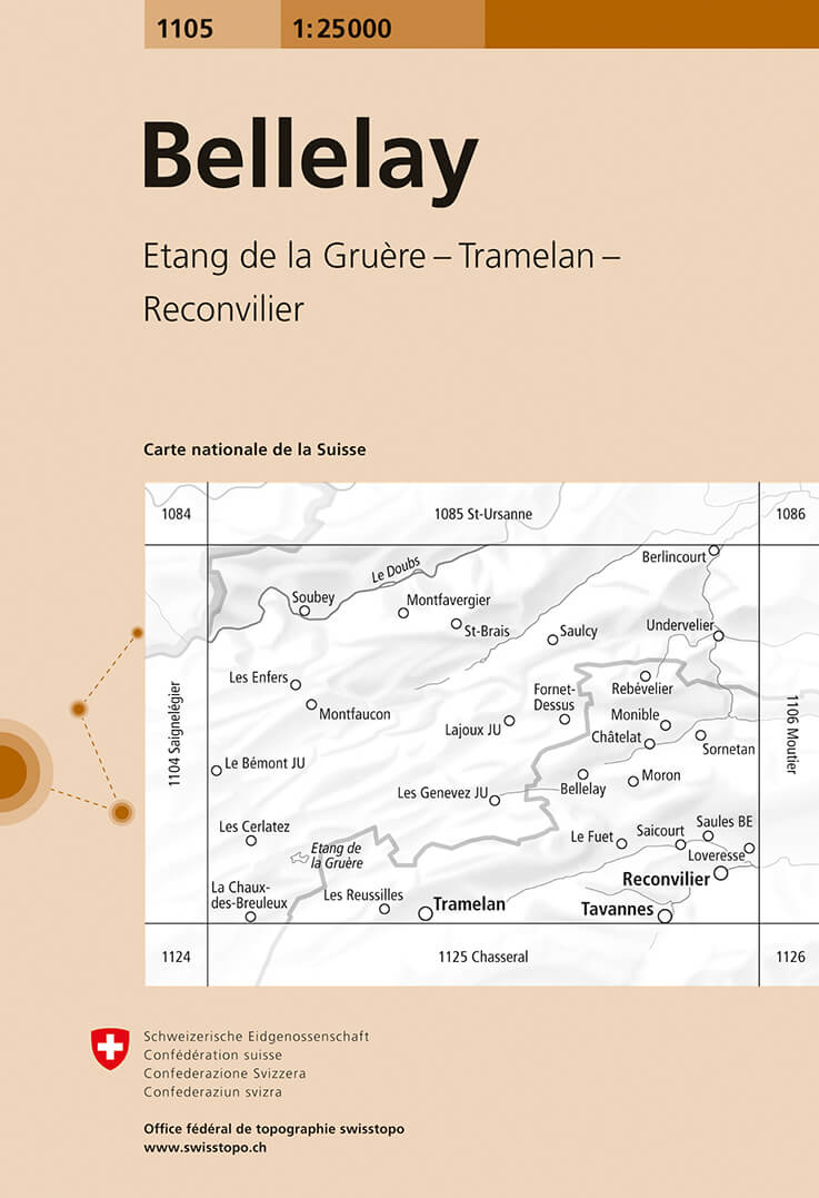
- Wandelkaart - Topografische kaart 1105 Bellelay | Swisstopo
- Map No. 1105, Bellelay, in the topographic survey of Switzerland at 1:25,000 from Bundesamt f Read more
- Also available from:
- Stanfords, United Kingdom

Stanfords
United Kingdom
United Kingdom
- Bellelay Swisstopo 1105
- Map No. 1105, Bellelay, in the topographic survey of Switzerland at 1:25,000 from Bundesamt für Landestopographie (swisstopo), covering the whole country on 247 small format sheets, with special larger maps published for popular regions including some titles now available in hiking versions.Highly regarded for their superb use of graphic relief... Read more
De Zwerver
Netherlands
Netherlands
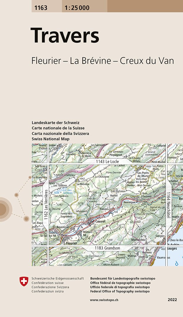
- Wandelkaart - Topografische kaart 1163 Travers | Swisstopo
- Map No. 1163, Travers, in the topographic survey of Switzerland at 1:25,000 from Bundesamt f Read more
- Also available from:
- Stanfords, United Kingdom

Stanfords
United Kingdom
United Kingdom
- Travers Swisstopo 1163
- Map No. 1163, Travers, in the topographic survey of Switzerland at 1:25,000 from Bundesamt für Landestopographie (swisstopo), covering the whole country on 247 small format sheets, with special larger maps published for popular regions including some titles now available in hiking versions.Highly regarded for their superb use of graphic relief... Read more

De Zwerver
Netherlands
Netherlands
- Wandelkaart 3 Stara Planina gebergte | Domino
- Stara Planina Western: Belogradchik to Berkovita map at 1:50,000 from Bulgarian publishers Domino, contoured and GPS compatible, with hiking trails, accommodation options including a list of local mountain refuges, etc. The map is double-sided and covers the mountains from the peak of Byala Voda near Belogradchik eastwards to just beyond... Read more
- Also available from:
- Stanfords, United Kingdom

Stanfords
United Kingdom
United Kingdom
- Stara Planina Western: Belogradchik to Berkovita Domino Map
- Stara Planina Western: Belogradchik to Berkovita map at 1:50,000 from Bulgarian publishers Domino, contoured and GPS compatible, with hiking trails, accommodation options including a list of local mountain refuges, etc. The map is double-sided and covers the mountains from the peak of Byala Voda near Belogradchik eastwards to just beyond... Read more
De Zwerver
Netherlands
Netherlands
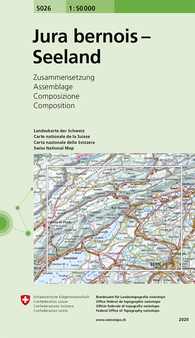
- Wandelkaart - Topografische kaart 5026 Jura Bernois - Seeland | Swisstopo
- Bernese Jura and Lakes, map No. 5026, in the standard topographic survey of Switzerland at 1:50,000 from Swisstopo, i.e. without the special overprint highlighting walking trails, local bus stops, etc, presented in Swisstopo Read more
- Also available from:
- Stanfords, United Kingdom

Stanfords
United Kingdom
United Kingdom
- Bernese Jura and Lakes Swisstopo 5026
- Bernese Jura and Lakes, map No. 5026, in the standard topographic survey of Switzerland at 1:50,000 from Swisstopo, i.e. without the special overprint highlighting walking trails, local bus stops, etc, presented in Swisstopo’s hiking editions of the 50K survey. Highly regarded for their superb use of graphic relief and hill shading, the maps... Read more

De Zwerver
Netherlands
Netherlands
- Wandelkaart - Fietskaart - Wegenkaart - landkaart 450 Eastern Crete - Kreta Oost | Terrain maps
- Eastern Crete at 1:100,000 on an indexed, GPS compatible road map from Terrain Editions, printed on light, waterproof and tear-resistant plastic paper, with a street plan of central Aghios Nikolaos.This title is part of a series which covers Crete in three sheets. The maps have contours at 100m intervals, enhanced by relief shading with spot... Read more
- Also available from:
- Stanfords, United Kingdom

Stanfords
United Kingdom
United Kingdom
- Eastern Crete Terrain Editions 450
- Eastern Crete at 1:100,000 on an indexed, GPS compatible road map from Terrain Editions, printed on light, waterproof and tear-resistant plastic paper, with a street plan of central Aghios Nikolaos.This title is part of a series which covers Crete in three sheets. The maps have contours at 100m intervals, enhanced by relief shading with spot... Read more
De Zwerver
Netherlands
2011
Netherlands
2011
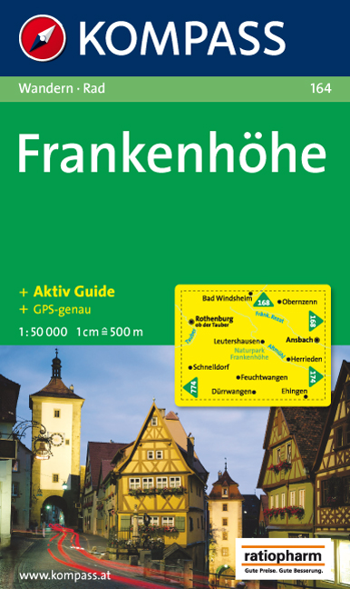
- Wandelkaart 164 Frankenhöhe | Kompass
- Goede wandelkaart met vrijwel alle topografische details en ingetekende routes. Ook met symbolen voor toeristische bezienswaardigheden, register. Berghutten duidelijk weergegeven. Gevaarlijke wandelroutes zijn goed herkenbaar. GPS toepasbaar. KOMPASS-Wanderkarten enthalten alles Wissenswerte für Wanderer wie aktuelle Wanderwege mit... Read more

De Zwerver
Netherlands
Netherlands
- Wandelkaart 05 Outdoorkarte FR Elsass - Colmar - Sélestat - Elzas | Kümmerly & Frey
- The central part of Alsace around Colmar and Sélestat on a GPS compatible, double-sided map at 1:50,000 from Kümmerly+Frey printed on sturdy, waterproof and tear-resistant synthetic paper; contoured, with hiking and cycling routes, sites for other recreational activities, various accommodation options, restaurants and ferme-auberge locations,... Read more
- Also available from:
- Stanfords, United Kingdom

Stanfords
United Kingdom
United Kingdom
- Alsace - Colmar - Sélestat - Freiburg im Breisgau - Lahr K+F Outdoor Map 5
- The central part of Alsace around Colmar and Sélestat on a GPS compatible, double-sided map at 1:50,000 from Kümmerly+Frey printed on sturdy, waterproof and tear-resistant synthetic paper; contoured, with hiking and cycling routes, sites for other recreational activities, various accommodation options, restaurants and ferme-auberge locations,... Read more
De Zwerver
Netherlands
Netherlands
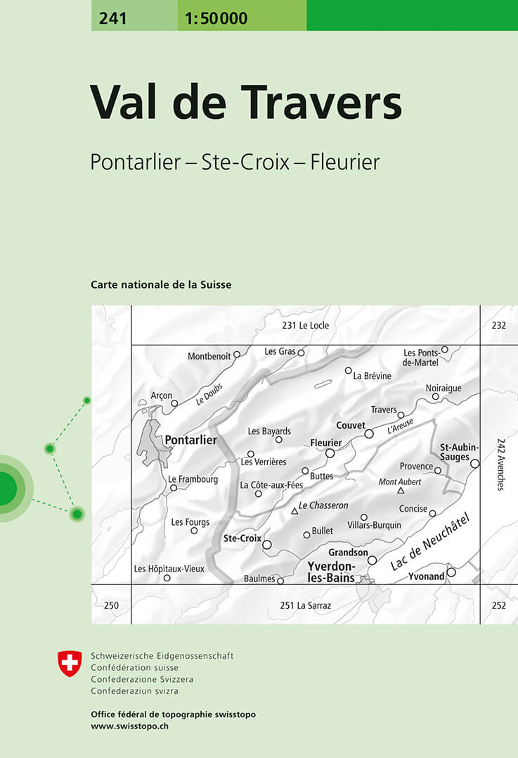
- Wandelkaart - Topografische kaart 241 Val de Travers | Swisstopo
- Val de Travers, map No. 241, in the standard topographic survey of Switzerland at 1:50,000 from Swisstopo, i.e. without the special overprint highlighting walking trails, local bus stops, etc, presented in Swisstopo Read more
- Also available from:
- Stanfords, United Kingdom

Stanfords
United Kingdom
United Kingdom
- Val de Travers Swisstopo 241
- Val de Travers, map No. 241, in the standard topographic survey of Switzerland at 1:50,000 from Swisstopo, i.e. without the special overprint highlighting walking trails, local bus stops, etc, presented in Swisstopo’s hiking editions of the 50K survey. Coverage extends across the French border to include Pontalier.Highly regarded for their... Read more