
Jefferson National Forest
Beschrijving
Paden in deze regio
Links
Feiten
Verslagen
Gidsen en kaarten
Overnachting
Organisaties
Reisorganisaties
GPS
Anders
Boeken

De Zwerver
Netherlands
2018
Netherlands
2018
- Wandelgids USA: Appalachian Trail | Conrad Stein Verlag
- Handzame overzichtsgids van deze geweldige en uitdagende lange afstands wandeling in het oosten van de USA: de Appalachian Trail. Het is een ideale gids om de hele tocht voor te bereiden en als basisgids bij je te hebben. Goede beschrijvingen van etappes en veel praktische informatie. Het enige wat mager is zijn dekaarten: goed voor overzicht... Read more


De Zwerver
Netherlands
Netherlands

Bol.com
Netherlands
Netherlands
- My Appalachian Trial II
- Steve Adams, a retired, overweight, 61-year-old Brit, who had never hiked in his life, decided one day that he wanted an adventure. Not willing to settle for just any old adventure, he decided to hike the entire length of Americas Appalachian Trail, a beguiling attraction for many hikers, both home-grown and from all corners of the globe.... Read more
- Also available from:
- Bol.com, Belgium
- The Book Depository, United Kingdom
Bol.com
Belgium
Belgium
- My Appalachian Trial II
- Steve Adams, a retired, overweight, 61-year-old Brit, who had never hiked in his life, decided one day that he wanted an adventure. Not willing to settle for just any old adventure, he decided to hike the entire length of Americas Appalachian Trail, a beguiling attraction for many hikers, both home-grown and from all corners of the globe.... Read more


Bol.com
Netherlands
Netherlands
- Wildflowers of the Appalachian Trail
- Wildflowers of the Appalachian Trail is the go-to resource for anyone interested in the wildflowers found along the 2,175-mile-long Appalachian National Scenic Trail. Stunning full-page color photos by Joe Cook and Monica Cook accompany the detailed descriptions by author Leonard Adkins. Also included for many of the 94 flowers profiled in the... Read more
- Also available from:
- Bol.com, Belgium
Bol.com
Belgium
Belgium
- Wildflowers of the Appalachian Trail
- Wildflowers of the Appalachian Trail is the go-to resource for anyone interested in the wildflowers found along the 2,175-mile-long Appalachian National Scenic Trail. Stunning full-page color photos by Joe Cook and Monica Cook accompany the detailed descriptions by author Leonard Adkins. Also included for many of the 94 flowers profiled in the... Read more
Bol.com
Netherlands
Netherlands
- A Door Into Another Land
- A door into another land describes the adventures of Chris “Windscreen” Homan and everything it means to hike the Appalachian Trail. Chris has just spent two years doing a dangerous and exhausting job in Iraq during the surge of US forces, and he wants to do something that he has never done before. Drawing inspiration from Bill... Read more
- Also available from:
- Bol.com, Belgium
Bol.com
Belgium
Belgium
- A Door Into Another Land
- A door into another land describes the adventures of Chris “Windscreen” Homan and everything it means to hike the Appalachian Trail. Chris has just spent two years doing a dangerous and exhausting job in Iraq during the surge of US forces, and he wants to do something that he has never done before. Drawing inspiration from Bill... Read more
Bol.com
Netherlands
Netherlands
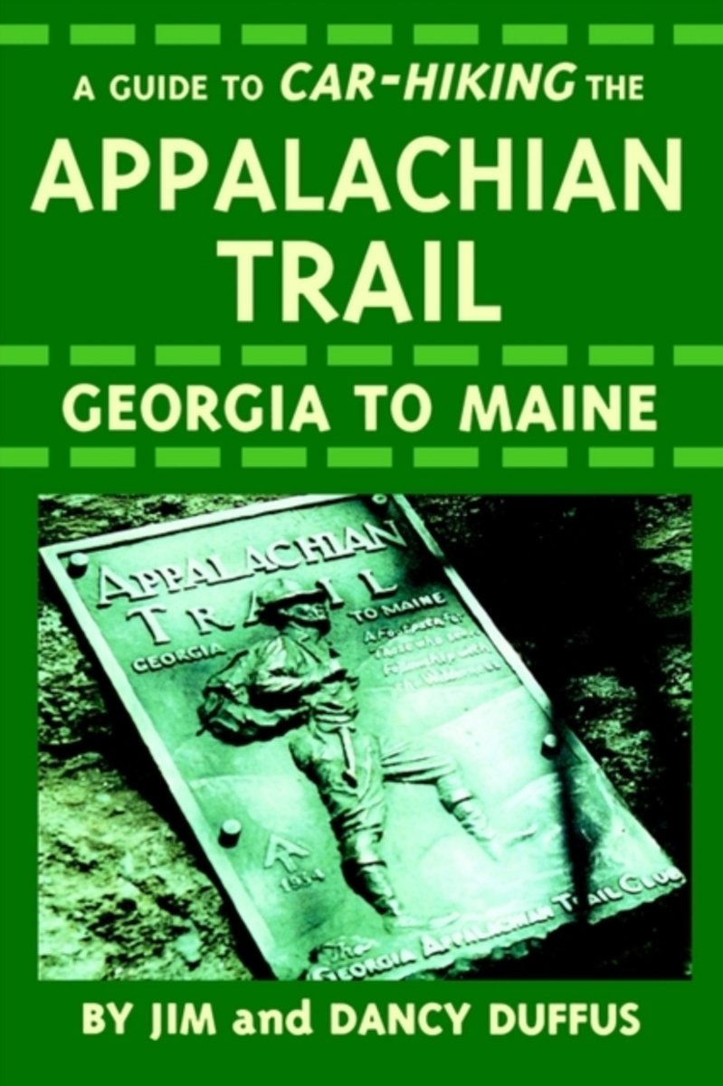
- A Guide to Car-Hiking the Appalachian Trail
- This treatise details Maxwell's theory of electromagnetism. The theory elaborated here inspired both Lorentz's theories on the electron and Einstein's theory of relativity. This volume deals with the theory of electricity, covering electrostatics and electrokinematics. Read more
- Also available from:
- Bol.com, Belgium
Bol.com
Belgium
Belgium
- A Guide to Car-Hiking the Appalachian Trail
- This treatise details Maxwell's theory of electromagnetism. The theory elaborated here inspired both Lorentz's theories on the electron and Einstein's theory of relativity. This volume deals with the theory of electricity, covering electrostatics and electrokinematics. Read more

Bol.com
Netherlands
Netherlands
- Appalachian Scenic Trail Wildlife
- The Appalachian Trail runs 2,175 miles from Springer Mountain in Georgia to Mount Katahdin in Maine, encompassing a myriad of ecosystems and inhabitants. This beautifully illustrated guide highlights over 140 familiar species of birds, mammals, reptiles, amphibians and insects (including the dreaded sweat bees). A map also features prominent... Read more
- Also available from:
- Bol.com, Belgium
Bol.com
Belgium
Belgium
- Appalachian Scenic Trail Wildlife
- The Appalachian Trail runs 2,175 miles from Springer Mountain in Georgia to Mount Katahdin in Maine, encompassing a myriad of ecosystems and inhabitants. This beautifully illustrated guide highlights over 140 familiar species of birds, mammals, reptiles, amphibians and insects (including the dreaded sweat bees). A map also features prominent... Read more
Bol.com
Netherlands
Netherlands
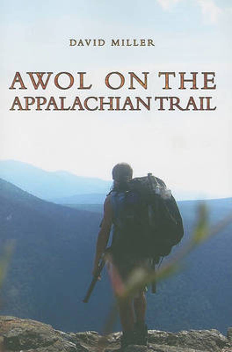
- AWOL on the Appalachian Trail
- In 2003, software engineer David Miller left his job, family, and friends to hike 2,172 miles of the Appalachian Trail. AWOL on the Appalachian Trail is Miller's account of this thru-hike from Georgia to Maine. Listeners are treated to rich descriptions of the Appalachian Mountains, the isolation and reverie, the inspiration that fueled his... Read more
- Also available from:
- Bol.com, Belgium
- The Book Depository, United Kingdom
Bol.com
Belgium
Belgium
- AWOL on the Appalachian Trail
- In 2003, software engineer David Miller left his job, family, and friends to hike 2,172 miles of the Appalachian Trail. AWOL on the Appalachian Trail is Miller's account of this thru-hike from Georgia to Maine. Listeners are treated to rich descriptions of the Appalachian Mountains, the isolation and reverie, the inspiration that fueled his... Read more

Bol.com
Netherlands
Netherlands
- Appalachian Trail Design, Construction, and Maintenance
- This is the classic, comprehensive manual on how to build a footpath to withstand the beating of 8 million boots a year (some hitting the ground 5 million times), to rest lightly on the land, to preserve the natural resources around it, and to allow a true backcountry experience-all at the same time. It is addressed to those who work on the... Read more
- Also available from:
- Bol.com, Belgium
Bol.com
Belgium
Belgium
- Appalachian Trail Design, Construction, and Maintenance
- This is the classic, comprehensive manual on how to build a footpath to withstand the beating of 8 million boots a year (some hitting the ground 5 million times), to rest lightly on the land, to preserve the natural resources around it, and to allow a true backcountry experience-all at the same time. It is addressed to those who work on the... Read more

Bol.com
Netherlands
Netherlands
- Five-Star Trails
- The definitive guide to hiking in Asheville.Five-Star Trails: Asheville by accomplished hiker and writer Jennifer Pharr Davis covers 35 hikes in the greater Asheville region, from area nature preserves to treks along the Blue Ridge Parkway and in Great Smoky Mountains National Park. The Asheville resident has sought out her favorite hikes, as... Read more
- Also available from:
- Bol.com, Belgium
- The Book Depository, United Kingdom
Bol.com
Belgium
Belgium
- Five-Star Trails
- The definitive guide to hiking in Asheville.Five-Star Trails: Asheville by accomplished hiker and writer Jennifer Pharr Davis covers 35 hikes in the greater Asheville region, from area nature preserves to treks along the Blue Ridge Parkway and in Great Smoky Mountains National Park. The Asheville resident has sought out her favorite hikes, as... Read more

The Book Depository
United Kingdom
United Kingdom
- Five-Star Trails: Asheville
- 35 Spectacular Hikes in the Land of Sky Read more
Bol.com
Netherlands
Netherlands
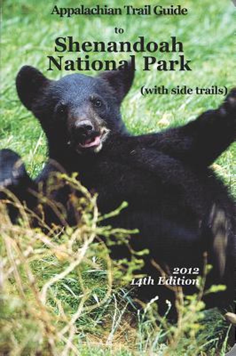
- Appalachian Trail Guide to Shenandoah National Park
- This is the official guide to the 107 miles of the Appalachian Trail that bisect Shenandoah National Park (the route of Skyline Drive, renowned for fall drives, was the original route of the A.T.). This book includes background information and trail-route descriptions for the A.T., as well as descriptions for about 400 miles of popular side... Read more
- Also available from:
- Bol.com, Belgium
Bol.com
Belgium
Belgium
- Appalachian Trail Guide to Shenandoah National Park
- This is the official guide to the 107 miles of the Appalachian Trail that bisect Shenandoah National Park (the route of Skyline Drive, renowned for fall drives, was the original route of the A.T.). This book includes background information and trail-route descriptions for the A.T., as well as descriptions for about 400 miles of popular side... Read more

Bol.com
Netherlands
Netherlands
- Blue Ridge Parkway
- One of the most beloved parks in the country, Blue Ridge Parkway, called America's Most Scenic Drive, is a 469-mile roadway that climbs the ridgelines and peaks of the Appalachian Mountains between Shenandoah National park and the Great Smoky Mountains. Historic sites such as gristmills, bridges, and one-room schoolhouses exist along the... Read more
- Also available from:
- Bol.com, Belgium
Bol.com
Belgium
Belgium
- Blue Ridge Parkway
- One of the most beloved parks in the country, Blue Ridge Parkway, called America's Most Scenic Drive, is a 469-mile roadway that climbs the ridgelines and peaks of the Appalachian Mountains between Shenandoah National park and the Great Smoky Mountains. Historic sites such as gristmills, bridges, and one-room schoolhouses exist along the... Read more
De Zwerver
Netherlands
Netherlands
- Also available from:
- Bol.com, Netherlands
- Bol.com, Belgium
- The Book Depository, United Kingdom
Bol.com
Netherlands
Netherlands
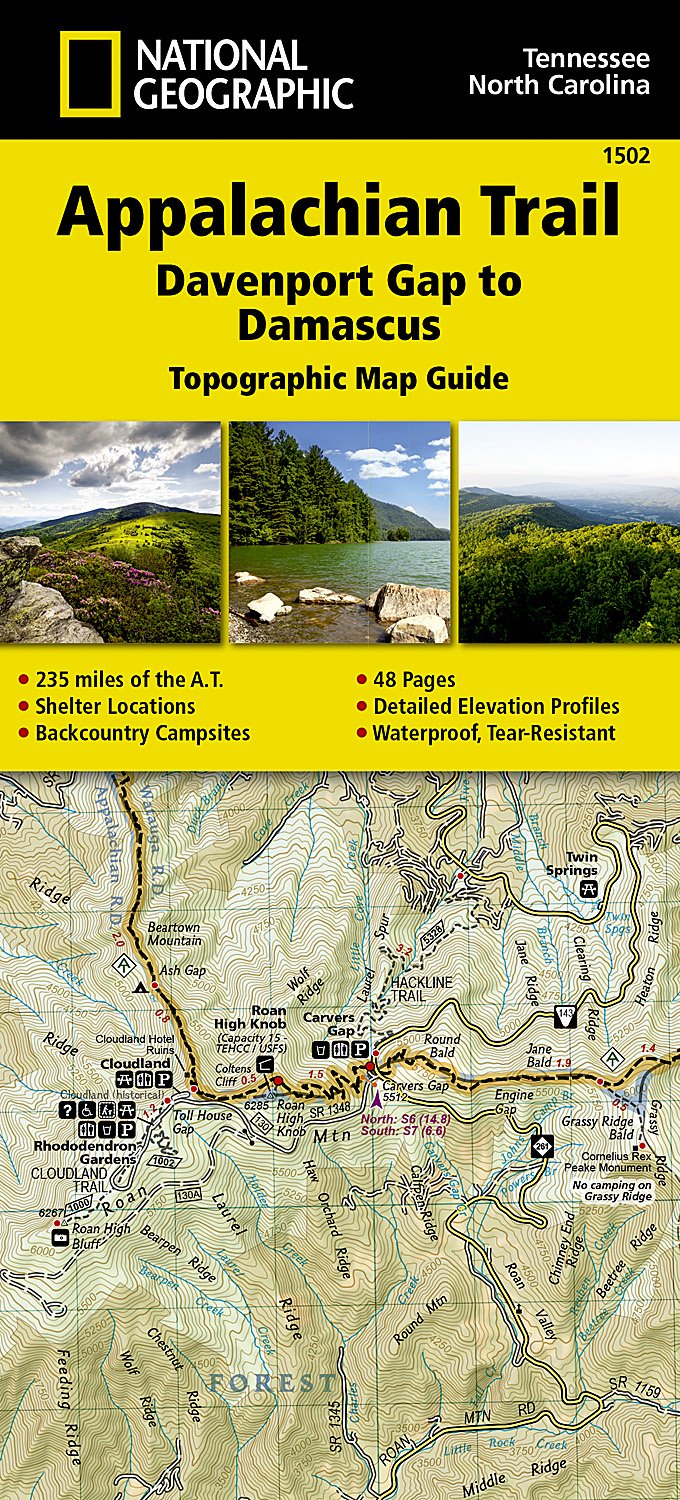
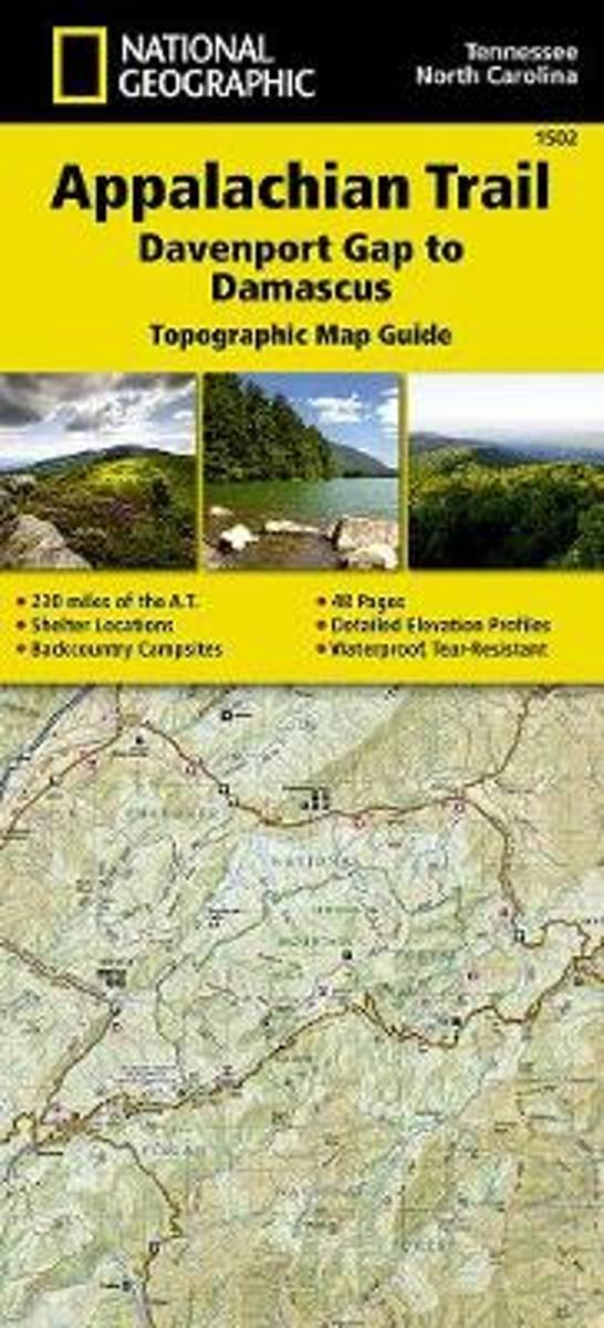
- Appalachian Trail, Davenport Gap To Damascus, North Carolina, Tennessee
- Waterproof Tear-Resistant Topographic Map GuideThe Davenport Gap to Damascus Topographic Map Guide makes a perfect traveling companion when traversing the northeastern Tennessee and western North Carolina section of the Appalachian Trail (A.T.). The A.T. in northeastern Tennessee and western North Carolina mostly follows a high, crooked... Read more
Bol.com
Belgium
Belgium
- Appalachian Trail, Davenport Gap To Damascus, North Carolina, Tennessee
- Waterproof Tear-Resistant Topographic Map GuideThe Davenport Gap to Damascus Topographic Map Guide makes a perfect traveling companion when traversing the northeastern Tennessee and western North Carolina section of the Appalachian Trail (A.T.). The A.T. in northeastern Tennessee and western North Carolina mostly follows a high, crooked... Read more

The Book Depository
United Kingdom
United Kingdom
Bol.com
Netherlands
Netherlands
- Appalachian Trail Thru-Hiker's Companion (2018)
- The champion of Appalachian Trail guides for long-distance hiking for a quarter-century! With professionally crafted elevation profiles, almost 50 updated maps, and redesigned tables for more at-a-glance information on-trail. Still the only such guide written by volunteers for which all the proceeds are returned to the Trail by these two... Read more
- Also available from:
- Bol.com, Belgium
Bol.com
Belgium
Belgium
- Appalachian Trail Thru-Hiker's Companion (2018)
- The champion of Appalachian Trail guides for long-distance hiking for a quarter-century! With professionally crafted elevation profiles, almost 50 updated maps, and redesigned tables for more at-a-glance information on-trail. Still the only such guide written by volunteers for which all the proceeds are returned to the Trail by these two... Read more
Kaarten

De Zwerver
Netherlands
Netherlands
- Wandelkaart - Topografische kaart 316 Cades Cove - Elkmont - Great Smoky Mountains National Park | National Geographic
- Prachtige geplastificeerde kaart van het bekende nationaal park. Met alle recreatieve voorzieningen als campsites, maar ook met topografische details en wandelroutes ed. Door uitgekiend kleurgebruik zeer prettig in gebruik. Scheur en watervast! This title provides an increased scale of one of the most visited National Parks in the US, and one... Read more
- Also available from:
- Bol.com, Netherlands
- Bol.com, Belgium
- Stanfords, United Kingdom

Bol.com
Netherlands
Netherlands
- Cades Cove/elkmont, Great Smoky Mountains National Park
- Waterproof Tear-Resistant Topographic MapThis title provides an increased scale of one of the most visited National Parks in the US, and one of our more popular map titles. This increased scale will provide greater detail to the backcountry users and Appalachian Trail through-hikers.Park Introduction:Great Smoky Mountains National Park is... Read more
Bol.com
Belgium
Belgium
- Cades Cove/elkmont, Great Smoky Mountains National Park
- Waterproof Tear-Resistant Topographic MapThis title provides an increased scale of one of the most visited National Parks in the US, and one of our more popular map titles. This increased scale will provide greater detail to the backcountry users and Appalachian Trail through-hikers.Park Introduction:Great Smoky Mountains National Park is... Read more

Stanfords
United Kingdom
United Kingdom
- Cades Cove - Elkmont - Great Smoky Mountains National Park NC/TN
- Map No. 316, Great Smoky Mountains National Park: Cades Cove - Elkmont, NC/TN, in an extensive series of GPS compatible, contoured hiking maps of USA’s national and state parks or forests and other popular recreational areas. Cartography based on the national topographic survey, with additional tourist information.The maps, with most titles now... Read more
Bol.com
Netherlands
Netherlands
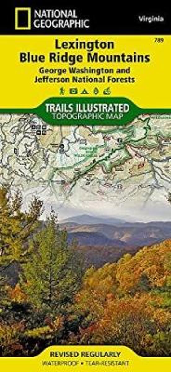
- Lexington/blue Ridge, G.w. & Jefferson National Forests
- Waterproof Tear-Resistant Topographic MapCoverage includes George Washington and Jefferson National Forest. Towns: Lexington, Buena Vista, Waynesboro, Bedford, Blue Ridge. Wilderness Areas: The Priest, Three Ridges, Saint Mary's, Thunder Ridge, James River Face. Major Trails: Appalachian National Scenic Trail, Glenwood Horse Trail. Other... Read more
- Also available from:
- Bol.com, Belgium
- Stanfords, United Kingdom
Bol.com
Belgium
Belgium
- Lexington/blue Ridge, G.w. & Jefferson National Forests
- Waterproof Tear-Resistant Topographic MapCoverage includes George Washington and Jefferson National Forest. Towns: Lexington, Buena Vista, Waynesboro, Bedford, Blue Ridge. Wilderness Areas: The Priest, Three Ridges, Saint Mary's, Thunder Ridge, James River Face. Major Trails: Appalachian National Scenic Trail, Glenwood Horse Trail. Other... Read more

Stanfords
United Kingdom
United Kingdom
- Lexington - Blue Ridge Mts - George Washington and Jefferson NF VA
- Map No. 789, George Washington and Jefferson National Forest: Lexington - Blue Ridge, VA, in an extensive series of GPS compatible, contoured hiking maps of USA’s national and state parks or forests and other popular recreational areas. Cartography based on the national topographic survey, with additional tourist information.The maps, with most... Read more

Bol.com
Netherlands
Netherlands
- Springer & Cohutta Mountains, Chattahoochee National Forest
- Waterproof Tear-Resistant Topographic MapLocated just north of Atlanta, the Chattahoochee National Forest contains the southern terminus of the Appalachian Trail along with an abundance of recreational opportunities for outdoor enthusiasts of all interests.This detailed recreation map contains carefully researched trails, campsites,... Read more
- Also available from:
- Bol.com, Belgium
- Stanfords, United Kingdom
Bol.com
Belgium
Belgium
- Springer & Cohutta Mountains, Chattahoochee National Forest
- Waterproof Tear-Resistant Topographic MapLocated just north of Atlanta, the Chattahoochee National Forest contains the southern terminus of the Appalachian Trail along with an abundance of recreational opportunities for outdoor enthusiasts of all interests.This detailed recreation map contains carefully researched trails, campsites,... Read more

Stanfords
United Kingdom
United Kingdom
- Chattahoochee National Forest - Springer and Cohutta Mountains GA/SC 777
- Map No. 777, Chattahoochee National Forest: Springer and Cohutta Mountains, GA/SC, in an extensive series of GPS compatible, contoured hiking maps of USA’s national and state parks or forests and other popular recreational areas. Cartography based on the national topographic survey, with additional tourist information.The maps, with most titles... Read more

De Zwerver
Netherlands
Netherlands
- Wandelkaart - Topografische kaart 318 Mount Rogers High Country - Grayson Highlands State Park | National Geographic
- Prachtige geplastificeerde kaart van het bekende nationaal park. Met alle recreatieve voorzieningen als campsites, maar ook met topografische details en wandelroutes ed. Door uitgekiend kleurgebruik zeer prettig in gebruik. Scheur en watervast! National Geographic's Trails Illustrated map of Mount Rogers High Country and Grayson Highlands... Read more
- Also available from:
- Bol.com, Netherlands
- Bol.com, Belgium
- Stanfords, United Kingdom
- The Book Depository, United Kingdom

Bol.com
Netherlands
Netherlands
- Mount Rogers High Country
- Waterproof Tear-Resistant Topographic MapNational Geographic's Trails Illustrated map of Mount Rogers High Country and Grayson Highlands State Park, Southwest Virginia, is a two-sided, waterproof, topographic trail map designed to meet the needs of outdoor enthusiasts with unmatched durability and detail. This map was created in... Read more
Bol.com
Belgium
Belgium
- Mount Rogers High Country
- Waterproof Tear-Resistant Topographic MapNational Geographic's Trails Illustrated map of Mount Rogers High Country and Grayson Highlands State Park, Southwest Virginia, is a two-sided, waterproof, topographic trail map designed to meet the needs of outdoor enthusiasts with unmatched durability and detail. This map was created in... Read more

Stanfords
United Kingdom
United Kingdom
- Mount Rogers High Country VA
- Map No. 318 - Mount Rogers High Country in Virginia in an extensive series of GPS compatible, contoured hiking maps of USA’s national and state parks or forests and other popular recreational areas. Cartography based on the national topographic survey, with additional tourist information.The maps, with most titles now printed on light,... Read more

The Book Depository
United Kingdom
United Kingdom
- Mount Rogers High Country
- Trails Illustrated Other Rec. Areas Read more

De Zwerver
Netherlands
Netherlands
- Wandelkaart - Topografische kaart 747 Green Mountain National Forest North - Moosalamoo NRA - Rutland | National Geographic
- Prachtige geplastificeerde kaart van het bekende nationaal park. Met alle recreatieve voorzieningen als campsites, maar ook met topografische details en wandelroutes ed. Door uitgekiend kleurgebruik zeer prettig in gebruik. Scheur en watervast! National Geographic's Green Mountain National Forest North Trails Illustrated topographic map is... Read more
- Also available from:
- Bol.com, Netherlands
- Bol.com, Belgium
- Stanfords, United Kingdom
- The Book Depository, United Kingdom

Bol.com
Netherlands
Netherlands
- Green Mountains N.F., Moosalamoo NRA/Rutland
- Waterproof Tear-Resistant Topographic MapNational Geographic's Green Mountain National Forest North Trails Illustrated topographic map is the most comprehensive available for outdoor enthusiasts of all types. Designed to be easy-to-read, yet highly detailed this map includes a comprehensive road and trail network distinguishing between... Read more
Bol.com
Belgium
Belgium
- Green Mountains N.F., Moosalamoo NRA/Rutland
- Waterproof Tear-Resistant Topographic MapNational Geographic's Green Mountain National Forest North Trails Illustrated topographic map is the most comprehensive available for outdoor enthusiasts of all types. Designed to be easy-to-read, yet highly detailed this map includes a comprehensive road and trail network distinguishing between... Read more

Stanfords
United Kingdom
United Kingdom
- Green Mountain National Forest - Moosalamoo NRA - Rutland VT
- Map No. 747, Green Mountain National Forest: Moosalamoo NRA - Rutland area in Vermont, in an extensive series of GPS compatible, contoured hiking maps of USA’s national and state parks or forests and other popular recreational areas. Cartography based on the national topographic survey, with additional tourist information.The maps, with most... Read more

The Book Depository
United Kingdom
United Kingdom
- Green Mountains N.f., Moosalamoo Nra/rutland
- Trails Illustrated Other Rec. Areas Read more