
White Mountain National Forest
Beschrijving
Paden in deze regio
Links
Feiten
Verslagen
Gidsen en kaarten
Overnachting
Organisaties
Reisorganisaties
GPS
Anders
Boeken


De Zwerver
Netherlands
2018
Netherlands
2018
- Wandelgids USA: Appalachian Trail | Conrad Stein Verlag
- Handzame overzichtsgids van deze geweldige en uitdagende lange afstands wandeling in het oosten van de USA: de Appalachian Trail. Het is een ideale gids om de hele tocht voor te bereiden en als basisgids bij je te hebben. Goede beschrijvingen van etappes en veel praktische informatie. Het enige wat mager is zijn dekaarten: goed voor overzicht... Read more

De Zwerver
Netherlands
Netherlands
Bol.com
Netherlands
Netherlands
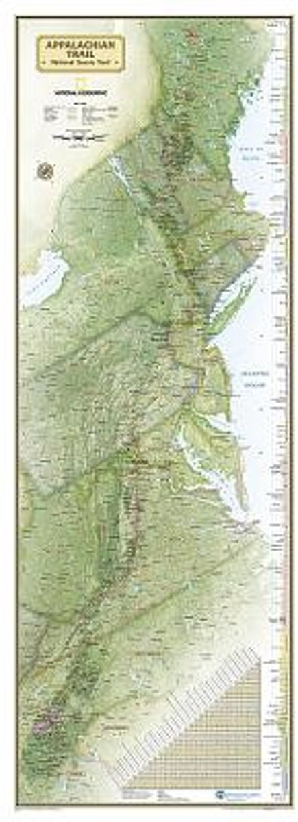
- Appalachian Trail Wall Map [Laminated]
- National Geographic's wall map of the Appalachian Trail is ideal for fans and hikers of this magnificent national scenic trail.Developed in cooperation with the Appalachian Trail Conservancy, this beautiful poster, measuring 48"x18", shows the entire length of the trail from Maine to Georgia. A unique elevation profiles highlight the trail's... Read more
- Also available from:
- Bol.com, Belgium
Bol.com
Belgium
Belgium
- Appalachian Trail Wall Map [Laminated]
- National Geographic's wall map of the Appalachian Trail is ideal for fans and hikers of this magnificent national scenic trail.Developed in cooperation with the Appalachian Trail Conservancy, this beautiful poster, measuring 48"x18", shows the entire length of the trail from Maine to Georgia. A unique elevation profiles highlight the trail's... Read more
Bol.com
Netherlands
Netherlands
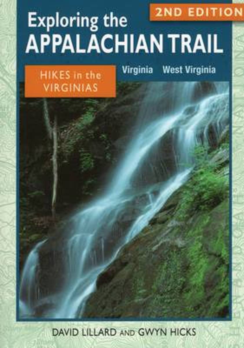
- Exploring the Appalachian Trail
- A guide to 46 day hikes and overnight trips in Virginia and West Virginia. Read more
- Also available from:
- Bol.com, Belgium
- The Book Depository, United Kingdom
Bol.com
Belgium
Belgium
- Exploring the Appalachian Trail
- A guide to 46 day hikes and overnight trips in Virginia and West Virginia. Read more

The Book Depository
United Kingdom
United Kingdom
- Exploring the Appalachian Trail: Hikes in the Virginias
- Virginia, West Virginia Read more

Bol.com
Netherlands
Netherlands
- A Pink Suitcase
- A Pink Suitcase brings together a talented group of daring women as they journey across the globe on adventures that are as unforgettable as they are moving. These intrepid explorers take on the world with wide eyes, an open heart and a woman's point of view. They tackle Mother Nature, dive into other cultures and try new things. And in the... Read more
- Also available from:
- Bol.com, Belgium
Bol.com
Belgium
Belgium
- A Pink Suitcase
- A Pink Suitcase brings together a talented group of daring women as they journey across the globe on adventures that are as unforgettable as they are moving. These intrepid explorers take on the world with wide eyes, an open heart and a woman's point of view. They tackle Mother Nature, dive into other cultures and try new things. And in the... Read more

Bol.com
Netherlands
Netherlands
- Fodor's Maine, Vermont & New Hampshire
- Written by locals, Fodor's travel guides have been offering expert advice for all tastes and budgets for more than 80 years. Northern New England is a classic American destination: iconic landscapes such as the rocky Maine coast, Vermont's Green Mountains, and New Hampshire's Lake District are all made for exploring. This full-color guide will... Read more
- Also available from:
- Bol.com, Belgium
Bol.com
Belgium
Belgium
- Fodor's Maine, Vermont & New Hampshire
- Written by locals, Fodor's travel guides have been offering expert advice for all tastes and budgets for more than 80 years. Northern New England is a classic American destination: iconic landscapes such as the rocky Maine coast, Vermont's Green Mountains, and New Hampshire's Lake District are all made for exploring. This full-color guide will... Read more
De Zwerver
Netherlands
Netherlands
- Also available from:
- Bol.com, Netherlands
- Bol.com, Belgium
- The Book Depository, United Kingdom

Bol.com
Netherlands
Netherlands
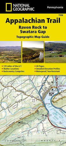
- Appalachian Trail, Raven Rock To Swatara Gap, Pennsylvania
- Waterproof Tear-Resistant Topographic MapThe Raven Rock to Swatara Gap Topographic Map Guide makes a perfect traveling companion when traversing the southeastern Pennsylvania section of the Appalachian Trail (A.T.). The map follows the ridges of the Appalachian Mountains, crosses the 12-mile wide, agriculturally rich Cumberland Valley,... Read more
Bol.com
Belgium
Belgium
- Appalachian Trail, Raven Rock To Swatara Gap, Pennsylvania
- Waterproof Tear-Resistant Topographic MapThe Raven Rock to Swatara Gap Topographic Map Guide makes a perfect traveling companion when traversing the southeastern Pennsylvania section of the Appalachian Trail (A.T.). The map follows the ridges of the Appalachian Mountains, crosses the 12-mile wide, agriculturally rich Cumberland Valley,... Read more

The Book Depository
United Kingdom
United Kingdom
- Appalachian Trail, Raven Rock To Swatara Gap, Pennsylvania
- Trails Illustrated Read more
Bol.com
Netherlands
Netherlands
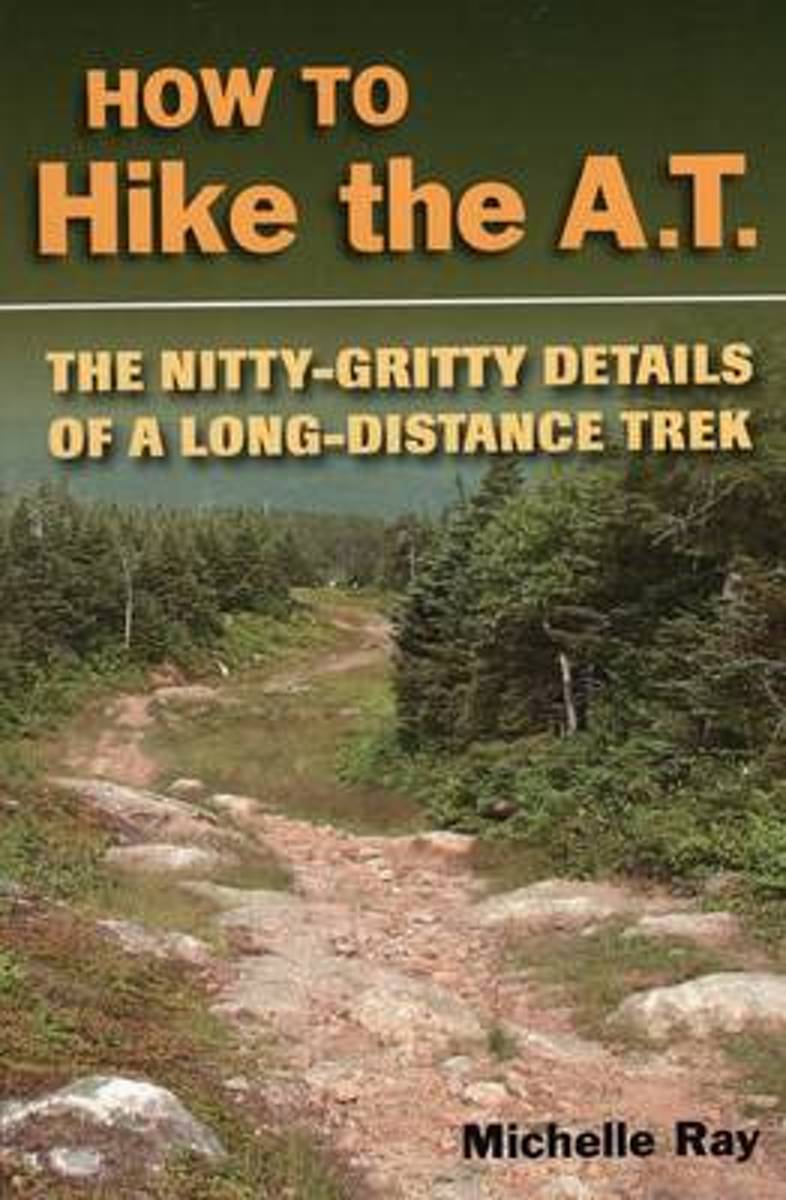
- How to Hike the A.T.
- How to plan and prepare for a long-distance hike on the Appalachian Trail. Includes information on trail nutrition, culture, first aid, gear, weather conditions, and more. Expert advice from an experienced long-distance hiker along with useful information for any long-distance trek. Read more
- Also available from:
- Bol.com, Belgium
- The Book Depository, United Kingdom
Bol.com
Belgium
Belgium
- How to Hike the A.T.
- How to plan and prepare for a long-distance hike on the Appalachian Trail. Includes information on trail nutrition, culture, first aid, gear, weather conditions, and more. Expert advice from an experienced long-distance hiker along with useful information for any long-distance trek. Read more

The Book Depository
United Kingdom
United Kingdom
- How to Hike the A.T.
- The Nitty-Gritty Details of a Long-Distance Trek Read more
Bol.com
Netherlands
Netherlands
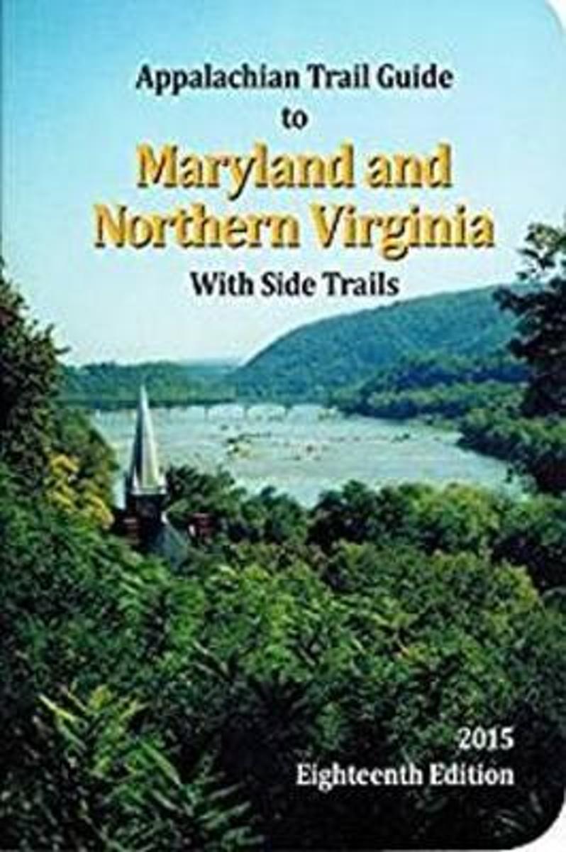
- Appalachian Trail Guide to Maryland-Northern Virginia
- The official guide to 95 miles of the Appalachian Trail from the Pennsylvania line, south through the center of Maryland, briefly into West Virginia through Harpers Ferry National Historical Park, and down along the West Virginia-Virginia line to the entrance to Shenandoah National Park. The book includes trail-route descriptions in a... Read more
- Also available from:
- Bol.com, Belgium
Bol.com
Belgium
Belgium
- Appalachian Trail Guide to Maryland-Northern Virginia
- The official guide to 95 miles of the Appalachian Trail from the Pennsylvania line, south through the center of Maryland, briefly into West Virginia through Harpers Ferry National Historical Park, and down along the West Virginia-Virginia line to the entrance to Shenandoah National Park. The book includes trail-route descriptions in a... Read more
Bol.com
Netherlands
Netherlands
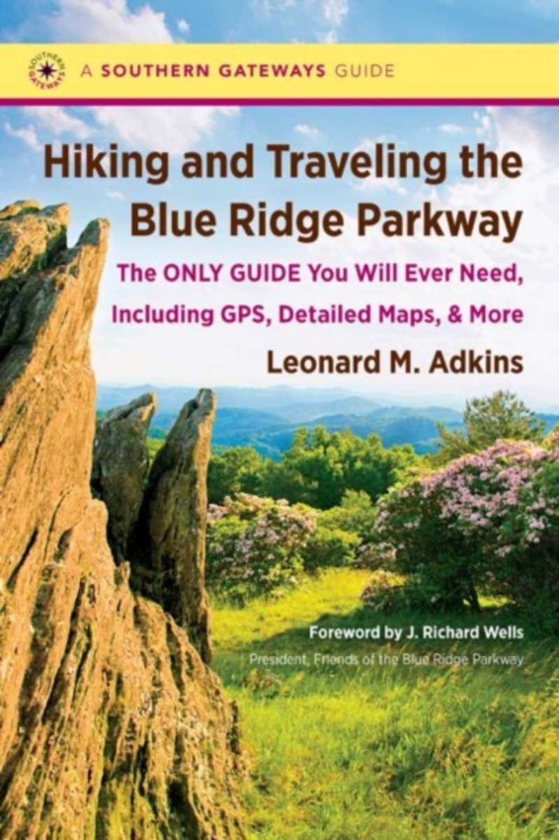
- Hiking and Traveling the Blue Ridge Parkway
- This comprehensive guidebook provides a detailed description of every official trail along the Blue Ridge Parkway. But that's just the beginning: veteran hiker Leonard M. Adkins includes information on every trail that touches the Parkway, including the Appalachian Trail, the Mountains-to-Sea Trail, and other public pathways on national park,... Read more
- Also available from:
- Bol.com, Belgium
Bol.com
Belgium
Belgium
- Hiking and Traveling the Blue Ridge Parkway
- This comprehensive guidebook provides a detailed description of every official trail along the Blue Ridge Parkway. But that's just the beginning: veteran hiker Leonard M. Adkins includes information on every trail that touches the Parkway, including the Appalachian Trail, the Mountains-to-Sea Trail, and other public pathways on national park,... Read more

Bol.com
Netherlands
Netherlands
- Finding Tarzan
- Engaged to be married and overweight, Jamie sets out to hike the Appalachian Trail not only to lose weight but to find herself. Her passion for hiking brought her to Georgia where she started her Flip Flop Style hike of the 2,100-mile trail. She soon finds her self in love in more than one way. A hiker named Tarzan helps her discover herself... Read more
- Also available from:
- Bol.com, Belgium
- The Book Depository, United Kingdom
Bol.com
Belgium
Belgium
- Finding Tarzan
- Engaged to be married and overweight, Jamie sets out to hike the Appalachian Trail not only to lose weight but to find herself. Her passion for hiking brought her to Georgia where she started her Flip Flop Style hike of the 2,100-mile trail. She soon finds her self in love in more than one way. A hiker named Tarzan helps her discover herself... Read more

The Book Depository
United Kingdom
United Kingdom
- Finding Tarzan
- Discovering true love on the Appalachian Trail Read more
Bol.com
Netherlands
Netherlands
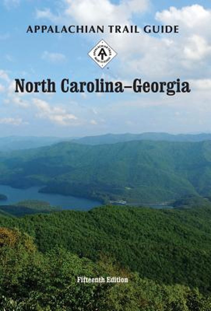
- Appalachian Trail Guide to North Carolina-Georgia
- The official guide to the 238 miles of the Appalachian Trail from its southern terminus on Springer Mountain in Georgia (about an hour north of Atlanta) to the eastern boundary of Great Smoky Mountains National Park on the North Carolina-Tennessee border. This guidebook comes with four five-color topographic maps printed on two sheets of... Read more
- Also available from:
- Bol.com, Belgium
Bol.com
Belgium
Belgium
- Appalachian Trail Guide to North Carolina-Georgia
- The official guide to the 238 miles of the Appalachian Trail from its southern terminus on Springer Mountain in Georgia (about an hour north of Atlanta) to the eastern boundary of Great Smoky Mountains National Park on the North Carolina-Tennessee border. This guidebook comes with four five-color topographic maps printed on two sheets of... Read more
- Also available from:
- Bol.com, Belgium
Bol.com
Netherlands
Netherlands
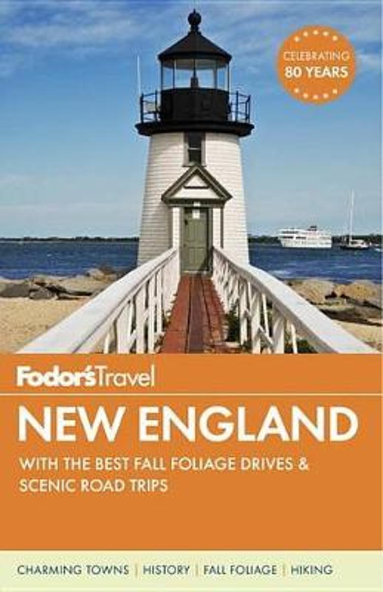
- Fodor's New England
- Written by locals, Fodor's travel guides have been offering expert advice for all tastes and budgets for 80 years. Fodor's New Englandhighlights the bestthis classic American destination has to offer: Boston's Revolutionary-era sites, Connecticut's antiques, Rhode Island's mansions, the rocky Maine coast, Vermont's Green Mountains, and New... Read more
- Also available from:
- Bol.com, Belgium
Bol.com
Belgium
Belgium
- Fodor's New England
- Written by locals, Fodor's travel guides have been offering expert advice for all tastes and budgets for 80 years. Fodor's New Englandhighlights the bestthis classic American destination has to offer: Boston's Revolutionary-era sites, Connecticut's antiques, Rhode Island's mansions, the rocky Maine coast, Vermont's Green Mountains, and New... Read more
Kaarten

Bol.com
Netherlands
Netherlands
- Springer & Cohutta Mountains, Chattahoochee National Forest
- Waterproof Tear-Resistant Topographic MapLocated just north of Atlanta, the Chattahoochee National Forest contains the southern terminus of the Appalachian Trail along with an abundance of recreational opportunities for outdoor enthusiasts of all interests.This detailed recreation map contains carefully researched trails, campsites,... Read more
- Also available from:
- Bol.com, Belgium
- Stanfords, United Kingdom
Bol.com
Belgium
Belgium
- Springer & Cohutta Mountains, Chattahoochee National Forest
- Waterproof Tear-Resistant Topographic MapLocated just north of Atlanta, the Chattahoochee National Forest contains the southern terminus of the Appalachian Trail along with an abundance of recreational opportunities for outdoor enthusiasts of all interests.This detailed recreation map contains carefully researched trails, campsites,... Read more

Stanfords
United Kingdom
United Kingdom
- Chattahoochee National Forest - Springer and Cohutta Mountains GA/SC 777
- Map No. 777, Chattahoochee National Forest: Springer and Cohutta Mountains, GA/SC, in an extensive series of GPS compatible, contoured hiking maps of USA’s national and state parks or forests and other popular recreational areas. Cartography based on the national topographic survey, with additional tourist information.The maps, with most titles... Read more

De Zwerver
Netherlands
Netherlands
- Wandelkaart - Topografische kaart 318 Mount Rogers High Country - Grayson Highlands State Park | National Geographic
- Prachtige geplastificeerde kaart van het bekende nationaal park. Met alle recreatieve voorzieningen als campsites, maar ook met topografische details en wandelroutes ed. Door uitgekiend kleurgebruik zeer prettig in gebruik. Scheur en watervast! National Geographic's Trails Illustrated map of Mount Rogers High Country and Grayson Highlands... Read more
- Also available from:
- Bol.com, Netherlands
- Bol.com, Belgium
- Stanfords, United Kingdom
- The Book Depository, United Kingdom

Bol.com
Netherlands
Netherlands
- Mount Rogers High Country
- Waterproof Tear-Resistant Topographic MapNational Geographic's Trails Illustrated map of Mount Rogers High Country and Grayson Highlands State Park, Southwest Virginia, is a two-sided, waterproof, topographic trail map designed to meet the needs of outdoor enthusiasts with unmatched durability and detail. This map was created in... Read more
Bol.com
Belgium
Belgium
- Mount Rogers High Country
- Waterproof Tear-Resistant Topographic MapNational Geographic's Trails Illustrated map of Mount Rogers High Country and Grayson Highlands State Park, Southwest Virginia, is a two-sided, waterproof, topographic trail map designed to meet the needs of outdoor enthusiasts with unmatched durability and detail. This map was created in... Read more

Stanfords
United Kingdom
United Kingdom
- Mount Rogers High Country VA
- Map No. 318 - Mount Rogers High Country in Virginia in an extensive series of GPS compatible, contoured hiking maps of USA’s national and state parks or forests and other popular recreational areas. Cartography based on the national topographic survey, with additional tourist information.The maps, with most titles now printed on light,... Read more

The Book Depository
United Kingdom
United Kingdom
- Mount Rogers High Country
- Trails Illustrated Other Rec. Areas Read more

De Zwerver
Netherlands
Netherlands
- Wandelkaart - Topografische kaart 747 Green Mountain National Forest North - Moosalamoo NRA - Rutland | National Geographic
- Prachtige geplastificeerde kaart van het bekende nationaal park. Met alle recreatieve voorzieningen als campsites, maar ook met topografische details en wandelroutes ed. Door uitgekiend kleurgebruik zeer prettig in gebruik. Scheur en watervast! National Geographic's Green Mountain National Forest North Trails Illustrated topographic map is... Read more
- Also available from:
- Bol.com, Netherlands
- Bol.com, Belgium
- Stanfords, United Kingdom
- The Book Depository, United Kingdom

Bol.com
Netherlands
Netherlands
- Green Mountains N.F., Moosalamoo NRA/Rutland
- Waterproof Tear-Resistant Topographic MapNational Geographic's Green Mountain National Forest North Trails Illustrated topographic map is the most comprehensive available for outdoor enthusiasts of all types. Designed to be easy-to-read, yet highly detailed this map includes a comprehensive road and trail network distinguishing between... Read more
Bol.com
Belgium
Belgium
- Green Mountains N.F., Moosalamoo NRA/Rutland
- Waterproof Tear-Resistant Topographic MapNational Geographic's Green Mountain National Forest North Trails Illustrated topographic map is the most comprehensive available for outdoor enthusiasts of all types. Designed to be easy-to-read, yet highly detailed this map includes a comprehensive road and trail network distinguishing between... Read more

Stanfords
United Kingdom
United Kingdom
- Green Mountain National Forest - Moosalamoo NRA - Rutland VT
- Map No. 747, Green Mountain National Forest: Moosalamoo NRA - Rutland area in Vermont, in an extensive series of GPS compatible, contoured hiking maps of USA’s national and state parks or forests and other popular recreational areas. Cartography based on the national topographic survey, with additional tourist information.The maps, with most... Read more

The Book Depository
United Kingdom
United Kingdom
- Green Mountains N.f., Moosalamoo Nra/rutland
- Trails Illustrated Other Rec. Areas Read more

De Zwerver
Netherlands
Netherlands
- Wandelkaart - Topografische kaart 316 Cades Cove - Elkmont - Great Smoky Mountains National Park | National Geographic
- Prachtige geplastificeerde kaart van het bekende nationaal park. Met alle recreatieve voorzieningen als campsites, maar ook met topografische details en wandelroutes ed. Door uitgekiend kleurgebruik zeer prettig in gebruik. Scheur en watervast! This title provides an increased scale of one of the most visited National Parks in the US, and one... Read more
- Also available from:
- Bol.com, Netherlands
- Bol.com, Belgium
- Stanfords, United Kingdom

Bol.com
Netherlands
Netherlands
- Cades Cove/elkmont, Great Smoky Mountains National Park
- Waterproof Tear-Resistant Topographic MapThis title provides an increased scale of one of the most visited National Parks in the US, and one of our more popular map titles. This increased scale will provide greater detail to the backcountry users and Appalachian Trail through-hikers.Park Introduction:Great Smoky Mountains National Park is... Read more
Bol.com
Belgium
Belgium
- Cades Cove/elkmont, Great Smoky Mountains National Park
- Waterproof Tear-Resistant Topographic MapThis title provides an increased scale of one of the most visited National Parks in the US, and one of our more popular map titles. This increased scale will provide greater detail to the backcountry users and Appalachian Trail through-hikers.Park Introduction:Great Smoky Mountains National Park is... Read more

Stanfords
United Kingdom
United Kingdom
- Cades Cove - Elkmont - Great Smoky Mountains National Park NC/TN
- Map No. 316, Great Smoky Mountains National Park: Cades Cove - Elkmont, NC/TN, in an extensive series of GPS compatible, contoured hiking maps of USA’s national and state parks or forests and other popular recreational areas. Cartography based on the national topographic survey, with additional tourist information.The maps, with most titles now... Read more

Stanfords
United Kingdom
United Kingdom
- New Hampshire - Vermont DeLorme Atlas & Gazetteer
- New Hampshire Recreational Atlas & Gazetteer at 1:100,000 approx. in a series of large format paperback state atlases from DeLorme, with detailed, contoured, GPS compatible topographic mapping. The atlas includes indexed street plans of 67 main cities and towns, including Concord, Plymouth, Manchester, Exeter, Rochester, Laconia, Dover, Nashua,... Read more