
Yosemite National Park
Beschrijving
Paden in deze regio
Links
Feiten
Verslagen
Gidsen en kaarten
Overnachting
Organisaties
Reisorganisaties
GPS
Anders
Boeken
De Zwerver
Netherlands
2020
Netherlands
2020

De Zwerver
Netherlands
Netherlands
- Reisverhaal Six Months With Three Pairs Of Undies | André De Jel, Lian De Jel
- The Pacific Crest Trail Read more
De Zwerver
Netherlands
2024
Netherlands
2024

De Zwerver
Netherlands
2018
Netherlands
2018
Bol.com
Netherlands
Netherlands
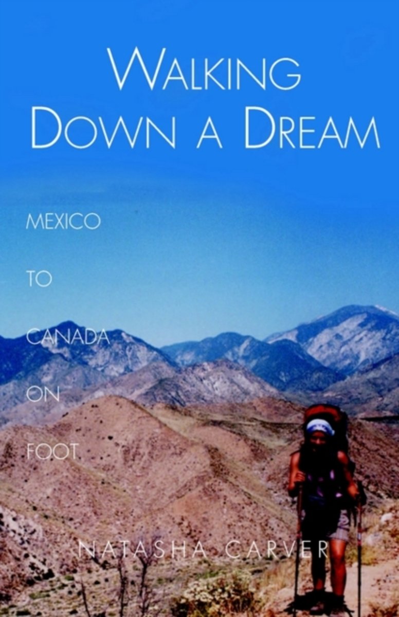
- Walking Down a Dream
- Day 88 &8211; 1,130 trail miles north,Ward Peak, Northern California"Boy that was a long way up!" exclaims the day-hiker, a mile or two from the road. "Where are you coming from?""Oh, Mexico," I say coolly, and saunter on by.Faced with the prospect of a nine-to-five job, Natasha Carver instead decided to walk from Mexico to Canada. She followed... Read more
- Also available from:
- Bol.com, Belgium
Bol.com
Belgium
Belgium
- Walking Down a Dream
- Day 88 &8211; 1,130 trail miles north,Ward Peak, Northern California"Boy that was a long way up!" exclaims the day-hiker, a mile or two from the road. "Where are you coming from?""Oh, Mexico," I say coolly, and saunter on by.Faced with the prospect of a nine-to-five job, Natasha Carver instead decided to walk from Mexico to Canada. She followed... Read more

Bol.com
Netherlands
Netherlands
- Rough Guide to California
- A comprehensive guidebook to California with full coverage of the state's sights and attractions and detailed listings of accommodation - from budget to upscale - restaurants and nightlife. In-depth coverage of all the national and state parks and reserves, including Death Valley, Sequoia, Yosemite and Lassen, with detailed information on... Read more
- Also available from:
- Bol.com, Belgium
Bol.com
Belgium
Belgium
- Rough Guide to California
- A comprehensive guidebook to California with full coverage of the state's sights and attractions and detailed listings of accommodation - from budget to upscale - restaurants and nightlife. In-depth coverage of all the national and state parks and reserves, including Death Valley, Sequoia, Yosemite and Lassen, with detailed information on... Read more
Bol.com
Netherlands
Netherlands
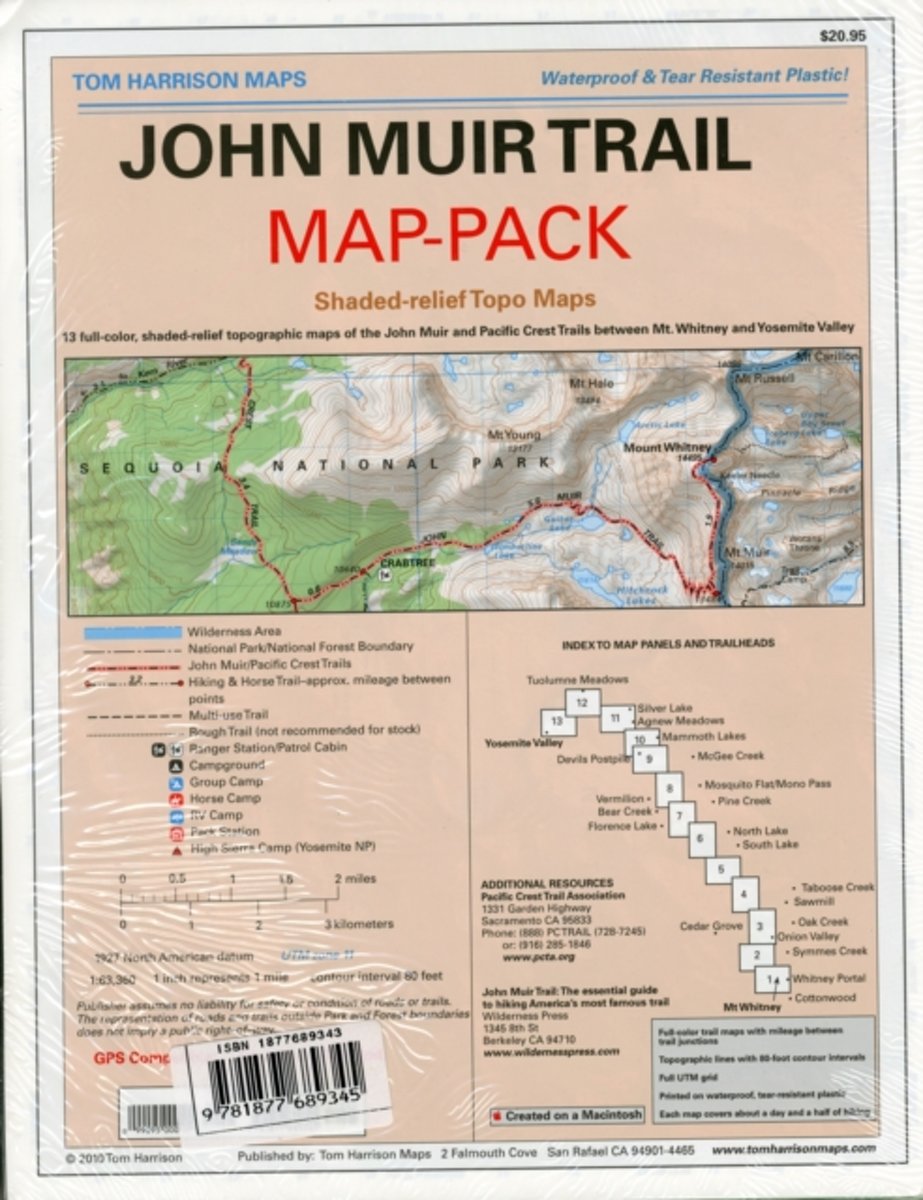
- Map-pack of the John Muir Trail
- Shaded Relief Topo Maps packet of the famous Sierra High Route that will take hikers from Mount Whitney to Yosemite, CA. Well marked trails over USGS topo maps that were beautifully enhanced with shaded relief to better distinguish details. Scale 1:630360. 1 inch on map equals 1 mile. Whitney Portal, Symmes Creek, Onion Valley, Oak Creek,... Read more
- Also available from:
- Bol.com, Belgium
- The Book Depository, United Kingdom
Bol.com
Belgium
Belgium
- Map-pack of the John Muir Trail
- Shaded Relief Topo Maps packet of the famous Sierra High Route that will take hikers from Mount Whitney to Yosemite, CA. Well marked trails over USGS topo maps that were beautifully enhanced with shaded relief to better distinguish details. Scale 1:630360. 1 inch on map equals 1 mile. Whitney Portal, Symmes Creek, Onion Valley, Oak Creek,... Read more


Bol.com
Netherlands
Netherlands
- Wild Yosemite
- An ideal gift for lovers of nature.This beautiful literary collection explores the spectacular natural features of Yosemite through the eyes of some of America s most notable and extraordinarily talented writers. In 1851, Lafayette Bunnell chronicled his travels with the Mariposa Battalion, the first non-natives to visit Yosemite Valley.... Read more
- Also available from:
- Bol.com, Belgium
Bol.com
Belgium
Belgium
- Wild Yosemite
- An ideal gift for lovers of nature.This beautiful literary collection explores the spectacular natural features of Yosemite through the eyes of some of America s most notable and extraordinarily talented writers. In 1851, Lafayette Bunnell chronicled his travels with the Mariposa Battalion, the first non-natives to visit Yosemite Valley.... Read more
Bol.com
Netherlands
Netherlands
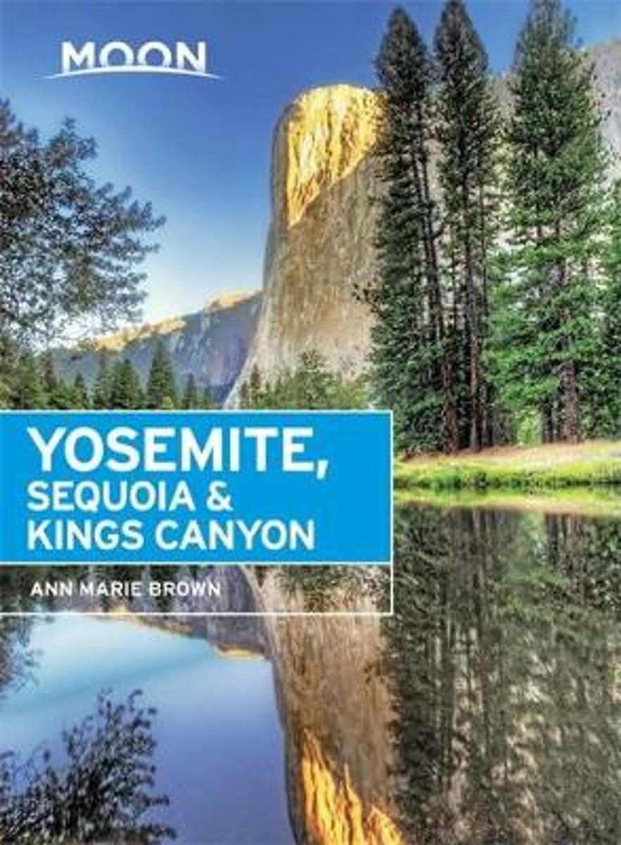
- Moon Yosemite, Sequoia & Kings Canyon, 7th Edition
- Find Your AdventureTravel writer and outdoorswoman Ann Marie Brown shares her expert perspective on Yosemite, Sequoia, and Kings Canyon National Parks, guiding you on a memorable and unique experience. Whether you're hiking through Tuolumne Meadows, horseback riding in Wawona, or buying shower time at local campgrounds, Moon Yosemite, Sequoia &... Read more
- Also available from:
- Bol.com, Belgium
Bol.com
Belgium
Belgium
- Moon Yosemite, Sequoia & Kings Canyon, 7th Edition
- Find Your AdventureTravel writer and outdoorswoman Ann Marie Brown shares her expert perspective on Yosemite, Sequoia, and Kings Canyon National Parks, guiding you on a memorable and unique experience. Whether you're hiking through Tuolumne Meadows, horseback riding in Wawona, or buying shower time at local campgrounds, Moon Yosemite, Sequoia &... Read more
Bol.com
Netherlands
Netherlands
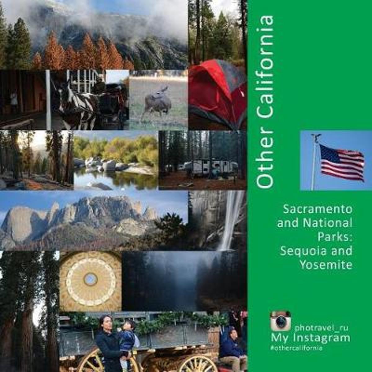
- Other California
- What is the first thing you think of when you hear the word: ''California''? The answer is as plain as the day - ocean, golden sand, palm trees, wind in the hair, relaxed and smiling people. But, it's not that simple, California is not just fun by the beach. It is much more interesting than just bright leaflets made for tourists.If you want to... Read more
- Also available from:
- Bol.com, Belgium
Bol.com
Belgium
Belgium
- Other California
- What is the first thing you think of when you hear the word: ''California''? The answer is as plain as the day - ocean, golden sand, palm trees, wind in the hair, relaxed and smiling people. But, it's not that simple, California is not just fun by the beach. It is much more interesting than just bright leaflets made for tourists.If you want to... Read more

Bol.com
Netherlands
Netherlands
- Sierra High Route
- * Author conceived and pioneered the Sierra High Route * Covers Kings Canyon National Park to northern Yosemite National Park * Each route chapter includes points of interest, maps, approach instructions, and directions No ordinary guidebook, Sierra High Route leads you from point to point through a spectacular 195-mile timberline route in... Read more
- Also available from:
- Bol.com, Belgium
Bol.com
Belgium
Belgium
- Sierra High Route
- * Author conceived and pioneered the Sierra High Route * Covers Kings Canyon National Park to northern Yosemite National Park * Each route chapter includes points of interest, maps, approach instructions, and directions No ordinary guidebook, Sierra High Route leads you from point to point through a spectacular 195-mile timberline route in... Read more
Bol.com
Netherlands
Netherlands
- Triple Crown of Hiking [In Gift Box]
- The United States has numerous long distance trails but three trails have risen to the top of the consciousness of the hiking community. These are the Appalachian Trail at 2,200 miles, the Pacific Crest Trail at 2,700 miles and the Contental Divide Trail at 3,100 miles. Added together these three trails cover almost 8,000 miles of the most... Read more
- Also available from:
- Bol.com, Belgium
Bol.com
Belgium
Belgium
- Triple Crown of Hiking [In Gift Box]
- The United States has numerous long distance trails but three trails have risen to the top of the consciousness of the hiking community. These are the Appalachian Trail at 2,200 miles, the Pacific Crest Trail at 2,700 miles and the Contental Divide Trail at 3,100 miles. Added together these three trails cover almost 8,000 miles of the most... Read more
Bol.com
Netherlands
Netherlands
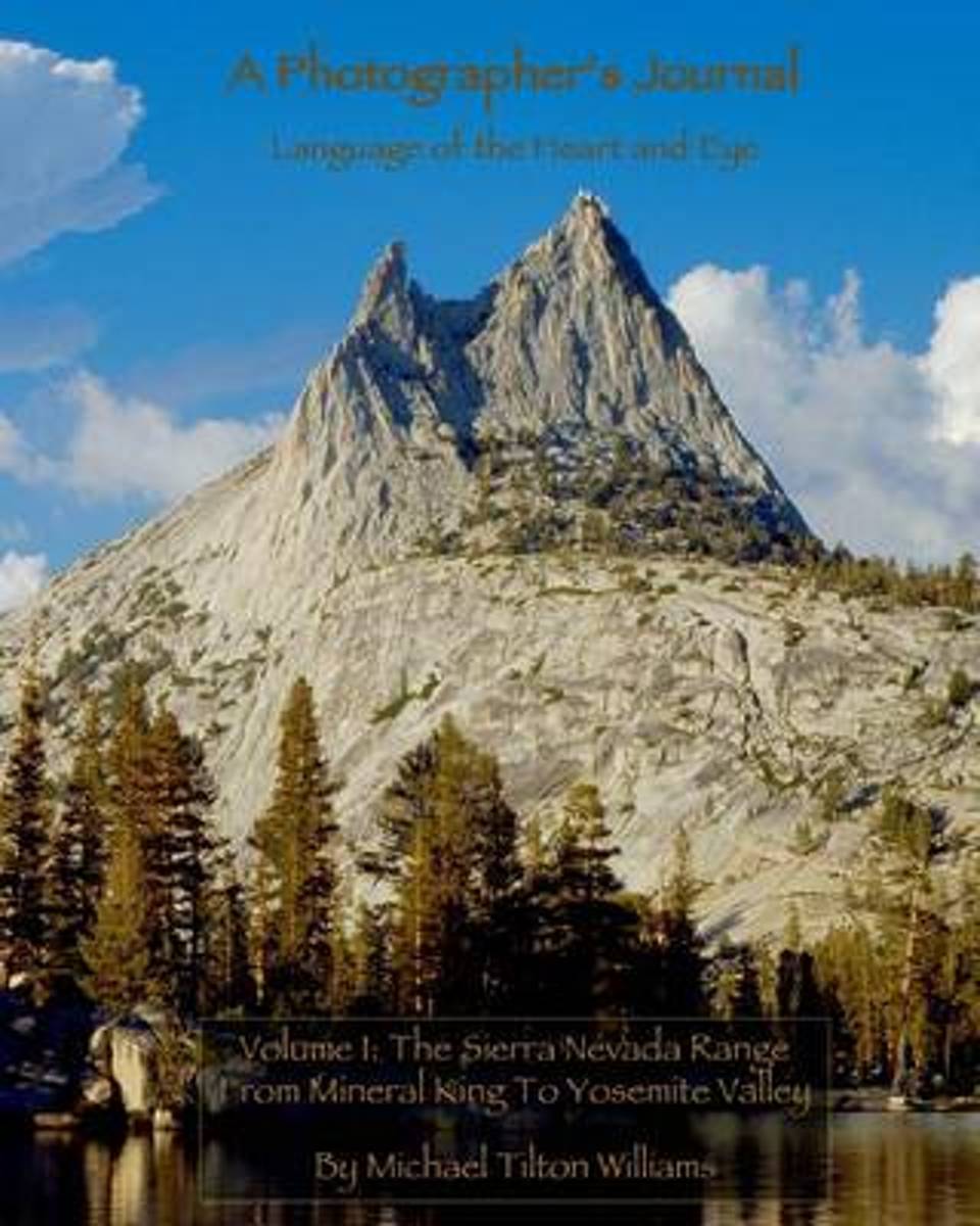
- A Photographer's Journal
- This book is powered by sweat and joy; steep hills and exhilarating telemark skiing descents into silent stands of snowy trees. The land and its smells and tastes are embedded in the memory of those lucky enough to have immersed themselves in it. My goal is to transport you: to the soft meadows, the smooth, hard granite, and the dancing trees... Read more
- Also available from:
- Bol.com, Belgium
Bol.com
Belgium
Belgium
- A Photographer's Journal
- This book is powered by sweat and joy; steep hills and exhilarating telemark skiing descents into silent stands of snowy trees. The land and its smells and tastes are embedded in the memory of those lucky enough to have immersed themselves in it. My goal is to transport you: to the soft meadows, the smooth, hard granite, and the dancing trees... Read more

Bol.com
Netherlands
Netherlands
- Topographic Yosemite National Park and Vicinity
- Covering the 1169-square-mile park, plus most of Emigrant, Ansel Adams, and Hoover Wilderness, and portions of John Muir Wilderness and Mono Basin National Forest, this Wilderness Press classic has undergone a dramatic transformation. The full-color 1:125,000-scale topographic map has the same accurate trail data as before, field-checked by... Read more
- Also available from:
- Bol.com, Belgium
Bol.com
Belgium
Belgium
- Topographic Yosemite National Park and Vicinity
- Covering the 1169-square-mile park, plus most of Emigrant, Ansel Adams, and Hoover Wilderness, and portions of John Muir Wilderness and Mono Basin National Forest, this Wilderness Press classic has undergone a dramatic transformation. The full-color 1:125,000-scale topographic map has the same accurate trail data as before, field-checked by... Read more
Bol.com
Netherlands
Netherlands
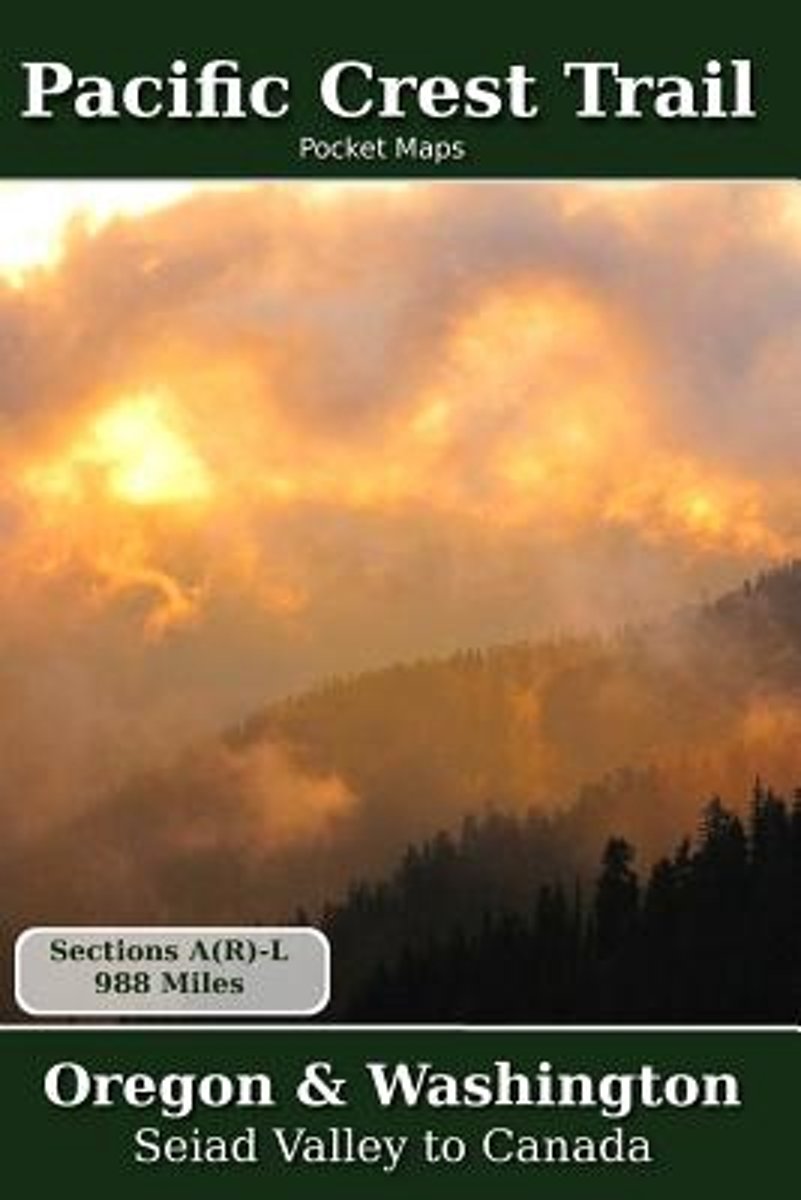
- Pacific Crest Trail Pocket Maps - Oregon & Washington
- Oregon & WashingtonThe Pacific Crest Trail Pocket Map Series is a complete and concise set of topographic maps created with digitized base maps covering every step of the 2,655 mile trail from Mexico to Canada.The land cover, hydrology and contour data used to create these maps has been collected within the last 5 years, presented in a... Read more
- Also available from:
- Bol.com, Belgium
Bol.com
Belgium
Belgium
- Pacific Crest Trail Pocket Maps - Oregon & Washington
- Oregon & WashingtonThe Pacific Crest Trail Pocket Map Series is a complete and concise set of topographic maps created with digitized base maps covering every step of the 2,655 mile trail from Mexico to Canada.The land cover, hydrology and contour data used to create these maps has been collected within the last 5 years, presented in a... Read more
Kaarten
De Zwerver
Netherlands
Netherlands
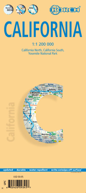
- Wegenkaart - landkaart Californië - California | Borch
- California ( Kalifornien) 1 : 1 200 000 ab 9.9 EURO California North, California South, Yosemite National Park Borch Map. 12. Auflage Read more
De Zwerver
Netherlands
2019
Netherlands
2019
De Zwerver
Netherlands
Netherlands
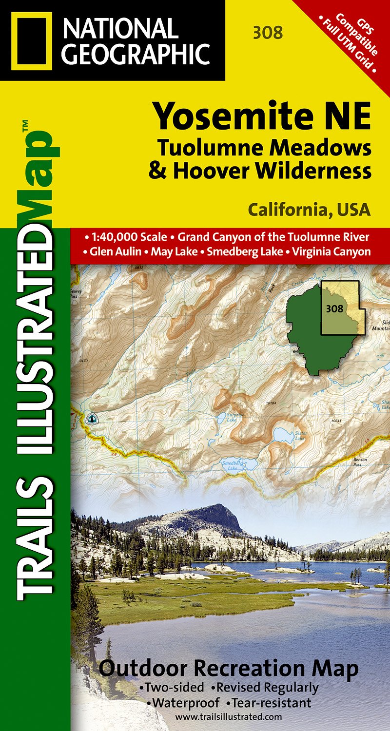
- Wandelkaart - Topografische kaart 308 Yosemite NE - Tuolumne Meadows and Hoover Wilderness | National Geographic
- Prachtige geplastificeerde kaart van het nationaal park. Met alle recreatieve voorzieningen als campsites, maar ook met topografische details en wandelroutes ed. Door uitgekiend kleurgebruik zeer prettig in gebruik. Scheur en watervast! Coverage of the Tuolomne Meadows and Hoover Wilderness area of Yosemite National Park includes Ansel Adams... Read more
- Also available from:
- Stanfords, United Kingdom

Stanfords
United Kingdom
United Kingdom
- Yosemite NE - Tuolumne Meadows & Hoover Wilderness CA
- Map No. 308, Yosemite NE: Tuolumne Meadows and Hoover Wilderness, CA, in an extensive series of GPS compatible, contoured hiking maps of USA’s national and state parks or forests and other popular recreational areas. Cartography based on the national topographic survey, with additional tourist information.The maps, with most titles now printed... Read more
De Zwerver
Netherlands
2019
Netherlands
2019
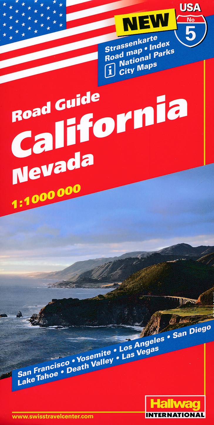
- Wegenkaart - landkaart 05 Californië, California - Nevada | Hallwag
- Hallwag USA Road Guide 05. California 1 : 1 000 000 ab 11.95 EURO Nevada. Straßenkarte. Road map. Index. National Parks. City Maps: San Francisco, Yosemite, Los Angeles, San Diego, Lake Tahoe, Death Valley, Las Vegas Hallwag USA Road Guide. Neuauflage, Laufzeit bis 2022 Read more

Bol.com
Netherlands
Netherlands
- Goat Rocks & Norse Peak Wilderness Area, Gifford-pinchot & Okanogan-wenatchee National Forests
- Waterproof Tear-Resistant Topographic MapGifford-Pinchot and Okanogan-Wenatchee National Forests Washington, USAOne of five new Trails Illustrated maps for the Washington Cascades region offers the most detailed and up-to-date map for the forest, carefully researched and developed in co-operation with local land managers and agencies.... Read more
- Also available from:
- Bol.com, Belgium
- Stanfords, United Kingdom
Bol.com
Belgium
Belgium
- Goat Rocks & Norse Peak Wilderness Area, Gifford-pinchot & Okanogan-wenatchee National Forests
- Waterproof Tear-Resistant Topographic MapGifford-Pinchot and Okanogan-Wenatchee National Forests Washington, USAOne of five new Trails Illustrated maps for the Washington Cascades region offers the most detailed and up-to-date map for the forest, carefully researched and developed in co-operation with local land managers and agencies.... Read more

Stanfords
United Kingdom
United Kingdom
- Goat Rocks - Norse Peak William O. Douglas Wilderness Area WA
- Map No. 823, Goat Rocks and Norse Peak Wilderness Area - Gifford-Pinchot and Okanogan-Wenatchee National Forests, WA, in an extensive series of GPS compatible, contoured hiking maps of USA’s national and state parks or forests and other popular recreational areas. Cartography based on the national topographic survey, with additional tourist... Read more

Bol.com
Netherlands
Netherlands
- Alpine Lakes Wilderness Area, Mount Baker-snoqualmie & Okanogan-wenatchee National Forests
- Waterproof Tear-Resistant Topographic MapMount Baker-Snoqualmie and Okanogan-Wenatchee National Forests Washington, USAOne of five new Trails Illustrated maps for the Washington Cascades region offering the most detailed and up-to-date map for the forest, carefully researched and developed in co-operation with local land managers and... Read more
- Also available from:
- Bol.com, Belgium
- Stanfords, United Kingdom
Bol.com
Belgium
Belgium
- Alpine Lakes Wilderness Area, Mount Baker-snoqualmie & Okanogan-wenatchee National Forests
- Waterproof Tear-Resistant Topographic MapMount Baker-Snoqualmie and Okanogan-Wenatchee National Forests Washington, USAOne of five new Trails Illustrated maps for the Washington Cascades region offering the most detailed and up-to-date map for the forest, carefully researched and developed in co-operation with local land managers and... Read more

Stanfords
United Kingdom
United Kingdom
- Alpine Lakes Wilderness - Mt Baker-Snoqualmie and Okanogan-Wenatchee National Forests WA
- Map No. 825, Alpine Lakes Wilderness Area - Mount Baker-Snoqualmie Wilderness Areas and Okanogan-Wenatchee National Forests, WA, in an extensive series of GPS compatible, contoured hiking maps of USA’s national and state parks or forests and other popular recreational areas. Cartography based on the national topographic survey, with additional... Read more

Bol.com
Netherlands
Netherlands
- Mount Whitney
- Waterproof Tear-Resistant Topographic MapMount Whitney is universally famous as the highest mountain in the United State outside of Alaska, as well as the highest point in California. National Geographic's Trails Illustrated map of Mount Whitney is a two-sided, waterproof map designed to meet the needs of Whitney visitors with unmatched... Read more
- Also available from:
- Bol.com, Belgium
- Stanfords, United Kingdom
Bol.com
Belgium
Belgium
- Mount Whitney
- Waterproof Tear-Resistant Topographic MapMount Whitney is universally famous as the highest mountain in the United State outside of Alaska, as well as the highest point in California. National Geographic's Trails Illustrated map of Mount Whitney is a two-sided, waterproof map designed to meet the needs of Whitney visitors with unmatched... Read more

Stanfords
United Kingdom
United Kingdom
- Mount Whitney CA NGS Trails Illustrated Map 322
- Map No. 322, Mount Whitney in California at 1:40,000, in an extensive series of GPS compatible, contoured hiking maps of USA’s national and state parks or forests and other popular recreational areas. Cartography is based on the national topographic survey, with additional tourist information.The maps, with most titles now printed on light,... Read more

De Zwerver
Netherlands
Netherlands
- Wandelkaart - Topografische kaart 205 Sequoia - Kings Canyon National Parks | National Geographic
- Prachtige geplastificeerde kaart van het nationaal park. Met alle recreatieve voorzieningen als campsites, maar ook met topografische details en wandelroutes ed. Door uitgekiend kleurgebruik zeer prettig in gebruik. Scheur en watervast! Trails Illustrated maps are the most trusted and popular recreation maps available. Continually setting the... Read more
- Also available from:
- Bol.com, Netherlands
- Bol.com, Belgium
- Stanfords, United Kingdom
- The Book Depository, United Kingdom

Bol.com
Netherlands
Netherlands
- Sequoia/kings Canyon National Park
- Waterproof Tear-Resistant Topographic MapIn Sequioa and Kings Canyon National Parks you can walk among the world's largest trees, hike the alpine landscape of the Sierra Crest, and marvel at the towering granite cliffs of one of the deepest canyons in the United States. National Geographic's Trails Illustrated map of Sequoia and Kings... Read more
Bol.com
Belgium
Belgium
- Sequoia/kings Canyon National Park
- Waterproof Tear-Resistant Topographic MapIn Sequioa and Kings Canyon National Parks you can walk among the world's largest trees, hike the alpine landscape of the Sierra Crest, and marvel at the towering granite cliffs of one of the deepest canyons in the United States. National Geographic's Trails Illustrated map of Sequoia and Kings... Read more

Stanfords
United Kingdom
United Kingdom
- Sequoia - Kings Canyon National Parks CA NGS Trails Illustrated Map 205
- Map No. 205, Sequoia/Kings Canyon National Park, CA, in an extensive series of GPS compatible, contoured hiking maps of USA’s national and state parks or forests and other popular recreational areas. Cartography based on the national topographic survey, with additional tourist information.The maps, with most titles now printed on light,... Read more

The Book Depository
United Kingdom
United Kingdom
- Sequoia/kings Canyon National Park
- Trails Illustrated National Parks Read more

De Zwerver
Netherlands
Netherlands
- Wandelkaart - Topografische kaart 809 Mammoth Lakes - Mono Divide - Inyo and Sierra National Forests | National Geographic
- Prachtige geplastificeerde kaart van het bekende nationaal park. Met alle recreatieve voorzieningen als campsites, maar ook met topografische details en wandelroutes ed. Door uitgekiend kleurgebruik zeer prettig in gebruik. Scheur en watervast! Trails Illustrated Mammoth Lakes / Mono Divide is the first of five exciting new maps for the... Read more
- Also available from:
- Bol.com, Netherlands
- Bol.com, Belgium
- Stanfords, United Kingdom

Bol.com
Netherlands
Netherlands
- Mammoth Lakes/mono Divide
- Waterproof Tear-Resistant Topographic MapTrails Illustrated Mammoth Lakes / Mono Divide is the first of five exciting new maps for the California Sierra Nevadas that will combine to form seamless coverage of the high-use National Forest areas between Sequoia / Kings Canyon National Parks and Lake Tahoe. This region contains some of the... Read more
Bol.com
Belgium
Belgium
- Mammoth Lakes/mono Divide
- Waterproof Tear-Resistant Topographic MapTrails Illustrated Mammoth Lakes / Mono Divide is the first of five exciting new maps for the California Sierra Nevadas that will combine to form seamless coverage of the high-use National Forest areas between Sequoia / Kings Canyon National Parks and Lake Tahoe. This region contains some of the... Read more

Stanfords
United Kingdom
United Kingdom
- Mammoth Lakes - Mono Divide CA
- Map No. 809, Mammoth Lakes / Mono Divide, CA, in an extensive series of GPS compatible, contoured hiking maps of USA’s national and state parks or forests and other popular recreational areas. Cartography based on the national topographic survey, with additional tourist information.The maps, with most titles now printed on light, waterproof and... Read more

Bol.com
Netherlands
Netherlands
- Carson-iceberg/emigrant/mokleumne Wilderness Areas
- Waterproof Tear-Resistant Topographic MapPart of our exciting new coverage for California's Sierra Nevada, our Carson-Iceberg, Emigrant and Mokelumne Wilderness Trails Illustrated map details the high use recreation areas of Stanislaus and Humboldt-Toiyabe National Forests from Yosemite National Park north to Caples Lake and Markleeville.... Read more
- Also available from:
- Bol.com, Belgium
- Stanfords, United Kingdom
Bol.com
Belgium
Belgium
- Carson-iceberg/emigrant/mokleumne Wilderness Areas
- Waterproof Tear-Resistant Topographic MapPart of our exciting new coverage for California's Sierra Nevada, our Carson-Iceberg, Emigrant and Mokelumne Wilderness Trails Illustrated map details the high use recreation areas of Stanislaus and Humboldt-Toiyabe National Forests from Yosemite National Park north to Caples Lake and Markleeville.... Read more

Stanfords
United Kingdom
United Kingdom
- Carson-Iceberg - Emigrant and Mokleumne Wilderness Areas CA
- Map No. 807, Carson-Iceberg / Emigrant / Mokleumne Wilderness Areas, CA, in an extensive series of GPS compatible, contoured hiking maps of USA’s national and state parks or forests and other popular recreational areas. Cartography based on the national topographic survey, with additional tourist information.The maps, with most titles now... Read more
De Zwerver
Netherlands
Netherlands
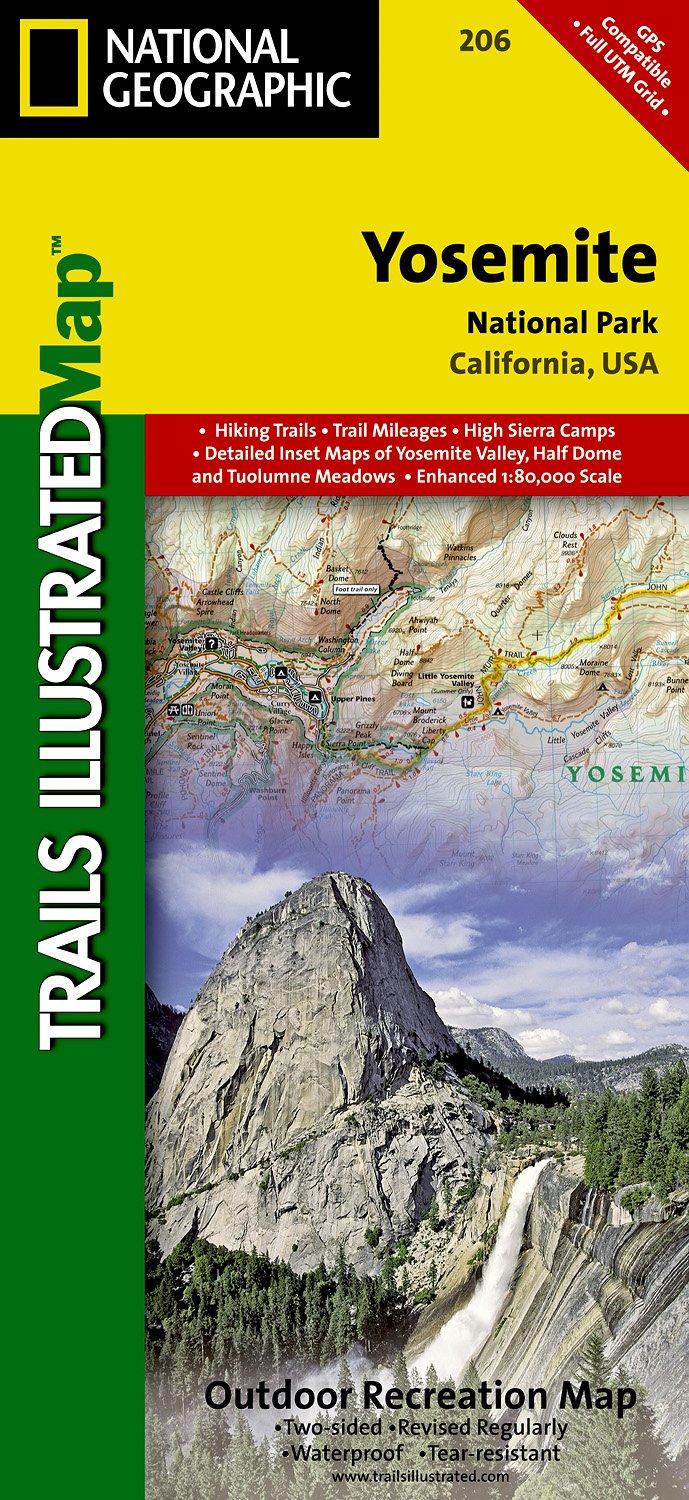
- Wandelkaart - Topografische kaart 206 Yosemite National Park | National Geographic
- Prachtige geplastificeerde kaart van het bekende nationaal park. Met alle recreatieve voorzieningen als campsites, maar ook met topografische details en wandelroutes ed. Door uitgekiend kleurgebruik zeer prettig in gebruik. Scheur en watervast! Coverage includes Stanislaus National Forest, Emigrant Wilderness, Carson Iceberg Wilderness, Toiyabe... Read more
- Also available from:
- Bol.com, Netherlands
- Bol.com, Belgium
- Stanfords, United Kingdom
- The Book Depository, United Kingdom
Bol.com
Netherlands
Netherlands
- Yosemite National Park
- Waterproof Tear-Resistant Topographic MapExplore the majesty of Yosemite National Park with National Geographic's Trails Illustrated map. Loaded with helpful information on camping, hiking, lodging, transportation, regulations, and safety, this map is an invaluable tool for casual park visitors and avid adventurers alike. Expertly... Read more
Bol.com
Belgium
Belgium
- Yosemite National Park
- Waterproof Tear-Resistant Topographic MapExplore the majesty of Yosemite National Park with National Geographic's Trails Illustrated map. Loaded with helpful information on camping, hiking, lodging, transportation, regulations, and safety, this map is an invaluable tool for casual park visitors and avid adventurers alike. Expertly... Read more

Stanfords
United Kingdom
United Kingdom
- Yosemite National Park CA NGS Trails Illustrated Map 206
- Map No. 206, Yosemite National Park, CA, in an extensive series of GPS compatible, contoured hiking maps of USA’s national and state parks or forests and other popular recreational areas. Cartography based on the national topographic survey, with additional tourist information.The maps, with most titles now printed on light, waterproof and... Read more

De Zwerver
Netherlands
Netherlands
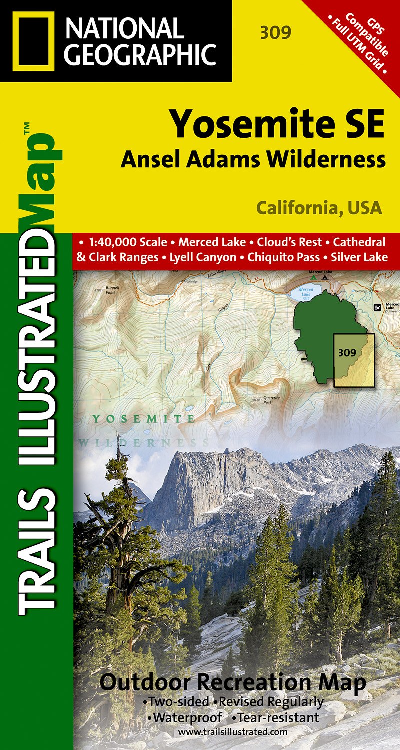
- Wandelkaart 309 Yosemite SE - Ansel Adams Wilderness | National Geographic
- Prachtige geplastificeerde kaart van het nationaal park. Met alle recreatieve voorzieningen als campsites, maar ook met topografische details en wandelroutes ed. Door uitgekiend kleurgebruik zeer prettig in gebruik. Scheur en watervast! Coverage of the Tuolomne Meadows and Hoover Wilderness area of Yosemite National Park includes Ansel Adams... Read more
- Also available from:
- Stanfords, United Kingdom
- The Book Depository, United Kingdom

Stanfords
United Kingdom
United Kingdom
- Yosemite SE - Ansel Adams Wilderness CA
- Map No. 309, Yosemite SE: Ansel Adams Wilderness, CA, in an extensive series of GPS compatible, contoured hiking maps of USA’s national and state parks or forests and other popular recreational areas. Cartography based on the national topographic survey, with additional tourist information.The maps, with most titles now printed on light,... Read more

The Book Depository
United Kingdom
United Kingdom
- Yosemite Se, Ansel Adams Wilderness
- Trails Illustrated National Parks Read more
De Zwerver
Netherlands
Netherlands
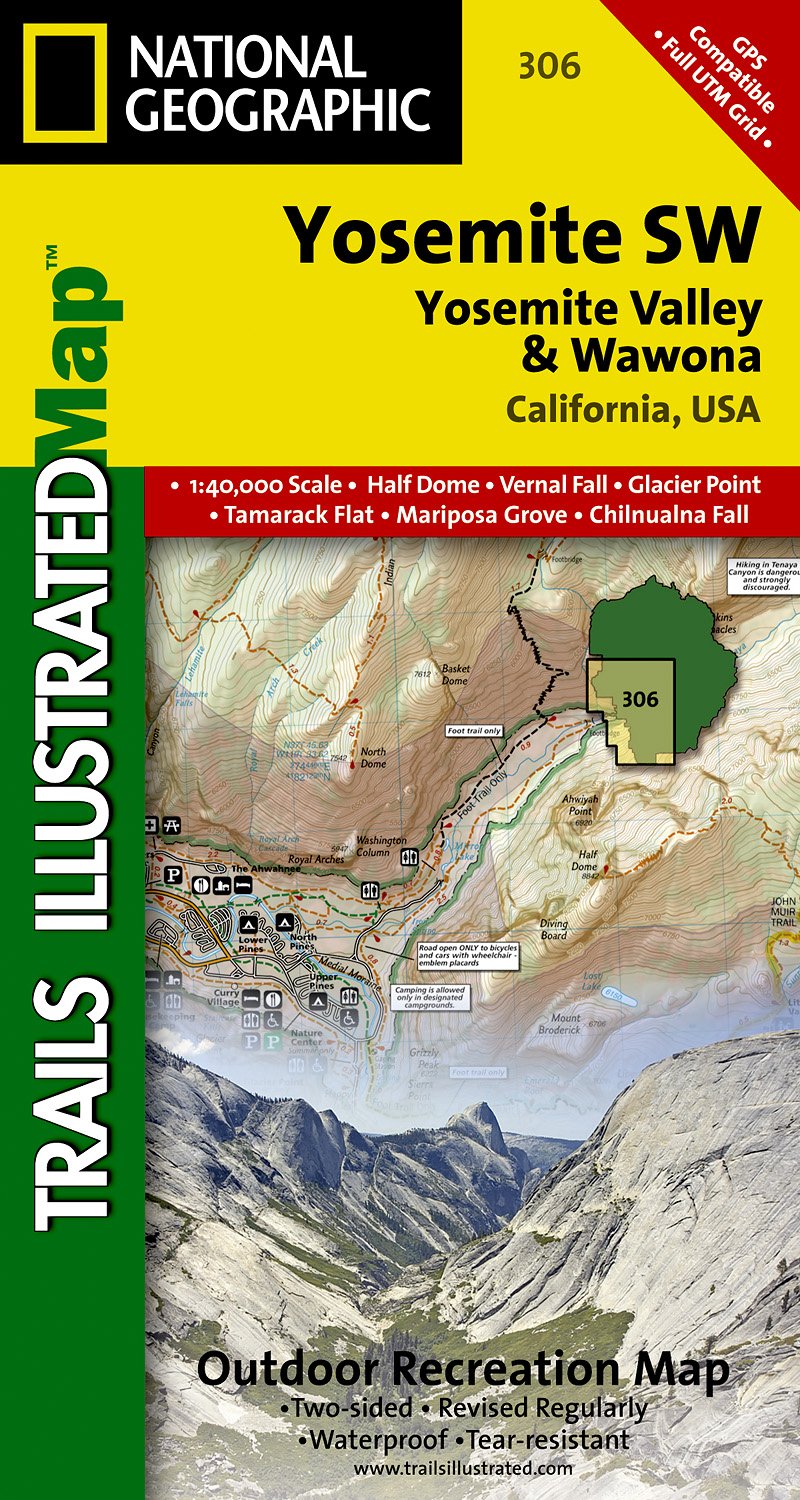
- Wandelkaart - Topografische kaart 306 Yosemite SW - Yosemite Valley & Wawona | National Geographic
- Prachtige geplastificeerde kaart van het nationaal park. Met alle recreatieve voorzieningen als campsites, maar ook met topografische details en wandelroutes ed. Door uitgekiend kleurgebruik zeer prettig in gebruik. Scheur en watervast! Coverage of the Yosemite Valley and Wawona area of Yosemite National Park includes Sierra National Forest,... Read more
- Also available from:
- Stanfords, United Kingdom
- The Book Depository, United Kingdom

Stanfords
United Kingdom
United Kingdom
- Yosemite SW - Yosemite Valley and Wawona CA NGS Trails Illustrated Mpa 306
- Map No. 306, Yosemite SW: Yosemite Valley and Wawona, CA, in an extensive series of GPS compatible, contoured hiking maps of USA’s national and state parks or forests and other popular recreational areas. Cartography based on the national topographic survey, with additional tourist information.The maps, with most titles now printed on light,... Read more

The Book Depository
United Kingdom
United Kingdom
- Yosemite Sw, Yosemite Valley & Wawona
- Trails Illustrated National Parks Read more
De Zwerver
Netherlands
Netherlands
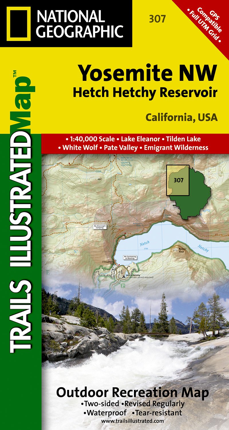
- Wandelkaart - Topografische kaart 307 Yosemite NW - Hetch Hetchy Reservoir | National Geographic
- Prachtige geplastificeerde kaart van het nationaal park. Met alle recreatieve voorzieningen als campsites, maar ook met topografische details en wandelroutes ed. Door uitgekiend kleurgebruik zeer prettig in gebruik. Scheur en watervast! Coverage of the Yosemite Valley and Wawona area of Yosemite National Park includes Sierra National Forest,... Read more
- Also available from:
- Stanfords, United Kingdom
- The Book Depository, United Kingdom

Stanfords
United Kingdom
United Kingdom
- Yosemite NW - Hetch Hetchy Reservoir CA
- Map No. 307, Yosemite NW: Hetch Hetchy Reservoir, CA, in an extensive series of GPS compatible, contoured hiking maps of USA’s national and state parks or forests and other popular recreational areas. Cartography based on the national topographic survey, with additional tourist information.The maps, with most titles now printed on light,... Read more

The Book Depository
United Kingdom
United Kingdom
- Yosemite Nw, Hetch Hetchy Reservoir
- Trails Illustrated National Parks Read more