
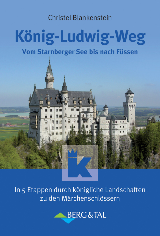
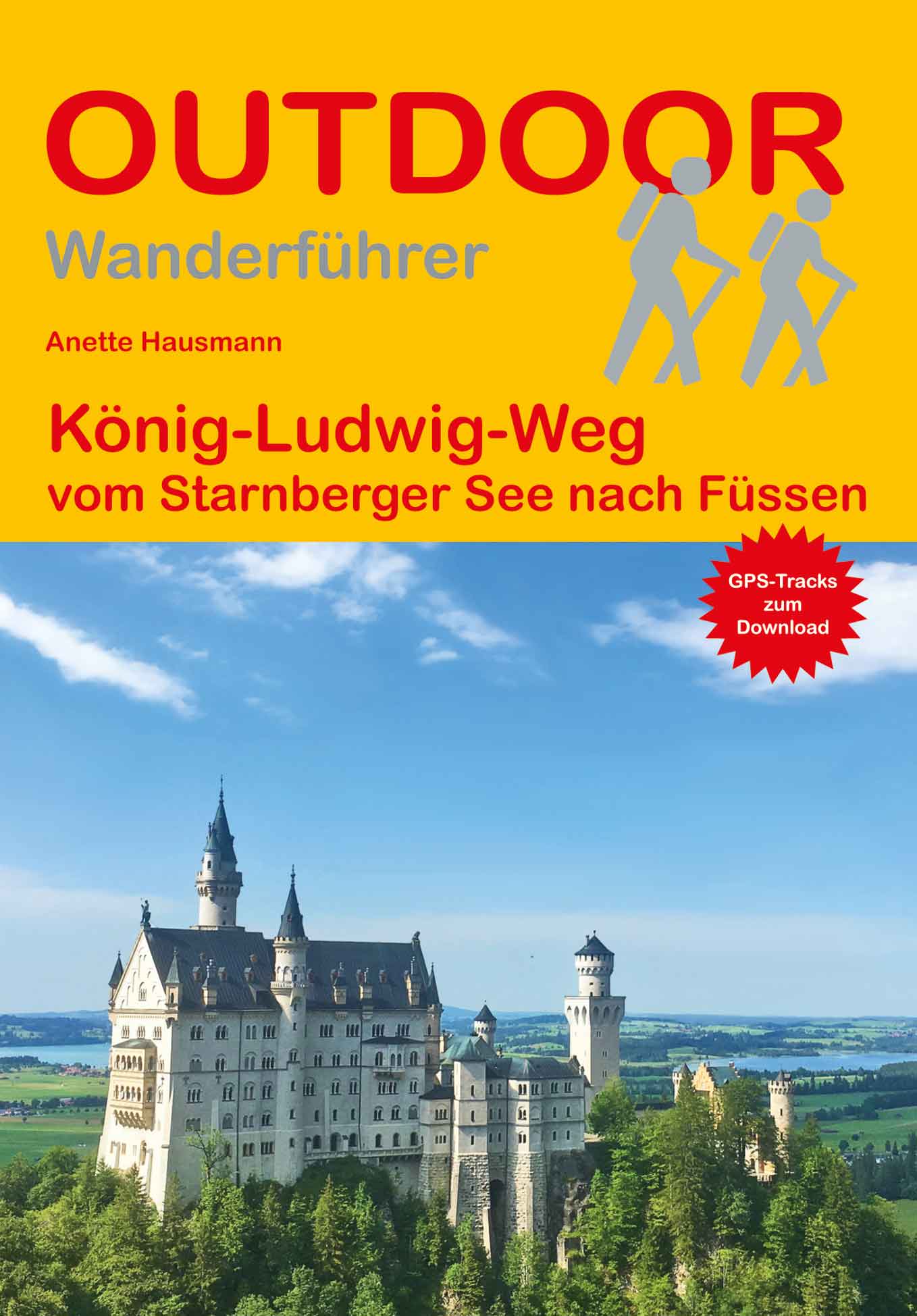
König Ludwigweg
Beschrijving
- Name König Ludwigweg
- Lengte van pad 115 km, 71 mijl
- Lengte in dagen 6 dagen
- Start van pad Starnberger See
- Einde van pad Füssen
- Traildino graad EW, Makkelijke wandeling, natuurpad

Starnberger See - Füssen, 115 km, 5 - 7 days
This trail is in the south of Germany, Bayern / Bavaria. It is mainly a forest walk, and can be made in summer and winter alike. Accommodation is easy to find.
Links
Feiten
Verslagen
Gidsen en kaarten
Overnachting
Organisaties
Reisorganisaties
GPS
Anders
Boeken

Bol.com
Netherlands
Netherlands
- Mountain Days at Home and Abroad
- 'Mountain Days at Home and Abroad' is a lively account of the author's adventures in the mountains over a period of some 40 years, starting from the early days when he took part in annual mountain challenges and volunteered as an instructor on various Hill Walking and Climbing courses run by the Scouts from the old railway station at... Read more
- Also available from:
- Bol.com, Belgium
Bol.com
Belgium
Belgium
- Mountain Days at Home and Abroad
- 'Mountain Days at Home and Abroad' is a lively account of the author's adventures in the mountains over a period of some 40 years, starting from the early days when he took part in annual mountain challenges and volunteered as an instructor on various Hill Walking and Climbing courses run by the Scouts from the old railway station at... Read more

Bol.com
Netherlands
Netherlands
- Walking Distance
- Long-distance walking is good for you and good for the earth... But most of all, walking is a joyful celebration of life and the diverse, beautiful, and curious world in which we live. -from the Introduction Walking is simple, but it can also be profound. In an increasingly complex and frantic world, walking can simplify our lives. It... Read more
- Also available from:
- Bol.com, Belgium
Bol.com
Belgium
Belgium
- Walking Distance
- Long-distance walking is good for you and good for the earth... But most of all, walking is a joyful celebration of life and the diverse, beautiful, and curious world in which we live. -from the Introduction Walking is simple, but it can also be profound. In an increasingly complex and frantic world, walking can simplify our lives. It... Read more
Kaarten
De Zwerver
Netherlands
Netherlands
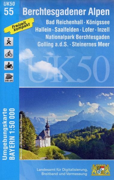
- Wandelkaart 55 UK50 Bayern Berchtesgadener Alpen | LVA Bayern
- Berchtesgaden Alps: Königssee - Bad Reichenhall area, map no. 50-55 including Hallein, Lofer and Saalfelden, in a series of special contoured and GP-compatible recreational maps from the Bavarian state survey organization, with cartography of the German topographic survey at 1:50,000 and extensive additional tourist overprint highlighting... Read more
- Also available from:
- Stanfords, United Kingdom

Stanfords
United Kingdom
United Kingdom
- Berchtesgaden Alps - Bad Reichenhall - Konigssee UK50-55
- Berchtesgaden Alps: Königssee - Bad Reichenhall area, map no. 50-55 including Hallein, Lofer and Saalfelden, in a series of special contoured and GP-compatible recreational maps from the Bavarian state survey organization, with cartography of the German topographic survey at 1:50,000 and extensive additional tourist overprint highlighting... Read more
De Zwerver
Netherlands
2018
Netherlands
2018
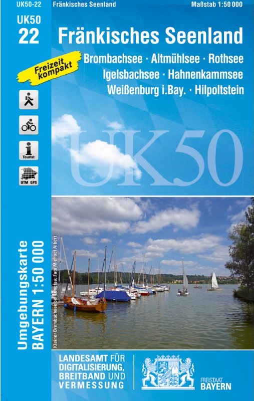
- Wandelkaart 22 UK50 Fränkisches Seenland | LVA Bayern
- Franconia Lake District, map no. 50-22 covering an area around Altmühlsee, Rothsee, Bronbachsee, Ingelsbachsee, Hahnenkamm and Dennenloher See, in a series of special contoured and GP-compatible recreational maps from the Bavarian state survey organization, with cartography of the German topographic survey at 1:50,000 and extensive additional... Read more
- Also available from:
- Stanfords, United Kingdom

Stanfords
United Kingdom
2018
United Kingdom
2018
- Franconia Lake District UK50-22
- Franconia Lake District, map no. 50-22 covering an area around Altmühlsee, Rothsee, Bronbachsee, Ingelsbachsee, Hahnenkamm and Dennenloher See, in a series of special contoured and GP-compatible recreational maps from the Bavarian state survey organization, with cartography of the German topographic survey at 1:50,000 and extensive additional... Read more
Bol.com
Netherlands
Netherlands
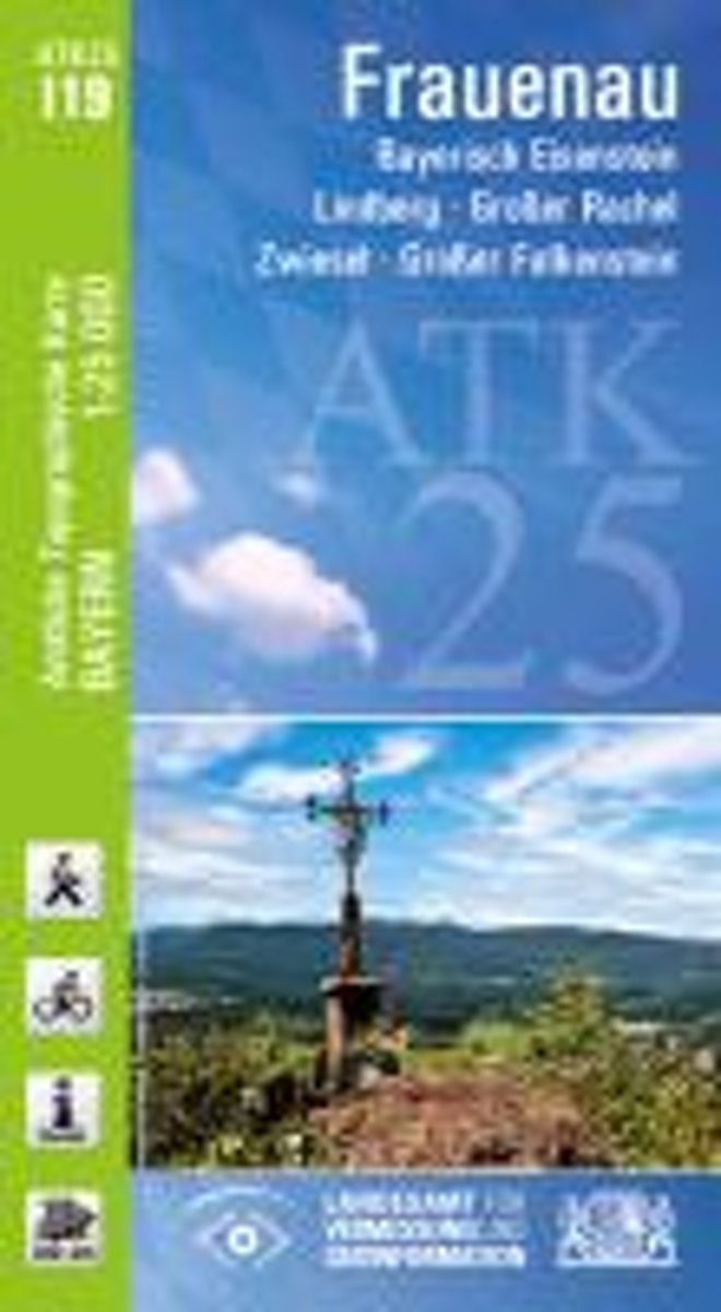
- Frauenau 1 : 25 000
- Frauenau in a series of GPS compatible recreational editions of the Bavarian topographic survey at 1:25,000, with waymarked hiking trails and cycling routes, campsites and youth hostels, etc. Coverage includes Bayerisch Eisenstein, Lindberg, Gro Read more
- Also available from:
- Bol.com, Belgium
Bol.com
Belgium
Belgium
- Frauenau 1 : 25 000
- Frauenau in a series of GPS compatible recreational editions of the Bavarian topographic survey at 1:25,000, with waymarked hiking trails and cycling routes, campsites and youth hostels, etc. Coverage includes Bayerisch Eisenstein, Lindberg, Gro Read more

Stanfords
United Kingdom
United Kingdom
- Augsburg NP - Western Forests UK50-32
- Augsburg map UK50-32, in a series of special contoured and GP-compatible recreational maps from the Bavarian state mapping agency, with cartography at 1:50,000 and additional tourist overprint highlighting hiking trails and cycling routes, campsites and youth hostels, etc.Maps in this series have cartography identical to the standard... Read more
Stanfords
United Kingdom
United Kingdom
- Bavarian Forest National Park - Nature Park East UK50-29
- Bavarian Forest (Bayerischer Wald) National Park and the eastern part of the Bavarian Forest Regional Park, map no. 50-29 covering an area around Regen, Zwisel, Bayerisch Eisenstein and Grafenau, in a series of special contoured and GP-compatible recreational maps from the Bavarian state survey organization, with cartography of the German... Read more

Stanfords
United Kingdom
United Kingdom
- Munchberg Leisure Map C12
- Munchberg in a series of GPS compatible recreational editions of the Bavarian topographic survey at 1:25,000, with waymarked hiking trails and cycling routes, campsites and youth hostels, etc. Coverage includes Helmbrechts, Marktleugast, Stammbach, Weißenstadt, Gefrees, Zell im Fichtelgebirge.Contours used in this map vary between 5 to 20m... Read more

Stanfords
United Kingdom
United Kingdom
- Garching b. Munich N12
- Garching b.München in a series of GPS compatible recreational editions of the Bavarian topographic survey at 1:25,000, with waymarked hiking trails and cycling routes, campsites and youth hostels, etc. Coverage includes Ismaning, Markt Schwaben, Neufahrn b.Freising, Moosinning, Poing, Kirchheim b.München.Contours used in this map vary between 5... Read more
Stanfords
United Kingdom
United Kingdom
- Bavarian Forest Nature Park South UK50-30
- The southern part of the Bavarian Forest (Bayerischer Wald) Regional Park, map no. 50-30 covering an area around Passau, Freyung, Deggendorf and Vilshofen, in a series of special contoured and GP-compatible recreational maps from the Bavarian state survey organization, with cartography of the German topographic survey at 1:50,000 and extensive... Read more

Stanfords
United Kingdom
United Kingdom
- Neumarkt Sankt Veit Leisure Map M15
- Neumarkt-Sankt Veit in a series of GPS compatible recreational editions of the Bavarian topographic survey at 1:25,000, with waymarked hiking trails and cycling routes, campsites and youth hostels, etc. Coverage includes Gangkofen, Vilsbiburg, Bodenkirchen,Massing, Egglkofen, Niedertaufkirchen.Contours used in this map vary between 5 to 20m... Read more

Stanfords
United Kingdom
United Kingdom
- Munich North N11
- Munich Nord in a series of GPS compatible recreational editions of the Bavarian topographic survey at 1:25,000, with waymarked hiking trails and cycling routes, campsites and youth hostels, etc. Coverage includes Dachau, Oberschleißheim, Garching b.München, Karlsfeld, Unterschleißheim, Eching.Contours used in this map vary between 5 to 20m... Read more

Stanfords
United Kingdom
United Kingdom
- Konigssee R17
- Königssee in a series of GPS compatible recreational editions of the Bavarian topographic survey at 1:25,000, with waymarked hiking trails and cycling routes, campsites and youth hostels, etc. Coverage includes Berchtesgaden, Hoher Göll, Schönau a.Königssee, Watzmann, Steinernes Meer.Contours used in this map vary between 5 to 20m according to... Read more

Stanfords
United Kingdom
United Kingdom
- Tischenreuth E15
- Tirschenreuth in a series of GPS compatible recreational editions of the Bavarian topographic survey at 1:25,000, with waymarked hiking trails and cycling routes, campsites and youth hostels, etc. Coverage includes Bärnau, Plößberg, Floß, Flossenbürg.Contours used in this map vary between 5 to 20m according to the terrain, with 20m interval... Read more

Stanfords
United Kingdom
United Kingdom
- Neukirchen b.Hl. Blut H17
- Neukirchen b.Hl.Blut in a series of GPS compatible recreational editions of the Bavarian topographic survey at 1:25,000, with waymarked hiking trails and cycling routes, campsites and youth hostels, etc. Coverage includes Furth im Wald, Arrach, Eschlkam, Lam, Hohenwarth, Rimbach.Contours used in this map vary between 5 to 20m according to the... Read more

Stanfords
United Kingdom
United Kingdom
- Erlangen F09
- Erlangen in a series of GPS compatible recreational editions of the Bavarian topographic survey at 1:25,000, with waymarked hiking trails and cycling routes, campsites and youth hostels, etc. Coverage includes Baiersdorf, Forchheim, Hemhofen, Neunkirchen a.Brand, Röttenbach, Kalchreuth.Contours used in this map vary between 5 to 20m according... Read more
Stanfords
United Kingdom
United Kingdom
- Uffenheim F06
- Uffenheim in a series of GPS compatible recreational editions of the Bavarian topographic survey at 1:25,000, with waymarked hiking trails and cycling routes, campsites and youth hostels, etc. Coverage includes Iphofen, Markt Einersheim, Mainbernheim, Ippesheim, Markt Bibart, Sugenheim.Contours used in this map vary between 5 to 20m according... Read more