
Appalachian Trail
Beschrijving
- Name Appalachian Trail (AT)
- Lengte van pad 3,476 km, 2,160 mijl
- Lengte in dagen 180 dagen
- Traildino graad SW, Inspannende wandeling, bergpad
- Huttentrektocht graad T2, Bergtocht
 The Appalachian Trail is the oldest and most famous long distance hike in the U.S. It follows the Appalachian mountain range through 14 eastern states. An estimated 10,000 thru-hikers have finished the Appalachian Trail. It is possible to thru-hike it in one season. The 2160 miles (3480 km) can be completed in 47 days, 13 hours and 31 minutes (Andrew Thompson did it in 2005).
Kaart


Links
Feiten
Verslagen
Gidsen en kaarten
Overnachting
Organisaties
Reisorganisaties
GPS
Anders
Boeken

De Zwerver
Netherlands
2018
Netherlands
2018
- Wandelgids USA: Appalachian Trail | Conrad Stein Verlag
- Handzame overzichtsgids van deze geweldige en uitdagende lange afstands wandeling in het oosten van de USA: de Appalachian Trail. Het is een ideale gids om de hele tocht voor te bereiden en als basisgids bij je te hebben. Goede beschrijvingen van etappes en veel praktische informatie. Het enige wat mager is zijn dekaarten: goed voor overzicht... Read more

De Zwerver
Netherlands
Netherlands


Bol.com
Netherlands
Netherlands
- 52 Weekends in Connecticut
- Full of year-round activities and fun excursions for both first-time visitors and long-time residents, 52 Weekends in Connecticut traverses the entire state, from the bucolic Northwest Corner to the Quiet Corner in the northeast, along the shoreline facing Long Island Sound and dozens of points in between. Tour an Ivy League campus; shop for... Read more
- Also available from:
- Bol.com, Belgium
Bol.com
Belgium
Belgium
- 52 Weekends in Connecticut
- Full of year-round activities and fun excursions for both first-time visitors and long-time residents, 52 Weekends in Connecticut traverses the entire state, from the bucolic Northwest Corner to the Quiet Corner in the northeast, along the shoreline facing Long Island Sound and dozens of points in between. Tour an Ivy League campus; shop for... Read more
Bol.com
Netherlands
Netherlands
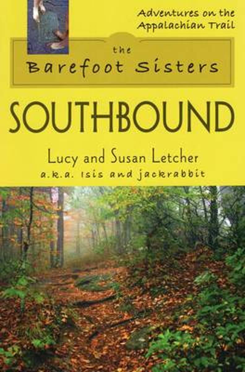
- Barefoot Sisters Southbound
- Sisters Lucy and Susan Letcher begin their barefoot thru-hike of the Appalachian Trail. A story filled with humor and determination. Read more
- Also available from:
- Bol.com, Belgium
Bol.com
Belgium
Belgium
- Barefoot Sisters Southbound
- Sisters Lucy and Susan Letcher begin their barefoot thru-hike of the Appalachian Trail. A story filled with humor and determination. Read more

Bol.com
Netherlands
Netherlands
- Wildflowers of the Appalachian Trail
- Whether you are a weekend hiker, a long-distance trekker, a trained naturalist, or a wildflower enthusiast, this is a necessary companion for anyone interested in the flora of the East's longest trail. Read more
- Also available from:
- Bol.com, Belgium
Bol.com
Belgium
Belgium
- Wildflowers of the Appalachian Trail
- Whether you are a weekend hiker, a long-distance trekker, a trained naturalist, or a wildflower enthusiast, this is a necessary companion for anyone interested in the flora of the East's longest trail. Read more
Bol.com
Netherlands
Netherlands
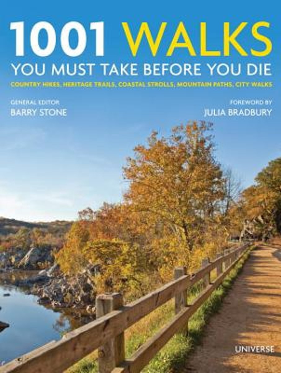
- 1001 Walks You Must Take Before You Die
- This generously illustrated volume features 1,001 carefully selected scenic walks throughout the world in both natural and urban settings from Africa s Rift Valley to the Appalachian Trail. This latest volume in the hugely popular 1,001 series is the ideal guide to the world s most exhilarating walks, hikes, and views. Walking is one of our... Read more
- Also available from:
- Bol.com, Belgium
- The Book Depository, United Kingdom
Bol.com
Belgium
Belgium
- 1001 Walks You Must Take Before You Die
- This generously illustrated volume features 1,001 carefully selected scenic walks throughout the world in both natural and urban settings from Africa s Rift Valley to the Appalachian Trail. This latest volume in the hugely popular 1,001 series is the ideal guide to the world s most exhilarating walks, hikes, and views. Walking is one of our... Read more

The Book Depository
United Kingdom
United Kingdom
- 1001 Walks You Must Take Before You Die
- Country Hikes, Heritage Trails, Coastal Strolls, Mountain Paths, City Walks Read more

Bol.com
Netherlands
Netherlands
- Unexpected Journey
- At a major turning point in his life, Chris Johnson dares to throw it all away to hike the Appalachian Trail. Along the way he is met with friendships, hardships, beauty, suffering, struggle and gain, confrontations with demons both old and new, and ultimately triumph. An honest account, told from the heart, of the life-altering events... Read more
- Also available from:
- Bol.com, Belgium
Bol.com
Belgium
Belgium
- Unexpected Journey
- At a major turning point in his life, Chris Johnson dares to throw it all away to hike the Appalachian Trail. Along the way he is met with friendships, hardships, beauty, suffering, struggle and gain, confrontations with demons both old and new, and ultimately triumph. An honest account, told from the heart, of the life-altering events... Read more
Bol.com
Netherlands
Netherlands
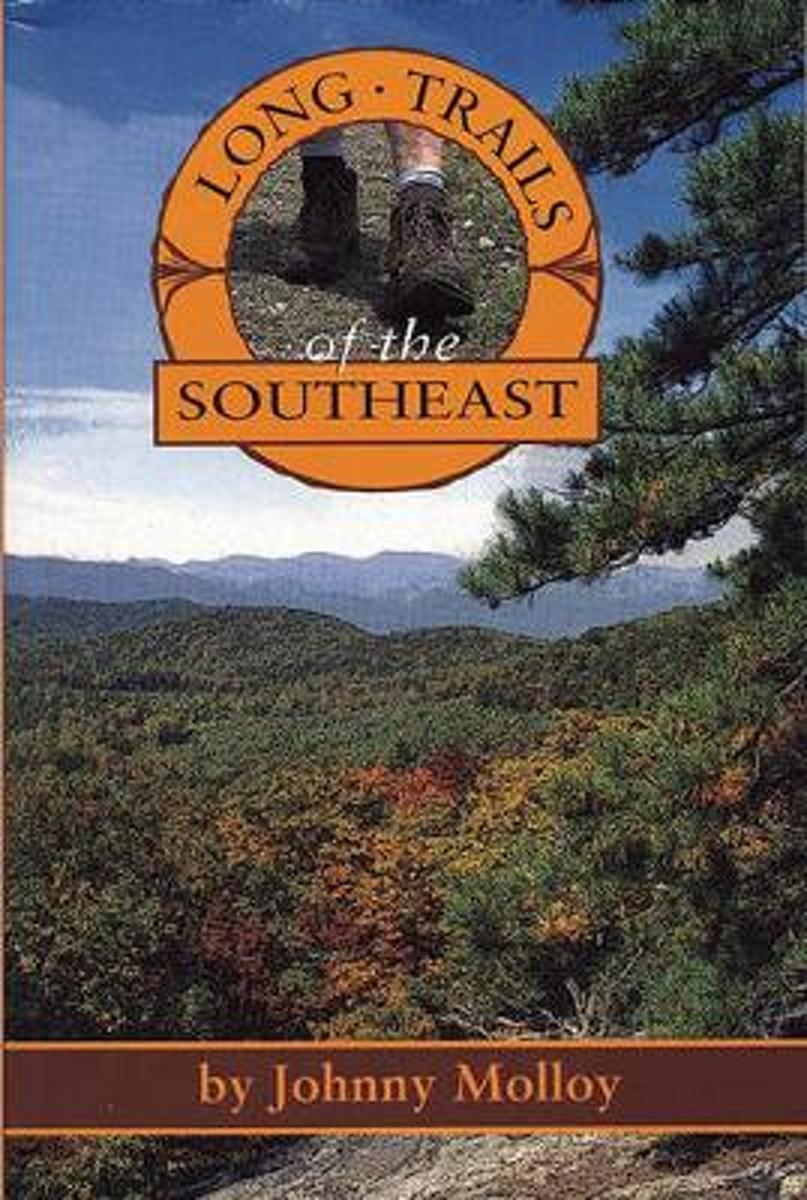
- Long Trails of the Southeast
- Trekking the Appalachian Trail is no longer the solitary experience it once was. Backpackers and hikers looking for less crowded outdoor experience should grab Long Trails of the Southeast to discover the many opportunities available in the Deep South. This guide covers 600 miles of trails in 6 states, including the 104-mile Pinhoti Trail, the... Read more
- Also available from:
- Bol.com, Belgium
Bol.com
Belgium
Belgium
- Long Trails of the Southeast
- Trekking the Appalachian Trail is no longer the solitary experience it once was. Backpackers and hikers looking for less crowded outdoor experience should grab Long Trails of the Southeast to discover the many opportunities available in the Deep South. This guide covers 600 miles of trails in 6 states, including the 104-mile Pinhoti Trail, the... Read more

Bol.com
Netherlands
Netherlands
- North to Katahdin
- When Thoreau stood on the flank of Maine's Mt. Katahdin 1846, he was one of a handful of Americans who had ventured so deeply into the wilderness for the mere sake of seeing what was there. Today, hundreds of thousands of people--some with cell phones and GPS--stand where Thoreau did. For some, Katahdin is the long-awaited terminus of the... Read more
- Also available from:
- Bol.com, Belgium
Bol.com
Belgium
Belgium
- North to Katahdin
- When Thoreau stood on the flank of Maine's Mt. Katahdin 1846, he was one of a handful of Americans who had ventured so deeply into the wilderness for the mere sake of seeing what was there. Today, hundreds of thousands of people--some with cell phones and GPS--stand where Thoreau did. For some, Katahdin is the long-awaited terminus of the... Read more

De Zwerver
Netherlands
Netherlands
- Also available from:
- Bol.com, Netherlands
- Bol.com, Belgium
Bol.com
Netherlands
Netherlands
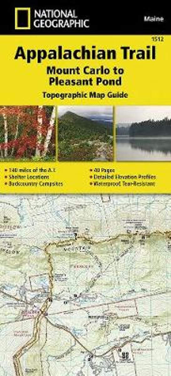
- Appalachian Trail, Mount Carlo To Pleasant Pond, Maine
- Waterproof Tear-Resistant Topographic Map GuideThe Mount Carlo to Pleasant Pond Topographic Map Guide makes a perfect traveling companion when traversing the southern Maine section of the Appalachian Trail (A.T.). The A.T. through Maine offers some of the most challenging sections of trail along the A.T., both in rugged terrain and... Read more
Bol.com
Belgium
Belgium
- Appalachian Trail, Mount Carlo To Pleasant Pond, Maine
- Waterproof Tear-Resistant Topographic Map GuideThe Mount Carlo to Pleasant Pond Topographic Map Guide makes a perfect traveling companion when traversing the southern Maine section of the Appalachian Trail (A.T.). The A.T. through Maine offers some of the most challenging sections of trail along the A.T., both in rugged terrain and... Read more

Bol.com
Netherlands
Netherlands
- Southbound on the Appalachian Trail
- While preparing for a 2007 thru-hike of the Appalachian Trail, Ken Sarzynski read half a dozen books on the subject, dozens of websites, blogs and journals. He had long-distance backpacked and bicycled many times and felt ready for the physical demands a 2,200 mile hike could extoll. Nothing could have prepared him for the social responsibility... Read more
- Also available from:
- Bol.com, Belgium
Bol.com
Belgium
Belgium
- Southbound on the Appalachian Trail
- While preparing for a 2007 thru-hike of the Appalachian Trail, Ken Sarzynski read half a dozen books on the subject, dozens of websites, blogs and journals. He had long-distance backpacked and bicycled many times and felt ready for the physical demands a 2,200 mile hike could extoll. Nothing could have prepared him for the social responsibility... Read more

Bol.com
Netherlands
Netherlands
- Appalachian Trail in Bits and Pieces
- Mary Mama Boots Sands introduced more than 100 Girl Scouts to the adventures of the Appalachian Trail during more than 16 years of hiking it in sections. It all adds up to well more than 100 individual adventures. Read more
- Also available from:
- Bol.com, Belgium
Bol.com
Belgium
Belgium
- Appalachian Trail in Bits and Pieces
- Mary Mama Boots Sands introduced more than 100 Girl Scouts to the adventures of the Appalachian Trail during more than 16 years of hiking it in sections. It all adds up to well more than 100 individual adventures. Read more
Bol.com
Netherlands
Netherlands
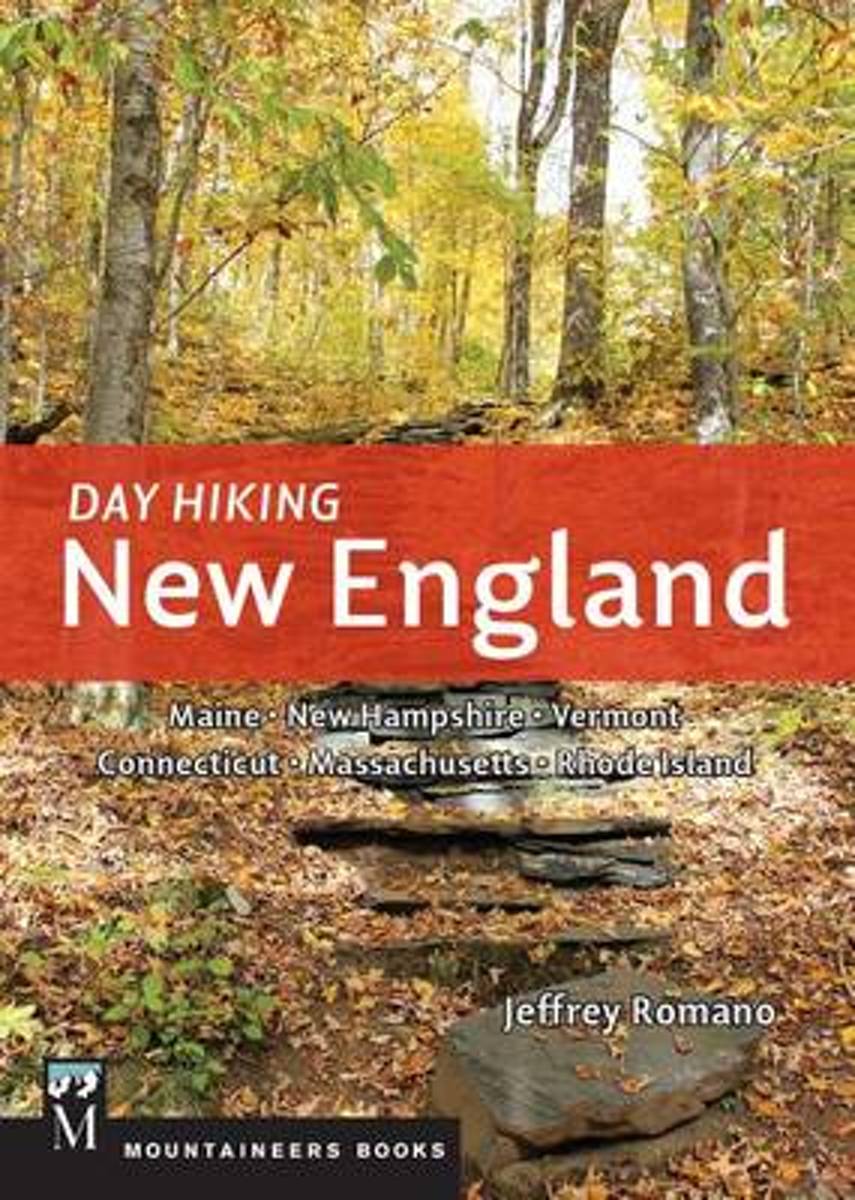
- Day Hiking New England
- *CLICK HERE to download sample hikes from Day Hiking New England* *Provides difficulty ratings, hike distances, GPS coordinates, elevation gains, permitting information, and more *115 routes including many loops *Doesn't overlap with the author's 100 Classics Hikes: New England together the two guides capture more than 200 unique hiking... Read more
- Also available from:
- Bol.com, Belgium
- The Book Depository, United Kingdom
Bol.com
Belgium
Belgium
- Day Hiking New England
- *CLICK HERE to download sample hikes from Day Hiking New England* *Provides difficulty ratings, hike distances, GPS coordinates, elevation gains, permitting information, and more *115 routes including many loops *Doesn't overlap with the author's 100 Classics Hikes: New England together the two guides capture more than 200 unique hiking... Read more

The Book Depository
United Kingdom
United Kingdom
- Day Hiking New England
- Maine, New Hampshire, Vermont, Connecticut, Massachusetts. Rhode Island Read more

Bol.com
Netherlands
Netherlands
- Appalachian Trail Guide to Tennessee-North Carolina
- The official guide to 302 miles of the Appalachian Trail, from Damascus, Va., near the Tennessee line south to the southern end of the Great Smoky Mountains National Park at Fontana Dam, N.C. The six detached maps (three sheets) included in the packet are water- and tear-resistant in seven colors at a scale of an inch to a mile, with elevation... Read more
- Also available from:
- Bol.com, Belgium
Bol.com
Belgium
Belgium
- Appalachian Trail Guide to Tennessee-North Carolina
- The official guide to 302 miles of the Appalachian Trail, from Damascus, Va., near the Tennessee line south to the southern end of the Great Smoky Mountains National Park at Fontana Dam, N.C. The six detached maps (three sheets) included in the packet are water- and tear-resistant in seven colors at a scale of an inch to a mile, with elevation... Read more
Kaarten

Bol.com
Netherlands
Netherlands
- Springer & Cohutta Mountains, Chattahoochee National Forest
- Waterproof Tear-Resistant Topographic MapLocated just north of Atlanta, the Chattahoochee National Forest contains the southern terminus of the Appalachian Trail along with an abundance of recreational opportunities for outdoor enthusiasts of all interests.This detailed recreation map contains carefully researched trails, campsites,... Read more
- Also available from:
- Bol.com, Belgium
- Stanfords, United Kingdom
Bol.com
Belgium
Belgium
- Springer & Cohutta Mountains, Chattahoochee National Forest
- Waterproof Tear-Resistant Topographic MapLocated just north of Atlanta, the Chattahoochee National Forest contains the southern terminus of the Appalachian Trail along with an abundance of recreational opportunities for outdoor enthusiasts of all interests.This detailed recreation map contains carefully researched trails, campsites,... Read more

Stanfords
United Kingdom
United Kingdom
- Chattahoochee National Forest - Springer and Cohutta Mountains GA/SC 777
- Map No. 777, Chattahoochee National Forest: Springer and Cohutta Mountains, GA/SC, in an extensive series of GPS compatible, contoured hiking maps of USA’s national and state parks or forests and other popular recreational areas. Cartography based on the national topographic survey, with additional tourist information.The maps, with most titles... Read more

De Zwerver
Netherlands
Netherlands
- Wandelkaart - Topografische kaart 318 Mount Rogers High Country - Grayson Highlands State Park | National Geographic
- Prachtige geplastificeerde kaart van het bekende nationaal park. Met alle recreatieve voorzieningen als campsites, maar ook met topografische details en wandelroutes ed. Door uitgekiend kleurgebruik zeer prettig in gebruik. Scheur en watervast! National Geographic's Trails Illustrated map of Mount Rogers High Country and Grayson Highlands... Read more
- Also available from:
- Bol.com, Netherlands
- Bol.com, Belgium
- Stanfords, United Kingdom
- The Book Depository, United Kingdom

Bol.com
Netherlands
Netherlands
- Mount Rogers High Country
- Waterproof Tear-Resistant Topographic MapNational Geographic's Trails Illustrated map of Mount Rogers High Country and Grayson Highlands State Park, Southwest Virginia, is a two-sided, waterproof, topographic trail map designed to meet the needs of outdoor enthusiasts with unmatched durability and detail. This map was created in... Read more
Bol.com
Belgium
Belgium
- Mount Rogers High Country
- Waterproof Tear-Resistant Topographic MapNational Geographic's Trails Illustrated map of Mount Rogers High Country and Grayson Highlands State Park, Southwest Virginia, is a two-sided, waterproof, topographic trail map designed to meet the needs of outdoor enthusiasts with unmatched durability and detail. This map was created in... Read more

Stanfords
United Kingdom
United Kingdom
- Mount Rogers High Country VA
- Map No. 318 - Mount Rogers High Country in Virginia in an extensive series of GPS compatible, contoured hiking maps of USA’s national and state parks or forests and other popular recreational areas. Cartography based on the national topographic survey, with additional tourist information.The maps, with most titles now printed on light,... Read more

The Book Depository
United Kingdom
United Kingdom
- Mount Rogers High Country
- Trails Illustrated Other Rec. Areas Read more

De Zwerver
Netherlands
Netherlands
- Wandelkaart - Topografische kaart 747 Green Mountain National Forest North - Moosalamoo NRA - Rutland | National Geographic
- Prachtige geplastificeerde kaart van het bekende nationaal park. Met alle recreatieve voorzieningen als campsites, maar ook met topografische details en wandelroutes ed. Door uitgekiend kleurgebruik zeer prettig in gebruik. Scheur en watervast! National Geographic's Green Mountain National Forest North Trails Illustrated topographic map is... Read more
- Also available from:
- Bol.com, Netherlands
- Bol.com, Belgium
- Stanfords, United Kingdom
- The Book Depository, United Kingdom

Bol.com
Netherlands
Netherlands
- Green Mountains N.F., Moosalamoo NRA/Rutland
- Waterproof Tear-Resistant Topographic MapNational Geographic's Green Mountain National Forest North Trails Illustrated topographic map is the most comprehensive available for outdoor enthusiasts of all types. Designed to be easy-to-read, yet highly detailed this map includes a comprehensive road and trail network distinguishing between... Read more
Bol.com
Belgium
Belgium
- Green Mountains N.F., Moosalamoo NRA/Rutland
- Waterproof Tear-Resistant Topographic MapNational Geographic's Green Mountain National Forest North Trails Illustrated topographic map is the most comprehensive available for outdoor enthusiasts of all types. Designed to be easy-to-read, yet highly detailed this map includes a comprehensive road and trail network distinguishing between... Read more

Stanfords
United Kingdom
United Kingdom
- Green Mountain National Forest - Moosalamoo NRA - Rutland VT
- Map No. 747, Green Mountain National Forest: Moosalamoo NRA - Rutland area in Vermont, in an extensive series of GPS compatible, contoured hiking maps of USA’s national and state parks or forests and other popular recreational areas. Cartography based on the national topographic survey, with additional tourist information.The maps, with most... Read more

The Book Depository
United Kingdom
United Kingdom
- Green Mountains N.f., Moosalamoo Nra/rutland
- Trails Illustrated Other Rec. Areas Read more

De Zwerver
Netherlands
Netherlands
- Wandelkaart - Topografische kaart 316 Cades Cove - Elkmont - Great Smoky Mountains National Park | National Geographic
- Prachtige geplastificeerde kaart van het bekende nationaal park. Met alle recreatieve voorzieningen als campsites, maar ook met topografische details en wandelroutes ed. Door uitgekiend kleurgebruik zeer prettig in gebruik. Scheur en watervast! This title provides an increased scale of one of the most visited National Parks in the US, and one... Read more
- Also available from:
- Bol.com, Netherlands
- Bol.com, Belgium
- Stanfords, United Kingdom

Bol.com
Netherlands
Netherlands
- Cades Cove/elkmont, Great Smoky Mountains National Park
- Waterproof Tear-Resistant Topographic MapThis title provides an increased scale of one of the most visited National Parks in the US, and one of our more popular map titles. This increased scale will provide greater detail to the backcountry users and Appalachian Trail through-hikers.Park Introduction:Great Smoky Mountains National Park is... Read more
Bol.com
Belgium
Belgium
- Cades Cove/elkmont, Great Smoky Mountains National Park
- Waterproof Tear-Resistant Topographic MapThis title provides an increased scale of one of the most visited National Parks in the US, and one of our more popular map titles. This increased scale will provide greater detail to the backcountry users and Appalachian Trail through-hikers.Park Introduction:Great Smoky Mountains National Park is... Read more

Stanfords
United Kingdom
United Kingdom
- Cades Cove - Elkmont - Great Smoky Mountains National Park NC/TN
- Map No. 316, Great Smoky Mountains National Park: Cades Cove - Elkmont, NC/TN, in an extensive series of GPS compatible, contoured hiking maps of USA’s national and state parks or forests and other popular recreational areas. Cartography based on the national topographic survey, with additional tourist information.The maps, with most titles now... Read more